
Fleeting warmth in Alberta could topple records, but there's a catch
Alberta's taste of spring weather could set records in some locales, but it won’t stick around, though, as a cold front will sweep away the warmth just as quickly as it arrived.
April is getting off to a pleasant start in Alberta, giving residents a a sweet, but short break from the recent snowfall.
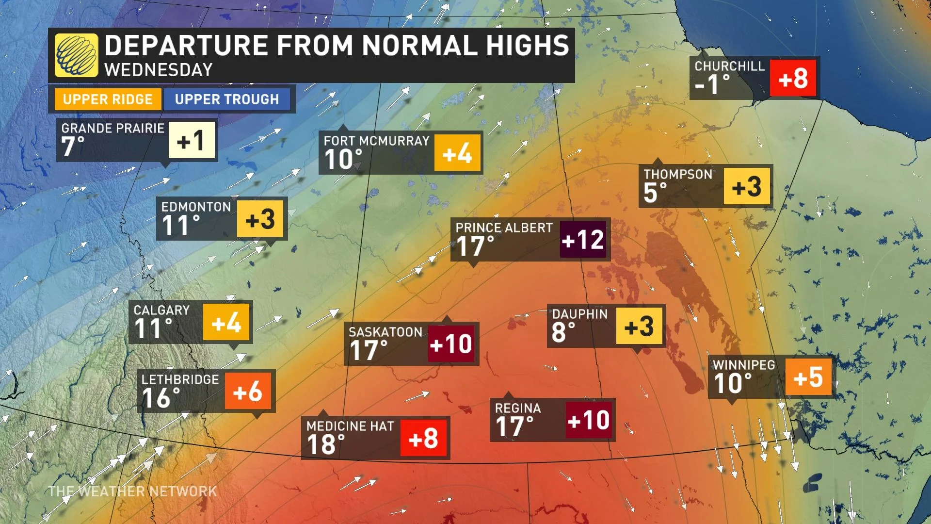
Daily high temperature records are in peril for some communities as Tuesday’s gusty winds help readings soar into the upper teens and even the lower 20s. Temperatures will be close to 15 degrees above seasonal across central Alberta.
DON’T MISS: Beware sneaky springtime sunburns as April warmth arrives
However, the warmth is on borrowed time as colder air and snow are looking to return by the weekend.
A ridge of high pressure building into Western Canada will send winds soaring up and over the Rockies, spilling down into Alberta with record-breaking warmth in spots.
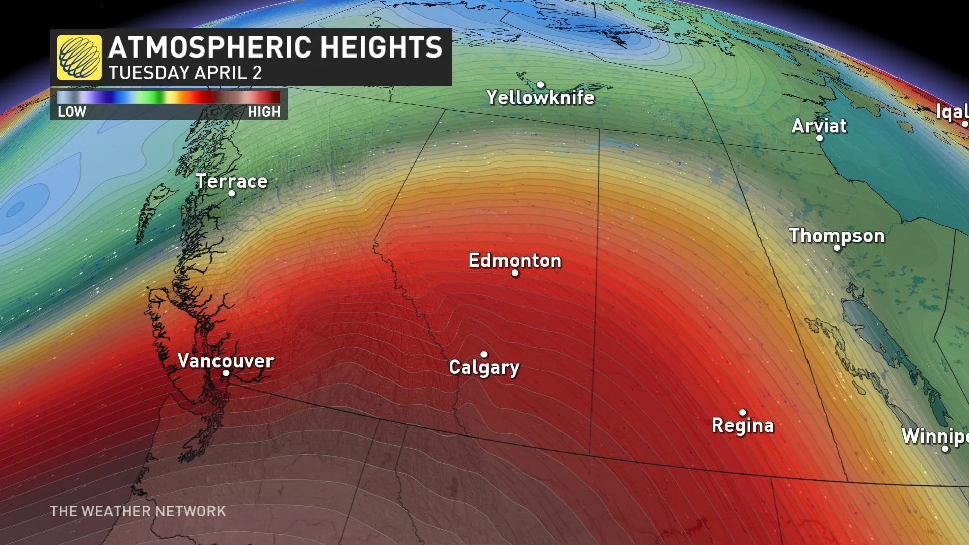
Saturday’s daytime high of -2°C in Calgary will seem like a distant memory by Tuesday as temperatures climb into the mid-teens.
Daily record highs are likely on Tuesday as readings peak around the 20-degree mark for some communities, thanks to favourable sunshine and southwesterly winds in Alberta.
The warmest temperature we’ve seen so far this year in Edmonton was 16.2°C, a benchmark we should easily surpass this week. Edmonton will likely reach the 20-degree mark on Tuesday, hitting that benchmark nearly three weeks earlier than normal.
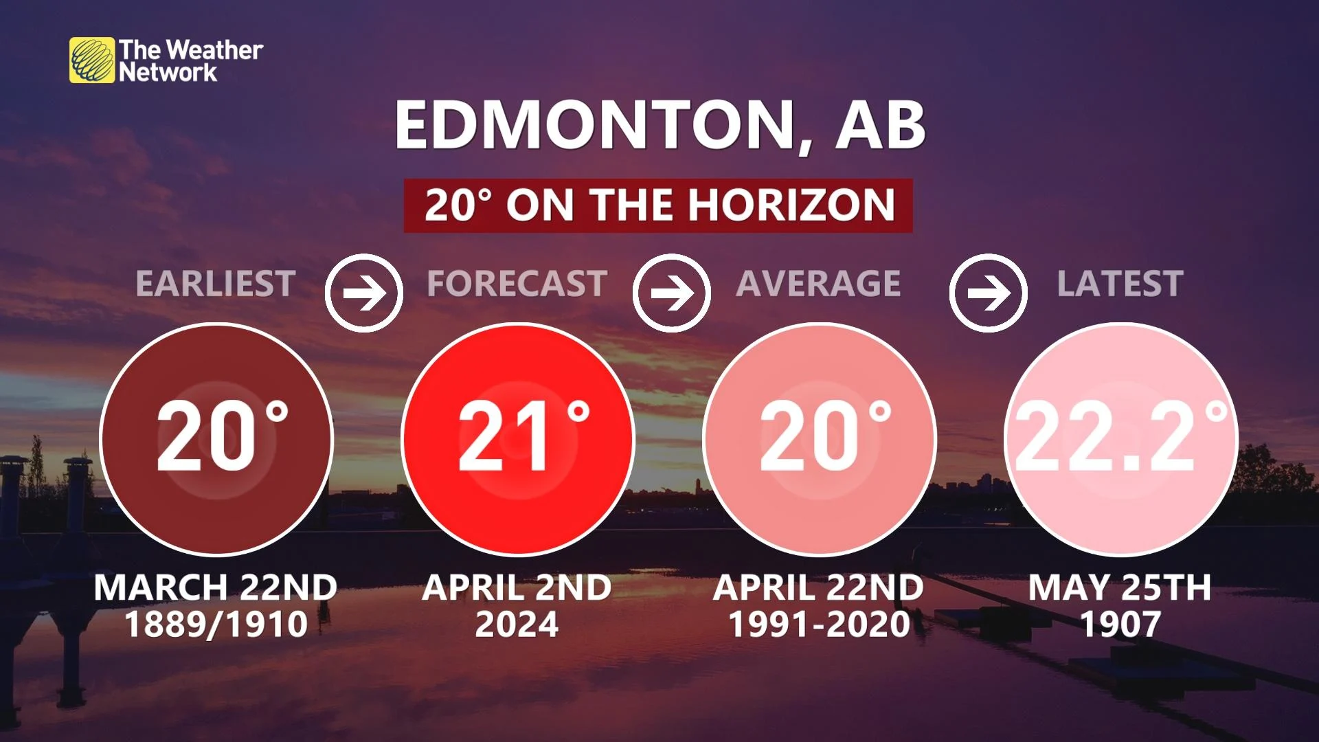
Edmonton's current record for April 2 is 22.8°C, and the forecast high could come within a couple of degrees of that mark.
Given that this warmth is partially due to downsloping, gusty winds of 60+ km/h are possible at times across the southern half of Alberta.
MUST SEE: How the tropics help produce big springtime snows on the Prairies
Due to the ongoing drought conditions, forecasters and officials will monitor the fire danger rating with temperatures in the 20s alongside dry, downsloping winds.
Beware the risk of a sneaky springtime sunburn if you plan to head outdoors and enjoy the short-lived warmth this week. The UV index is steadily climbing this time of year, and the sun angle in early April is equivalent to the sun angle in early September.
Warmth will manage to hold on for a final day on Wednesday, but a cold front will swiftly end the brief patio weather.
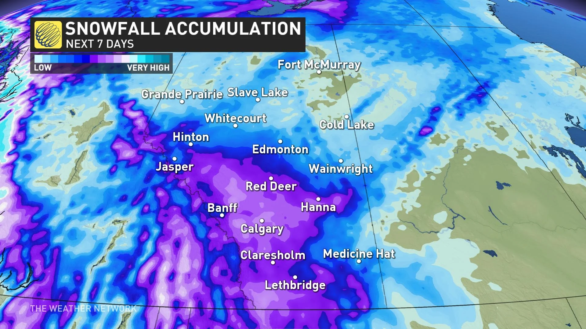
The front will crash into Alberta toward the latter half of the week will send temperatures sinking back toward seasonal, with highs once again in the lower single digits across Calgary and Edmonton.
Unsettled weather and a renewed risk for snow will accompany the cooler conditions by late this week and into next weekend. Plan ahead for travel disruptions—especially along the QE2 from Red Deer and Calgary south.
Stay with The Weather Network for all the latest on your forecast across Alberta.