Potent squalls could wallop parts of Ontario with 20-40 cm of snow
People near Lake Huron and Georgian Bay are being urged to postpone non-essential travel through Tuesday as bands of lake-effect snow will have major impacts on the roads, with high accumulations and reduced visibility to near zero expected
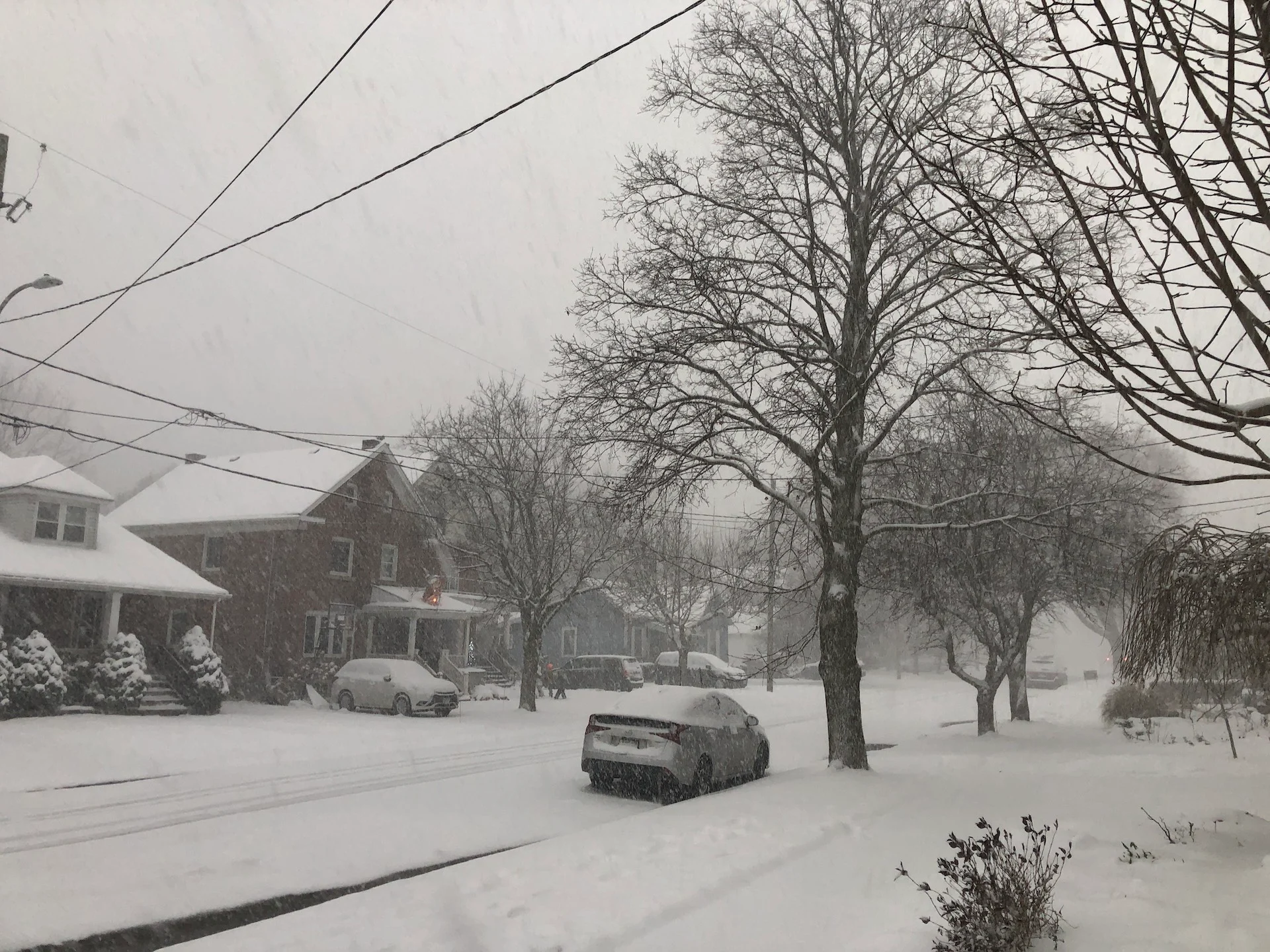
Cool, Arctic air has awoken the lake-effect machine in southern Ontario, bringing parts of the province major snowfall totals amid the coldest temperatures of the season.
Snow squall watches and warnings are in effect, with some areas anticipated to see 20-40 cm by the time the event winds down by mid-week.
DON'T MISS: Why snow squalls are one of the hardest events to forecast
Travel will be hazardous so people are urged to exercise extreme caution if they do plan to be on the roads. Visibility will be suddenly reduced to near zero at times in heavy snow and blowing snow. Rapidly accumulating snow could make travel difficult over some locations. Road closures are possible.
"Consider postponing non-essential travel until conditions improve," says Environment and Climate Change Canada (ECCC) in a snow squall warning issued for parts of the region.

Monday night and Tuesday
The first significant snow squalls of the year will create narrow bands of whiteouts and wintry travel through Tuesday and early Wednesday in parts of southern Ontario. 20-40 cm of snow is expected in the hardest-hit regions, with the risk for power outages, as well.
The narrow bands of snow will keep the heaviest accumulations highly localized but travel impacts and road closures could be more widespread. The primary danger is with reduced visibility under heavy snowfall, paired with wind gusts close to 60 km/h.

The lake-effect snow bands organized themselves through the day on Monday with westerly winds that had them impact areas east of Georgian Bay, including Parry Sound, Bala, Bracebridge, Coldwater, Huntsville, and east of Lake Huron including Bruce Peninsula, Owen Sound, Saugeen Shores and Goderich, among others.
Some of the flakes even made their way to parts of the Greater Toronto Area (GTA). The winds will shift overnight, having the squalls move into early Tuesday morning.
By Tuesday, the core of the cold is at its peak, as well, and daytime highs may fail to reach the freezing mark for the first time this season in the city of Toronto.

More importantly, there will be a stronger temperature gradient and contrast over the warmer lakes, which will result in more potent snow squalls.
Tuesday morning commuters taking highways 401 and 400 north, will likely experience a period of intense snowfall, gusty winds and limited visibility with blowing snow forecast within the bands. Be sure to check your routes and leave extra time for slower travel.
The worst squalls will set up on Lake Huron, affecting Kincardine, Goderich, Stratford, Kitchener-Waterloo and surrounding areas, with another intense squall setting up off Georgian Bay, heading overtop of Wasaga Beach, Highway 26, Barrie and south along the Highway 400.
Some of these areas could see 20-40 cm of snow, with some very localized areas potentially seeing even more.

Highly confident that the west GTA will see flurries and localized bursts of heavier snow. Most places should see a dusting of snow on the west side of the GTA, near and west of downtown, and definitely a risk for localized overachievement.
BURIED: Why the Great Lakes produce some of the world’s heaviest snow
Intense snowfall rates of 5 to 10 cm per hour are possible at times.
WATCH: What the Greater Toronto Area can expect from this week's snow squalls
Toronto & Hamilton: First squalls, first snow on the ground, first below freezing temperatures?
With bitterly cold air and persistent, northwesterly winds forecast, brief bursts of snowfall could temporarily move through the Greater Toronto and Hamilton Area (GTHA).
Accumulations will be limited here, but a light dusting is possible near Hamilton, Brantford and Kitchener, with slightly higher elevations and colder temperatures.
Toronto may record three different firsts this season with this particular wintry event.

Toronto's first snow squall may lead to our first snowfall accumulation, all fuelled by the coldest air of the season. As stated, our first daytime high below the freezing mark may be recorded on Tuesday. Wind chill values will easily dip into the double-digits below zero for many communities, as well.
If this happens, Toronto will be colder than Iqaluit, Nvt., in Canada's Far North -- more than 2,000 km away. Iqaluit's forecast of 0°C and 3°C on Tuesday and Wednesday will likely be warmer than both Toronto and Ottawa.
SEE ALSO: Windshield wiper blades: Is it a good idea to leave them up before a snowfall?
Setups like this can occur on occasion with the displacement of the polar vortex. However, it is highly unusual.
WATCH: Toronto prepares for three seasonal firsts with the arrival of wintry weather
Things will start looking up once we get past Wednesday, thankfully. Milder air will push into southern Ontario for the opening days of December, bringing near or slightly above-seasonal temperatures and a chance for communities to melt off some of that fresh snow.
Stay with The Weather Network for all the latest on conditions across Ontario.