Potent fall-like storm soaks B.C. coast, leaves thousands in the dark

The first significant storm in B.C. in months is nearing its end in the southern areas after cutting to power to thousands and bringing soaking rainfall totals Friday to many locales.
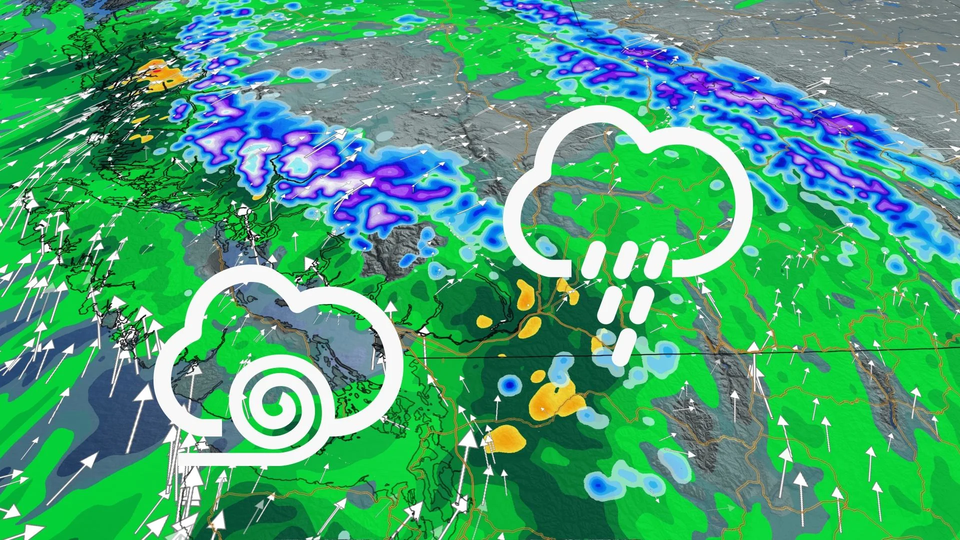
A moisture-laden system more typical of fall rather than late summer slammed into British Columbia Friday and Saturday, with very heavy rainfall amounts recorded, along with strong winds that triggered thousands of outages. Though the peak is long over, some impacts will linger somewhat into Sunday. Details, below.
Visit our Complete Guide to Fall 2021 for an in-depth look at the Fall Forecast, tips to plan for it and much more!
INTO SUNDAY: RAIN, WIND EASE OFF
B.C. has seen some substantial rainfall amounts since the rain began Friday. According to Environment and Climate Change Canada (ECCC), some of the heaviest totals were:
Port Mellon: 116
Pam Rocks: 84.2
Vancouver Harbour: 75.8
West Vancouver: 86.7
Pitt Meadows: 77
Bowser: 77
North Courtenay: 55.9
Abbotsford Airport: 58.7
Delta Burns Bog: 53.9
Vancouver International Airport: 50.9
The system isn't quite done with the province, and additional rainfall totals of 20-30 mm are possible for parts of the Lower Mainland through Sunday, and a general 10-20 mm elsewhere

The strong winds have largely eased off as well, though thousands of B.C. Hydro customers had yet to be reconnected as of Saturday evening.
Meanwhile, higher elevations of the Coastal and Interior mountains saw some heavy snow, with a few wayward flakes remaining overnight Saturday.

Beyond the weekend, scattered showers are possible on Monday, with a higher threat for showers again on Wednesday, but overall it will be a drier week.
Cool conditions early in the week, then warming up for the second half.
Be sure to check back for the latest updates on the weather conditions in British Columbia.


