
Ontario's first extreme heat event of the summer will invade this week
Get ready for the heat and humidity, Ontario, as peak temperatures this week will reach into the 30s while feels-like values could make their way into the 40s in some locales
A major heat wave building south of the border will extend its influence to Canada heading into the July 1 festivities.
Temperatures will climb well into the 30s this week for most areas, with the exception of a few shorelines. Humidex values for inland areas will easily reach into the 40s.
DON’T MISS: Why extreme heat is one of the world’s deadliest weather disasters

Many folks have outdoor plans for Canada Day this week. Excessive heat is a sneaky danger. Even a relatively healthy individual can succumb to heat-related illnesses without proper precautions.
Significant U.S. heat with Canadian implications
A heat dome that developed over the eastern half of the United States will last for all of this week.

Widespread feels-like values in the 40s will be common east of the Rockies, with actual air temperatures approaching 40°C possible in locations like North Carolina.
The northern edge of this formidable ridge of high pressure will extend into the Great Lakes region starting Monday, then lasting through the week.
The heat will build on Monday and Tuesday with daytime highs approaching the 30-degree mark--the coolest days of the week.

There will be very little relief overnight, starting Tuesday night as temperatures remain in the low- to mid-20s.
The U.S. heat dome retreats into the second week of July.

Downtown Toronto should only surpass 30°C by a degree or two on Canada Day, but communities away from the lake will see considerable heating.
Pearson International Airport will have a forecast of 34°C and a feels-like value of 44, likely to challenge the site’s hottest Canada Day on record.
A lake breeze will be music to peoples’ ears for the coming week. The Great Lakes are 2°C to 5°C below normal for Canada Day.

The biggest influence will be for beaches along the north and east shores of the lake. Communities where the southerly wind isn’t greatly moderated by the lake will still see temperatures push 30°C, however.
The building heat is expected to create an increasingly unstable atmosphere, which could provide plenty of fuel for thunderstorms (if the trigger is there).

Thunderstorms could be expected Wednesday and Thursday, but the exact location and severity is uncertain. Any storms that do develop will have the potential to become severe.
WATCH: How to keep your cool as a parent this summer
Heat safety is vital
Extreme heat claims more lives around the world than any other type of severe weather.
Everyone is susceptible to heat-related illnesses without taking proper precautions, such as frequent breaks, adequate hydration, and air conditioning.
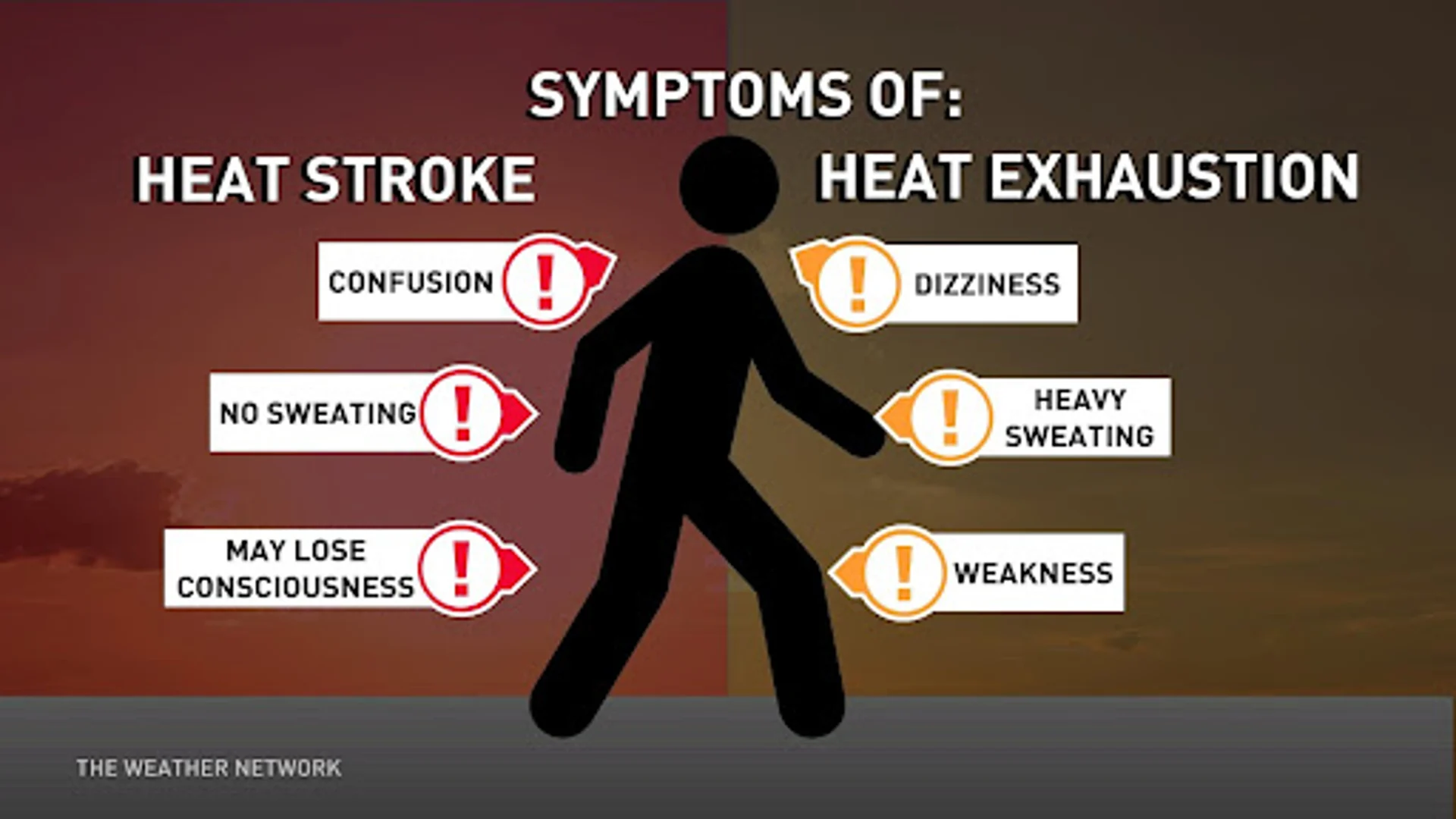
The compounding stress of hot days followed by muggy nights can be especially hard on vulnerable populations like the elderly, those with chronic health conditions, and folks who live without access to air conditioning. Keep in mind that certain medications can lower your body’s heat tolerance.