Parts of B.C. see first August rain this weekend, cooler temperatures follow

A much-needed weather system will bring rain to areas in British Columbia that have experienced a very dry August
This weekend, a ridge of high pressure will shift from B.C. into the Prairies, taking much of the heat with it. Interior temperatures will drop by more than 10°C between Friday and Sunday, while the Lower Mainland will see a 5–7°C decrease.
DON'T MISS: Why did NASA fly a former Cold War spy plane over B.C. wildfires?
A coastal low is set to develop and track northward, bringing much-needed rainfall to coastal areas and scattered thunderstorms to the Interior. For many regions, this marks the first rainfall in August.
However, dry lightning east of the Coastal Mountains raises concerns for wildfire risk.
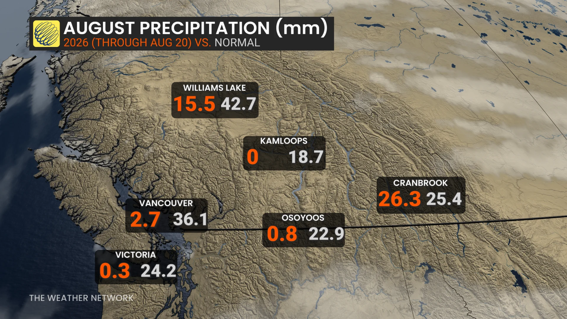
Rainfall relief, but with risk of thunderstorms and dry lightning
In Kelowna, which has already seen 41 days above 30°C this year (compared to a seasonal average of 28 days), rainfall totals are expected to provide relief, but fall short of significantly easing wildfire conditions.
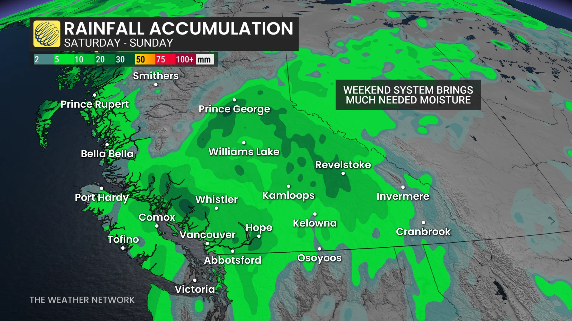
Rainfall estimates include Vancouver with 10–15 mm, Victoria with around 5 mm, Kelowna with approximately 5 mm, and Kamloops with 5–10 mm.
RELATED: Could climate change cause more lightning — and spark more wildfires?
Totals for the Interior could vary widely due to localized storms.
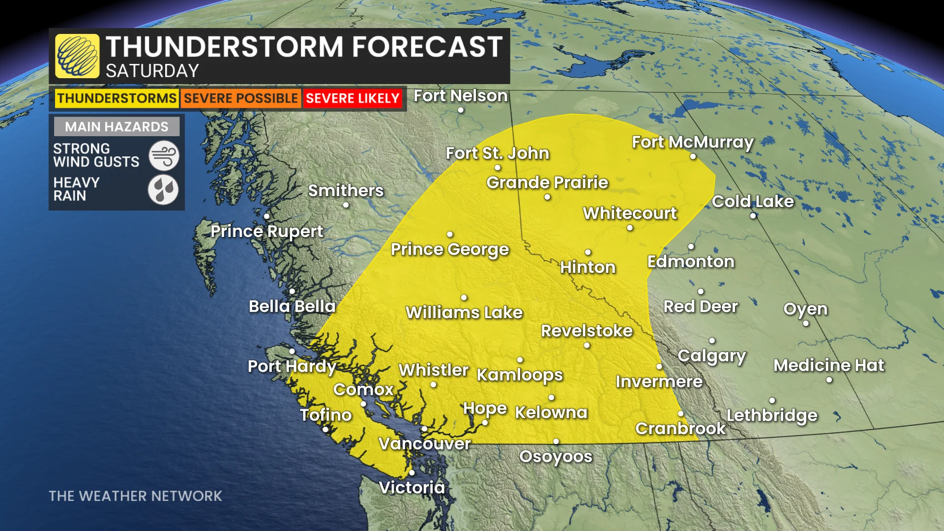
The first half of next week will bring warmer-than-normal temperatures, although not as intense as this week. Cooler and more unsettled conditions are expected by late next week into early September.