Feeling like 40: Health risks possible as intense heat wave hits the Maritimes

An intense heat wave is underway across the Maritimes with hot and muggy air in place. The heat event is likely to linger for several days, elevating health risks associated with it
One of the most important heat waves of the summer is impacting the Maritimes, and is also bringing sticky humidity and steamy nights with little opportunities to cool off.
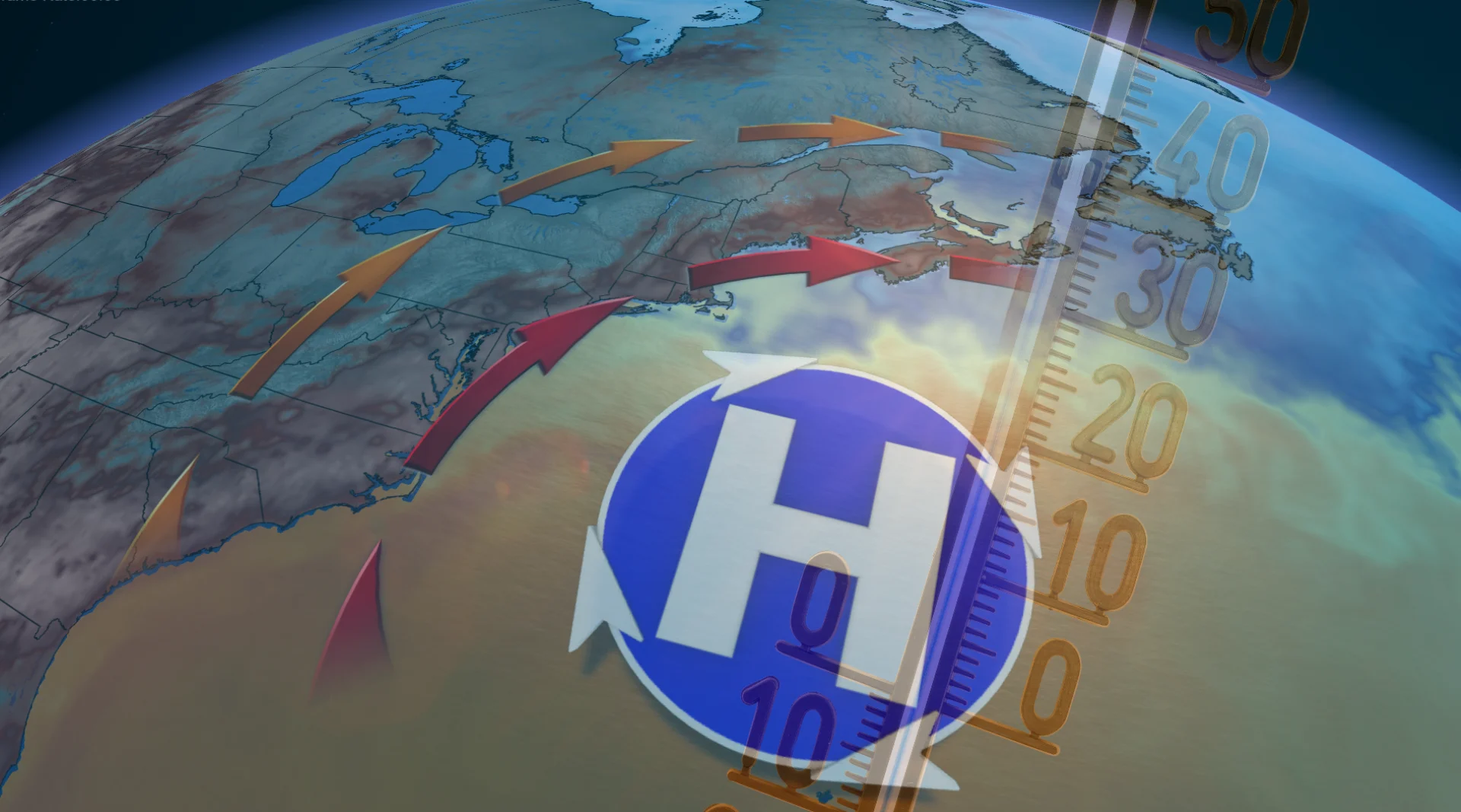
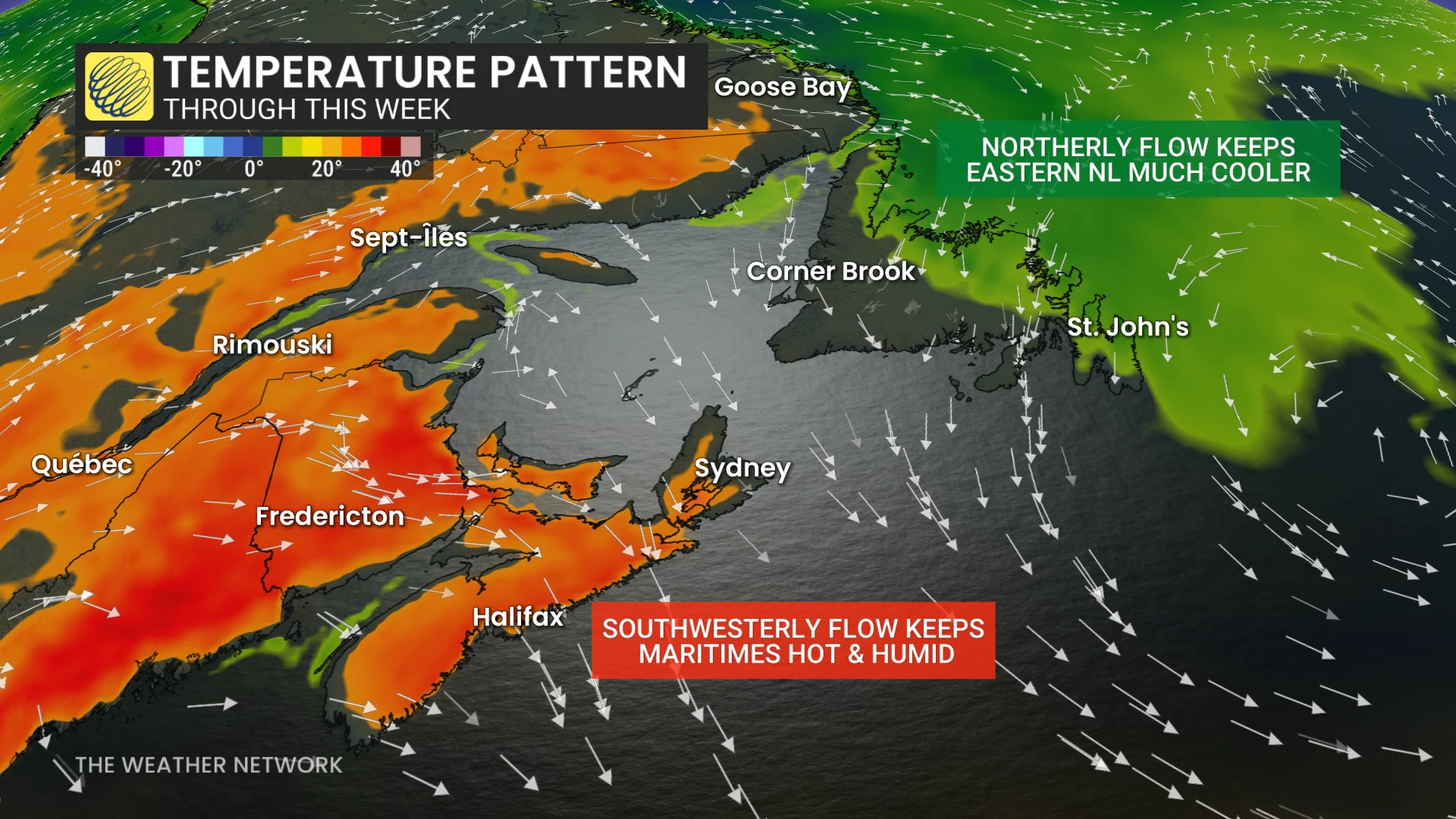
The heat arrived Wednesday as a strengthening Bermuda high began to bring abnormally hot and humid air to the region.
Temperatures will remain 5-10°C above normal in early August, with several communities experiencing daytime highs around or above 30°C through the remainder of the week.
Instead of respite after sunset, many inland locations will struggle to cool off, with overnight lows approaching or above 20°C.
RELATED: How the weather could be influencing your music taste
Thursday sees humidity ease somewhat but will bounce back
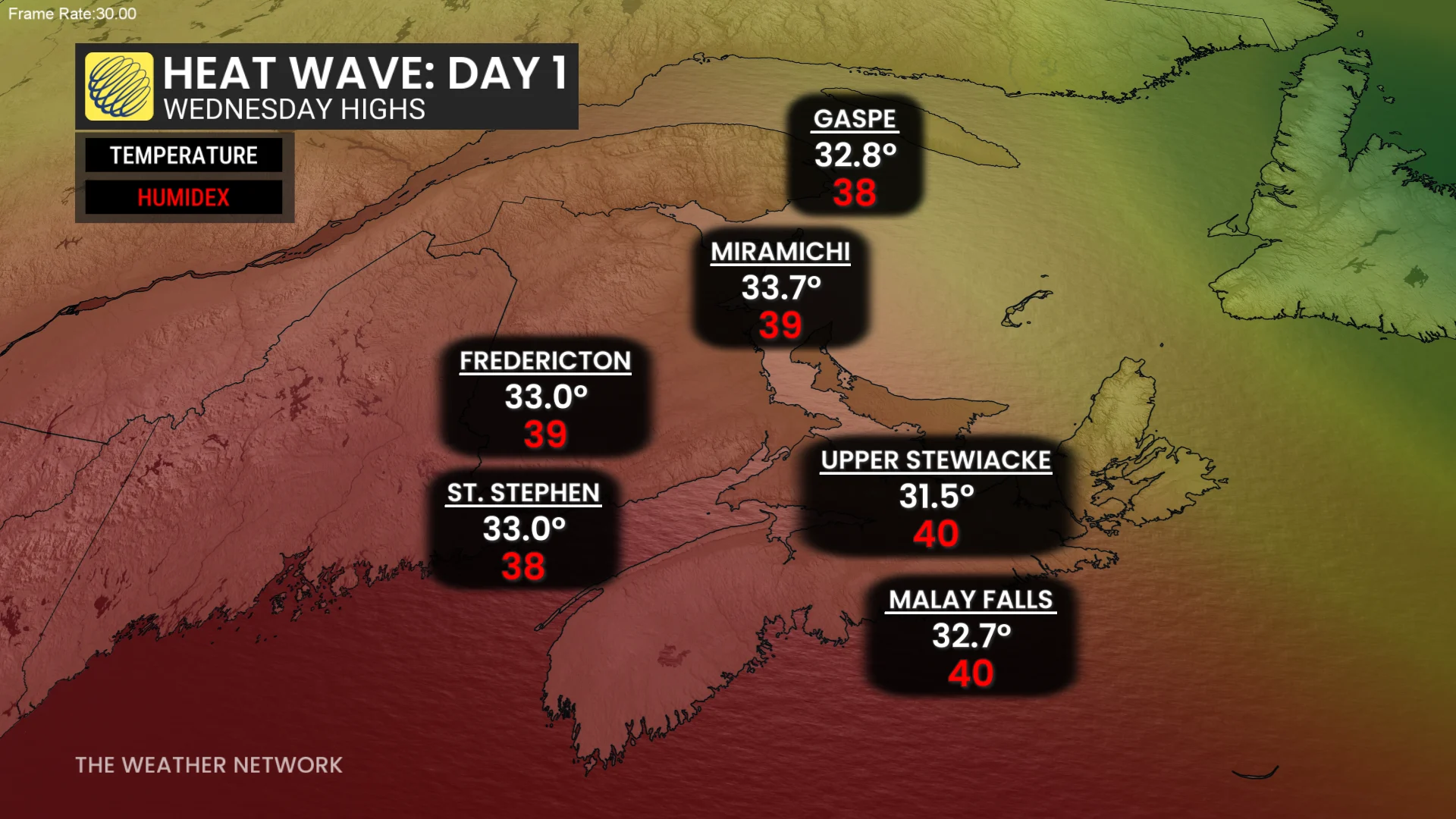
On Wednesday, numerous spots saw temperatures exceed 30°C, with humidex values hitting the upper 30s and even hitting 40 in some locales.
The number of 30-degree days in Atlantic Canada as of Aug. 5 range from zero in St. John's, N.L., to as high as 10 in Miramichi, N.B.
Thursday offers slightly decreased humidity, feeling closer to mid-to-high 30s, but temperatures will stay stubbornly around 30°C.
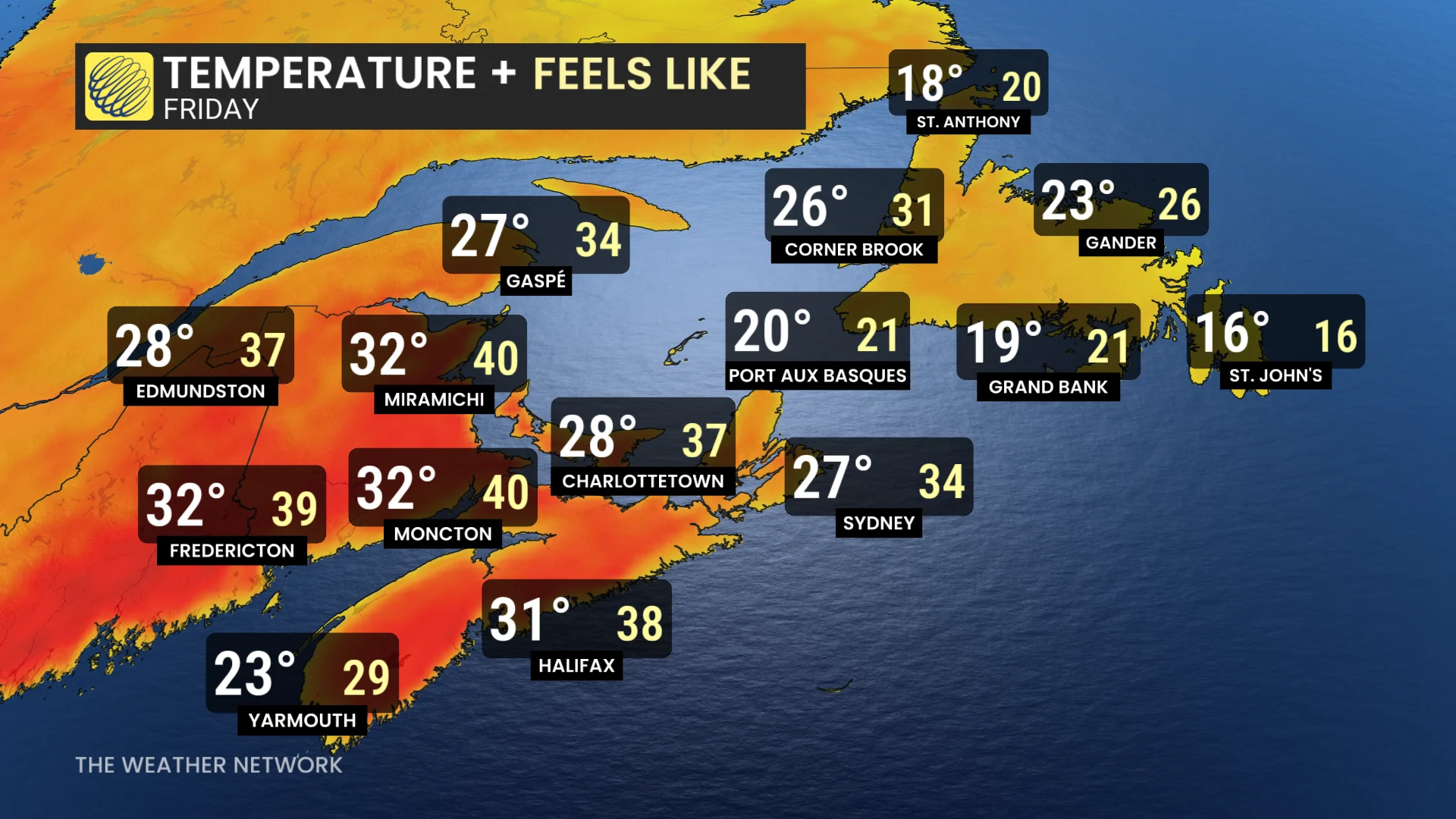
By Friday, another surge of tropical moisture is likely to drive humidex values back into the low 40s, with isolated thunderstorms possible over the weekend.
Halifax, N.S., already recorded a feels-like value of 40 during the first heat wave on July 3, not far off from its highest humidex value over the past 35 years.
From 1991-2020, the highest humidex reported was 40.7, with an all-time record of 41.9.
Storms return as temperatures dip
The same weather pattern that keeps the Maritimes hot will not reach eastern Newfoundland, where a continuous, onshore flow will keep temperatures substantially lower.
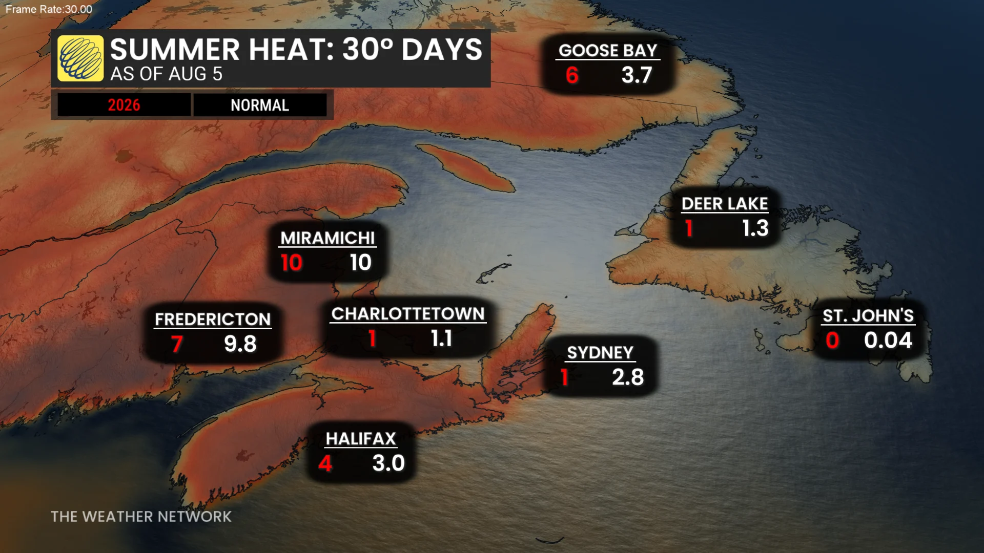
By the weekend, most places in the Maritimes will be at or above the normal number of 30°C readings in a year. St. John’s is still awaiting its first 30°C, but shouldn’t folks in the city shouldn't hold their breath. The city normally see 0.04 days of 30°C readings each year.
Also on the weekend, a trough moving in from Hudson Bay is predicted to drop temperatures by several degrees in the Maritimes. While colder air will relieve the heat, it will also increase the likelihood of showers and thunderstorms.
Next week will be unsettled with a few rounds of rain and thunderstorms. Temperatures will be warmer than seasonal early in the week, and then trend cooler to seasonal and then cooler than seasonal later in the week. That will continue through the third week of August.
Beware of heat-related illnesses
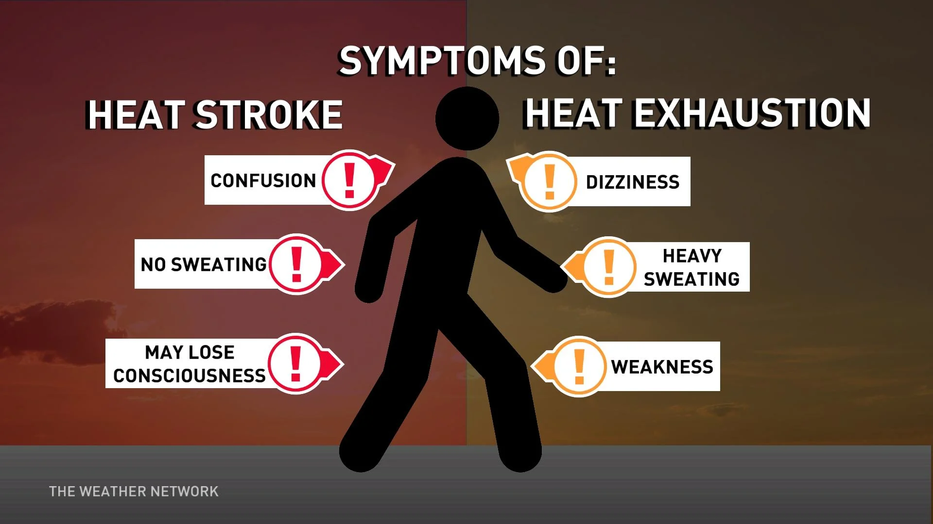
As the heat sets in, remember to stay hydrated, avoid excessive outdoor activities during the hottest portion of the day and never leave children or pets in parked cars. Older persons, small children, and people with chronic conditions are more sensitive to heat-related sickness.
WATCH BELOW: Warmer nights have you sweating? 6 sleep hacks for a cooler snooze
Stay with The Weather Network for the latest updates