Fast-growing tropical storm shatters Atlantic’s monthslong silence

A new and fast-strengthening tropical storm in the Atlantic Ocean is the first named storm we’ve seen in the basin in almost two months.
The Atlantic Ocean just produced a tropical storm for the first time in nearly two months, a rare stretch of quiet conditions that came to an end mere days from the peak of the season.
DON'T MISS: Canada's monthly outlook: Summer surges into September
Forecasters at the U.S. National Hurricane Center (NHC) have spent the week monitoring several disturbances over the Atlantic Ocean for possible tropical development.
One of those disturbances strengthened into a tropical storm just 12 hours after we ended August without any named storms.
Not only did we manage to eke out an unusually quiet August, but we haven’t had a tropical storm in the Atlantic basin since Tropical Storm Colin dissipated on July 3rd. This was the first time since the early 1940s we went without any named systems in the Atlantic during the 59-day period between July 3rd and August 31st.
Fortunately, this new drought-busting storm is out in the middle of nowhere.
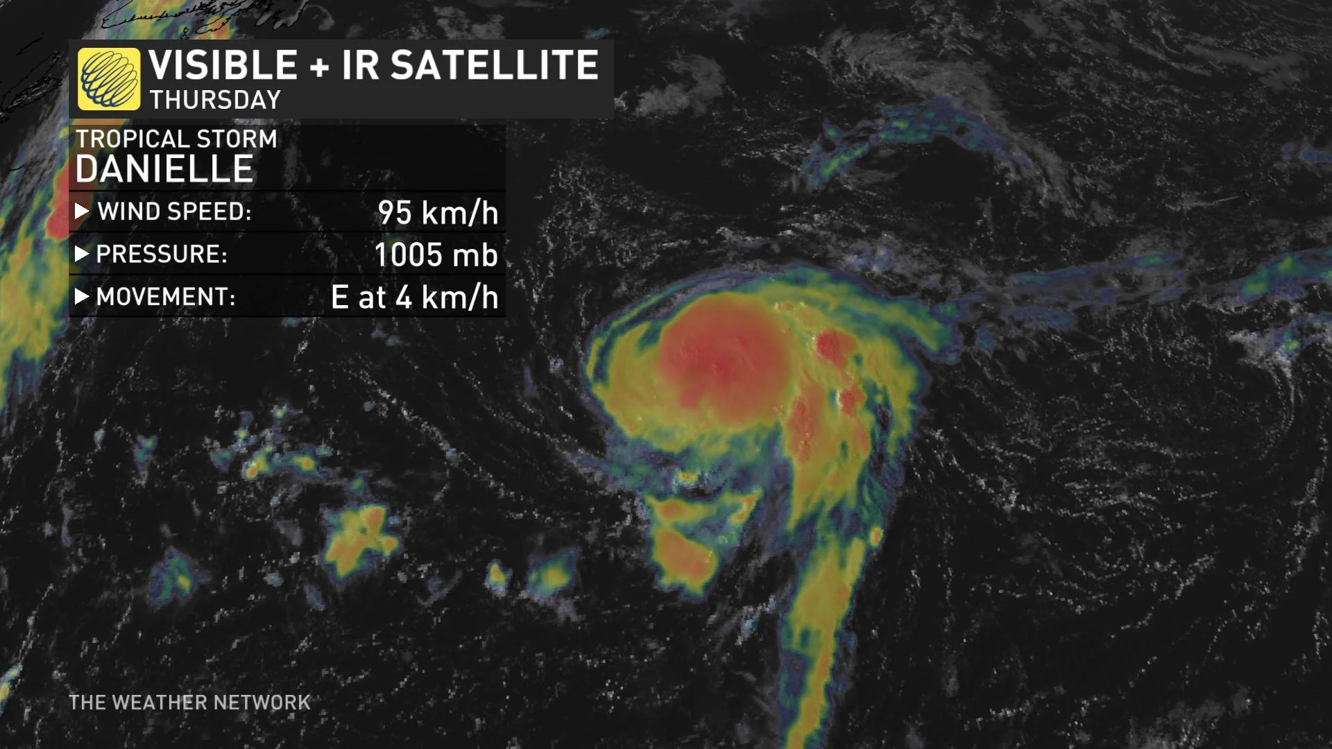
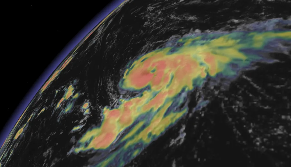
Tropical Storm Danielle formed on Thursday about 1,200 km southeast of St. John’s, Newfoundland, placing the system nearly smack dab in the middle of the northern Atlantic Ocean.
The NHC found that Danielle quickly strengthened through the day on Thursday, with its maximum sustained winds jumping to 95 km/h by the middle of the afternoon. Forecasters expect Danielle to grow into the season’s first hurricane by Friday.
Tropical Storm Danielle is barely moving. The system is stuck beneath a large ridge of high pressure over the northern Atlantic. This lack of winds to steer the storm along will keep it spinning in roughly the same location through the weekend.
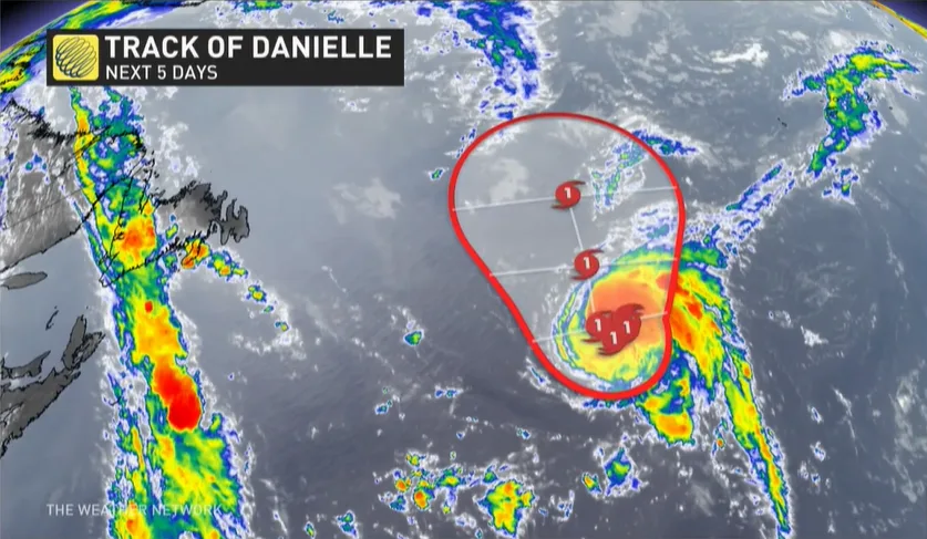
Danielle will begin to turn and move northeast early next week when a trough approaches the region and breaks the atmospheric logjam. The system will remain out at sea, posing no threat to land.
WATCH: East Coast newbies, are you ready for hurricane season?
Farther out in the tropical Atlantic, experts are watching two other disturbances for potential tropical cyclone development through early next week.
A system east of the Lesser Antilles has a high chance of growing into a tropical depression as it slowly makes its way toward the western Atlantic over the next five days.
Another disturbance in the eastern Atlantic has a low chance of development through early next week.
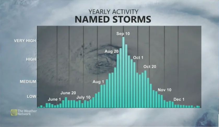
The climatological peak of the Atlantic hurricane season arrives during the second week of September.
The majority of storms that form in a typical year develop around and after the peak of the season. Make sure you’re prepared for anything that forms over the next couple of months so you’re ready if a storm approaches your area.
Stay tuned to The Weather Network for all the latest as we approach the peak of hurricane season.