Extreme weather pattern you have to see to believe, Canada

Depending on where you are in Canada, you may be facing an extremely hot end of summer, or perhaps some snow.
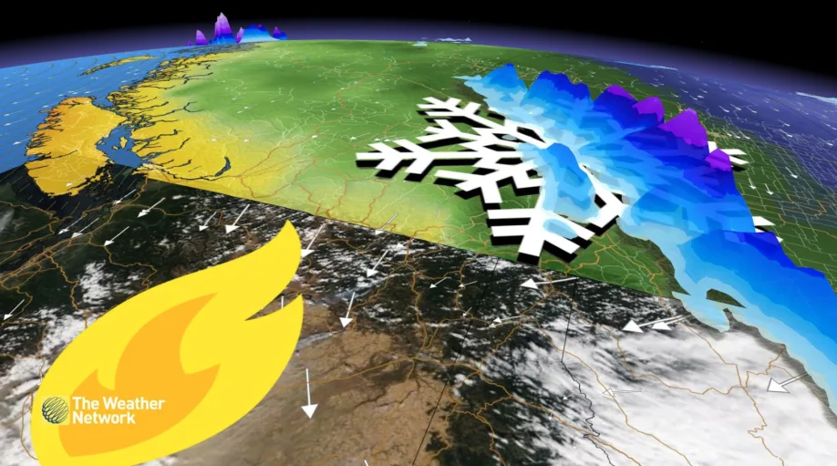
An intense pressure gradient developed over British Columbia on Monday, knocking out power to tens of thousands of customers. The province found itself between two extreme air masses.
Using the virtual ruler as a guide, we'll follow it west to east, encountering extreme weather, including rare firestorms along the way.

Firstly, the upper atmosphere is soaring to new heights because warm air expands. A freezing level 10 times taller than the CN Tower appears to be a record over the Pacific Northwest.

Another comparison, this is about 60% as tall as Mount Everest and challenges the tallest mountains in North America.
It's quite unusual for the hotspot in British Columbia to be near the coast. Check out the temperatures on Wednesday. Sorry Osoyoos, but looks like Abbotsford will take this one.

The pattern features a coastal lee trough that develops during downsloping winds; consequently, it induces a significant pressure gradient through the valleys and the interior – the high-pressure system in Alberta adds to a strengthening wind field.
Unfortunately, along out journey east, eastern Washington is caught in a hellish weather pattern – the region is experiencing firestorms, dust storms, and abysmal air quality as the cold, dry air sinks further south.
The cold air mass generating snow in British Columbia and Alberta, courtesy of the upper-level flow that has been further amplified by remnant typhoon energy in the western Pacific, has brought the first significant snowfall to the Rocky Mountains. Even the city of Calgary saw snowflakes mix in on Monday.

The volatile pattern won't last, as the record-breaking upper ridge meanders east, spreading warmer temperatures once again to the Prairie provinces by mid-week.