
Colorado low to track across Ontario with far-reaching warmth and rain
As temperatures soar into the double digits in southern Ontario, we will also welcome in a round of rainfall courtesy of a Colorado low that is spreading the warmth and unsettled weather across the province
The rain and energy from the deadly Southern California storms is going to have some impact on our weather pattern in southern Ontario this week.
While we don't need to be concerned about any extreme events, the moisture associated with them has helped develop a Colorado low, which is bringing plenty of rain and snow, and even unusual warmth with it to Ontario.
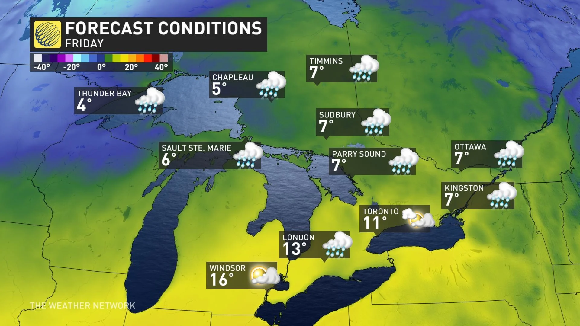
Double-digit highs will be more widespread for southern Ontario on Friday, with the potential for places like Toronto and Ottawa to reach new record highs for February.
However, it's not time to write off the winter season just yet, as we expect a return to more reflective conditions for the second half of the month and into March.
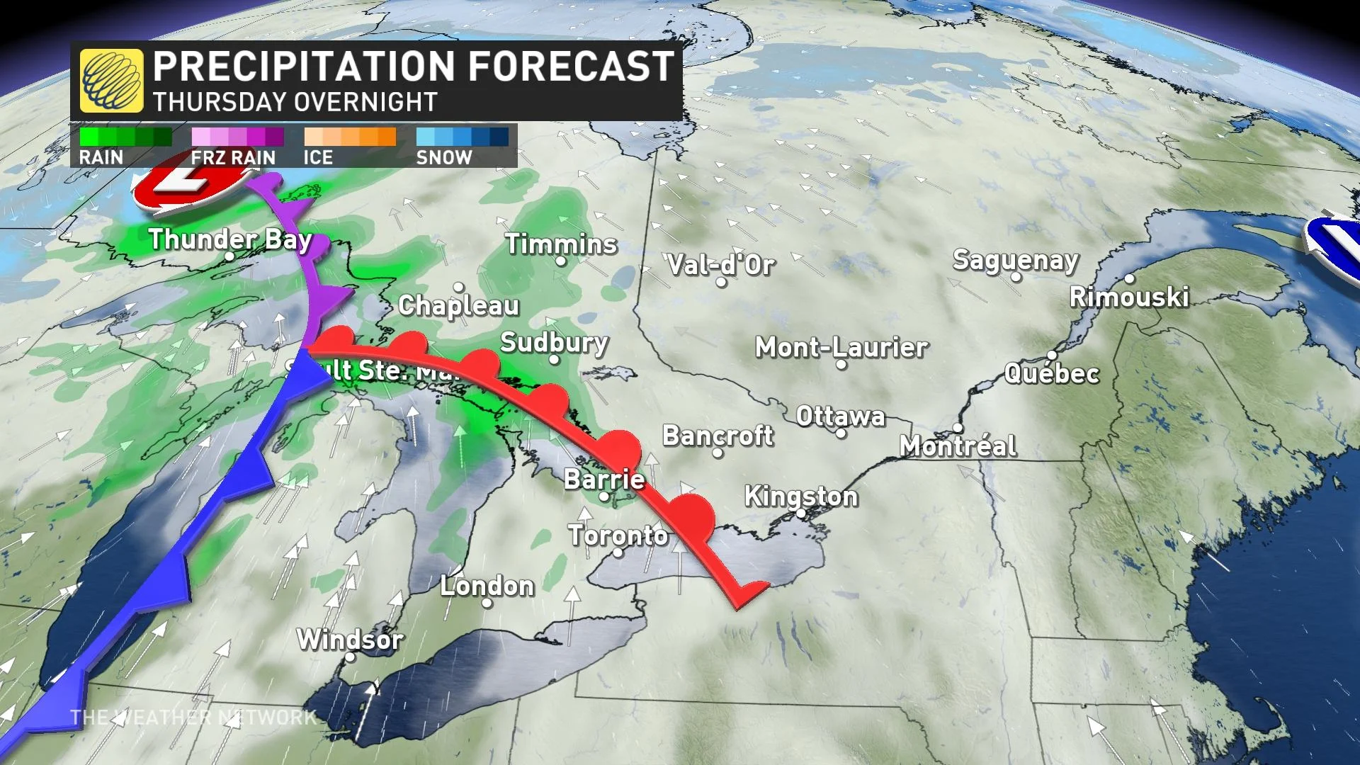
Thursday night into Friday
As milder temperatures take over most of Ontario, rain will fall as a Colorado low tracks through northern Ontario.
Rain will start for the Lake Superior and Lake Huron shorelines by Thursday evening.
RELATED: California's record-setting, wild weather set to impact Canada
By around midnight, the rain will engulf all of northeastern Ontario, even all the way up to Moosonee on James Bay, and then track east into the Greater Toronto Area (GTA).
This is the time period where most of the rain will fall, albeit the forecast amount is relatively low. By Friday morning, the majority of the rain has moved out of the GTA, with scattered showers in eastern Ontario as precipitation continues in the northeast.
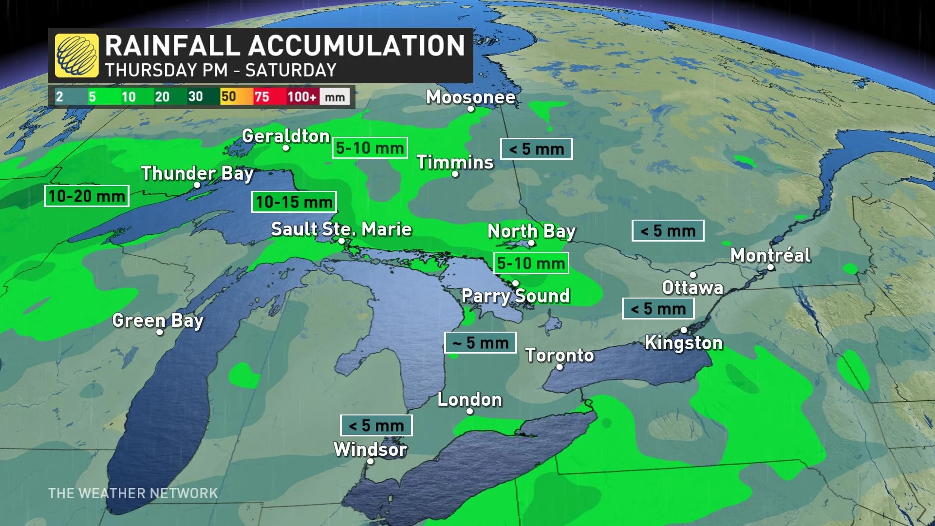
The rainfall amounts aren’t unusual. It’s how far north the rainfall is sprawling that is anomalous.
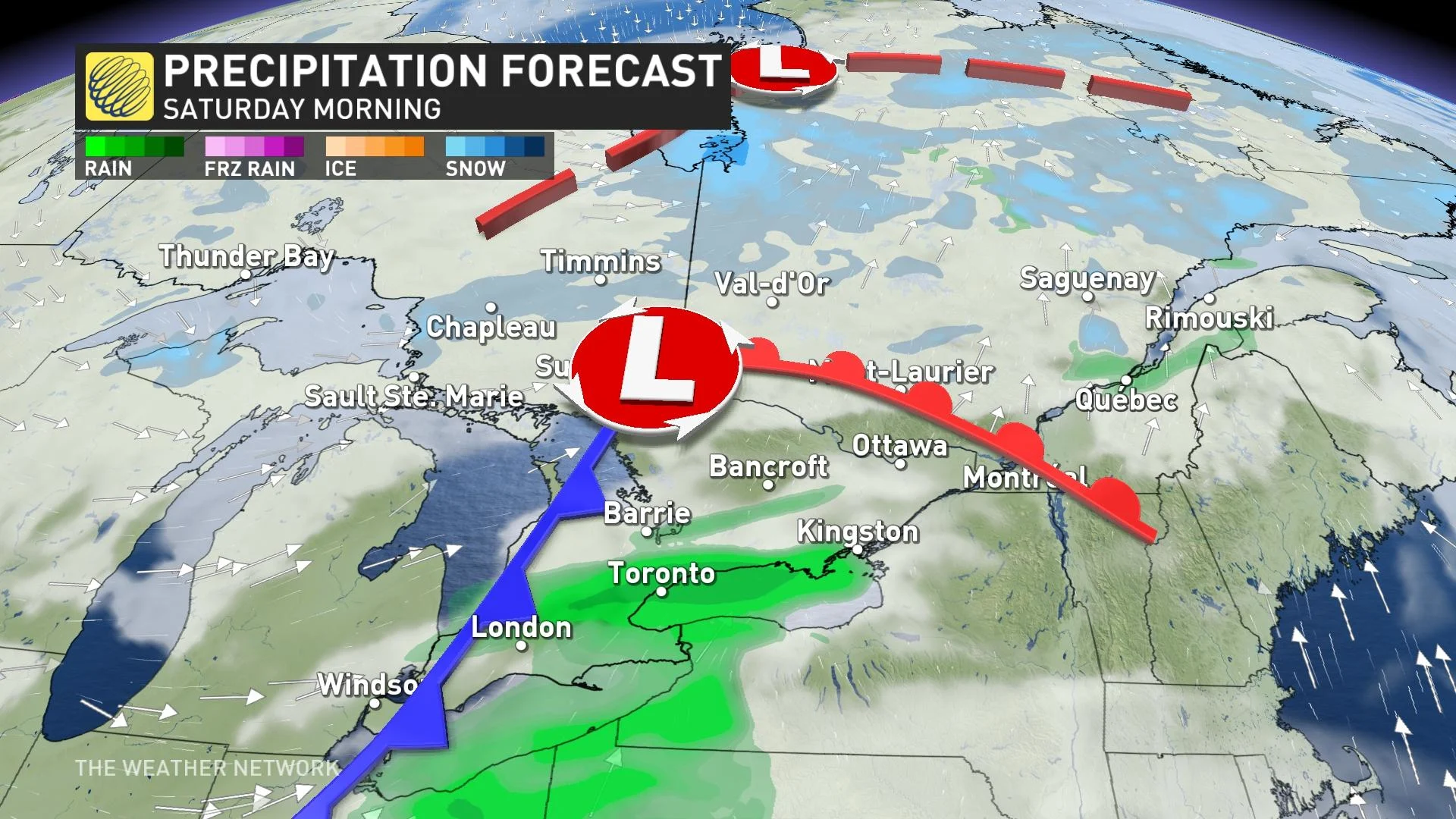
Saturday
Scattered showers continue for northeastern Ontario, and by Saturday morning, colder temperatures return. That will transition the rain to some flurries. As the rain moves into Quebec, it leaves drier conditions for southern Ontario.
The south remains very mild, with temperatures forecast to soar into the mid-teens across extreme southwestern Ontario, with temperatures of 12°C or 13°C pushing towards the GTA.
SEE ALSO: Deadly California atmospheric river storm triggers flooding, power outages
Another round of showers is forecast to move across parts of southern Ontario through the day on Saturday, but conditions will remain very mild.
Unusual February warmth takes hold
Ontario is not immune to winter thaws, but the temperature rise this week will be more noticeable and odd in northern sections of the province.
A mild air mass that was situated over the Prairies will continue to spread across Ontario, with a southerly flow pulling warmer air in from the southern U.S. Temperatures across northern Ontario will average more than 15°C above seasonal for several days, with extreme daily readings as high as 20-25 degrees above normal.
RELATED: Northwestern Ontario could see biggest snowfall totals of the season this week
The warmest day of the week for southern Ontario is forecast on Friday, when some communities will be looking at double-digit warmth. Temperatures spilling into the low teens are certainly not out of the question.
WATCH | How does California's flooding lead to incredible Ontario warmth
Don't write off the winter season just yet!
Despite this week's exceptional warm-up, it's not time to write off the winter season just yet.
A major pattern change will develop next week as temperatures trend colder.
There will be a period of transition, but we expect near seasonal, and at times, colder-than-seasonal temperatures will dominate during the second half of February and into the first half of March.
Thumbnail courtesy of Unsplash/Ajaykumar Kannan.
Be sure to check back for the latest weather updates across Ontario.
Thumbnail image courtesy: Getty Images