Exceptionally strong, and potentially record-breaking low set to hit Ontario
A potential record-setting low pressure system is set to impact Ontario, with heavy rain, strong winds, and thunderstorms expected
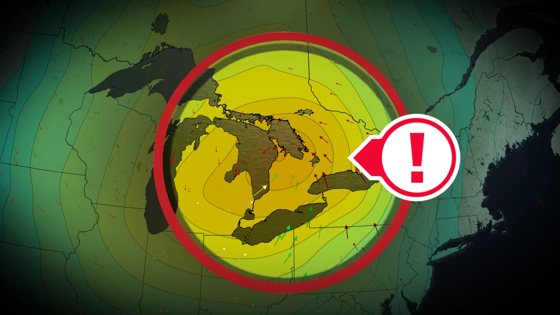
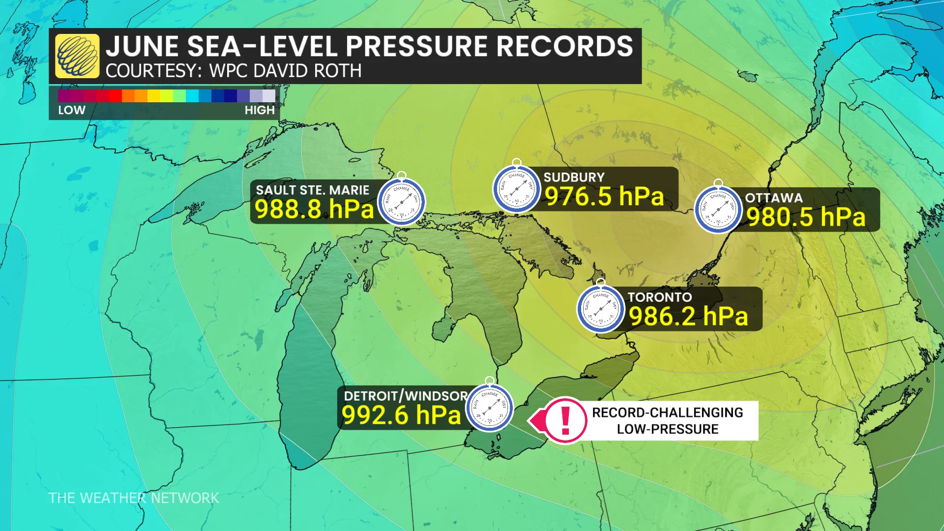
Ontario is bracing for a potentially record-breaking low pressure system as a storm intensifies over the Great Lakes mid-week. Deep low pressure, possibly dropping to 990 mb or lower, could set a new record for the lowest June pressure on record.
DON'T MISS: Visit our complete guide to Summer 2026 for an in-depth look at the Summer Forecast, tips to plan for it and much more!
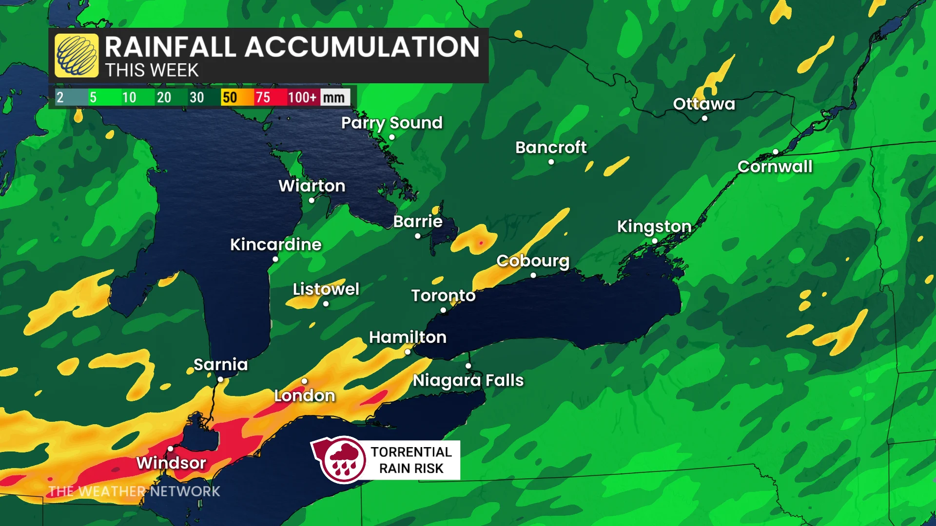
Most regions are expected to receive 20-40 mm of rain through Thursday, with localized areas possibly exceeding 50 mm. The system's rapid movement will help limit extreme rainfall amounts, however, the intensity and conditions will be more typical of a fall storm rather than a summer one.
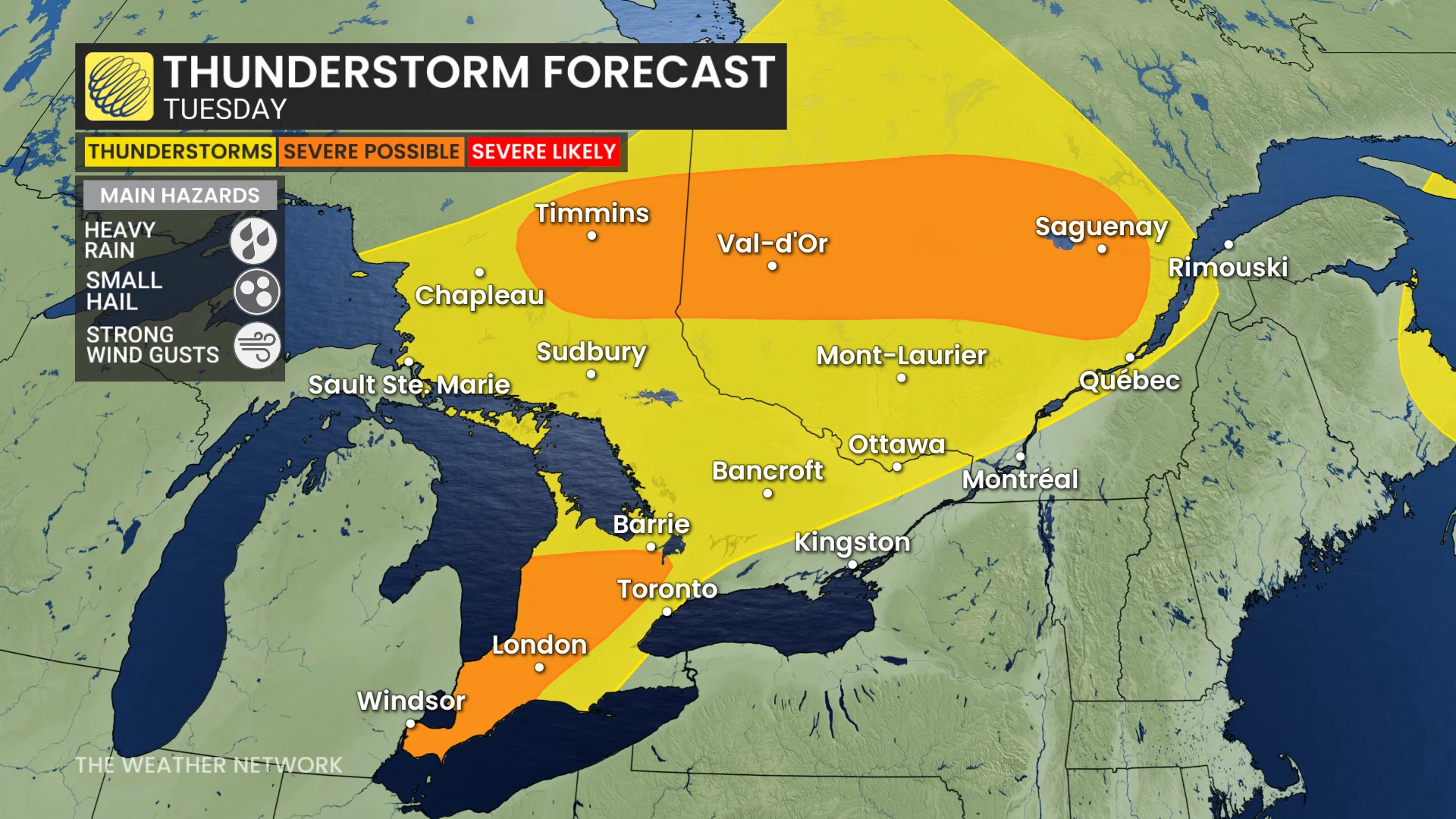
Tuesday: Thunderstorm chances with heavy rain and hail
A warm front will bring showers and thunderstorms to northeastern Ontario Tuesday. Isolated severe storms are possible, with threats of strong winds, hail over 2 cm, and heavy rainfall.
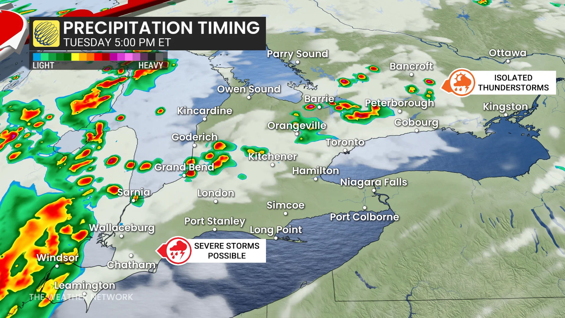
Pop-up afternoon showers are expected in inland areas of southern Ontario before instability builds in the evening.
Thunderstorms will spread across southwestern Ontario and along Lake Huron shores, moving inland and into the Greater Toronto Area (GTA) overnight.
Stronger storms near southern Georgian Bay and Lake Huron could bring heavy rain, strong winds, and small hail.
Wednesday: Strengthening storm could break records near Windsor
The storm will bring warm frontal showers to southwestern Ontario and along Lake Huron shores by Wednesday evening. Rainfall will intensify overnight as the system moves across southern Ontario, extending into the GTA.
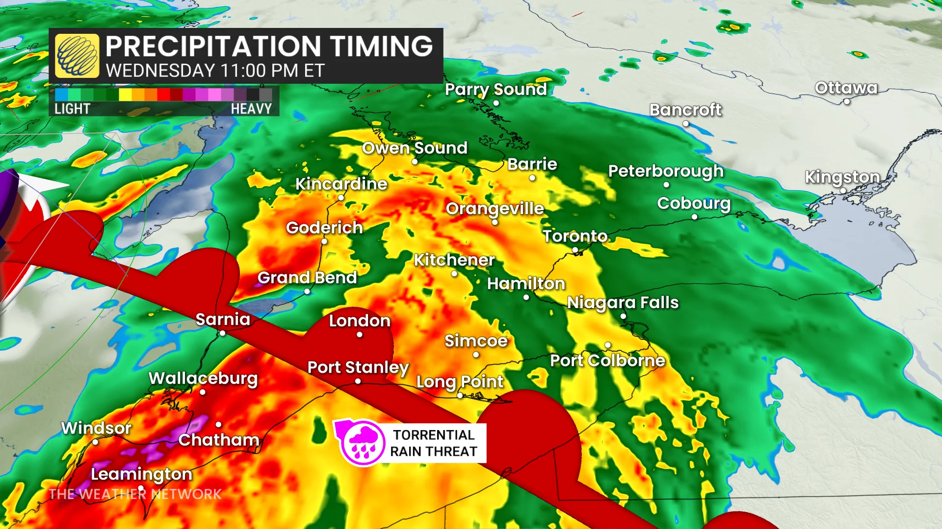
Increased atmospheric moisture will accompany the storm, leading to embedded thunderstorms with heavy to torrential rainfall.
As the low pressure system strengthens, strong winds are likely to develop, with gusts of 80-90+ km/h possible Wednesday night into early Thursday morning.
The deep low pressure system, potentially reaching 990 mb or lower, could set a new benchmark as the lowest June pressure ever recorded.
Thursday: Rain and winds continue, storm shifts into eastern Ontario
Windy and wet conditions will persist on Thursday, becoming more widespread as the storm moves into eastern Ontario and Quebec.
DON'T MISS: The wait is over: El Niño is officially here and it may make history
Widespread wind gusts of 60-80+ km/h are expected, with rainfall totals ranging from 30-50 mm.
Unsettled, cooler-than-seasonal end to June
The remainder of June is expected to bring near-seasonal to slightly cooler-than-seasonal temperatures on most days. Conditions will remain occasionally unsettled, with rainfall amounts projected to be close to the seasonal average across much of the region.