180,000 evacuated from Cuba as Tropical Storm Elsa approaches

Rainfall from Elsa will impact portions of the Florida Keys and Florida Peninsula on Monday through Wednesday.
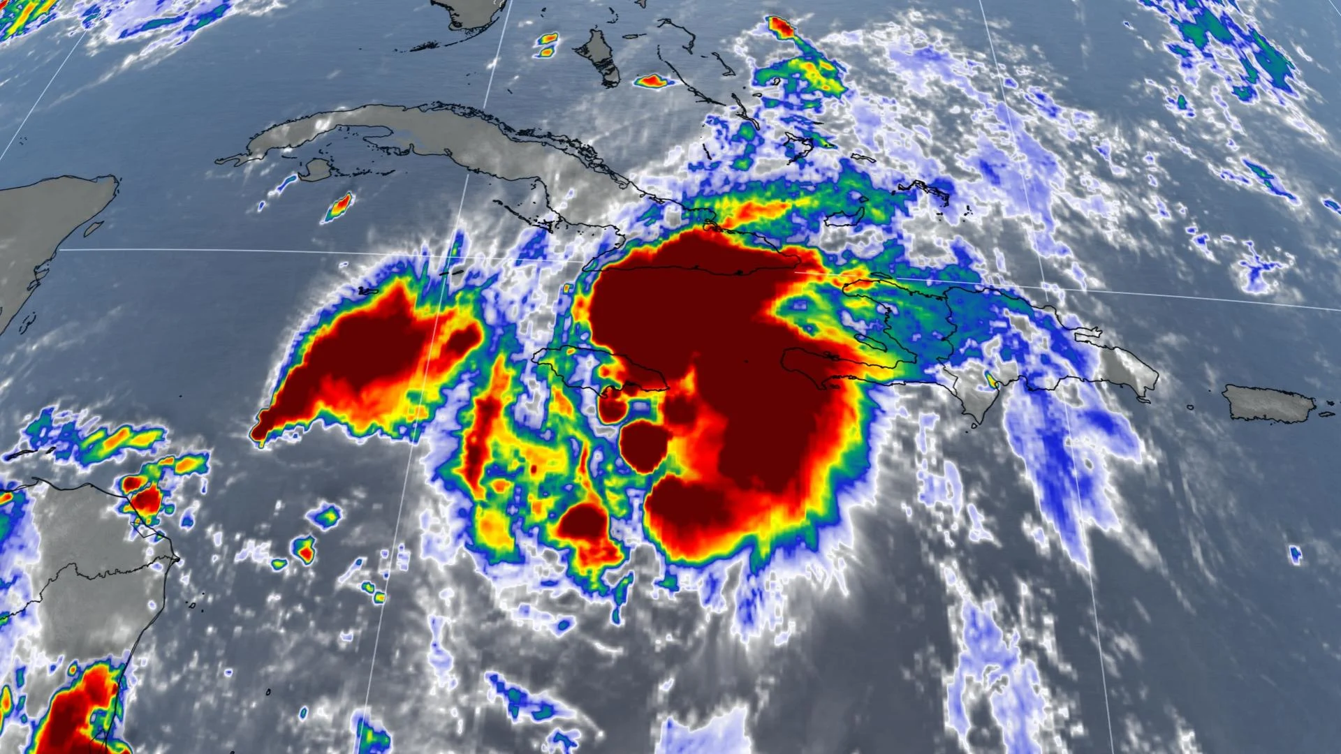
After bringing damaging winds and heavy rain to the Caribbean, Tropical Storm Elsa is set to track through Cuba and towards the Florida Straits on Monday. The U.S. National Hurricane Center (NHC) says that the storm is expected to track near or over parts of Florida’s west coast on Tuesday and Wednesday.
Elsa became first hurricane of Atlantic season on Friday before weakening and has resulted in at least three fatalities. As of Sunday evening, the storm was churning with maximum sustained winds of 95 km/h and was located roughly 160 km south of Camaguey, Cuba.

Tropical storm warnings and watches continue to cover a good portion of the Caribbean, with a hurricane watch for the Cuban provinces of Camaguey, Granma, and Las Tunas.
A tropical storm warning also extends to the Florida Keys from Craig Key westward to the Dry Tortugas, while a watch covers the southwest coast of the state.
Elsa’s path and speed are both the result of a large centre of high pressure parked over the western Atlantic Ocean. This high acts like a guardrail that prevents the storm from simply turning to the right and heading out into open waters.

Regardless of its strength, the storm’s greatest hazard will be flash flooding and mudslides on the islands in Elsa's path. Wind damage and coastal flooding are also possible during the peak of the storm’s strong winds.
Widespread rainfall totals of 100-200 mm are possible across parts of southern Haiti, Jamaica, and Cuba as Elsa passes through the area, with much higher totals possible in some communities. This rain may lead to flash flooding and mudslides, some of which could be significant.
Approximately 180,000 people have been evacuated from Cuba on Sunday amid the risk of severe flooding due to the 125-250 mm of rain in the forecast. Some isolated areas could see up to 400 mm from the storm.

Rainfall from Elsa will impact portions of the Florida Keys and Florida Peninsula on Monday through Wednesday. Amounts of 50-100 mm are expected, though localized maximum amounts up to 150 mm are possible. This is expected to result in isolated flash, urban, and minor river flooding.
It is currently too early to say what effects, if any, the storm or its remnants will have on Atlantic Canada by the end of the week.
Stay with The Weather Network throughout hurricane season for the latest updates.