Thunderstorm threat pops up in B.C., Alberta before cooldown with alpine snow

Get ready for a dynamic weather shift in Western Canada. Following a thunderstorm risk on Friday, a cold front will cause temperatures to plummet considerably, leading to snow for the higher elevations of B.C. and Alberta
A significant cooldown is set to arrive this weekend across B.C. and Alberta, with high-elevation snow, but before that happens, there will be a chance of thunderstorms for both provinces.
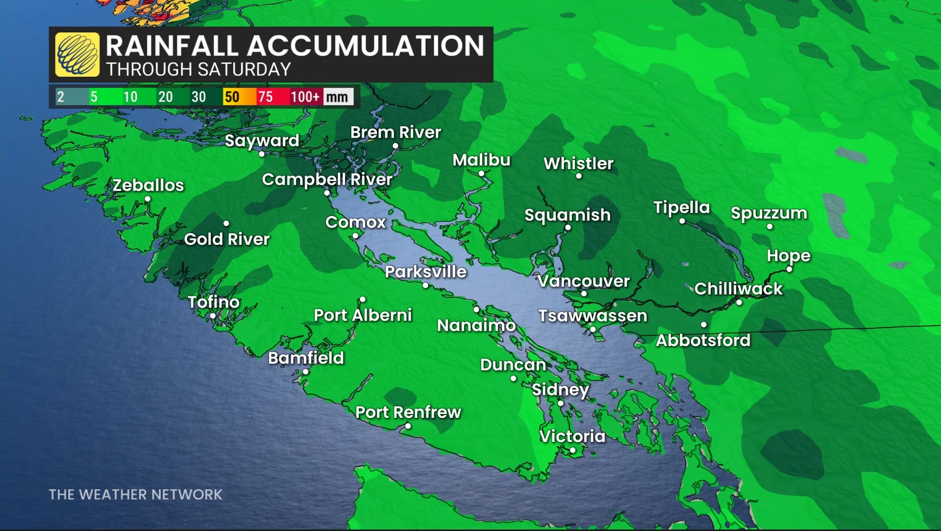
Widespread and much-needed rainfall totals of 20-40+mm are likely for parts of B.C., including the Lower Mainland. The rain will come with a non-severe thunderstorm risk on Friday, stretching into parts of Alberta, too.
Visit our Complete Guide to Fall 2026 for an in depth look at the Fall Forecast, tips to plan for it and much more!
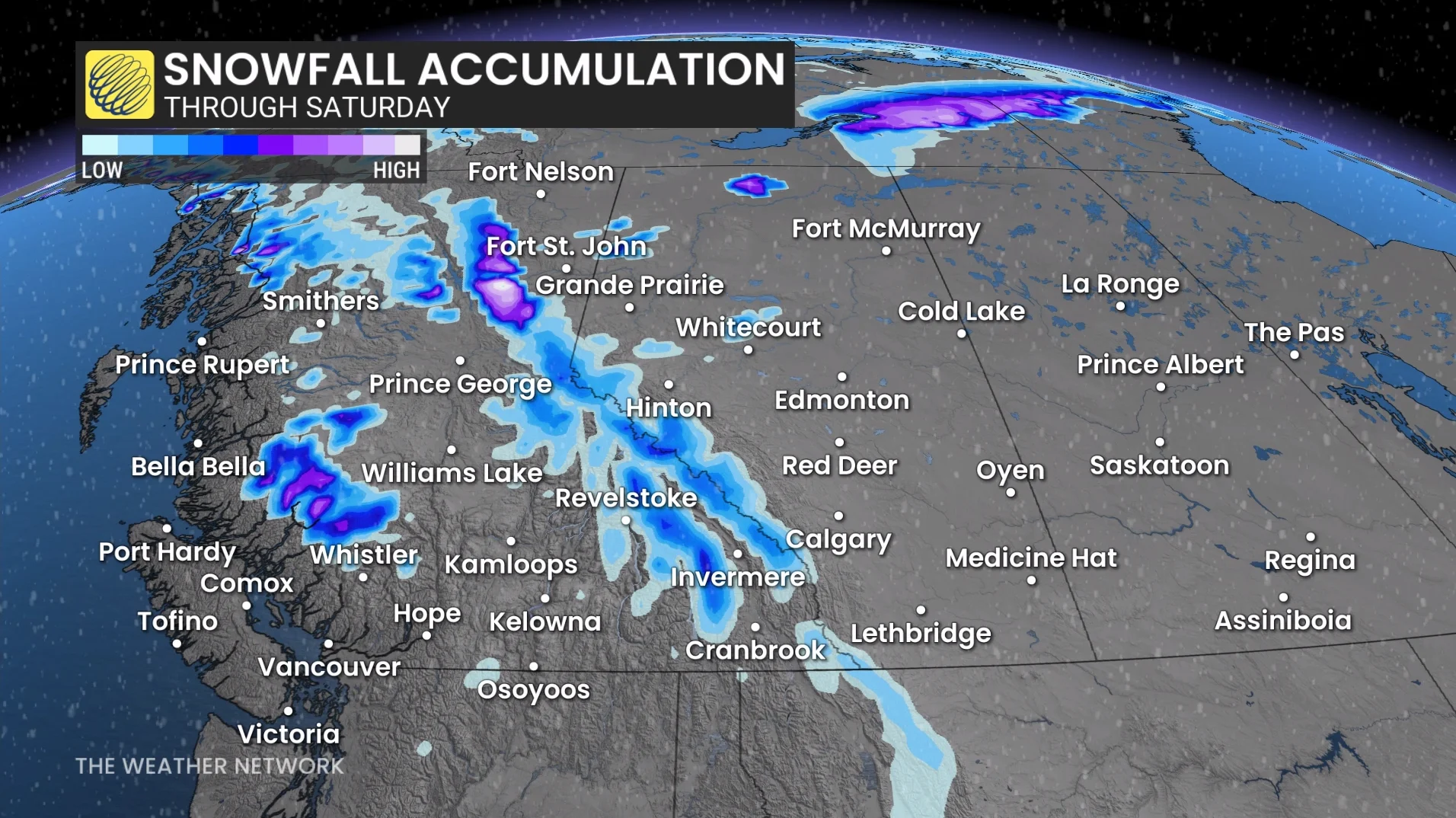
By Saturday, temperatures across B.C. and Alberta will drop noticeably, with the cooldown also leading to high-elevation snow in parts of both provinces.
Thunderstorm threat before cooldown arrives in B.C., Alberta
After a seasonably warm stretch of sun and temperatures in the mid-20s, change is coming to B.C. and Alberta.
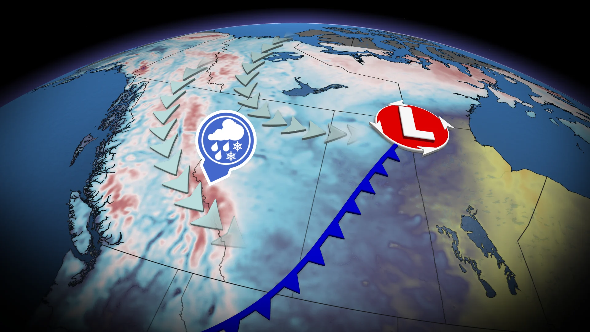
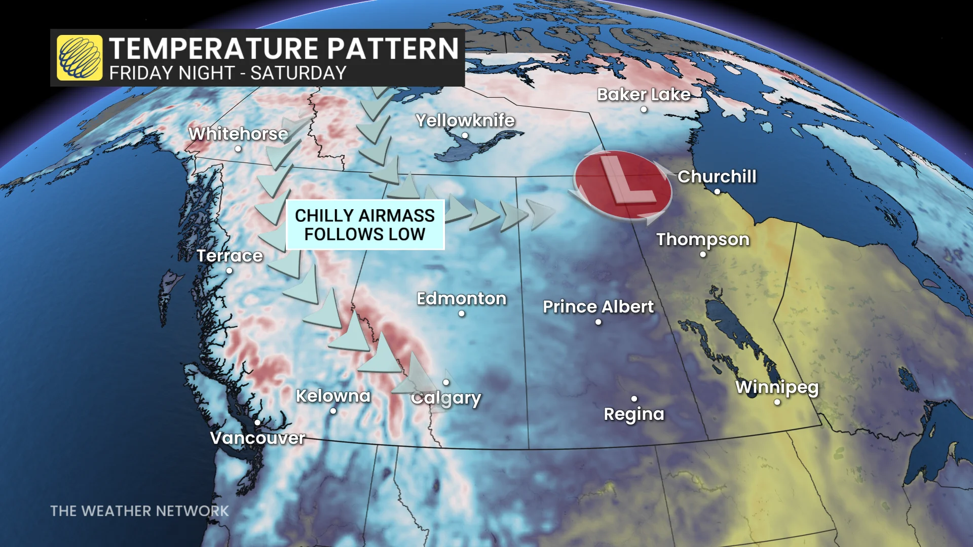
A strong low and cold front will develop stateside, tracking northwards over the Rockies and onto the Prairies through Friday.
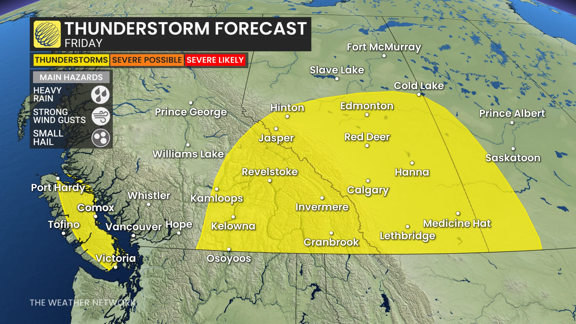
Widespread rainfall is expected, along with a non-severe storm chance, on Friday.
The recent heat has built up some thunderstorm energy, so storms will be possible on Vancouver Island, the Interior and across Alberta.
Much-needed rain is expected in the Lower Mainland where 0 mm has been recorded in Abbotsford, B.C., and a measely 2.5 mm seen at Vancouver airport so far this September.
The cold front will be sharp, though, wrapping in cold air from the north in its wake.
Expect a dramatic cooldown in Alberta, with a 10-degree or higher drop anticipated.
Temperatures will go from the mid-to-high 20s on Friday to the low, double digits on Saturday.
RELATED: Some of Canada’s first frost advisories of the season issued
Freezing levels will drop, as well, leading to alpine snow.
Alpine snow is expected for the Rockies and Coast Mountains.
The freezing level will hover near 1500 m in Jasper, Alta., on Saturday morning.