Blast of early morning snow prompts winter travel advisory in Ontario

Parts of Ontario are waking up to a decent coating of snow Wednesday, enough to impact morning commute times through the morning hours.
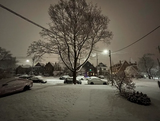
A weak clipper system spread snow into southern Ontario early Wednesday, with heavier bands impacting areas north and east of the Greater Toronto Area. Total snowfall accumulations won't amount to much overall, as temperatures rise and conditions improve through the morning hours. Still, some drivers may be faced with longer commute times, as quickly accumulating snow could make for slick and hazardous conditions. More on the timing of this mid-week dusting, plus a look at more impactful system that threatens periods of snow and freezing rain this weekend, below.
WEATHER HIGHLIGHTS:
Weak system brings a dusting of snow through Wednesday morning
Temperatures remain mild through week's end, with mostly cloudy conditions prevailing
Periods of snow, freezing rain and ice pellets threaten parts of Saturday, more significant impacts north of the GTA
WEDNESDAY: QUICK SHOT OF SNOW AHEAD OF RISING TEMPERATURES
As most areas wake up to a light dusting of snow on Wednesday, the Alberta clipper that pushed into the region late Tuesday night is having more of an impact for areas north and east of the GTA.
Environment Canada issued a winter weather travel advisory, warning of difficult travel over the hardest hit areas through Wednesday morning. The City of Toronto is included in the advisory as well.
"Travel may be hazardous for a few hours in the morning due to rapidly accumulating snow, slippery conditions and reduced visibility," EC says in the statement.
Generally, just 2-5 cm of snow is expected for most of southern Ontario, with locally higher amounts possible over higher elevations and about 5 cm around cottage country.
As the temperatures rise, the snow flurries will change to light rain or drizzle through the morning hours, allowing for improved travel conditions as the day wears on.

Most of Wednesday will then remain dry as temperatures begin the upwards climb to round out the work week.
Visit our Complete Guide to Winter 2021 for an in depth look at the Winter Forecast, Canada's ski season, and tips to plan for everything ahead!
THURSDAY AND FRIDAY: MOSTLY FAIR AND ABOVE SEASONAL TEMPERATURES
Temperatures will crack well above the freezing mark by Thursday, feeling even warmer on Friday as daytime highs sit at around 8°C for the south.
Mostly cloudy skies will persist, though with periods of sunshine at times as well.

WEEKEND: EYES ON A TEXAS LOW THAT THREATENS RAIN, SNOW AND FREEZING RAIN
The next system on the horizon for the region comes this weekend, as a storm develops over the southern U.S. and intensifies as it tracks into the Great Lakes on Saturday.
Widespread rain and very mild temperatures are expected for southern Ontario, though with a period of snow, freezing rain and ice pellets threatening central Ontario to start.
WATCH: TIMING THE WEEKEND WEATHER MAKER
"A more extended period of snow and ice is likely from Orangeville to Peterborough and into cottage country," says Weather Network meteorologist Dr. Doug Gillham.
The heaviest snow looks to target Nickel Belt, Upper Ottawa River and Temiskaming, with the threat for widespread totals of 10-20+ cm in those regions.
With the system still being so far out however, it's too early to have confidence in the exact track and impacts.

Blustery and more seasonal conditions are expected behind this storm in southern Ontario, with gusty winds and lake-effect snow developing Sunday and continuing into early next week.
"Near seasonal temperatures are expected for most of next week, however, at this point it looks like above seasonal temperatures could return to our region for the week leading up to Christmas," Gillham says, adding that no extended periods of cold weather are in sight.
Be sure to check back for the latest weather in your area.