Ontario: Potentially 'historic' snowfall event on tap for Monday

Ontario commuters can expect a slow, messy drive Monday morning but the afternoon/evening drive will be considerably worse
Sunday offered just a small glimpse into what's in store for southern and eastern Ontario Monday, when the main story will unfold. A cold front moving in from the U.S. will bring significant amounts of snowfall across much of the region. Snowfall warnings are in place from the western GTA to Niagara region, some of which could receive the largest amounts ever for this early in the season. For the timing of the snowfall, a look at snowfall records for November, as well as what's ahead for the rest of the month, read below.
Time to prepare for the season ahead! The Weather Network's Winter Forecast launches Monday, November 18.
WEATHER HIGHLIGHTS:
Snow/mix will into southwestern Ontario in the pre-dawn hours Monday
Heaviest snow in the GTA and Hamilton/Niagara area, lake-enhancement likely behind system Monday night and Tuesday
Chilly weather continues for much of November with some breaks in between
Stay up-to-date on the ALERTS in your area
WATCH BELOW: HOUR-BY-HOUR SNOWFALL FORECAST
While southern Ontarians should expect an extra slow and slick commute Monday morning, the afternoon/evening drive will be a nightmare as the heaviest bands of snow will fall during this time, along with a drop in temperatures. This could cause slush to freeze on the roads.
SEE ALSO: Windshield wiper blades: Is it a good idea to leave them up before a snowfall?
The significant storm rolling in is courtesy of a low-pressure system south of the Great Lakes. It will spread snow across southwestern areas beginning in the pre-dawn hours and will pick up across the western GTA and Niagra area by late morning.
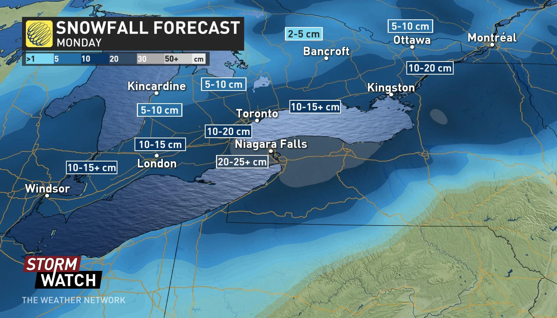
Snowfall totals across most of the GTA will hit the 10 to 15+ cm range, but areas towards Hamilton may see 15-20+ cm and the Niagara region will receive 20-25+ cm as a result of lake-effect enhancement. Travel will be particularly difficult near these areas.
Parts of eastern Ontario -- from Kingston to south of Ottawa and along the Quebec border -- could see 10 to 20 cm through Monday.
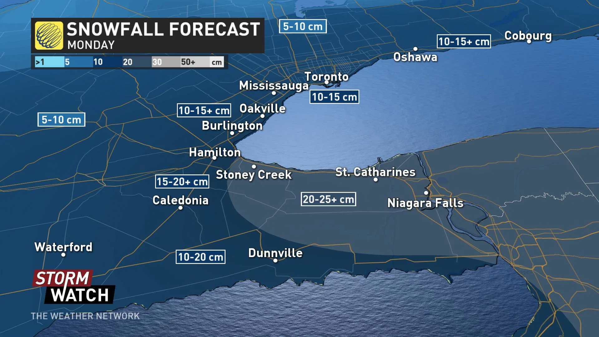
Areas north of the GTA including cottage country and the Ottawa area will see lesser amounts in the 5 to 10 cm range. While people in these areas will have a easier morning commute than southern communities, travel during the afternoon/evening hours will be impacted.
LARGEST AMOUNT OF SNOWFALL THIS EARLY IN THE SEASON?
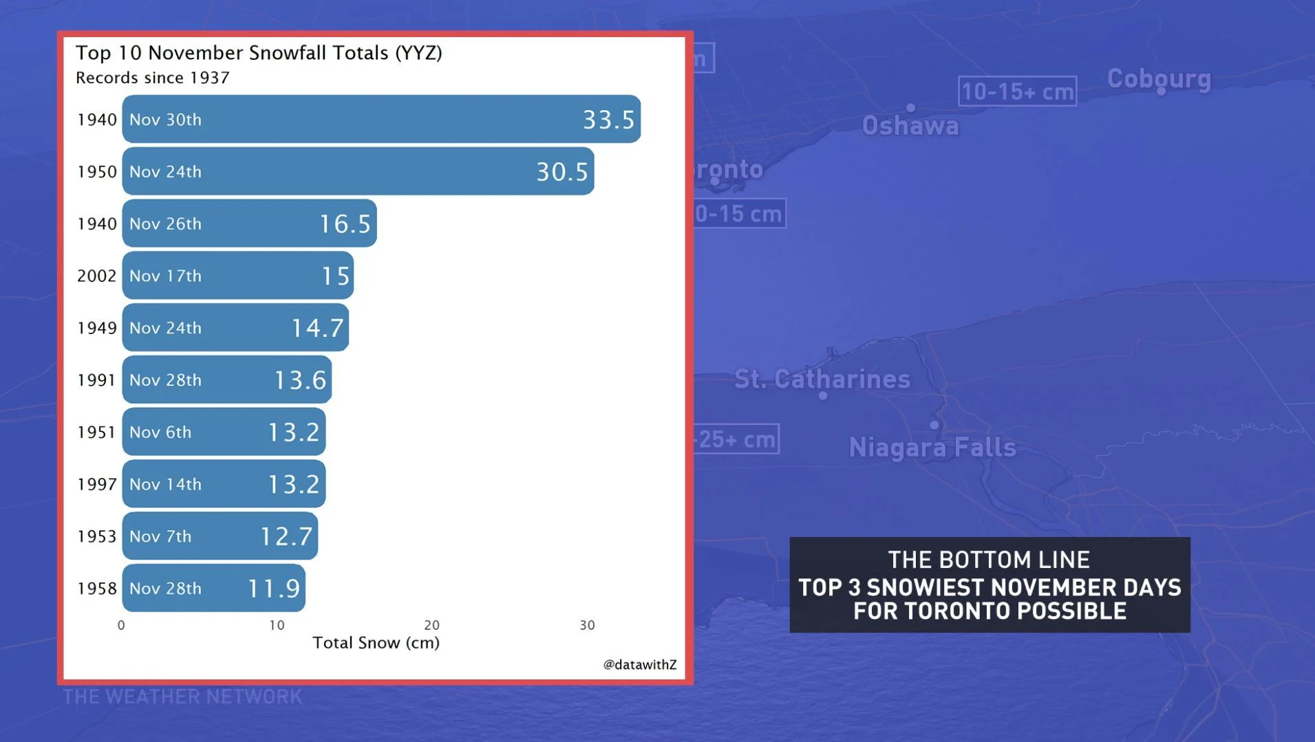
While Monday's snowfall will just crack the the top 10 of the highest amounts of the white stuff ever recorded at Pearson International Airport in all of November -- with a good chance of making the top 5 -- there's the potential for it to receive the highest amount this early in the season (on or prior to Nov. 11).

The current No.1 spot belongs to a Nov. 6, 1951 storm that dropped 13.2 cm of snow on the airport.
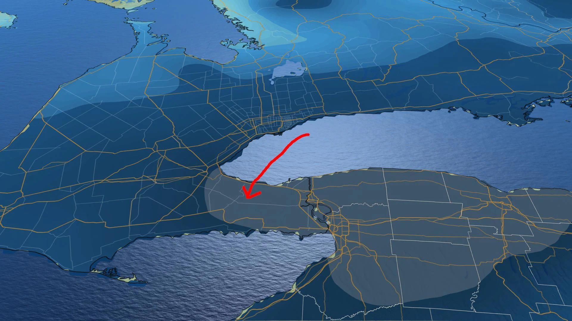
LAKE-EFFECT SNOW RETURNS AS COLD NORTH WINDS PICK UP
Behind the system, north winds will set the lake-effect machine back in motion from Monday night through early Wednesday. Intense squalls may impact travel southeast of Georgian Bay and Lake Huron, including areas near London and Collingwood.
For those who don't see another round of snow, those north winds will also bring a taste of January-like temperatures to southern Ontario, with highs nearly 10 degrees below average for many.
Although the cold pattern looks to relax at times during late November, overall, the chilly weather is set to dominate right through the end of the month.
Be sure to check back through the weekend for your latest forecast updates.


