Disruptive, snowy system in southern Ontario to be followed by lake-effect
Sunday will remain a poor travelling day across southern Ontario as road conditions remain messy from the wintry precipitation. Once the system departs, the lake-effect machine will kick up again--bringing more snow for the snowbelt communities as we enter December
With December nearly here, southern Ontario is getting a good preview of what's to come next month as bout of heavy snowfall on Sunday marks the end of November.
By the time the Colorado low departs on Sunday evening, snow totals will vary from 5 to 20 cm throughout the region. Following that, the some of the snowbelt regions can expect to see a fresh round of lake-effect snow to fire up to start the first week of December.
DON'T MISS: Severe snow squalls disrupt travel across southern Ontario
Allow extra time for travel as it will likely be challenging. Roads and walkways will likely be difficult to navigate due to accumulating snow. Visibility will likely be reduced at times.
Snowy impacts of Colorado low
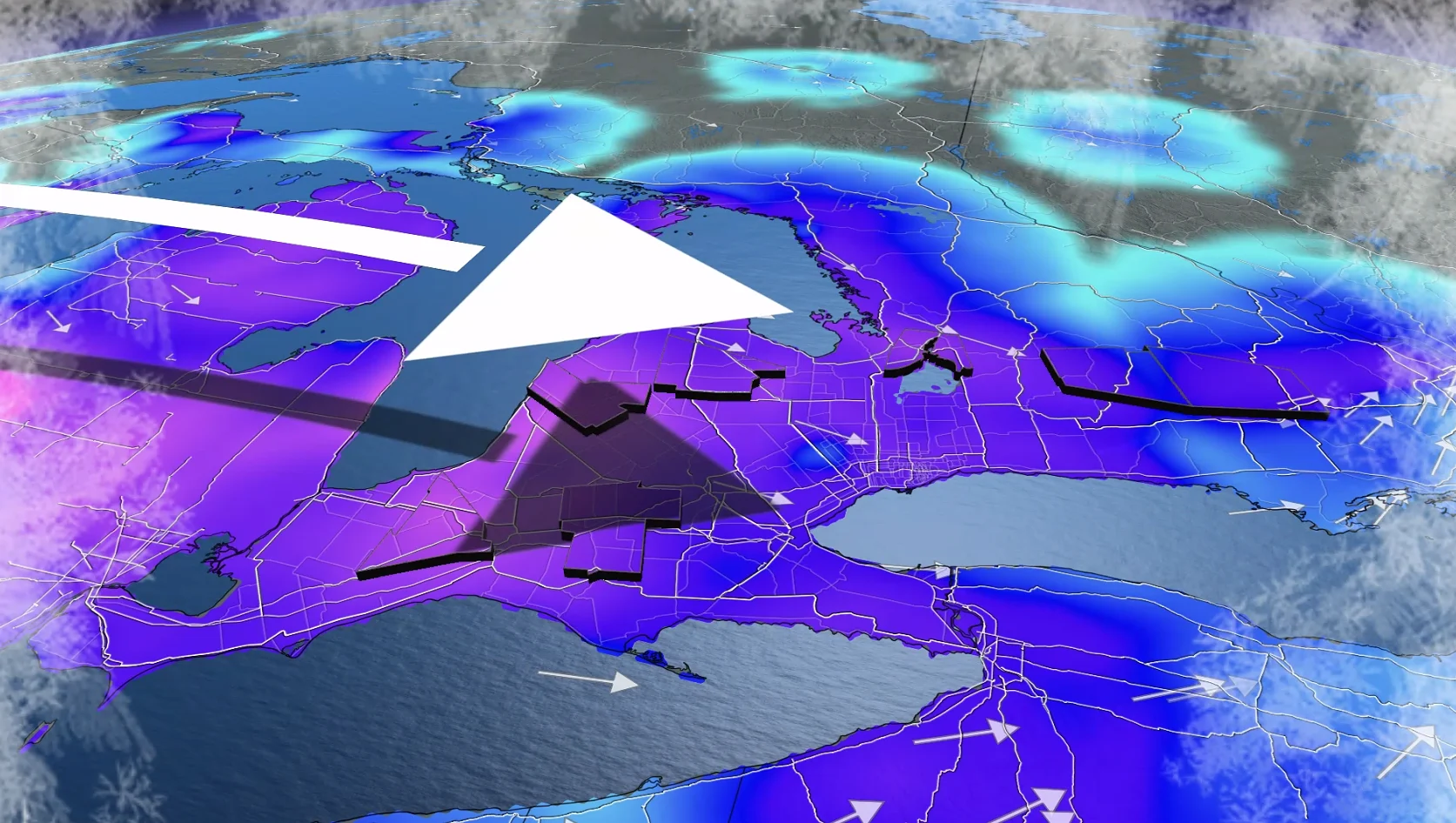
A Colorado low is sweeping across southern Ontario on Sunday, spreading a more uniform layer of snow across the region.
Some unofficial snowfall reports as of Sunday morning:

London: 11 cm
Aurora: 8 cm
Owen Sound: 7 cm
Caledonia: 6 cm
Toronto airport: 5 cm
Kingston: 2 cm
This system left a significant disruption in the Upper Midwest, with widespread reports of more than 20 cm of snow in Illinois, Michigan, Wisconsin and Indiana.
O’Hare International Airport reported hundreds of flight cancellations, which also created significant delays out of Dallas, NYC, and DC.
Flight Aware reported more than 2,600 flight cancellations within the U.S. on Saturday, with an additional 700 cancellations early Sunday.
WATCH: Snowfall accumulates across southern Ontario
What's left of the system?
Snow transitioned to a wintry mix or rainfall along the shores of Lake Ontario and Lake Erie, creating slushy conditions.
Periods of wet snow continue inland and over higher terrain across southern Ontario, as well as across Algonquin and eastern Ontario through the late morning.

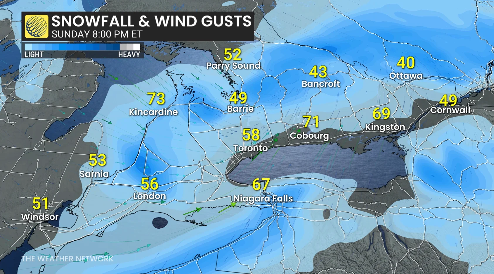
Gusty, southwesterly winds are developing as the low lifts north across Georgian Bay.
Peak wind gusts 60-70 km/h along the west end of Lake Ontario. Peak wind gusts 80-90+ km/h are expected across the north shore of Lake Erie.
Lake-effect machine revs up into Monday
Bands of lake-effect snow will develop southeast of Lake Huron and Georgian Bay as the system departs the region Sunday evening.
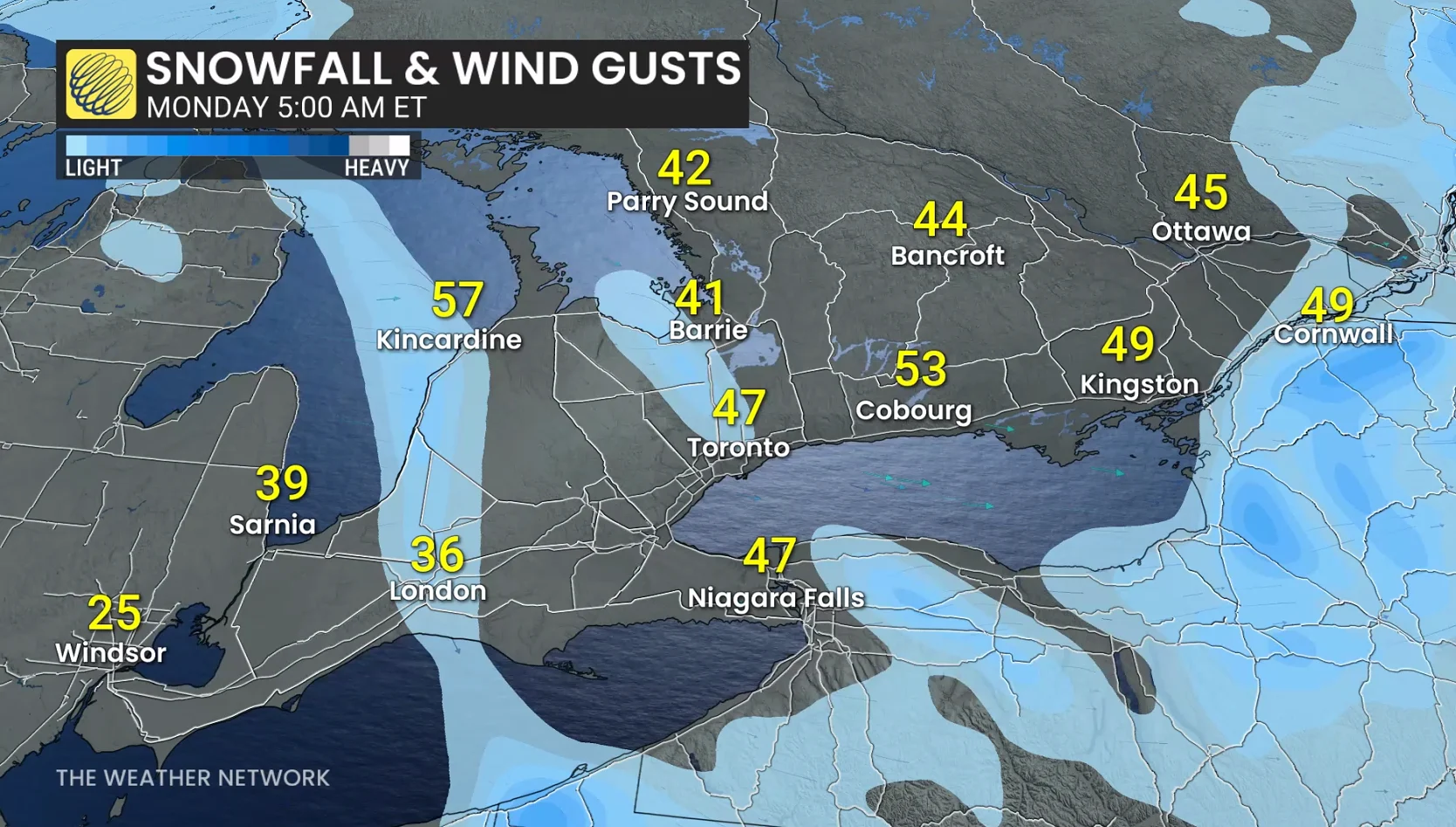
Strong, westerly winds kick up behind the cold front across Lake Huron, gusting to above 70 km/h, where snow squall activity will begin to once again increase through the early evening.

Periods of light, wet snow and a wintry mix spread into eastern Ontario before easing pre-dawn Monday as temperatures plunge.
Through pre-dawn Monday hours, squalls become more organized and intense along Highway 21 and in Huron County from Goderich to London.
Downwind of Georgian Bay, Collingwood and regions along and near the 400 are dealing with localized snowfall accumulation.

Squalls will transition to lighter flurries, thanks to a wind shift later Monday morning.
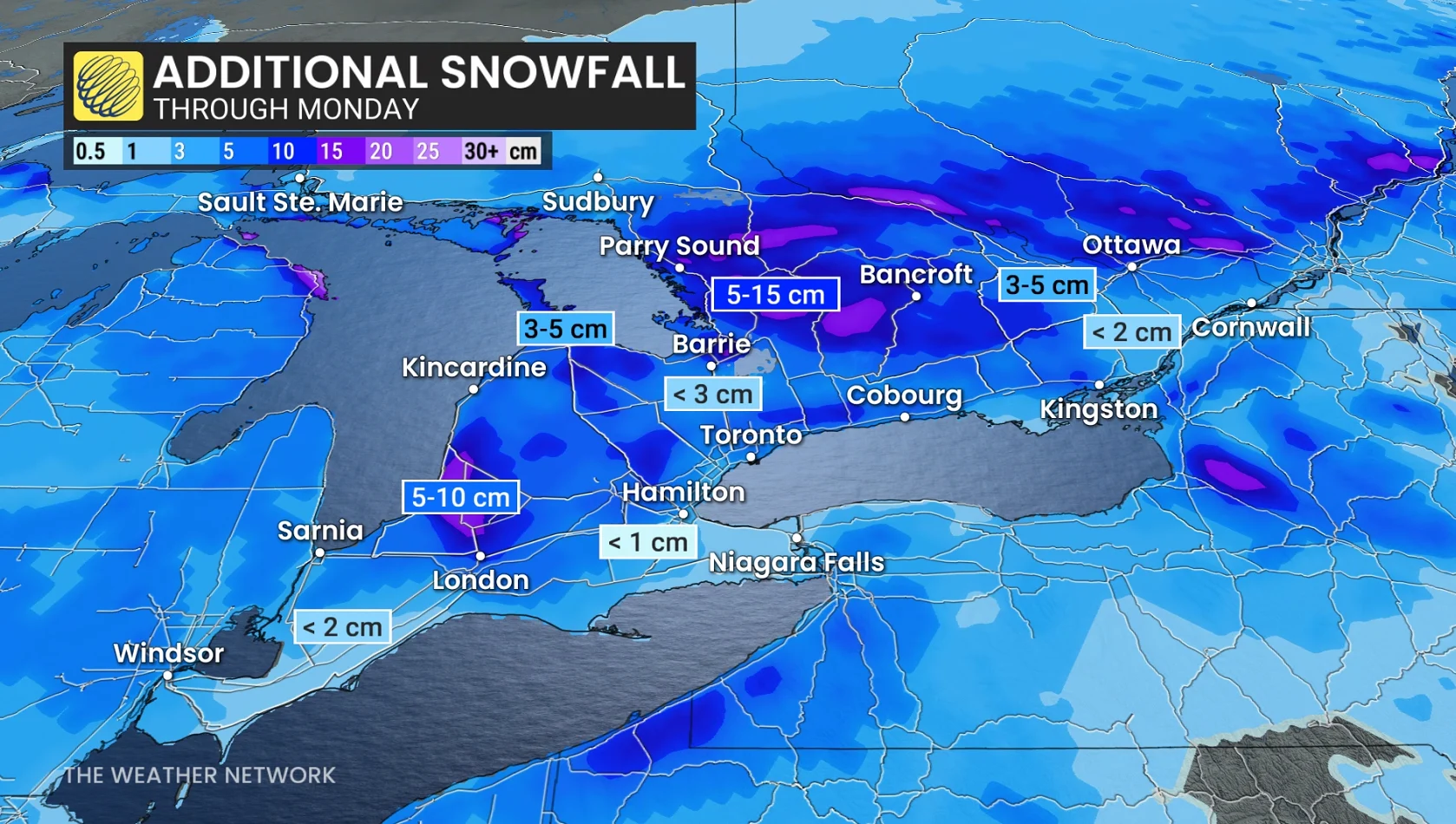
Additional snowfall forecast through Monday
10+cm: Regions north of London (Stratford)
5-10 cm: London, Haliburton, Parry Sound, Banfcroft and Petawawa
1-3 cm: Ottawa, Fergus, Orangeville

No more additional snowfall is forecast through much of the Greater Toronto Area (GTA), except a few cm north towards King City, Newmarket, and Alliston.
Looking into the beginning of December on Monday, we'll see temperatures take a dive behind the weekend's system. This will keep nearly all of Ontario below freezing--an apt start to meteorological winter.
Stay with The Weather Network for the latest updates across Ontario
