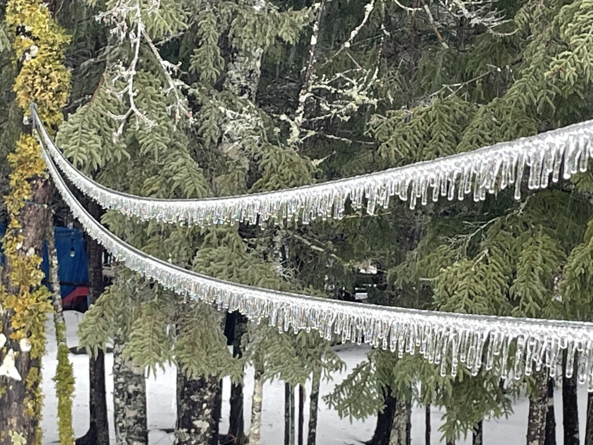
Multiple messy systems heading to Atlantic Canada, treacherous travel expected
Multiple icy systems are in the forecast for Atlantic Canada for the final days of 2023
Freezing rain, ice pellets, wet snow, and plain ol’ rain are all on the way for Atlantic Canada in a fitting end to a busy year of rollicking storms, threatening an all-you-can-scrape buffet of winter weather headaches across the region.
Our first storm is a low-pressure system that made its way into the Maritimes overnight Thursday into early Friday morning. Several hours of freezing rain brought icy conditions to sidewalks and roadways through the early morning hours on Friday.
A second system will swing across the region by Saturday, bringing the possibility of widespread wet snow across the Maritimes.

DON’T MISS: New Brunswick's pre-Christmas power outage among the worst in decade
Tiny changes in temperature a few hundred metres above the surface will have a huge impact on who sees liquid rain, freezing rain, ice pellets, and snow over the next 36 hours.
Cold air stubbornly hugging the ground will remain in place even as warm, moist air flows in from the south. This warm air will ride up and over the colder air below, creating a perfect setup for freezing rain and ice pellets through Friday.

For the better part of this first system, at least, regular rain is the most likely precipitation type close to the coast around Saint John, Halifax, and Yarmouth.
Currently, the best potential for a narrow band of freezing rain exists along the Trans-Canada Highway across New Brunswick and Nova Scotia, including the cities of Fredericton and Moncton. A freezing rain warning is in effect for these areas through late Friday morning.
Some areas could see up to 15 mm of ice accretion by Friday. A glaze of ice on streets, sidewalks, driveways, and stairs will make for dangerous driving and walking conditions for the duration of the storm. Isolated power outages are possible where ice weighs down trees and power lines.

MUST SEE: 2023 ending with mind-boggling warmth in Canada’s frigid Arctic
A changeover to ice pellets is likely by Friday afternoon across a large swath of northern Nova Scotia, as well as eastern portions of New Brunswick and Prince Edward Island. Some areas could see ice pellet accumulations on the order of 20-40+ mm.
Ice pellets accumulate like snow, but after a while, it can freeze into a slippery, solid sheet of ice that’s exceptionally difficult to remove from streets, sidewalks, and vehicles.
Colder air moving in will force precipitation to change over to wet snow by Friday evening.

We’ll have a better chance for widespread snow across the Maritimes come Saturday as another system quickly scoots into the region. The best opportunity for 5-15+ cm of snow looks to focus on eastern New Brunswick and Prince Edward Island.
Newfoundland can expect a mixed bag of wintry precipitation late Friday and into the day Saturday. Colder air here makes it more likely that snow will develop across the Avalon and south coast, but a period of ice pellets is possible overnight, eventually switching to rain by Saturday morning.
The 2nd system will add to the snowfall totals of the first system, however, temperatures will be hovering right around the freezing mark, potentially bringing the risk of ice pellets mixing with the snow.
Be sure to check back over the coming days as forecasters continue to refine this complex forecast across Atlantic Canada.
Thumbnail courtesy of Mike Macdonald.
