Fall offers southern Ontario a final summer heat boost, severe storm risk

A severe thunderstorm risk will accompany a summer-like boost in temperatures for southern Ontario. There will be the threat of heavy rainfall, strong winds, small hail and localized flooding Monday overnight and again on Tuesday
Get ready for what will likely be a parting gift from the summer season in southern Ontario.
Summer-like conditions and a risk of thunderstorms, perhaps for the final time this year, are expected early in the week before a sharp cooldown settles in. Some of the storms on Monday night and Tuesday could reach severe limits in many locales, so stay alert.
DON'T MISS: Canada's Winter Sneak Peek: El Niño puts record warmth in play
Be sure to stay alert to the changing conditions, and check for any weather warnings in your area.
Don't get used to the warmth: A significant temperature drop in time for the weekend.
Temperatures to soar early this week, with thunderstorm risk
Conditions will change Monday overnight into early Tuesday, when a potent low and warm front will spread showers and thunderstorms across southern Ontario.
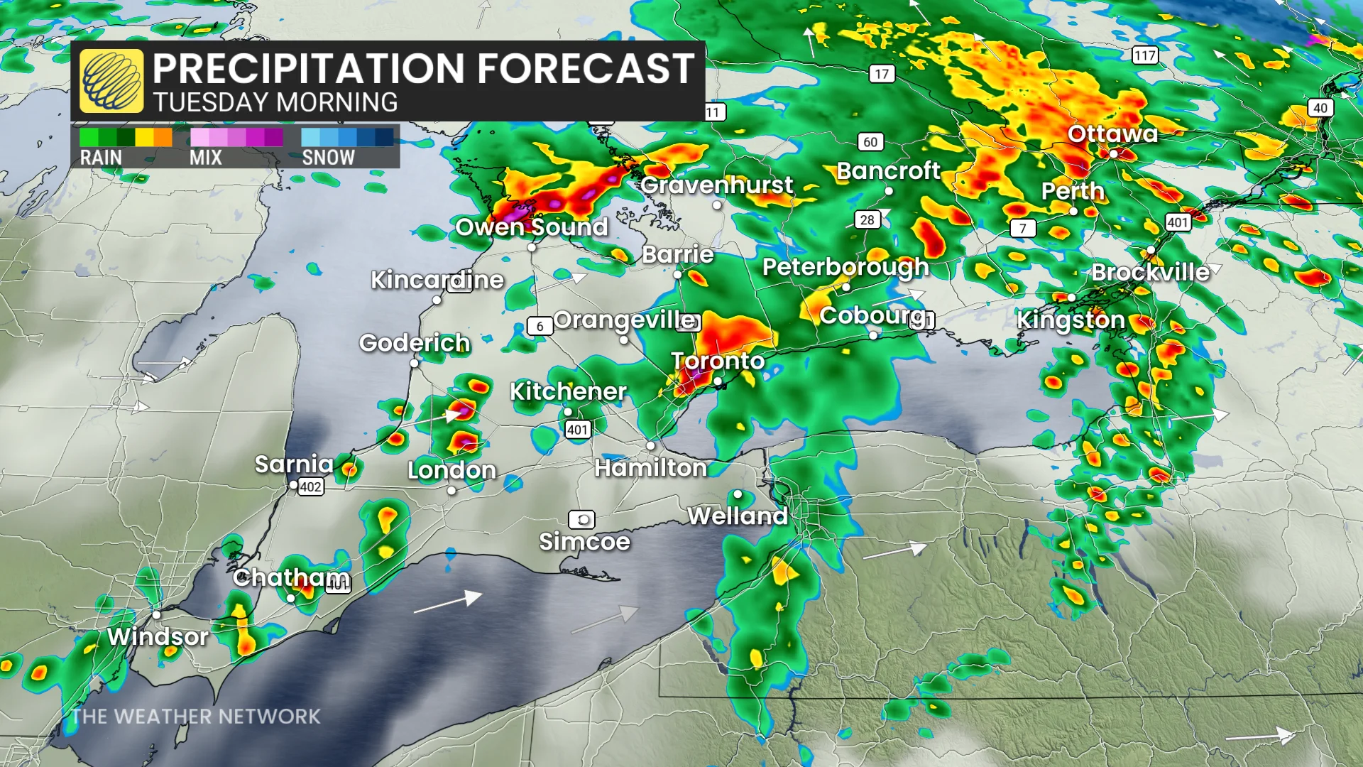
Folks can expect some strong storms ahead of and along the warm front, bringing heavy rain and strong 80+ km/h wind gusts into Tuesday morning.
It's also possible we could see some severe storms develop early Tuesday morning from Lake Huron's shores, across southern Georgian Bay, through Peterborough and the Kawarthas, all the way to Lake Ontario's eastern shores.
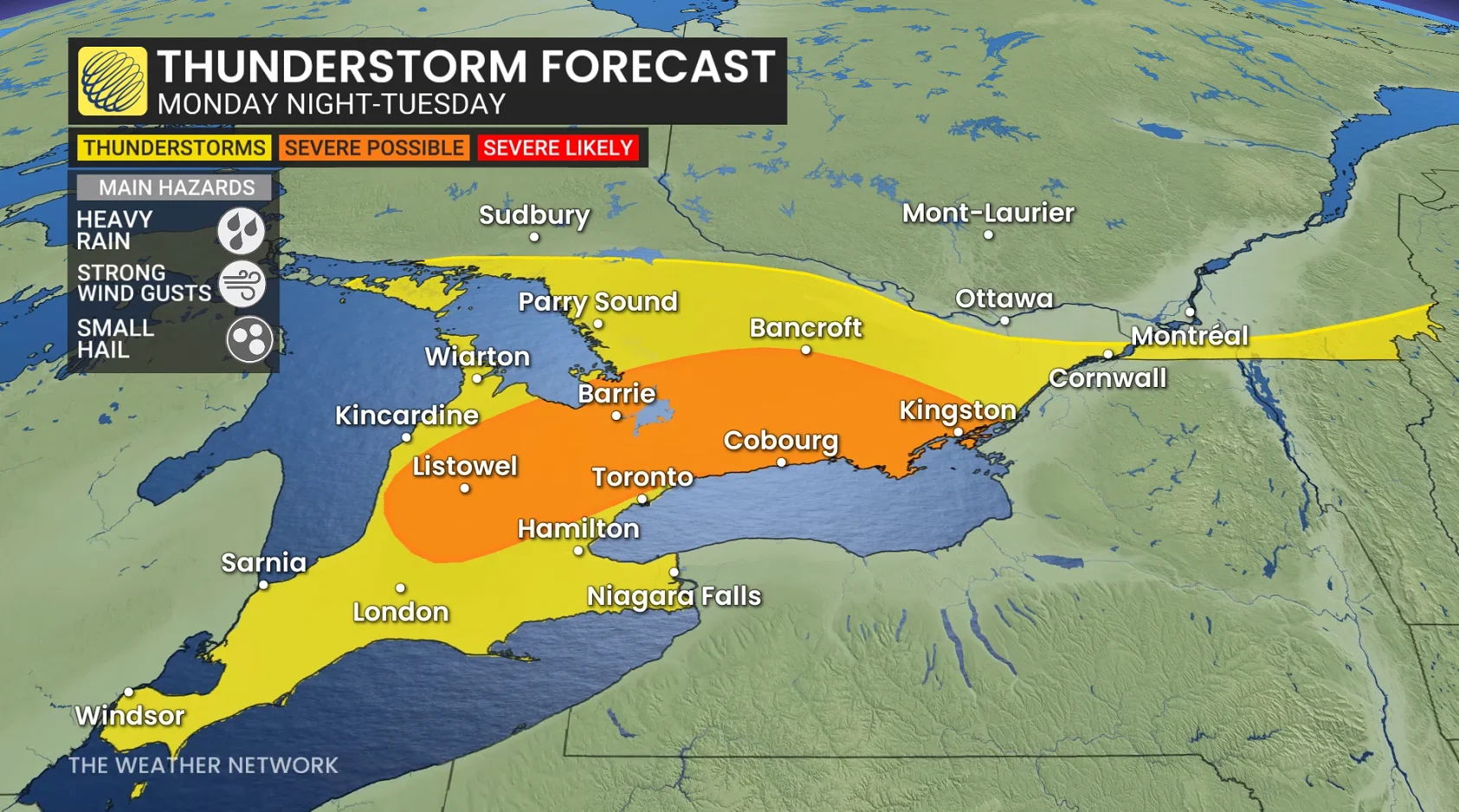
Localized flooding and power outages will be risks to watch out for.
Temperatures are forecast to climb into the mid-20s, with Windsor forecast to hit 28°C--remarkable heat for this time of the year.
SEE ALSO: Climate versus weather? What's the difference?
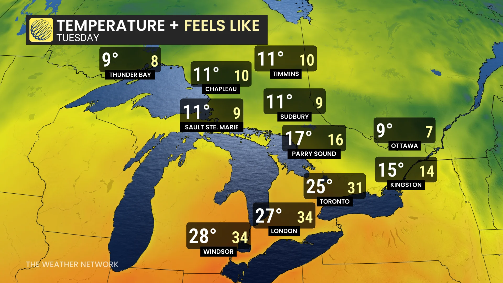
But it will feel even warmer on Tuesday, as moisture from the remnants of post-tropical storm Rachel will sweep across southern Ontario, bringing about three times the atmospheric moisture than we'd typically see this time of year. With the intense humidex, temperatures will feel more like the low to mid 30s across much of the region, including the Greater Toronto Area.
However, a cold front is expected to track through later Tuesday and break the warmth, as well as bring another round of showers and thunderstorms.
The heaviest rains should stay north of the Greater Toronto Area (GTA), in cottage country and eastern Ontario. With the tropical remnants and thunderstorms, we could even see up to 50 mm of rainfall across the Ottawa region.
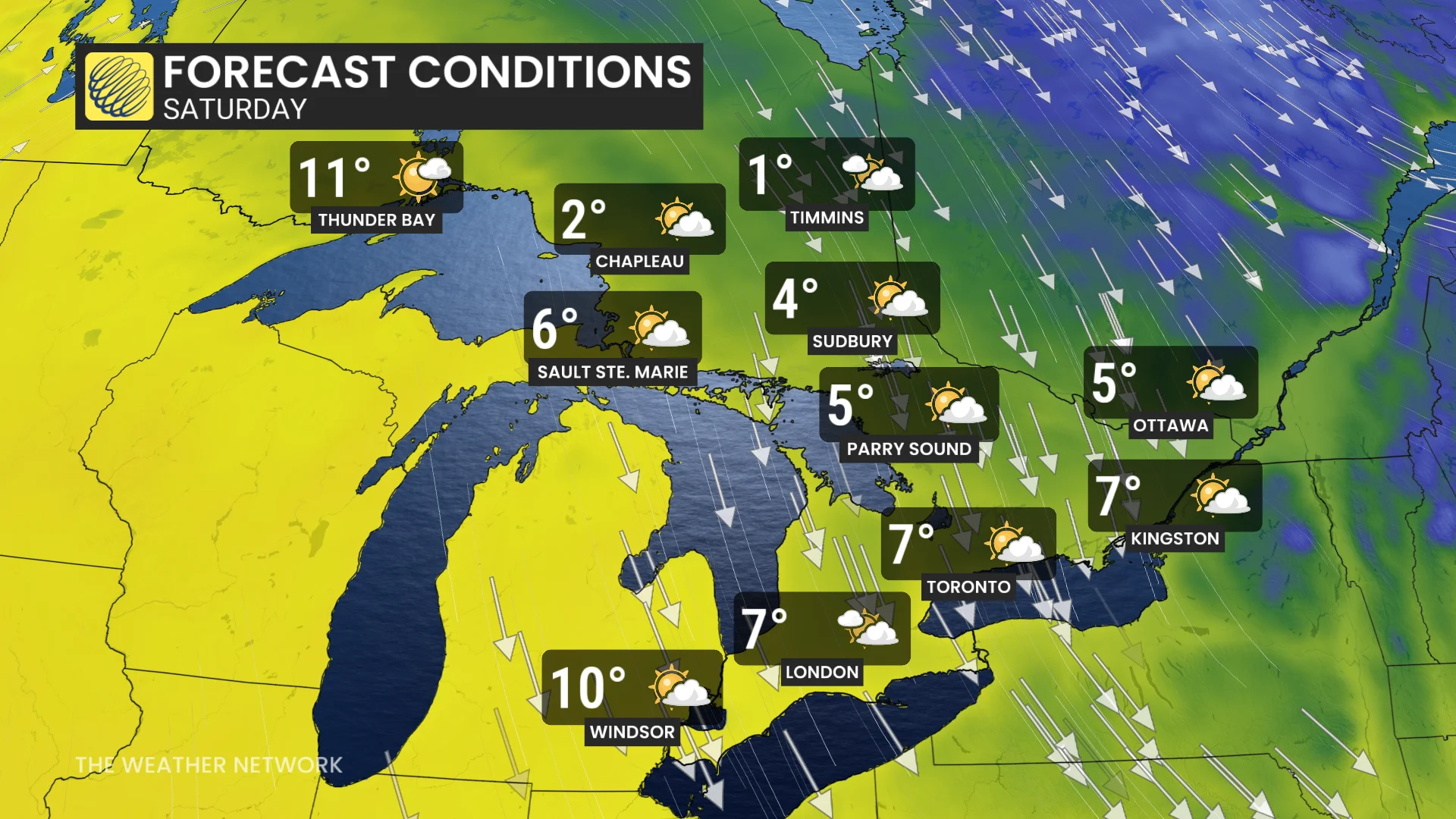
The winds will shift to come out of the north by Wednesday night, and by the end of the week, as we approach next weekend, temperatures will be drastically cooler. Some areas will only hit the single digits for highs.
However, temperatures are expected to be changeable through the following week. Above-seasonal temperatures are then expected to return for late October and November.
Stay tuned to The Weather Network for the latest forecast updates for Ontario.