December weather returns to Ontario with cold air, new bout of snowfall
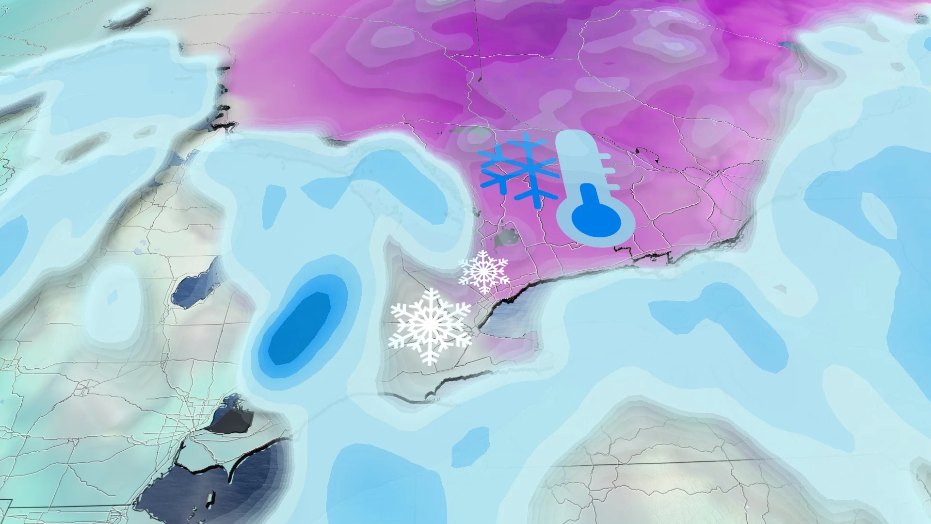
Southern Ontario welcomes back wintry weather on Wednesday and beyond. Parts of the region could see 5-10+ cm of snow this week, falling in two parts, followed by the coldest air of the season so far
After a nice breather from shovelling snow and cold temperatures, southern Ontario returns to more wintry weather Wednesday, and beyond.
Snowfall will return to southern and eastern Ontario on Wednesday and late Thursday, persisting into Friday. Some areas could see 5-10 cm of snowfall coming in two rounds. Following that, a noticeable temperature drop into the negative digits will be among the coldest air of the season for the region so far.
DON'T MISS: La Niña enters stealth mode as pattern flies under the radar
Brace for slower commutes come Wednesday as roads will become slippery with the wet surfaces from the snow and the recent rainfall.
This week: Snow and much-colder temperatures arrive
A weak system moves into the Great Lakes on Wednesday with some messy, snowy weather.

Temperatures appear marginal, but will cold enough for wet flurries Wednesday morning in the southern end of the province.
Precipitation moves into the Greater Toronto Area (GTA) and the Ottawa Valley by Wednesday afternoon. Expect slippery road conditions and slower commutes during this time.
Most of the GTA sees rain or periods of a rain-snow mix. Rain to start in Ottawa, but snow eventually takes over Wednesday evening.

The immediate lakeshores could see rain, however, thanks to the warming effect of Lake Ontario while Pearson International Airport and the northern GTA regions receive snow.
2-5 cm of snow is possible by Thursday morning. Totals will range and have uncertainty due to periods of a rain-snow mix. Toronto downtown and surrounding lakeshore regions will see less than 1 cm as it will be a mainly rain event.
SEE ALSO: Canada’s magic number: What exactly makes for a 'white Christmas'?

That won't be the end of the snow, either. Snowfall with higher totals is on the way.
A clipper from the Prairies moves into the Great Lakes, spilling snowfall across southern Ontario late Thursday through Friday. These two events could lead to a widespread 5-10 cm of accumulations.
Higher totals east of Sarnia, Ont., with a lake-effect band setting up, giving a potential for more than 15 cm with blowing snow.

This weekend will bring our coldest weather of the season thus far as Arctic air is forced eastward. Saturday and Sunday wind chills will be in the negative teens in the GTA, -20s in cottage country.
Frigid weather will continue through Sunday, but then temperatures will recover early next week.
WATCH BELOW: Toronto Airport breaks an all-time precipitation record
Be sure to check back for all the latest on conditions across Ontario.