December: Still a 'wild card' month for weather across Canada

The month of December looks to feature a changeable and active weather pattern across Canada.
Since early September we have been calling December the wild card in our winter forecast. Strongly contradictory signals gave us lower confidence in the pattern for December compared to the rest of winter and into early spring.
Now that December has begun, it seems that we still have more questions than answers as to exactly how December will unfold, but here is an overview of what we are currently thinking.
Visit our Complete Guide to Winter 2019/2020 for an in depth look at the Winter Forecast, tips to plan for it and a sneak peek at the spring season next year
'CHANGEABLE' WILL BE THE WORD OF THE MONTH
It looks like “changeable” will be the best word to describe the upcoming month. We do not expect that we will lock into a well defined pattern, especially not during the first half of the month. This is in contrast to much of the fall, which featured extended periods in which large parts of the country were well above normal or well below normal.
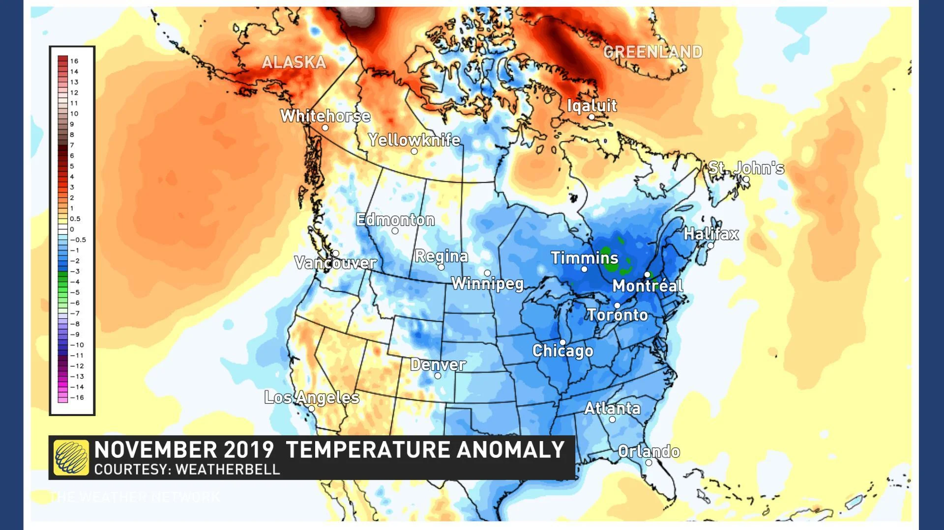
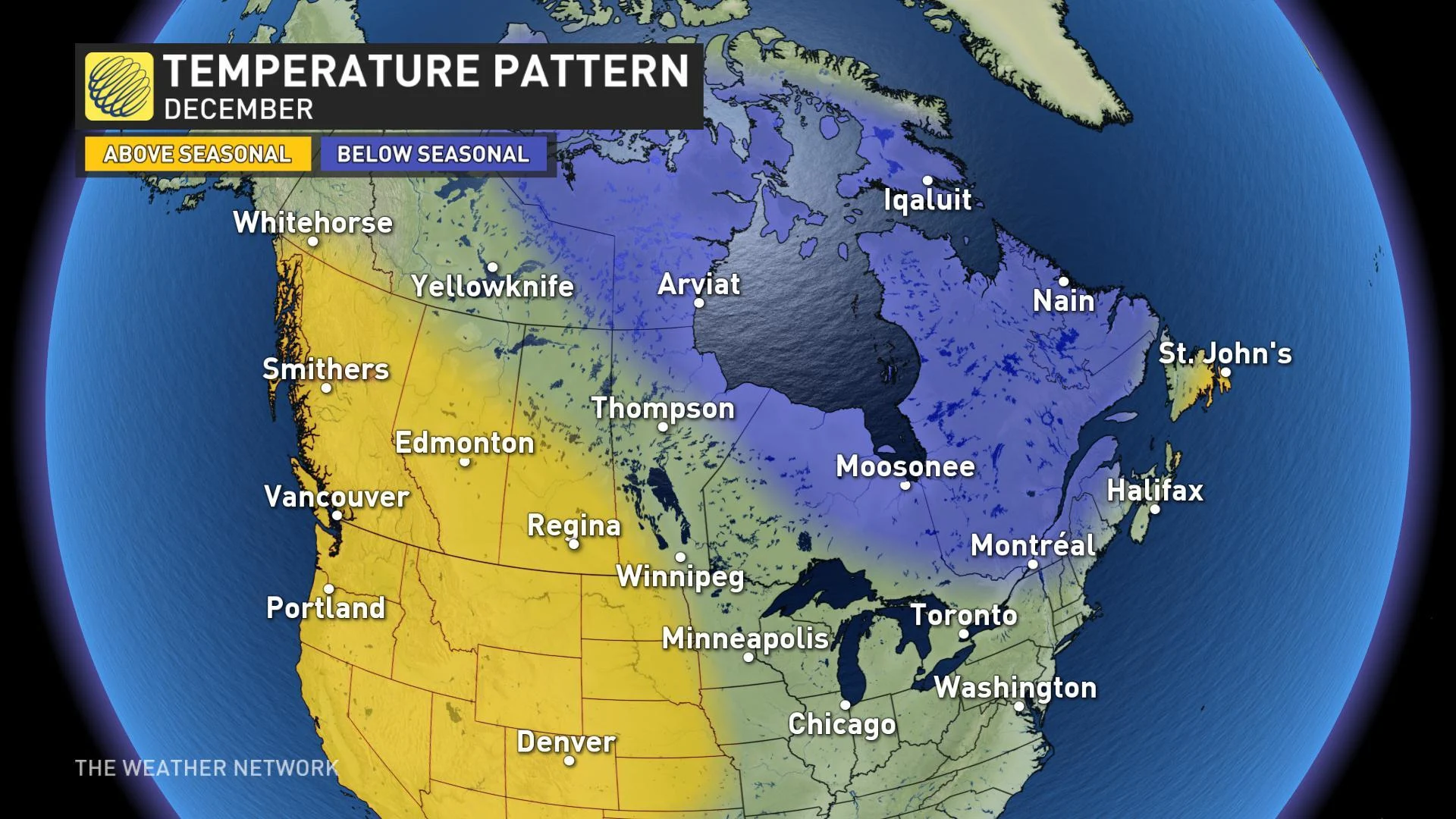
Below is a quick look back at what we saw during the month of November. Most of Canada was colder than normal, especially from Ontario to New Brunswick as highlighted by the various shades of blue on the map.
In contrast, we expect that much of Canada will be near normal or slightly above seasonal for the month of December, but we don’t expect any region of the country will end up more than a degree or two above or below normal for the month as a whole.
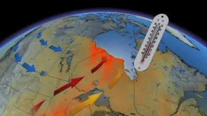
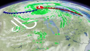
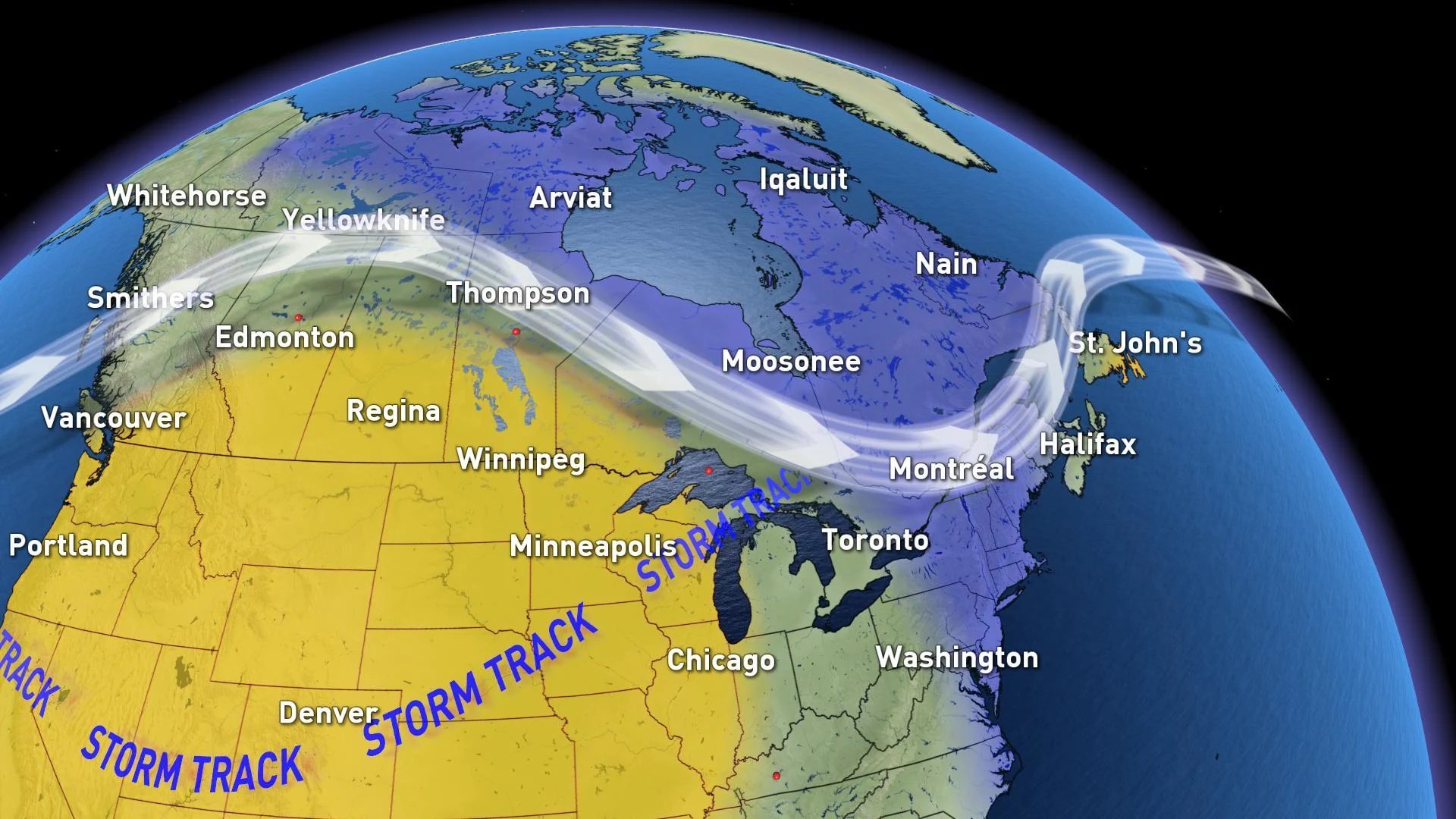
However, it is important to keep in mind that “normal” temperatures during December are considerably colder than they were in November and it is quite possible now to have high impact winter weather without being colder than normal. Changeable patterns are often active patterns and we expect that this December will have more winter storms than we saw last December.
Here is rough overview of how we think the month will progress.
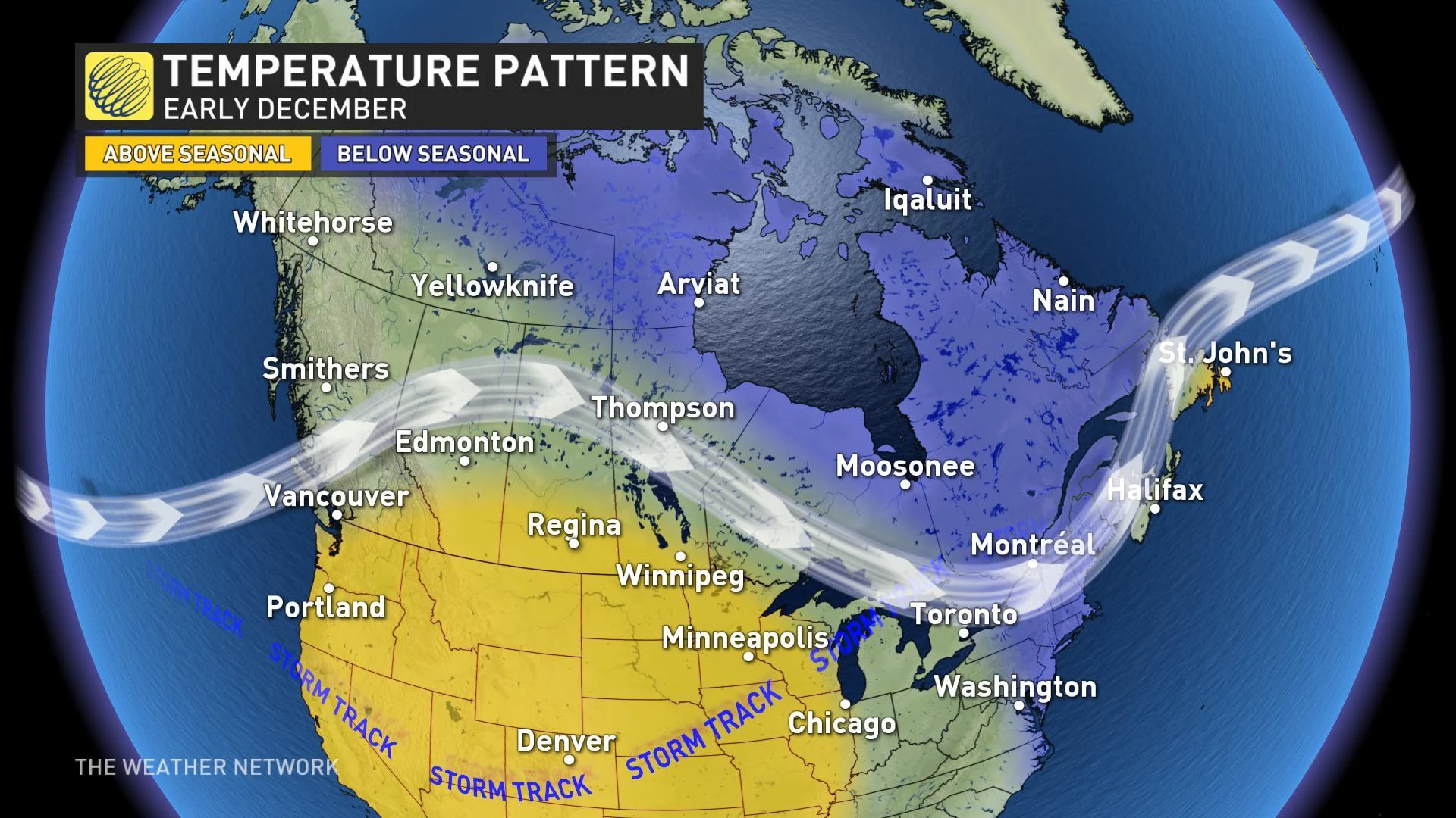
EARLY DECEMBER PATTERN OVERVIEW
The first 10 days of December will be changeable across the country, but the back and forth swings in temperature should result in near normal or above normal temperatures for most places west of the Great Lakes and also across Newfoundland. Meanwhile, temperatures should be near normal or below normal from the Great Lakes to the Maritimes and across northern Canada.
MID-DECEMBER PATTERN OVERVIEW
During the middle of December, forecast confidence completely breaks down for a while. There are a number of signals that point to a period of milder weather spreading east into the Great Lakes region and into Maritimes. However, with a large region of colder than normal weather nearby to the north and contradictory signals in the pattern, we have to acknowledge that any warm-up could be cut rather short.

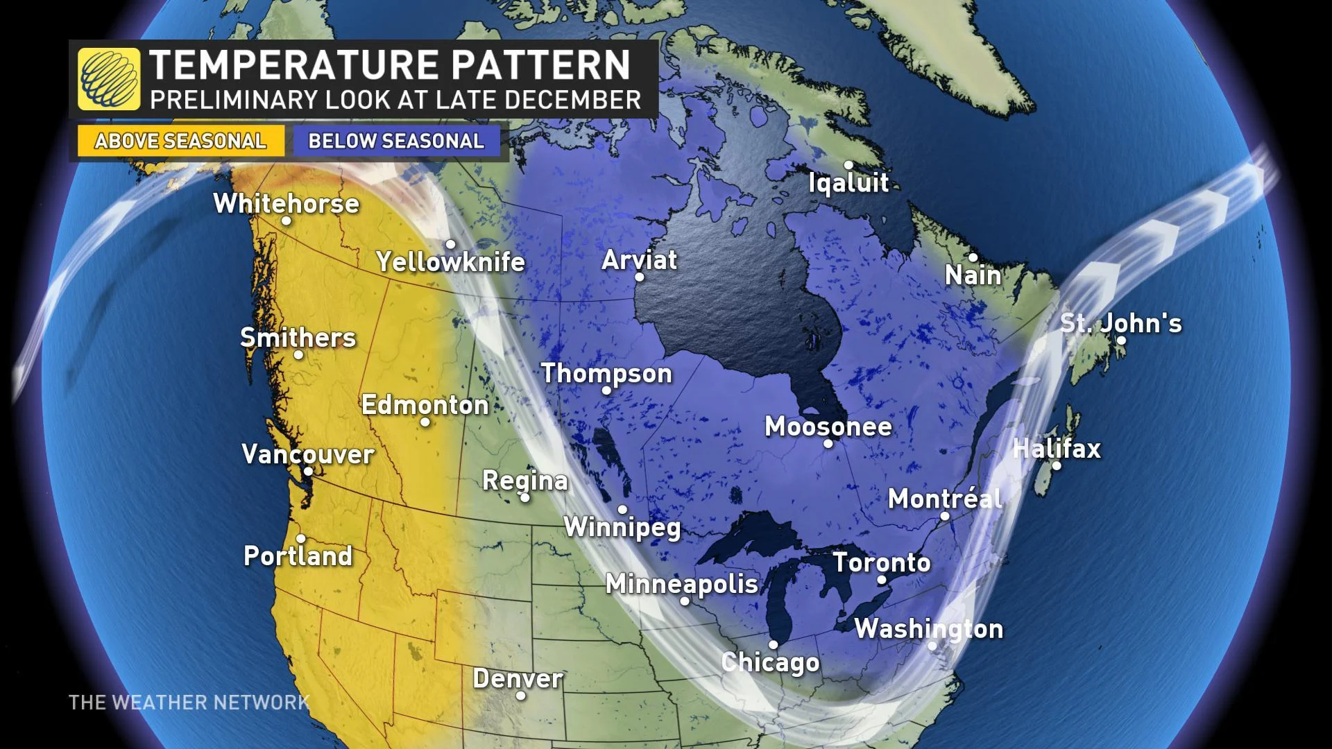
During late December, we think that we will start to transition towards our dominant pattern for the rest of winter with milder weather in the west and colder weather from the eastern Prairies to the Maritimes. However, it is not yet possible to put precise timing on this. Pattern changes are notorious for being delayed, so this could hold off until early January.
WHITE CHRISTMAS?
So, what does this tell you about your chance for having a White Christmas? Well, to be honest this doesn’t tell you anything about the important details of December 25. With the exception of more northern areas, the weather during the days immediately before Christmas will determine whether you have snow on the ground for Christmas morning. It is quite possible to have bare ground in a cold pattern and it is also possible to get snow on Christmas Eve while in a mild pattern. So, we will have to wait until mid-December to have more confidence in those details. Check back!
DECEMBER SUMMARY:
To wrap it all up, here are a few summary points:
Forecast confidence is lower than normal in our pattern maps, primarily due to December being a changeable month that will not feature persistent temperature extremes (at least not during the first two to three weeks)
Overall, we expect a milder pattern than November (compared to local normals) especially across the Prairies where fall has already featured a few rounds of extreme winter weather
Changeable patterns are often active patterns and we expect that this December will feature more winter storms than we saw last December. High impact winter weather can still occur in a “mild” pattern
As we progress through the month we will post updates and more details on what we expect leading up to and through the holidays.