Nasty November cold set to span most of the country

Widespread colder than normal weather kicks off November as a cross polar flow delivers arctic air directly from Siberia to central Canada.
As we kick off the month of November, parts of Canada have already had a taste of early in winter weather. During early November the wintry pattern will expand across much of Canada. We will dig into the details of our November forecast down below, but first a quick recap of October.
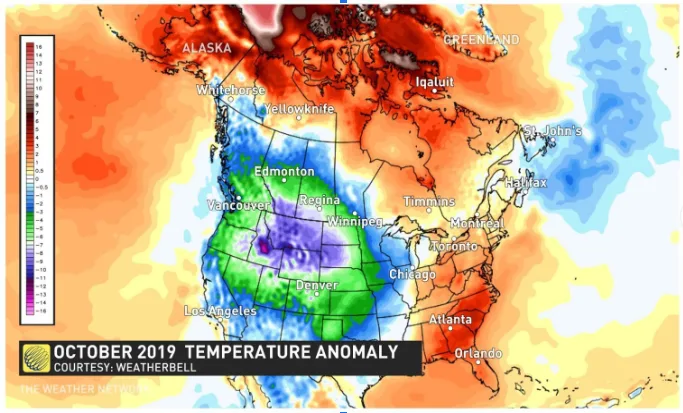
The coldest weather relative to normal during October was found across the Prairie provinces and B.C. Parts of southern Alberta were over 10 degrees colder than normal for the month. Meanwhile, northern Canada, Ontario, Quebec and western parts of Atlantic Canada were warmer than normal.
MUST READ: Who got frosty first? This fall's unusual pattern across Canada
The map below shows temperatures anomalies for October with the various shades of blue, green, and purple highlighting places that were colder than normal, while the various shades of orange and red indicate above normal temperatures.
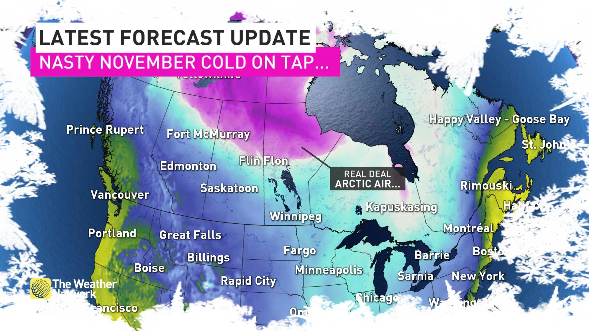
During the first week of November, the cold pattern will greatly expand and shift a bit to the east. The jet stream pattern for next week will be a classic pattern for widespread colder than normal weather as cross polar flow will deliver arctic air directly from Siberia to central Canada.
The map below shows a model forecast for temperature anomalies for the middle of next week. The violet colours show temperatures that are forecast to be 12 to 18°C colder than normal, meaning that temperatures will be more typical of late December across the Prairies. Meanwhile, temperatures will be quite mild across Atlantic Canada.

During the second half of next week, the arctic air will spread south and east with colder than normal temperatures found across nearly all of Canada. For much of central Canada this will mean that temperatures will be more typical of December rather than early November.
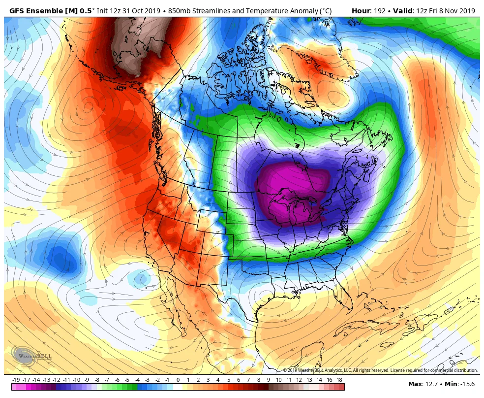
If the core of the coldest weather does indeed shift east towards the Great Lakes region -- as shown in the above model forecast -- then we will have the potential for a multi-day high impact lake-effect snow squall event in the traditional snowbelt areas east and southeast of the Great Lakes.
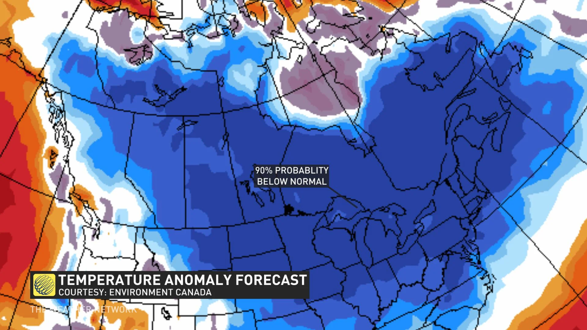
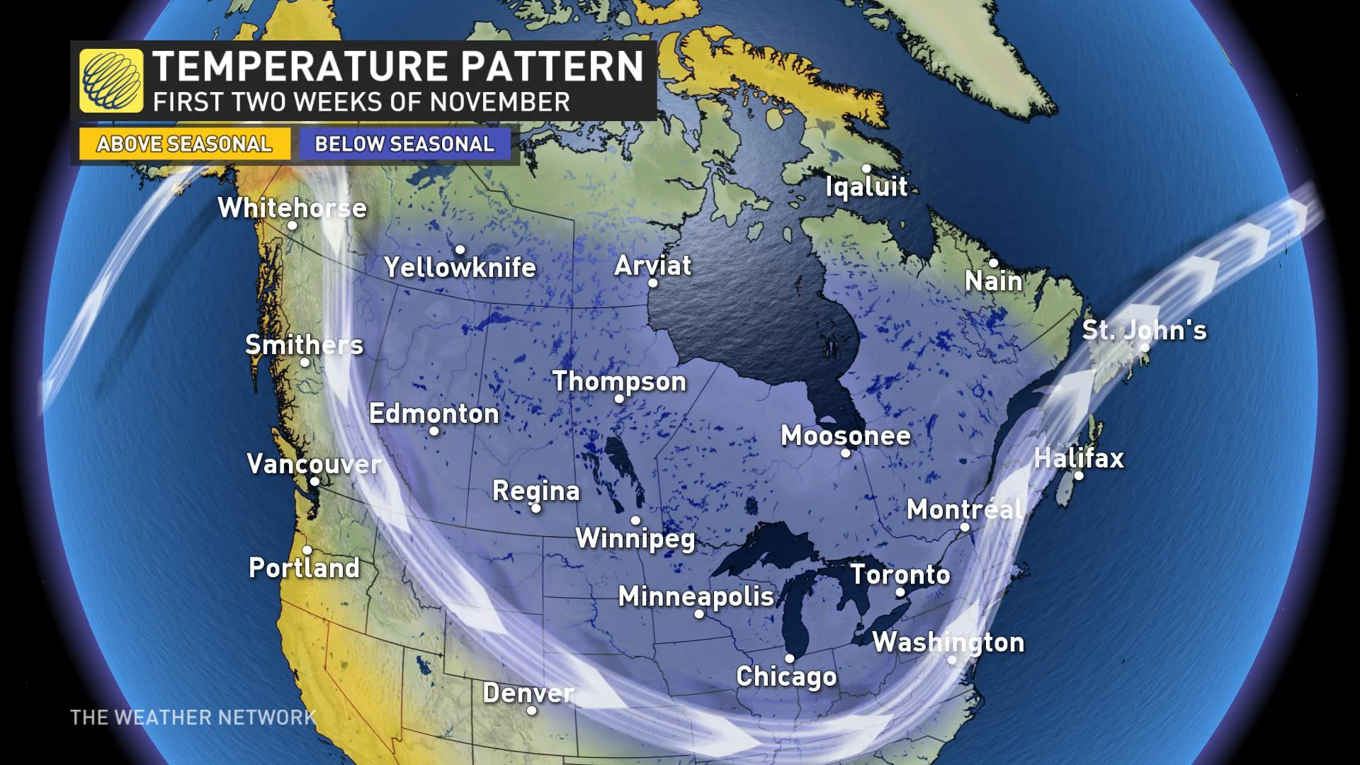
This overall pattern is expected to continue through the second week of November. The pattern map below shows that we expect that most of Canada will be colder than normal for the first half of November.
Another unusual aspect of our early November pattern is the extended period of dry weather for the south coast of B.C. November is typically the wettest month of the year for this region, so to have two weeks of dry weather during the final week of October and continuing through the first week of November is most unusual. A more typical/unsettled pattern is expected to return during the second week of November.
LOOKING AHEAD TO LATE NOVEMBER
During the second half of November we expect that the wintry pattern will relax somewhat, especially across the Prairies. However, colder than normal temperatures are expected to persist into the second half of November across the eastern half of Canada.
There are indications that we will eventually see a period of above seasonal temperatures across much of Canada before the end of the month. However, such pattern changes are often slower to develop than initially expected and it is unlikely that any milder weather will be able to offset the cold start to the month. As a result, we expect that the final numbers for the month of November will be colder than normal for most of Canada from the Prairies to Atlantic Canada with near seasonal temperatures for the B.C. coast, Newfoundland and Labrador.