Dangerous travel in Quebec with strong winds, blizzard-like conditions
Widespread winter warnings are in effect for a burst of rough conditions, and a dangerous travel risk across Quebec late Monday into Tuesday
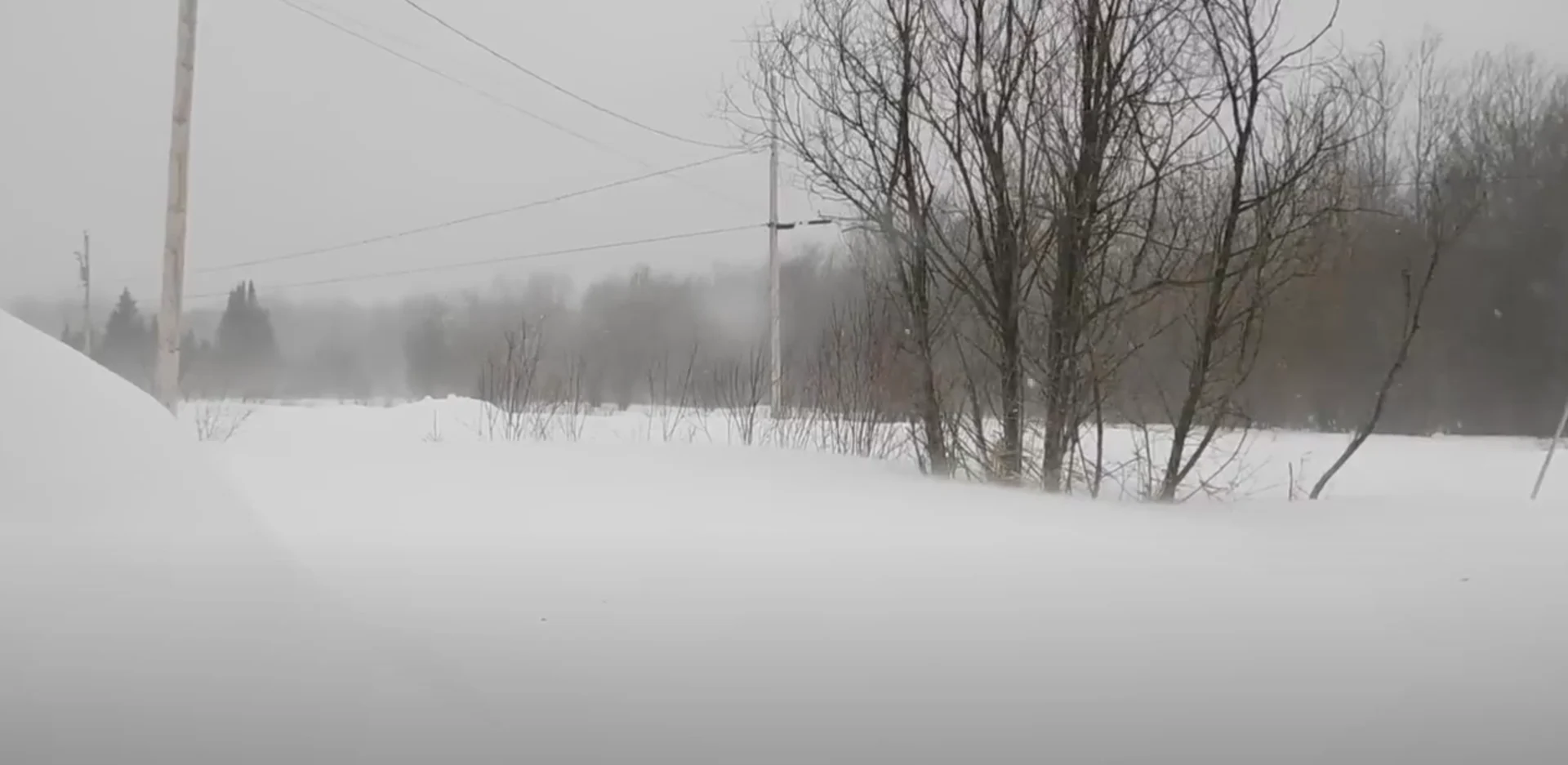
Expect rough conditions across much of Quebec starting Monday as a powerful low-pressure system swirls over Hudson Bay.
A cold front extending off this low will sweep across the province with gusty winds and bursts of heavy snow. The combination of winds and snow could lead to localized blizzard conditions.

Snow squall watches are in effect for much of western Quebec ahead of this front’s arrival. Wind warnings line the St. Lawrence Valley for the gusty wind threat.
Power outages due to the high winds are possible. Over 40,000 Hydro-Quebec customers across southern Quebec are without power as of 6 p.m. ET.
Stay up-to-date with the latest weather alerts in your area, and be sure to monitor road conditions throughout the region as this hazardous weather arrives.
DON’T MISS: January’s jet stream drama leads to February pattern swap in Canada
Damaging winds, heavy snow possible
The cold front will pass through Ontario and reach Quebec on Monday, sweeping through the province into the overnight hours.

Strong wind gusts of 90+ km/h are likely as the province falls under the influence of both the low-pressure system and the arriving cold front. Damaging southwesterly winds are expected to develop for the Montreal area by Monday afternoon.
Brief, but intense, bursts of snow are likely to accompany this front as it pushes across Quebec during the overnight hours. This risk includes Gatineau and Montreal.
The heaviest snowfall targets the Charlevoix region, where 20+ cm of fluffy snow is possible into Tuesday.

The dangerous combination of heavy snowfall and strong winds could catch commuters and drivers off guard throughout the region. Some locations could experience blizzard conditions with snowfall rates of 1-2 cm per hour.
RELATED: Montreal notches its coldest morning in nearly two years
We’ll likely see around 5 cm of snow accumulation around Metro Montreal, with higher totals possible up the St. Lawrence toward Trois-Rivieres and Quebec City.
Rapid temperature drop
Frigid air spilling into Quebec behind this system will send temperatures plunging for the final days of January.

Temperatures in Montreal will hover around -2°C at midnight on Tuesday, tumbling down to around -17°C by Tuesday morning. Expect bitterly cold wind chills in time for the Tuesday morning commute.
Expect some of the coldest temperatures of the season, with overnight lows approaching -20°C in Montreal on Wednesday and Thursday nights.
WATCH: Worldwide warmth shatters daily records despite Canada’s cold
Be sure to check back for the latest weather updates across Quebec
Thumbnail image credit to Manon Moreau.