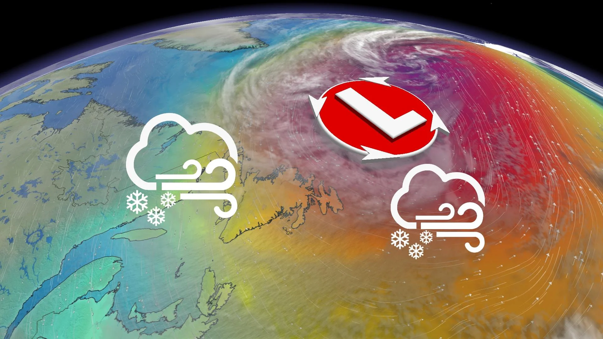
Moseying storm buffets Newfoundland with heavy snow, high winds

A pesky low north of Newfoundland will spray parts of the island with up to 30 cm of snow through the first half of this weekend.
Newfoundland has been bearing the brunt of heavy snow and wind from a slow-moving system since Friday evening.
Snowfall warnings spanned much of the Trans-Canada Highway between Terra Nova National Park and Sheppardville, including Gander, as well as the Avalon. These warnings have since been lifted, but special weather statements remain in place for the northern regions of the Avalon, as well as from St. John's to Terra Nova National Park.
Visit our Complete Guide to Spring 2023 for an in-depth look at the Spring Forecast, tips to plan for it and much more!
A large low-pressure system moseying off the northeastern tip of the island is responsible for this disruptive snow and wind event.
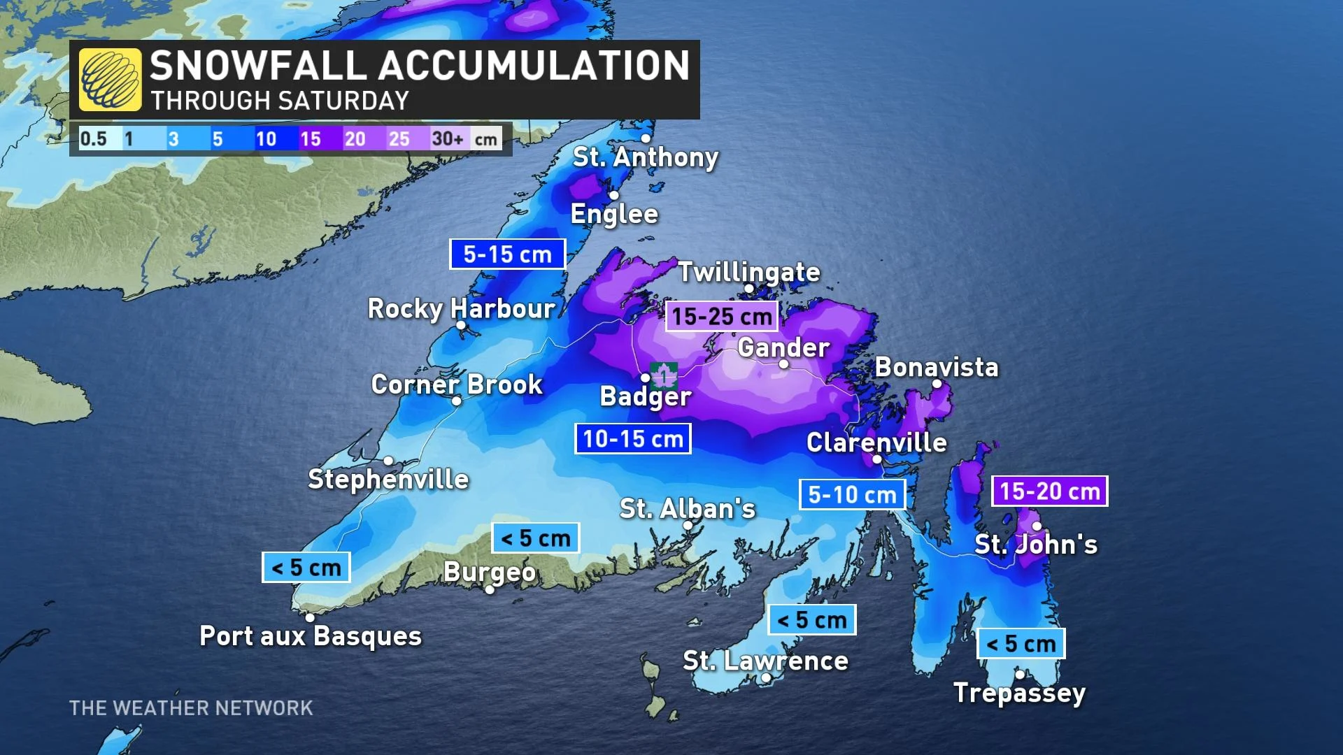
As much as 30 cm of snow is possible along and north of the Trans-Canada Highway -- from Clarenville to Badger. Between 15-20 cm is possible for St. John's and the northern Avalon. The snow may eventually mix with rain or drizzle over some coastal areas before ending later Saturday.
DON'T MISS: Check current highway conditions before heading out
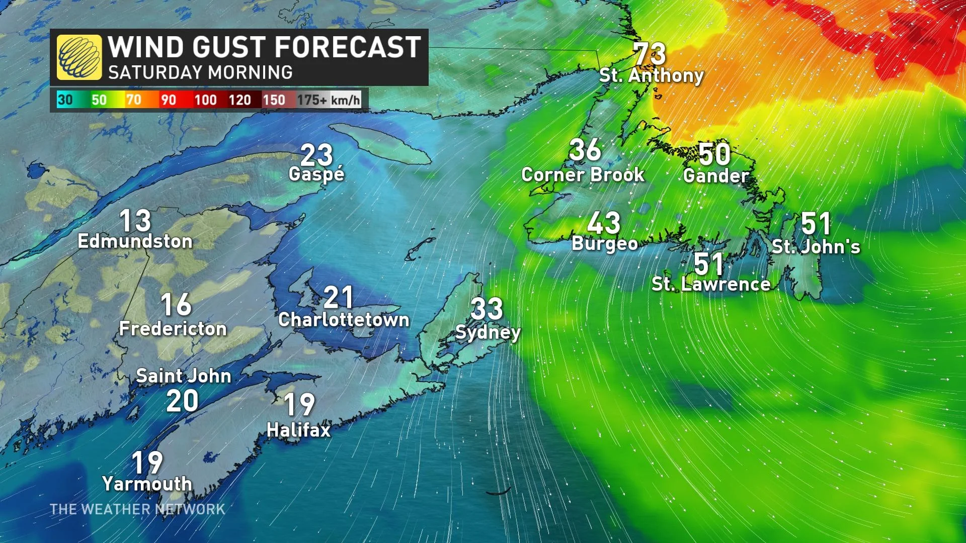
Northerly wind gusts between 60 to 80 km/h are also expected, with the strongest gusts whipping in along the coast.
"Be prepared to adjust your driving as weather and road conditions could vary along your route. Accumulating snow and slush could make travel difficult so if you must travel, allow extra time to reach your destination," advises Environment and Climate Change Canada (ECCC) in it's special weather statement for St. John's.
MUST SEE: Polar bear warning issued in northern Newfoundland, southern Labrador
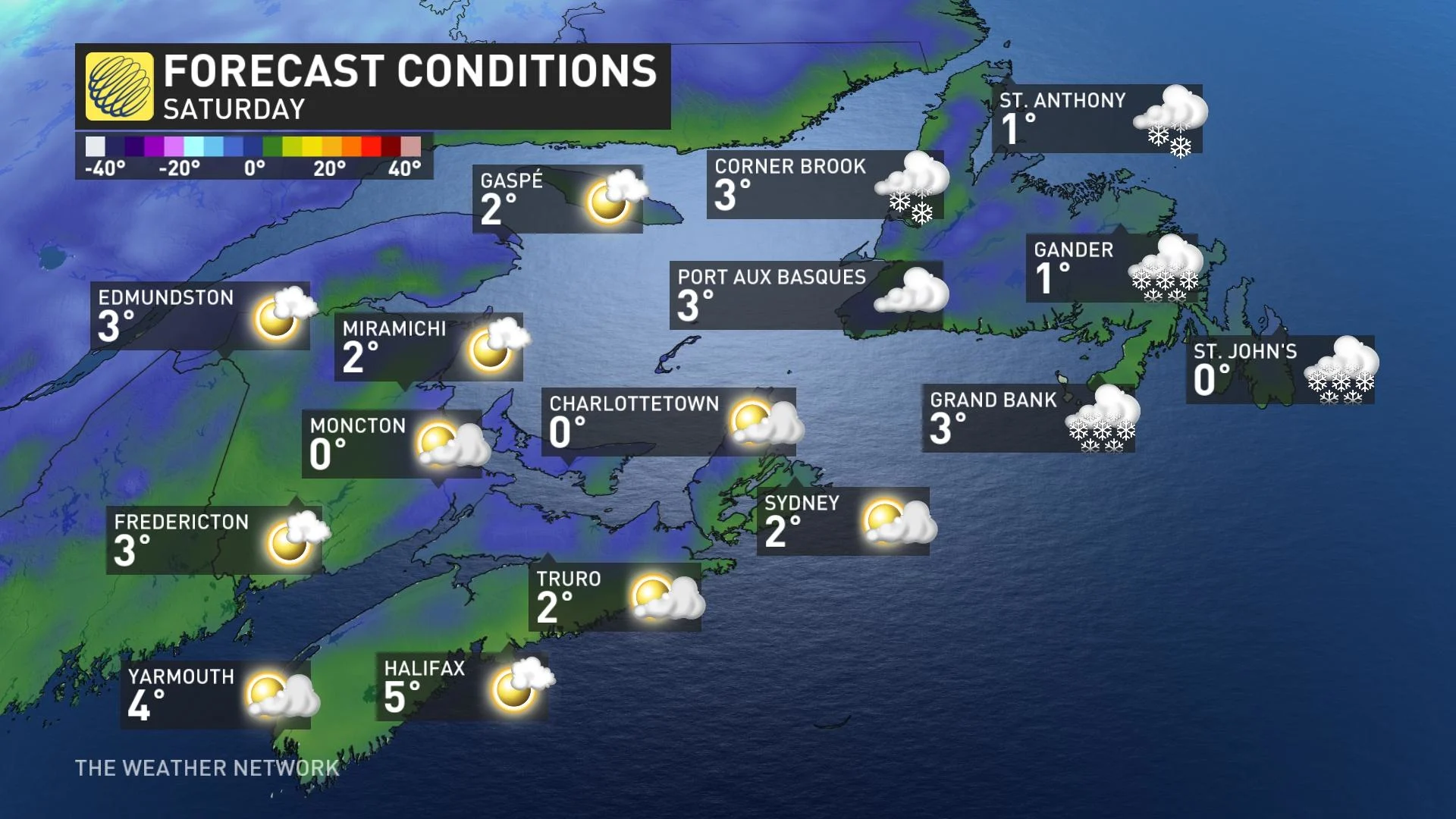
Meanwhile, fair weather is expected across the Maritimes through the beginning of next week.
Watching the potential for a nor'easter next week
Forecasters are keep a close eye on a brewing system for next week.
The storm will track up the U.S. East Coast early next week and is currently expected to track near southern Nova Scotia with widespread windy conditions and heavy snow. The snow however, could change to rain across Nova Scotia, depending on the ultimate storm track. This will be a multi-day event as the forward progress will slow as the system approaches the region.
WATCH: Daylight Saving can be tough for kids, tips to help soften the change
Be sure to check back for the latest updates across Atlantic Canada.