Dangerous severe storm setup threatens very large hail, wildfire risk

Monday’s storms could produce hail larger than golf balls across a wide swath of the central U.S.
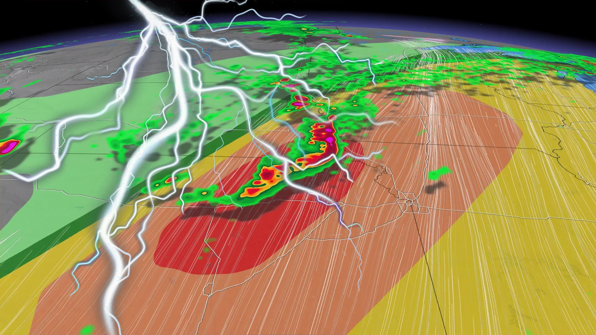
Forecasters are warning of the potential for very large hail, strong tornadoes, and an extreme fire danger across a large swath of the United States over the next couple of days.
This stretch of dangerous weather south of the border arrives courtesy of the same system responsible for flinging rounds of snow, ice, and thunderstorms into Canada this long weekend.
DON’T MISS: Tornado warning safety: Here’s what you should do
Severe thunderstorms carry large hail, tornado risks
A Colorado low lifting across the U.S. Plains is the culprit behind much of the active weather we’re seeing east of the Rockies over the next couple of days.

Plenty of warm, unstable air drawing north will provide the fuel needed for thunderstorms to thrive throughout the central U.S. and toward the Great Lakes region.
Severe thunderstorms on Saturday and Sunday served as a prelude to the main event expected on Monday. Forecasters with the U.S. Storm Prediction Center issued a level 4 out of 5 risk for severe weather in portions of Kansas and Nebraska during the day Monday.

RELATED: New U.S. severe storm forecasts will benefit Canadian travellers
A wide swath of the central Plains could see thunderstorms capable of producing hail larger than golf balls, strong to intense tornadoes, as well as damaging wind gusts in excess of 100 km/h.

After an unusual severe weather pattern for much of this spring, Monday’s storms will form pretty much exactly where you’d expect to see a threat for tornadoes develop during the middle of May.
While nothing this intense is expected over the border, strong to severe thunderstorms may bubble up across Ontario through the second half of the day on Monday. Pay close attention to severe weather alerts in your area and stay close to safe shelter if you have outdoor plans.
Extreme fire danger exists through Monday
Farther south, a combination of dry air, warm temperatures, and gusty winds will lead to an extreme fire danger building throughout western portions of Texas, Oklahoma, and Kansas.
RELATED: U.S., Canada off to surprising, contrasting wildfire season starts

The extreme fire risk that started over the region on Sunday will continue into Monday as conditions will remain extremely favourable for fast-growing wildfires.
Blazes that ignite in these grasslands can spread very quickly and threaten nearby communities. One example is the Morrill Fire, which tore through nearly 260,000 hectares of western Nebraska earlier this year as the state’s largest-ever wildfire.