Damaging winds, snow squalls raise outage threat in Ontario
Icy hazards will transition over to powerful winds and snow squalls through Monday, increasing the risk of power outages across southern Ontario
Major impacts are occurring across Ontario as another, powerful low-pressure system traverses the province with an entire assortment of hazardous conditions.
Warm air aloft provided plenty of freezing rain to southern and eastern Ontario through the day Sunday and early Monday, coating surfaces, trees, and power lines with a weighty crust of ice.
Meanwhile, northeastern Ontario has been battling against blizzard conditions, which have resulted in highways closures in and near locales such as Wawa, Sault Ste. Marie, Chapleau, and the Timmins area.
The threats don’t end there. Powerful winds and dangerous snow squalls are building in parts of southern Ontario, threatening more power outages and road closures.

RELATED: Treacherous road conditions in Ontario, travel not advised
Over 45,000 customers are without power in Ontario as of early Monday morning due to the icy weather and gusty winds.
Blizzard conditions continue in the northeast
Strong winds and heavy snow over northeastern Ontario are forecast to continue bringing whiteout conditions across the region through Monday afternoon. Portions of Highways 11, 17, 129, 144, and 101 have been closed due to the weather. These closures include cutting off highway access in and out of Wawa and Chapleau as of early Monday morning.

Areas hardest hit by the heavy snow could see up to 30-50+ cm by the time the storm passes. Folks should expect to see prolonged road and highway closures.
SEE ALSO: The polar vortex is on the move! Canada's winter forecast update

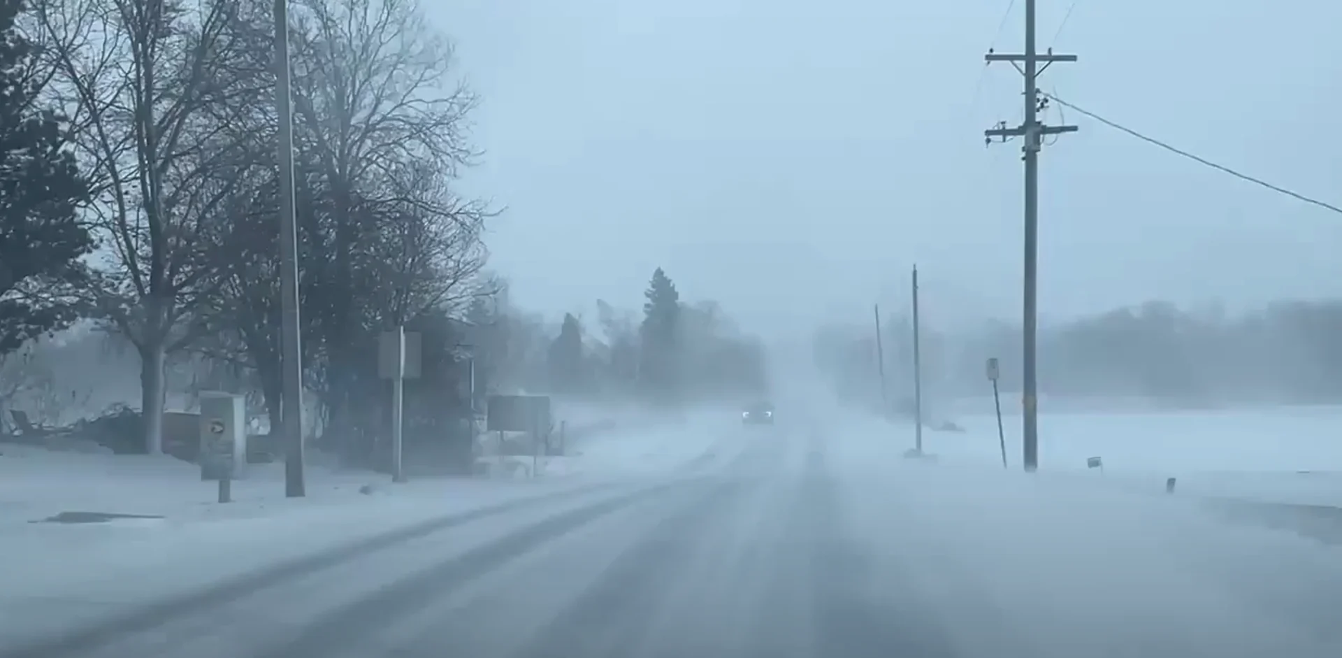
Lake-effect snow squalls threaten travel in southern Ontario
Warmer temperatures over southern Ontario paired with the high atmospheric moisture brought heavy late-December rains to the region late Sunday. Pearson International Airport recorded 41.2 mm of rainfall on Sunday, breaking the record for all-time rainiest December day--a record that had previously stood for 63 years.
Cold air rushing in through the overnight sent temperatures falling by over 10°C. The temperatures will continue to drop through Monday, quickly freezing things back up and making for slick conditions across the region.

With the temperatures falling, we'll see snowfall team up with increasingly gusty winds on Monday and Tuesday.
RELATED: Winter storm aftermath: How to prevent ice dams and roof leaks
Forecasters are watching for widespread lake-effect snow squalls through Monday and into Tuesday, which will further impact travel by creating sudden whiteout conditions, especially downwind of Lake Huron and Georgian Bay.

Two persistent bands of note will be off Lake Huron toward London, as well as off of Georgian Bay and into Barrie and Oshawa. These bands could bring a swath of 15-30 cm of snow to the impacted areas by late Tuesday.
WATCH: Major winter storm hits northeastern Ontario with blizzard conditions
Damaging winds raise outage threat Monday
As the low lifts over Georgian Bay on Monday, we'll also see winds begin to pick up to damaging levels along the Great Lake shorelines.
Winds are forecast to blow southwest over Lake Erie, gusting between 80-110+ km/h. The Niagara region will bear the brunt of this wind before it shifts to the northwest later in the day.

By late Monday, we'll see the winds gusting northwest off of Lake Huron and Georgian Bay, with peak gusts between 70-100 km/h.
The damaging winds will also persist on Lakes Erie and Ontario, as well as throughout Prince Edward County, despite the shift in direction.
Folks should be prepared for some power outages with these winds, as they could knock down tree limbs and damage power lines.
Waves could reach up to 5 metres on the lakes as well, with 6-8 metre waves possible on southern Lake Superior. Folks along the shores should keep an eye out for sudden ice shoves.
As the gusty winds linger through Tuesday, we could see blowing snow continue to bring hazardous conditions for folks travelling to celebrate the New Year.
WATCH BELOW: Track road conditions and visibility on the weather app
Stay with The Weather Network for more information and updates on this developing storm in Ontario.