Damaging winds rip across Newfoundland as gusts top 100 km/h
A powerful cold front is expected to pass through the province on Saturday, causing power outages, dangerous driving conditions and blowing snow.
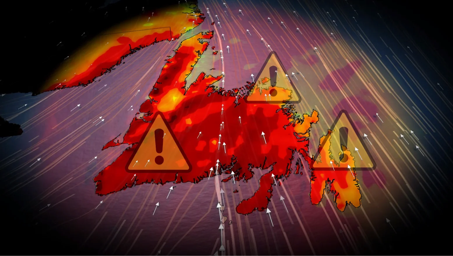
Strong winds are battering Newfoundland on Saturday as a powerful cold front moves across the island, bringing hazardous conditions from morning to afternoon.
Southerly winds intensified early Saturday, quickly becoming the primary concern for much of the province.
Forecasters warn that the strongest gusts will arrive late in the morning and last until the early afternoon, with some areas experiencing winds exceeding 100 kilometres per hour.
CHECK OUT: Scientists find unusual structure under Bermuda that causes it 'float'
Winds peak before slowly easing
The strongest winds are expected to shift eastward through the late morning, bringing damaging gusts across a large portion of the province. Although conditions are expected to improve later in the day, the threat will not go away quickly.
Winds are expected to drop below 100 km/h by late afternoon. However, a strong northwesterly flow will keep moving along the island's western end, with gusts of 70 to 100 kilometres per hour possible until the evening.

Power outages and hazardous travel likely
SEE ALSO: Why snow squalls are so tough to forecast
The strong winds are expected to trigger widespread power outages, particularly in exposed coastal areas. Residents are encouraged to secure any loose outdoor items to avoid damage.
Travel conditions can also deteriorate quickly, especially along the southern coast. High-sided vehicles are at danger of being blown off course between Burgeo and Ramea, where strong winds and poor visibility make driving extremely hazardous.
Blowing snow is also affecting parts of the western coastline, complicating already difficult conditions as sea-effect snow continues to hit the region.

Stay with The Weather Network for the latest updates across Newfoundland