Tornado warning issued in southern Alberta and Saskatchewan amid severe storms
ECC has issued a tornado warning as severe storms sweep through the region.
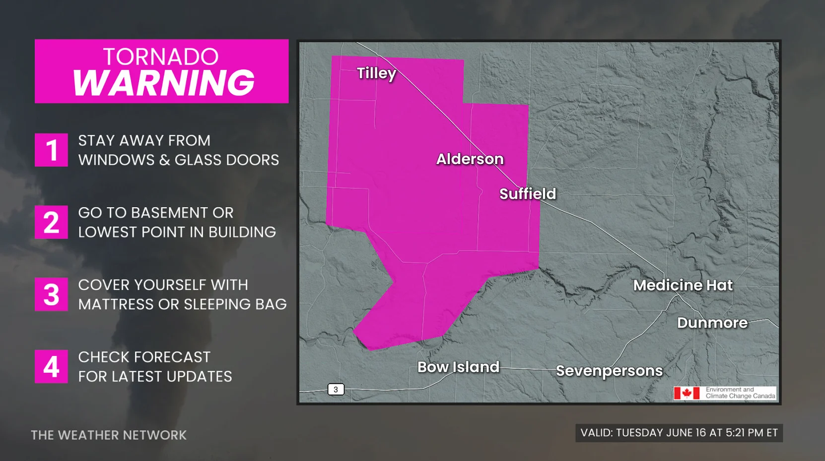
3:08 p.m. MDT - Severe thunderstorms prompted a tornado warning in southern Alberta and Saskatcehwan on Tuesday afternoon.
Environment and Climate Change Canada issued a tornado warning for the following areas in:
Saskatcehwan:
R.M. of Battle River including Sweet Grass Res. and Delmas; The Battlefords
Alberta:
City of Medicine Hat
Cypress CO. near Seven Persons, Bowell and Redcliff, Suffield and HWY 879
CO. of Newell near Tilley and Rolling Hills
The original article with the full forecast for the Prairies continues below.
"This is a dangerous and potentially life-threatening situation. Take cover immediately, if threatening weather approaches," ECCC said in its warning.
The agency added: "Go indoors to a room on the lowest floor, away from outside walls and windows, such as a basement, bathroom, stairwell or interior closet. Leave mobile homes, vehicles, tents, trailers and other temporary or free-standing shelter, and move to a strong building if you can. As a last resort, lie in a low spot and protect your head from flying debris.”
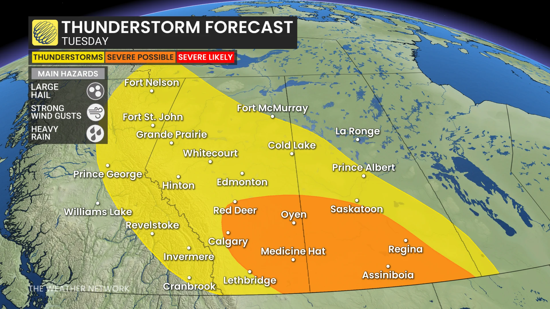
A multi-day thunderstorm risk will surface in Alberta and Saskatchewan this week, with severe storms possible Tuesday in locales such as Calgary and Red Deer.
On Tuesday, the setup will be particularly conducive for damaging winds and hail for some locations, so power outages are possible. Hail up to 4 centimetres in size will be possible in the strongest storms, so there is the risk of damage to vehicles and buildings.
DON’T MISS: The pros and cons of an El Niño summer across Canada
Stay alert for watches and warnings throughout the day.
Severe storm setup favours large hail, damaging winds this week
Hail and wind-producing storms are forecast to track from central Alberta towards southwestern Saskatchewan throughout the afternoon and evening on Tuesday.
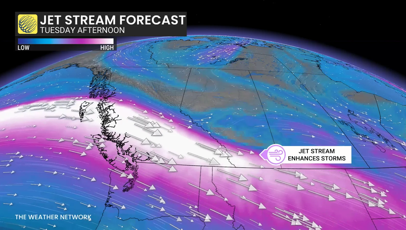
It’s not a day with explosive thunderstorm growth with extreme heat and high humidity, but rather a strong jet stream aloft, which will drive northwest flow and high wind shear, accompanied by a storm track that has supported damaging hail events in the past.
The main hazards will be large hail (2-4 cm), strong winds of up to 90+ km/h in most organized storms and heavy downpours.
Cities facing the potential for severe thunderstorms include Calgary, Red Deer, Medicine Hat, and even as far east as Saskatoon and Regina.
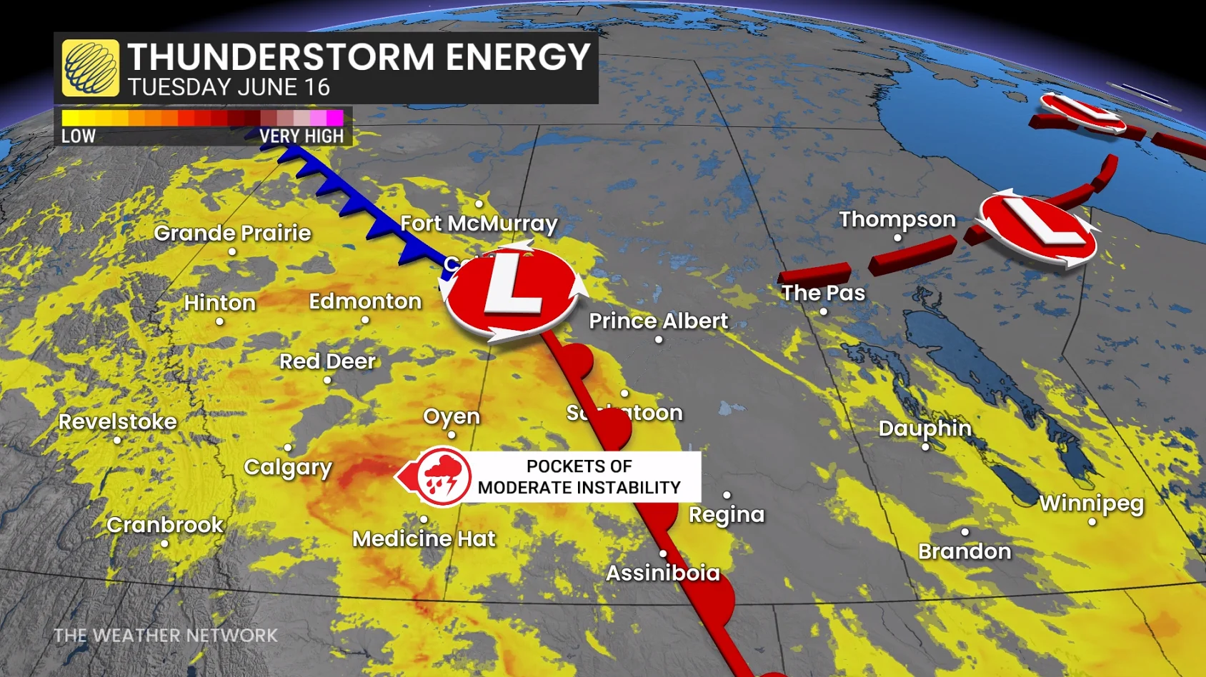
The upper-level pattern features a strong jet stream nosing across the province off the Pacific Ocean, helping steer storms off the foothills and towards the southeast.
For Calgary and southern Alberta, this matters because a northwesterly flow in severe weather setups have a history of producing impactful, wind-driven hail events as cells mature near the QE2.
Storms are expected to initiate midday northwest of Calgary, and then progress southeasterly between 40-60 km/h.
Instability is not overwhelmingly high, but deep-layer shear is what can give storms the longevity to continue for several hours.
That could keep storms well ventilated and help keep hailstones in favourable growth regions aloft.
This creates ingredients to support and sustain updrafts in a thunderstorm. The lowest one kilometre of the atmosphere is not supportive of tornadoes as a main hazard on Tuesday.
Storms merging can create wider, stronger updrafts, keeping hail suspended. That means more residence time.
The slower the storm travels, the more intense the hail damage and swath could be.. Larger storms create more hail production and a wider hail core.
Beyond, we are watching the potential for a significant low, which could develop over or just south of southern Alberta on Saturday, and then track east across the region during the weekend with heavy rain, thunderstorms and very windy conditions.
Cooler-than-seasonal temperatures will dominate this week and continue through the weekend and into next week. However, western areas should trend warmer next week--back to seasonal and possibly above seasonal.