Thunderstorm risk continues across Ontario and Quebec Friday
Much of eastern Ontario and Quebec remain at risk for thunderstorms on Friday ahead of unsettled weekend
Expect a stormy end to the week across Ontario and Quebec ahead of more unsettled weather arriving in time for the weekend.
Tropical humidity sloshing over parts of eastern Ontario fuelled a round of severe thunderstorms during the day on Thursday. The line of severe storms is now under investigation for tornadoes following crop damage near Stephanville, Ont.
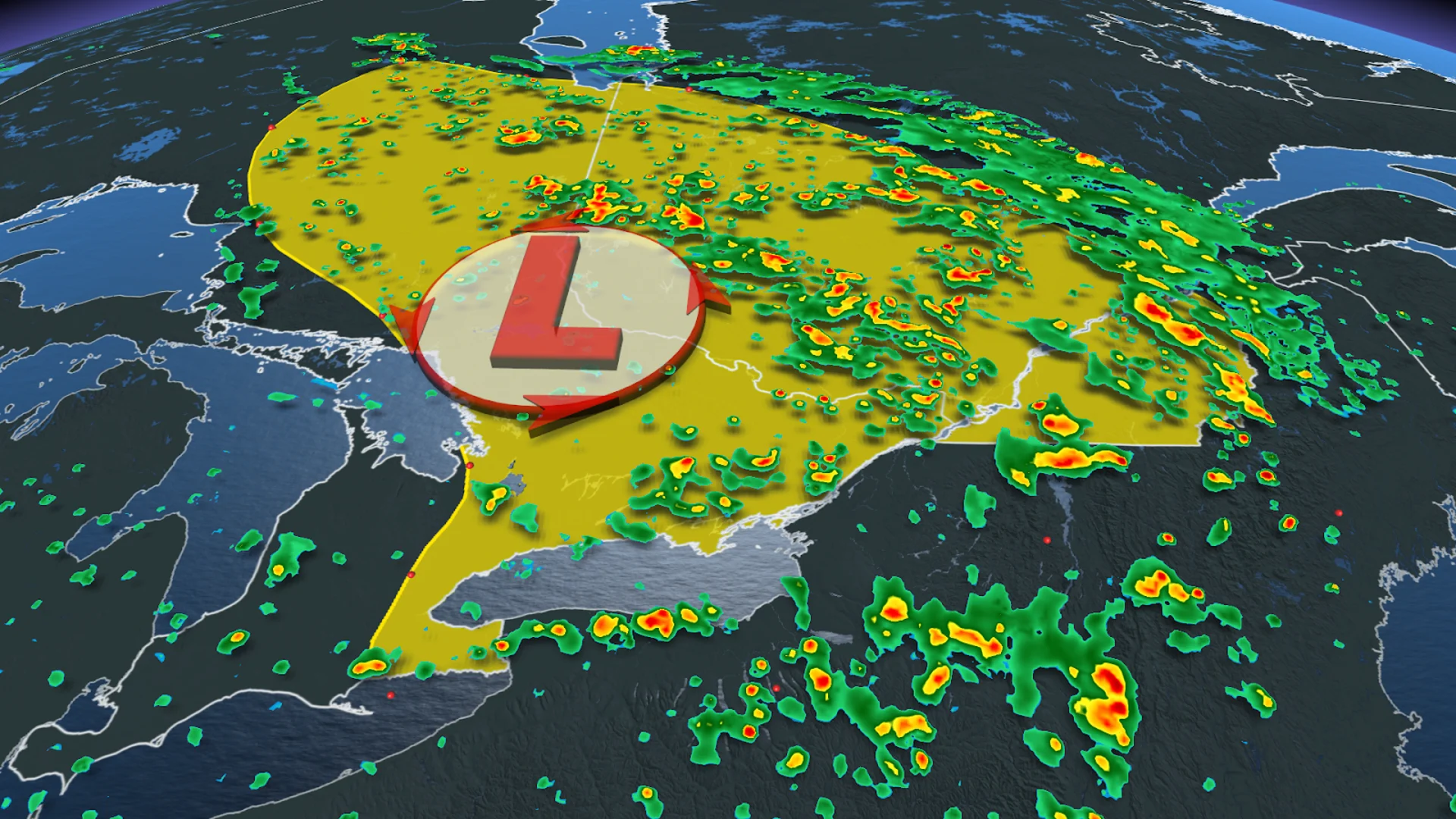
We’ll see a renewed risk for thunderstorms build over portions of eastern Ontario and southern Quebec as instability remains in place across the region.
DON’T MISS: Brief step back into spring this weekend before things really heat up in Ontario

The rain won't be enough to quench a growing forest fire threat in Quebec.
Be sure to stay up-to-date on all of the weather alerts in your area, especially with the growing thunderstorm chances as we inch even closer to the official start of summer this month.
Friday into the weekend: Rain persists with unsettled conditions
A broad upper-level low swinging down over the Great Lakes will keep things unsettled across Ontario and Quebec throughout the day Friday and into the weekend.
While the low has weakened, instability remains in place across the region, fuelling a widespread risk for scattered thunderstorms on Friday. These storms should remain below severe limits.

Below-seasonal temperatures and additional rounds of showers are on the way through Saturday and Sunday as this pesky upper-level disturbance moseys through the region.
By the end of the weekend, some folks across southern Quebec could see 40-80 mm of rainfall. Locally heavier totals are possible.
Localized flooding will continue to be a risk over the weekend, however the heavy rain will be a welcome scene for wildfire-prone regions in Quebec.

Temperatures will likely remain a few degrees below seasonal across southern and eastern Ontario on Saturday, with James Bay claiming the province’s hot spot as temperatures soar into the low- to mid-20s outside of the influence of this gloomy trough.
Forecasters expect the unsettled pattern to linger over southern Quebec into next week as well. While we’ll see rain-free periods and even some peeks of sunshine, temperatures will remain a few degrees below seasonal and some areas may even struggle to top 20 degrees beneath the thicker clouds.
Conditions will remain cooler for the second half of next week, lasting into Father's Day weekend. A warmer pattern will return during late June.
Be sure to check back for the latest weather updates across Ontario and Quebec.