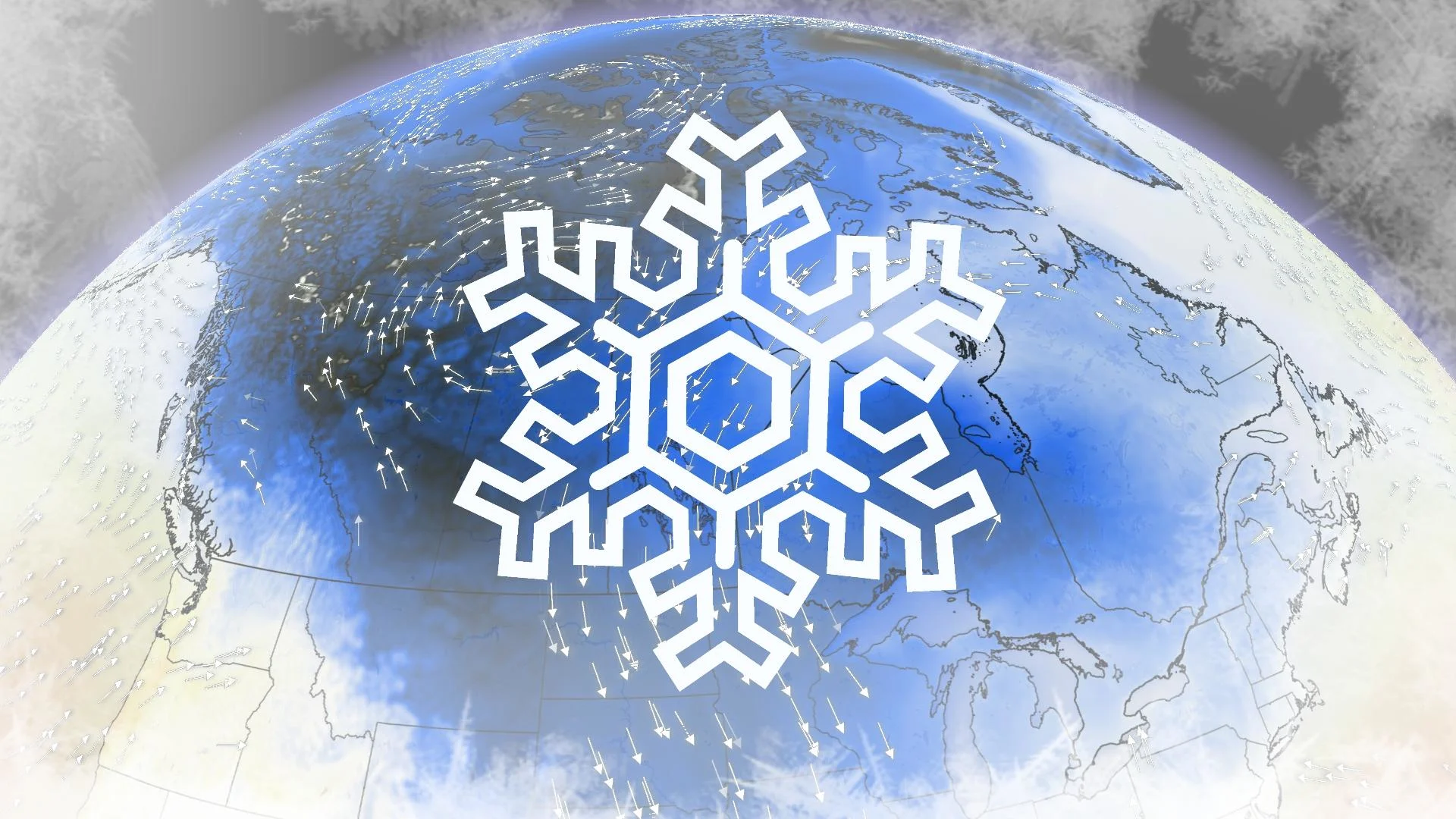
Could a frigid lead-up to Christmas leave Canada coated in snow?

History favours a white Christmas for most of Canada—but how much of the country will wake up to white on the big morning this year?
We're lumbering toward a fantastic setup if you’re hoping to see snow on the ground Christmas morning.
A tremendous blast of Arctic air will engulf much of North America heading into the final days before the Christmas weekend, putting most of the country in a solid position to greet Santa with a blanket of snow.
MUST SEE: Heads up, Canada: the coldest air on Earth is sinking south
Historically, snow on the ground leading into Christmas is no surprise for much of Canada.
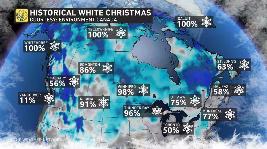
Every major city in the country except for Vancouver has at least a coin-flip’s chance of enjoying a white Christmas, and snow blanketing more than half of the country is virtually a sure bet most years.
This year, though, the setup is ripe for old snow to linger and fresh snow to fall just in time for Santa’s arrival on Sunday the 25th.
We’re looking ahead at a cold snap to remember for the Prairies, with dangerously cold temperatures dipping to the minus 40-degree mark for some communities.
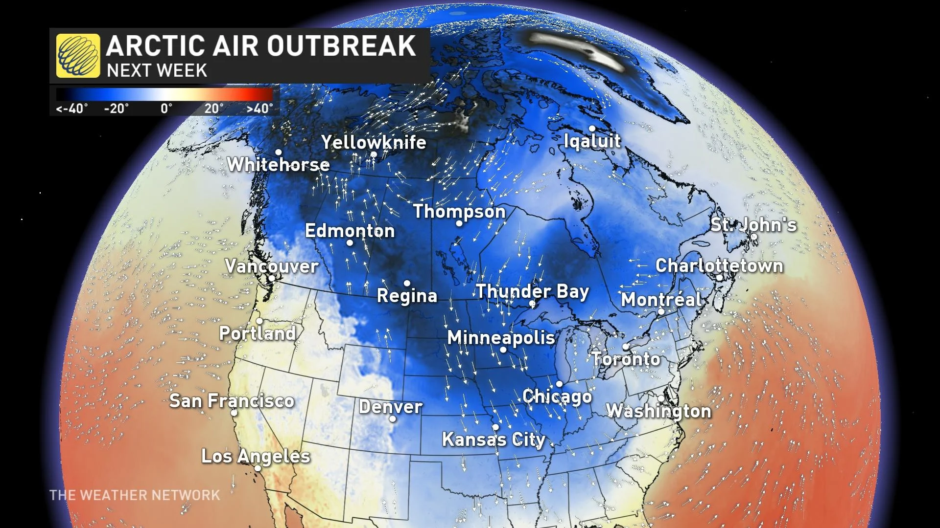
It’s even going to be a brutally cold stretch south of the border across much of the U.S., where temperatures will drop below freezing as far south as Florida. Miami’s low temperature on Christmas Eve could dip below 10°C, a truly frigid morning for this tropical city.
With frosty temperatures plunging all the way down to the Gulf of Mexico, it’s a sure bet that Canada is going to feel the freeze heading into the holiday.
Any snow that falls between now and then is likely to stick around, and the setup allowing such cold air to spill out of the Arctic will create fresh opportunities for additional snow leading into the big day.
DON’T MISS: Don’t let weather ruin your holiday baking with these sweet tips
The big question isn’t who will see a white Christmas, but rather: who won’t?
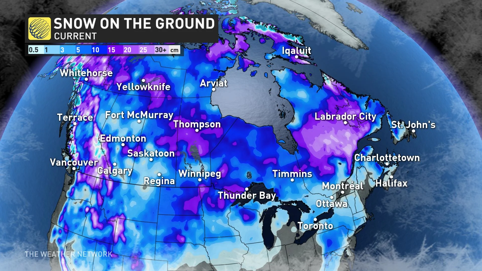
Given the cold air present across the country, and any existing snowpack’s sticking power as a result, there will be a few snowless gaps between now and Christmas Day that would need filling by additional storms over the next nine days.
The biggest gap—and greatest uncertainty—falls over B.C.’s South Coast, where Vancouver and Victoria don’t often see snow on Christmas. The snow that blanketed the region last year was a treat for snow lovers and a true anomaly when you look at the region’s climatology.
We’ll also have some glaring pockets of bare ground across southern Ontario and southeastern Newfoundland, where recent storms have arrived with just enough warm air in place to prevent any accumulating snow.
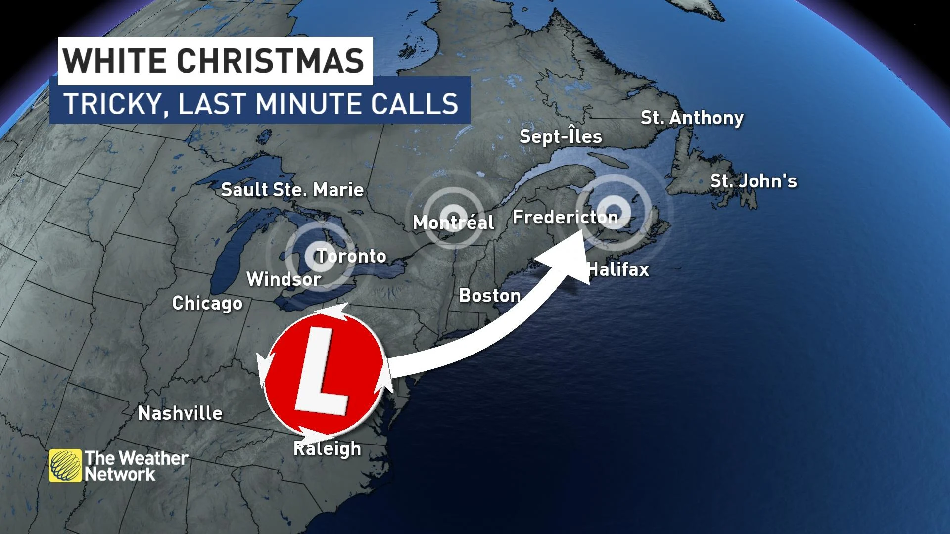
These snow-free areas across the eastern half of Canada could be in for some accumulation before the big day, though, depending on a tricky storm track accompanying the cold air east late next week.
It’s far too early to pinpoint any specifics, but there could be one or more opportunities for a last-minute snowfall to coat the ground before Christmas morning.
Stay tuned to The Weather Network as we monitor the forecast leading into the holidays.


