Nor’easter risk grows for the East Coast with snow, wind impacts
Models are showing a nor'easter will be targeting parts of Atlantic Canada this week. We have a first look at how things could play out.
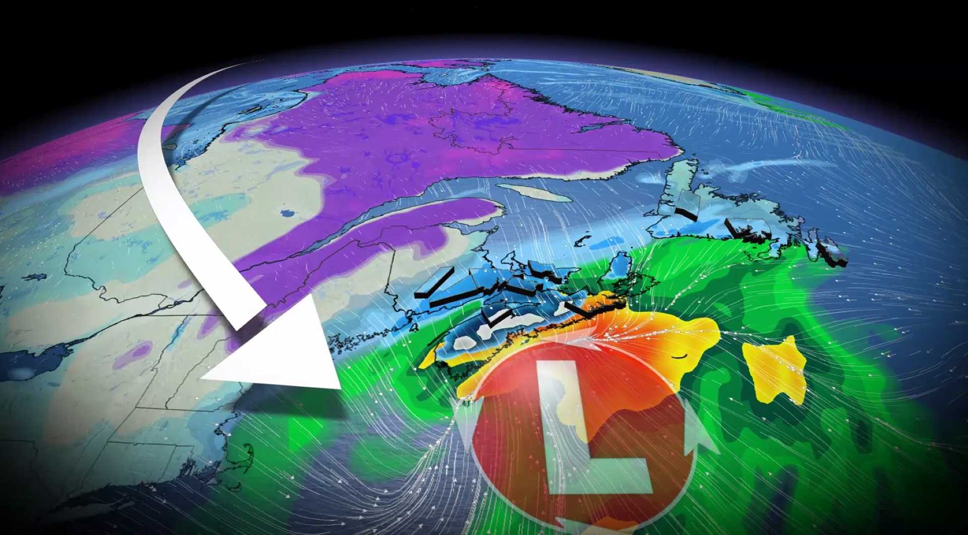
Forecasters are closely watching the threat for a nor’easter across Atlantic Canada beginning Tuesday night and lasting into Wednesday.
The growing system could threaten the region with intense wind gusts, heavy rain, and hefty snowfall, though exact amounts and locations remain uncertain as the forecast continues to evolve.
RELATED: La Niña and the polar vortex set to deliver a truly Canadian winter

Folks should brace for localized power outages, transportation issues, and ferry and bridge delays and/or closures.
Nor'easter in development this week
All the ingredients are coming into place for a nor’easter to affect Atlantic Canada this week.

The pieces of the puzzle will lock together by Tuesday morning, creating a favourable environment for the impressive intensification of our coastal low-pressure system.
Storm ingredient checklist:
Strong, upper-level support: A powerful jet stream lifts across eastern North America on Tuesday, deepening surface pressure
Energy streams merging: Moisture and instability from the Gulf of Mexico phase with the digging trough, further enhancing lift
Ample, cold air supply: Just ask Ontario and Quebec on Monday as cold air increases the available temperature gradient for storm development
-Warm ocean temperature: Heat and energy from the Gulf Stream can release energy, further fuelling the storm
More importantly, where is this nor’easter going?
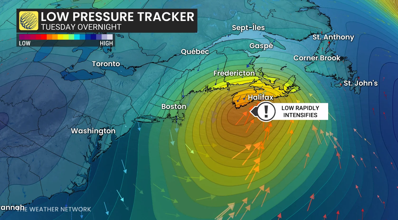
Models on Saturday were confused and uncertain, but on Sunday, models narrowed the range of solutions to a track that scrapes across the coast of Nova Scotia early Wednesday morning, before crossing eastern Newfoundland late in the day.
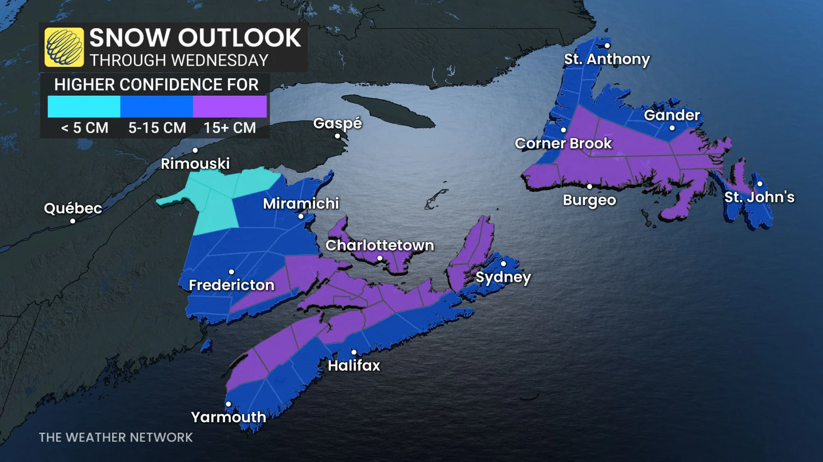
A track close to the coast means mixing and heavy rainfall threats increase along the coastline, but heavy snow will occur just inland where temperatures remain at or slightly below freezing.
The system will have a rich supply of Gulf moisture to work with. As such, regions that don’t experience wet snow will have the risk of more than 40 mm of rainfall.
Storm timeline
Periods of light snow will develop across the Maritimes on Tuesday evening, increasing in intensity as the night progresses.
The rain-snow line will likely gradually lift north, marking a messy transition zone. Winds will also increase during this period.
By Tuesday overnight and pre-dawn hours Wednesday morning, our centre of low pressure will pass directly south of Nova Scotia, building strong winds along the coast and heavy precipitation, including wet snow inland. Periods of light snow begin across Newfoundland.
During the day Wednesday, the low drifts southeast of Sable Island, with a band of lingering snowfall across the Maritimes on the backside. At the same time, heavy, wet snow increases along the warm front across much of Newfoundland.
Wet snow is expected across central Newfoundland while the Maritimes begins to see improving conditions late in the day Wednesday. A wintry mix is on tap for the Avalon Peninsula with varying types and precipitation totals.
Stay with The Weather Network for more information and updates on your weather across Atlantic Canada.