
Ontario braces for impactful storm with rain, snow, sudden warmup
An approaching Colorado low will bring the whole spectrum of rain, ice, and snow to Ontario through the middle of the week
A powerful spring storm will make itself known across Ontario this week as a formidable Colorado low gets its act together south of the border.
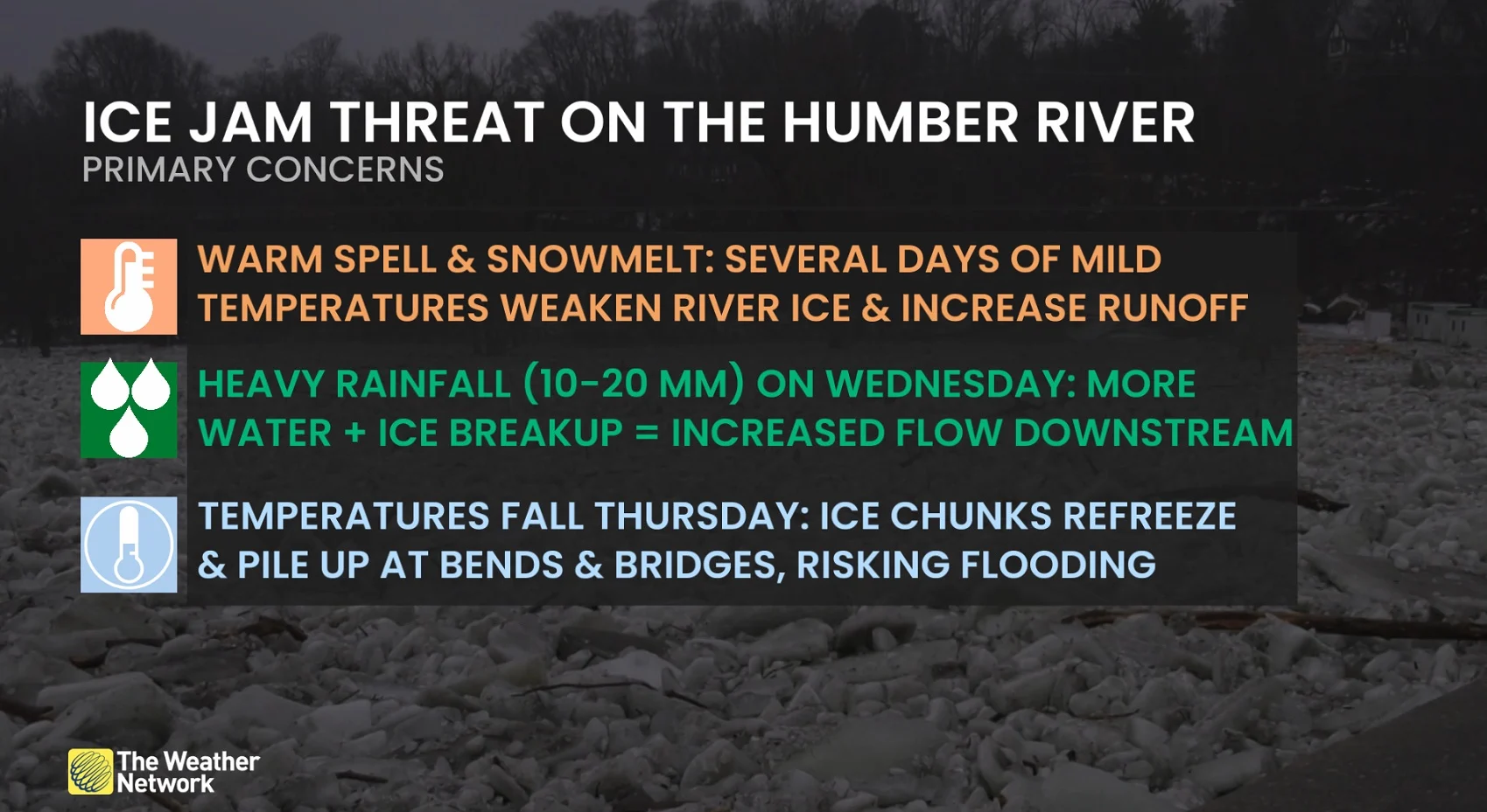
Bitterly cold temperatures are on the way out and the mercury will rapidly climb across southern Ontario. We’ll have to remain on the lookout for flooding and ice jams as temperatures rise.
MARCH 2025 OUTLOOK: Canada to see March madness as winter transitions to spring
Meanwhile, northern Ontario will be contending with significant snowfall where colder air will remain locked in place. Travel will be impacted in northern and southern Ontario as messy weather is expected for both regions.
Stay up-to-date on your local weather alerts, and be sure to check the latest highway conditions before heading out on the roads.
Colorado low brings buffet of spring and wintry impacts to Ontario
Ontario will begin to climb out of the freezer once the Monday morning chill wears off. The sudden warmup will arrive courtesy of a system approaching from the U.S.

Mild and rainy systems have been few and far between in Ontario so far this winter, but one is already brewing and it’ll swirl its way toward the Great Lakes.
Wednesday will be the main event for northern and southern Ontario.
Southern Ontario: Warmth and rain create flood and ice jam threats
While southern Ontario will find itself on the milder end of the low, the region could still see a brief dose of mixed precipitation as the warm front arrives Tuesday morning. Travel could be affected across the region, so plan ahead.
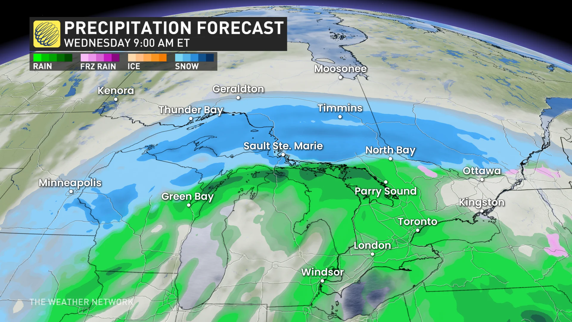
Expect Wednesday to be a washout across the southern and eastern sections of the province. A swath of 10-20+ mm of rainfall is possible, elevating the localized flood risk with rapid snowmelt, particularly in areas with a considerable snowpack. Ice jams will also be possible, so ensure your gutters are clear of any snow and ice.
Some areas in the southwestern end of Ontario could even hear a rumble or two with a little more instability and dynamics in place. The most favourable setup for severe weather will remain far south of the border.

As the storm exits east out of the province on Thursday, a noticeable drop in temperatures will see rainfall change into blowing snow for parts of southern and eastern Ontario.
Colder-than-normal temperatures are expected through the weekend, but will then trend much milder during the following week. Above-seasonal temperatures are expected to dominate from mid-March into near the end of the month.
Northern Ontario: Significant travel impacts from heavy snowfall
Meanwhile, more wintry weather will be felt in parts of northern Ontario as it will be on the colder side of the low.
The system will dump heavy snowfall and generate blustery winds on Wednesday, leading to treacherous winter weather near Sudbury, North Bay, Sault Ste. Marie and Timmins.
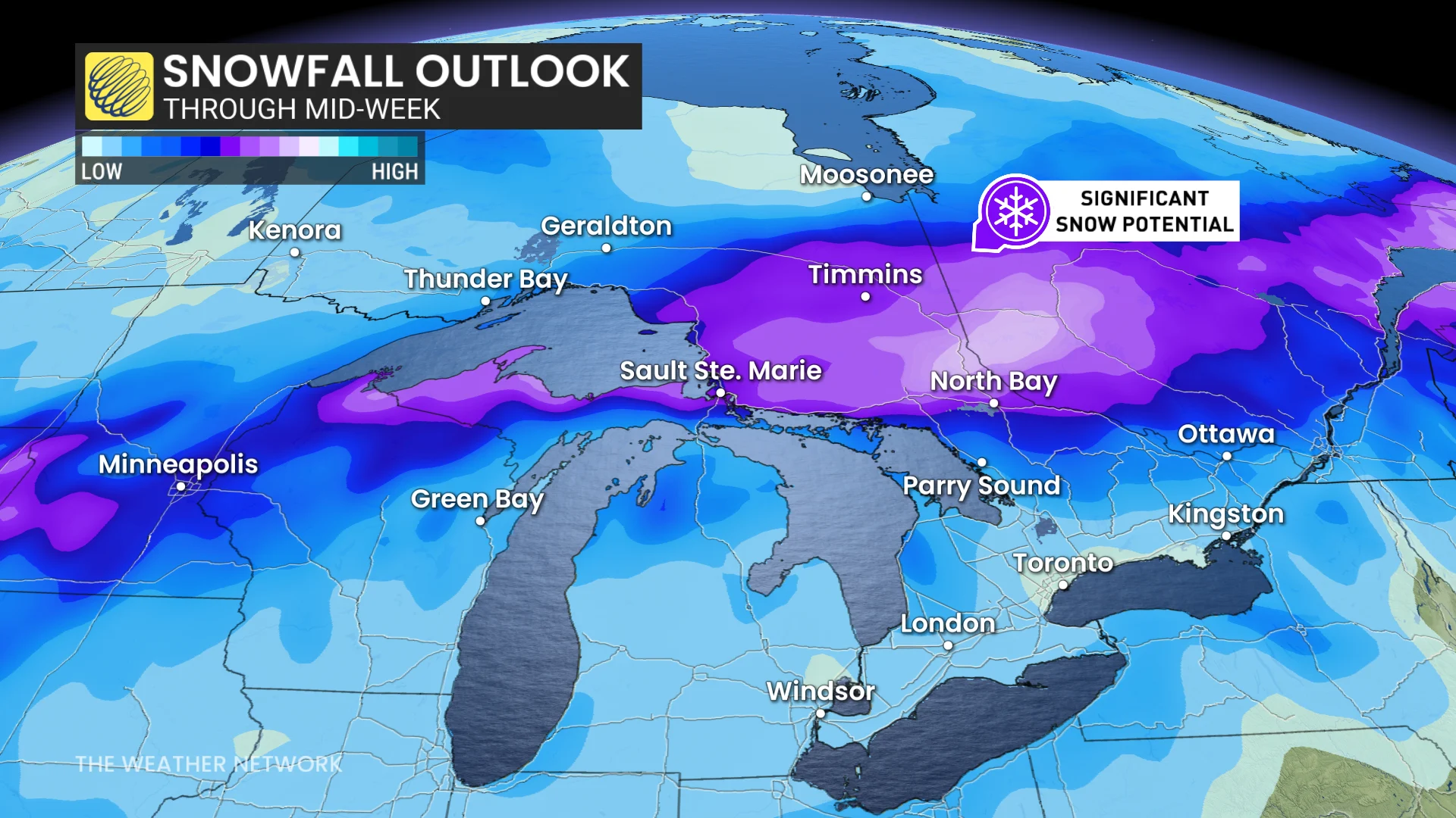
A swath of 15-20+ cm of snow is possible, so avoid travel if you can. Hazardous travel is expected on Highway 11 and Highway 17.
Blowing snow is then expected on Thursday as the storm exits east, especially for some of the snowbelts regions.
Stay with The Weather Network for all the latest on conditions across Ontario.