
Coldest temperature anomaly in North America includes these parts of Canada

May-like temperatures are forecast on Wednesday in parts of Ontario and Quebec, with parts of both provinces on tap to possibly experience the coldest anomaly in the Northern Hemisphere.
With plenty of summer left, parts of Canada will be taking a short breather from temperatures that are reflective of the season this week.
After severe weather and tornado warnings on Tuesday, a cold front ushers in a cooler, smoke-free air mass to Central Canada. On Wednesday, a cooldown will bring more May-like daytime highs in parts of Ontario and Quebec.
DON'T MISS: Watch? Warning? How we communicate severe weather in Canada
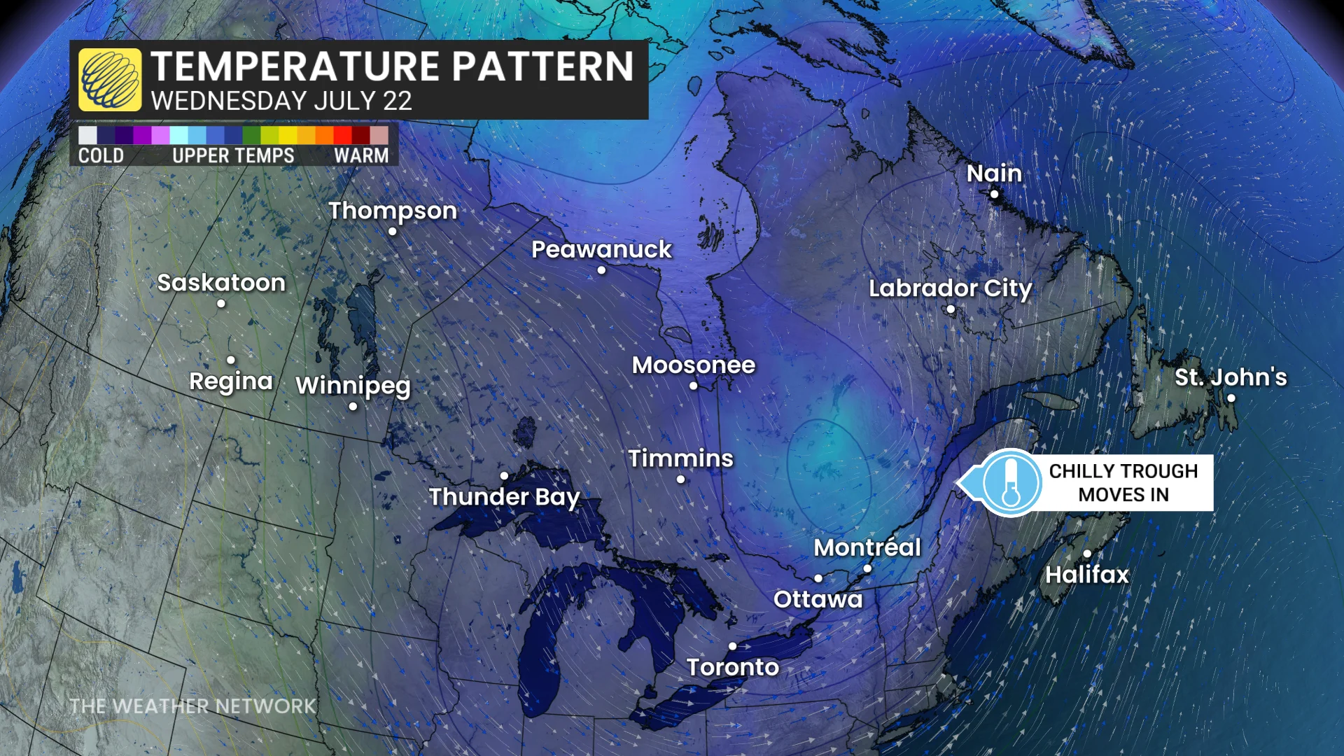
Western Quebec and parts of far northeastern Ontario may have the coldest temperature anomaly across the entire Northern Hemisphere.
Temperatures will be cool enough to put on a sweater or a light jacket if you're planning on being outdoors on Wednesday.
A taste of spring on Wednesday in Ontario and Quebec
Scattered showers will persist into Wednesday morning for parts of Ontario, gradually clearing to make way for mostly sunny skies.
DON'T MISS: Ontario's 2026 Summer Forecast: A changeable and reactive season
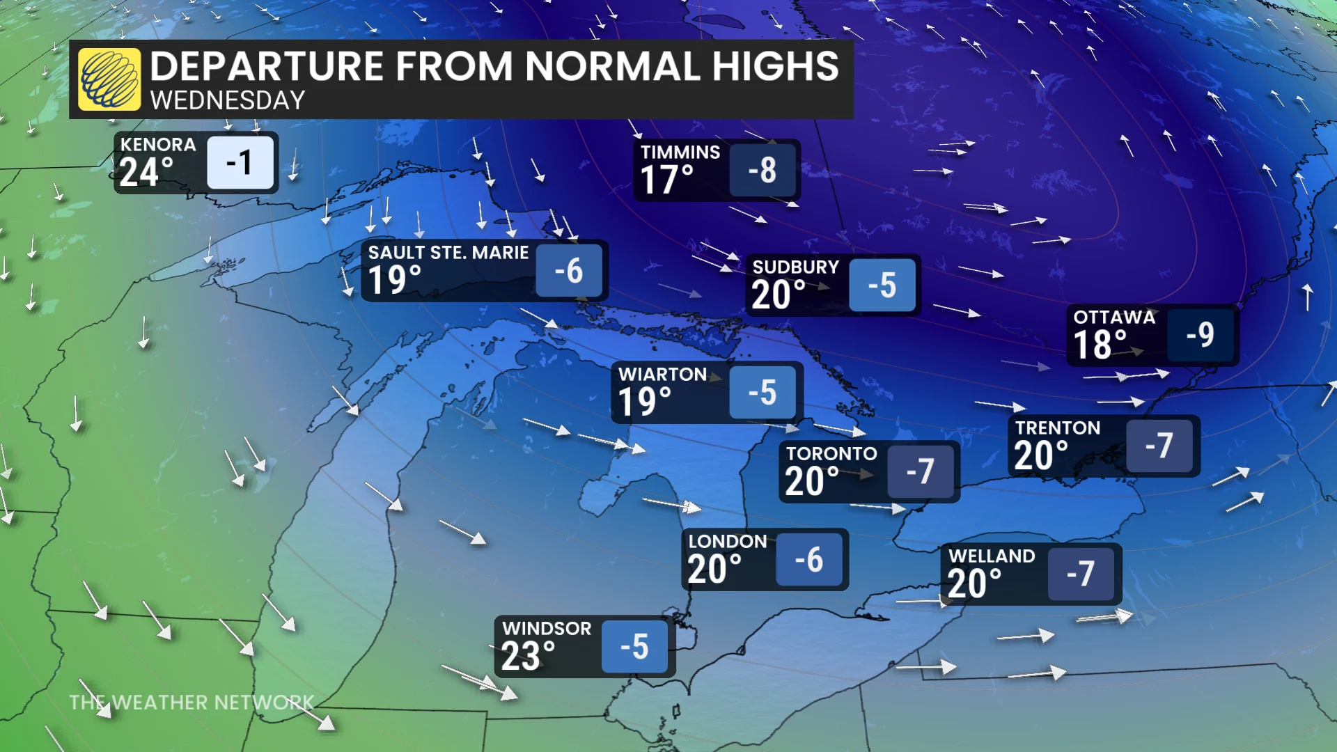
Cool air from the northwest will bring below seasonal temperatures across the two provinces.
On Wednesday, Ottawa is forecast to just reach 18 C, while most of the rest of southern Ontario will jump to the low 20s.
A normal daytime high, meanwhile, in Ottawa and Toronto, is 27 C. Temperatures are expected to be 5-10 C below normal.
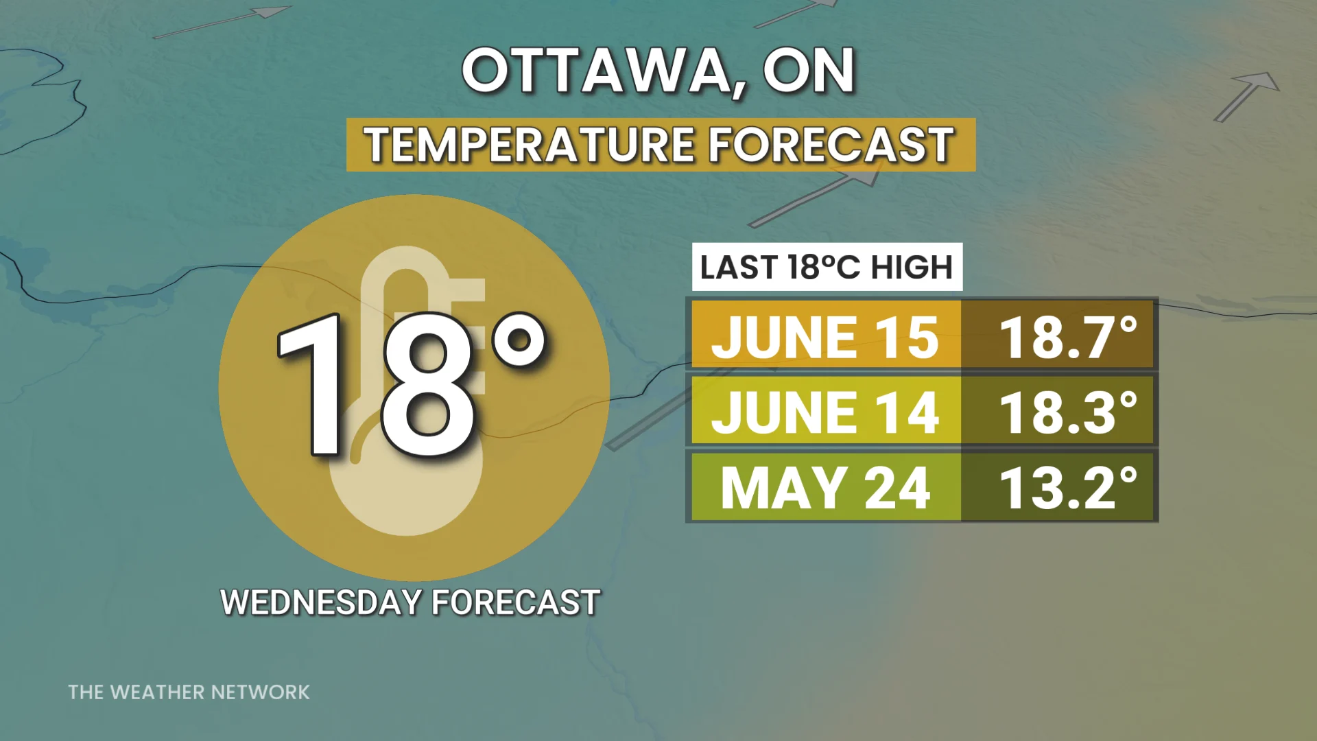
If Ottawa airport records 18 C or lower, that will be the coldest temperature since May 24.
In northwestern Ontario, daytime highs will be in the low- to mid-20s--helpful temperatures for fire weather.
Western Quebec and parts of far northeastern Ontario may have the coldest temperature anomaly across the entire Northern Hemisphere.
Temperature anomaly is the difference between the forecast temperature and the long-term climate normal.
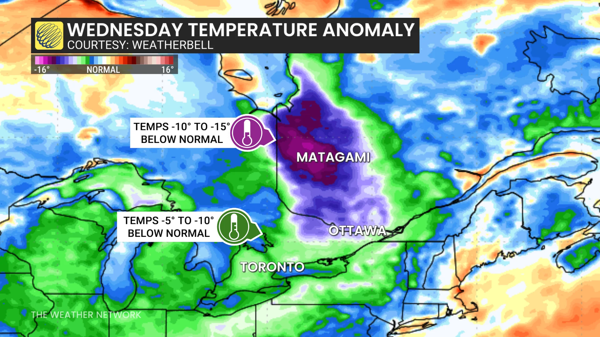
Communities south of James Bay may record temperatures of 10 to 15 C below normal on Wednesday.
Val-d'Or, Que., forecast will be near 10 C under the deep trough, with cool, northwesterly winds and showers or cloud cover through the day.
These temperatures are very anomalous for the middle of and end of July.
Cooler temperatures may linger into Thursday, but humid air feeling like the 30s will return to southern Ontario by the weekend.
Stay with The Weather Network for the latest on your weather across Ontario.