Watching some heavy lake-effect snow for Ontario, extreme cold tightens

Temperatures continue to get colder across southern Ontario, with wind chills during the daytime coming close to the -20 mark by this weekend. There's also several shots of snow on the table into next week.
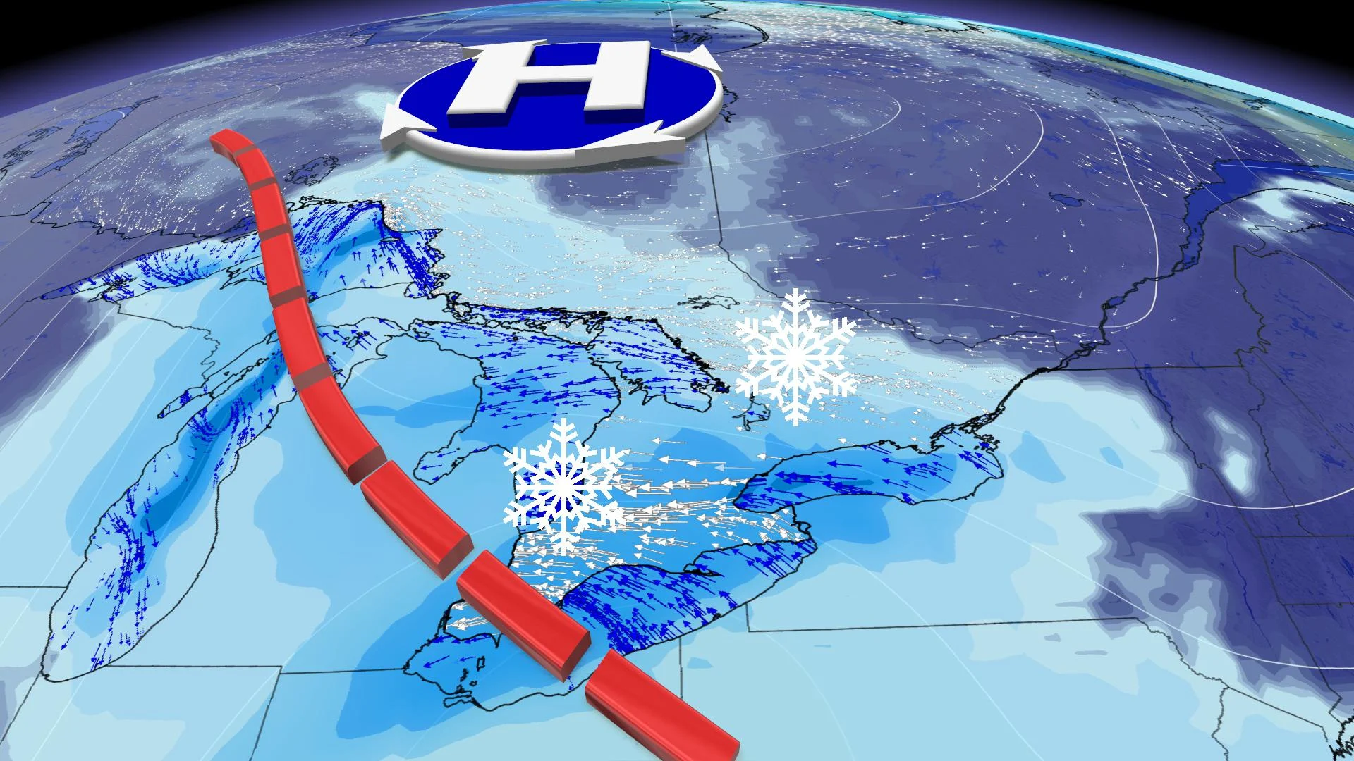
Though accompanied by welcome sunshine for most people, the first half of February has very much felt like the heart of winter temperature-wise, and the lead-in to the weekend features some of the coldest temperatures of the season so far, with daytime highs down to the negative double-digits, and feeling near -20 with the wind chill. There's also a few chances of snow in the near future, beginning Friday, where a narrow band of lake-effect snow could bring some locally heavy totals to communities along the west end of Lake Ontario. Beyond is more weekend snow, plus a more significant storm forecasters are watching for next week, below.
WEATHER HIGHLIGHTS
Weak system to bring widespread snow Friday, possible lake enhancement for west end of Lake Ontario
Remaining cold in southern Ontario this week, reinforcing shot Friday and into the weekend
More widespread snow on Saturday, localized amounts up to 20 cm possible
FRIDAY: COLD AIR REINFORCED, SNOW RETURNS
It's been chilly enough, but Friday will be colder still, with widespread daytime highs no warmer than the negative double digits for many communities, including parts of the Greater Toronto Area. Some, including the city of Toronto itself, declared extreme cold alerts, activating additional shelter spacing for people with nowhere to live.
Wind chills approaching or at -20 are possible. The risk for frostbite will increase somewhat as a result, and people should take this extreme cold event very seriously.

In terms of snow, a weak surface low tracking through may bring some light snow, but it's the west end of Lake Ontario where forecasters are paying the most attention.
The lake is still largely unfrozen, and with a bitter cold northeasterly wind setting up, periods of lake-effect snow are expected, and prodigious amounts of it. Though lake-effect snow bands have a habit of shifting, some parts of the QEW corridor between Hamilton and Niagara could pick up 5-10 cm.

MUST SEE: Canada set to endure the most widespread cold this century
However, people in that region should be aware that there's a good chance of locally higher amounts. The snow, coupled with the wind, will make for difficult travel on the roads, something drivers should be aware of.
WEEKEND: COLDEST TEMPERATURES OF THE WINTER SO FAR, WIDESPREAD SNOW DEVELOPS WITH LOCALLY HEAVY AMOUNTS
A shot of widespread snow is also likely on Saturday, as well as another narrow band of heavier lake-enhanced snow near the west of Lake Ontario, this time between the Toronto lakeshore and Hamilton, due to the easterly wind off the lake.

Snow will continue for much of the region into Saturday night.
At this point, it looks like most of the GTA will see 5-10 cm, with less than 5 cm expected north of the GTA. However, localized snow totals of 10-20 cm are possible near the west end of Lake Ontario, due to the band of lake-effect snow.
Temperatures continue to be very cold, with the weekend featuring daytime highs that will struggle to reach even the negative single-digit mark, with wind chills once again down to -20.

SEE ALSO: Ontario ski hills to reopen as restrictions ease
COLD TEMPERATURES CREATE TEMPORARY RELIEF FROM ICE JAMS:
BEYOND: CLOSELY WATCHING A SIGNIFICANT SNOW POTENTIAL FOR TUESDAY
A more significant storm is possible later Tuesday or on Wednesday for southern Ontario, but it is still too early to have confidence in the details and exact snow totals.
"But this storm has the potential to bring 10-20 cm of snow to our region," says Weather Network meteorologist Dr. Doug Gillham, adding that snow totals will be much lower if the storm track stays further to the south.
At this point it looks like near normal or colder than normal temperatures will dominate for the rest of the month of February.
Be sure to check back for the latest on the winter weather in Ontario.


