
Severe storm with tornado potential shifts in Ontario

While the storm risk lingers in southern Ontario Thursday, severe storms and a tornado are possible in northeastern areas.
Thursday will be the final day of the muggy conditions in southern Ontario as an incoming low from the north will wipe it out. However, as it does so, it could set off thunderstorms in the region. The threat for severe storms will be in the northeast, where the potential also includes the slim possibility of a tornado or two. On Friday, temperatures will plummet to the low 20s, even upper teens in some locales, as cooler air arrives for the start of the long weekend. Details and timing, below.
WEATHER HIGHLIGHTS
Widespread thunderstorm risk on Thursday; severe possible in northeastern areas, with slight tornado chance
Cooldown to start the long weekend
Uncertainty in forecast next week
Keep on top of severe weather ALERTS in your area
THURSDAY: STORM, TORNADO POTENTIAL, GUSTY WINDS
Northeastern Ontario
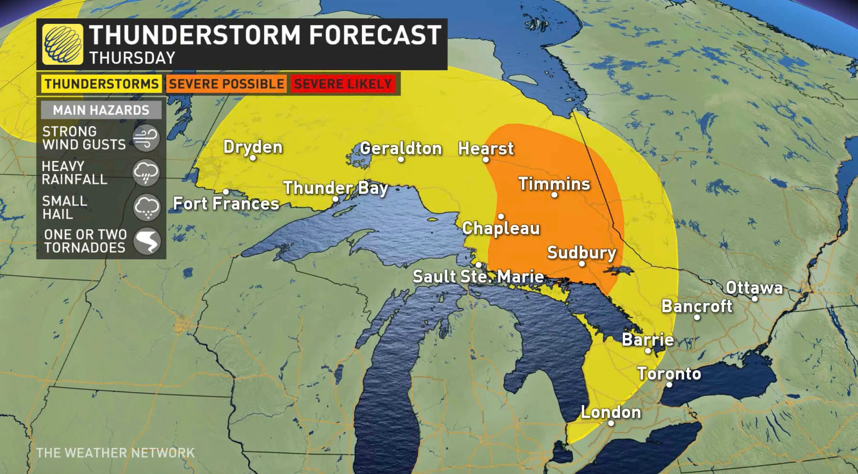
A slow-moving low will make its way through northeastern Ontario on Thursday. This could trigger severe thunderstorms in the morning and early afternoon, with small hail, strong wind gusts up to 100 km/h, heavy rain and the slight potential for a tornado or two. Areas at risk to see a tornado will be east of Timmins, northeast of Sudbury. There will be favourable directional wind shear present.
SEE ALSO: Distant typhoon set to bring an early taste of fall to Canada
Southern Ontario
Meanwhile, the same system will slide through central and southern sections in the afternoon and evening hours. It may spark non-severe thunderstorms as it does trek through.
Winds will pick up Thursday afternoon, with gusts hitting 50-60 km/h along the Lake Huron shores, southwestern and central areas. The GTA will also see some windy conditions in the evening but gusts will range between 40 and 40 km/h.
Warm and slightly above seasonal temperatures will hang on in the south for one more day. The hottest daytime highs will be in the southwest, where they will be just shy of 30°C. The humidity will make them feel like the low- to mid-30s.
FRIDAY AND BEYOND: LONG WEEKEND COOLDOWN, UNCERTAINITY FOR LABOUR DAY, BACK TO SCHOOL
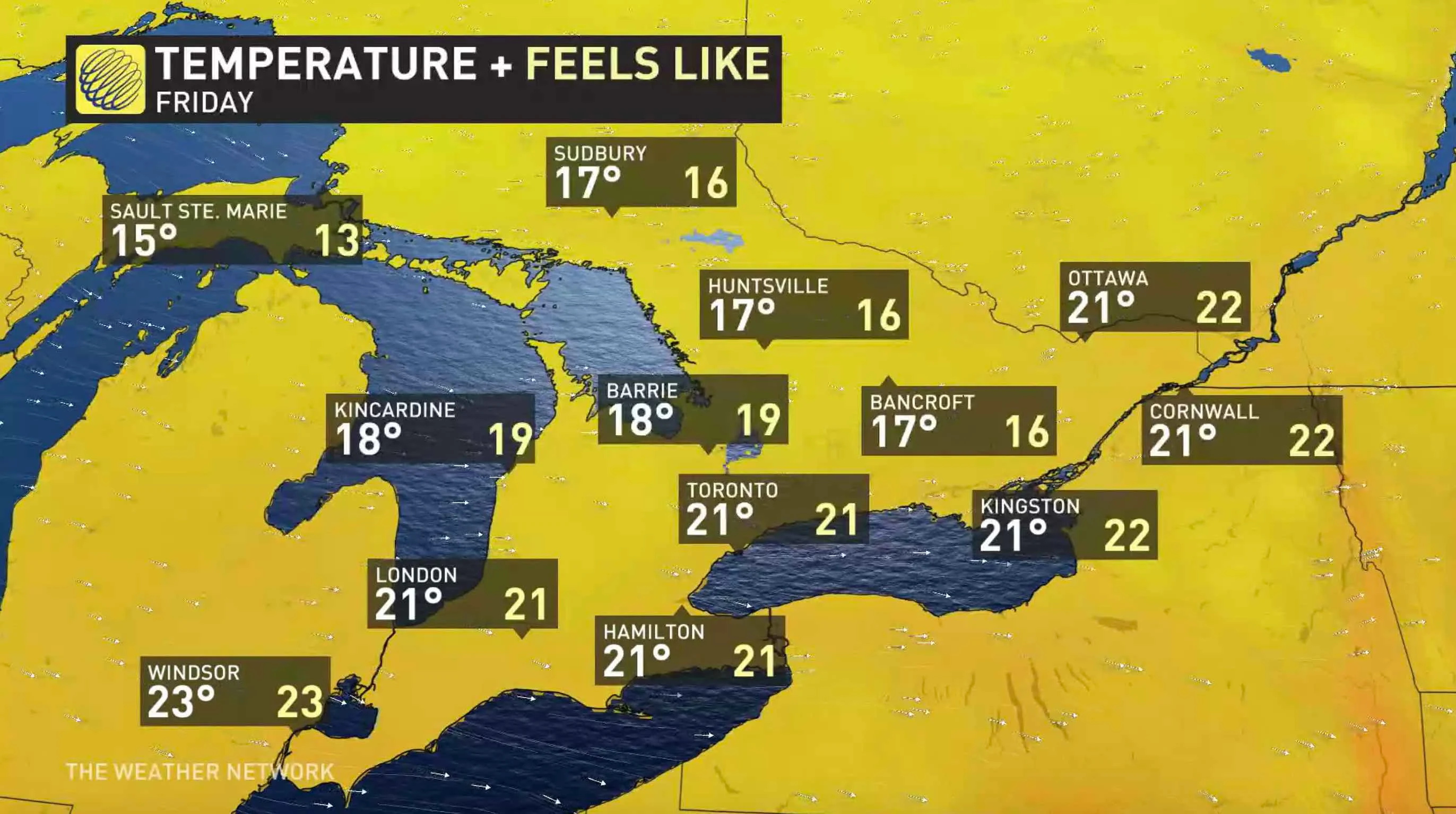
Behind the front, temperatures will dip to below seasonal values Friday and the humidity will disappear, setting the stage for a cool start to the Labour Day long weekend. Daytime highs will be in the upper teens and low 20s across the south. With the cooler temperatures and warmer waters of the Great Lakes, waterspouts will be possible.
There may also be wraparound showers and thunderstorms in Georgian Bay and northeastern Ontario in the afternoon, though very isolated in nature.
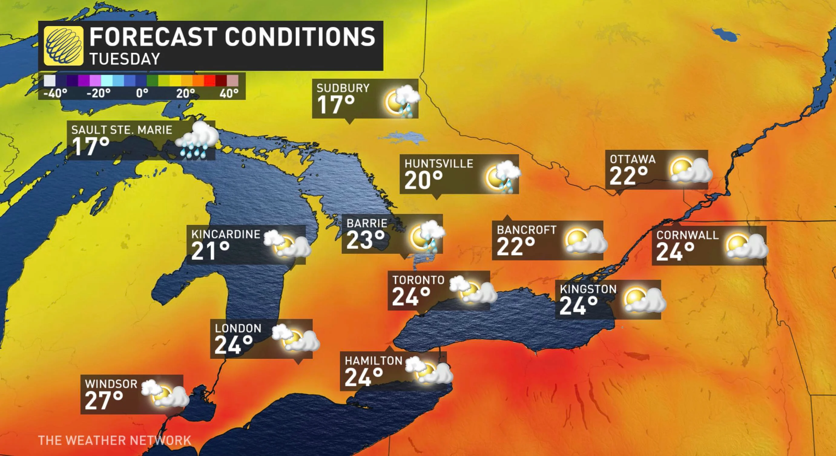
Sunday will feature slightly warmer temperatures, with mid-20s for southern Ontario. As well, forecasters will be keeping an eye on a strong cold front, which will approach the region late Sunday or Monday but it could stall before reaching the region. It is creating some uncertainity for the forecast for Labour Day and back to school.
For the week beyond, the region will be the battle zone between the autumnal weather and mid-summer heat and humidity. As a result, there is more uncertainty than usual regarding the temperature pattern across this region.
"The spread in the models is 15-20 degrees for the middle of next week. Our current forecast is a conservative compromise until confidence increases as to whether the heat or the chilly weather will win out," says Weather Network meteorologist Dr. Doug Gillham.
Recent models have been trending towards the cold weather, remaining west of southern Ontario, giving the potential for mid-summer weather for a few days rather than autumnal weather for back to school but the chilly air could still win out. Also, there will likely be some wet and stormy weather along the battle zone between summer and fall weather.
Keep an eye on the forecast as we continue to monitor Ontario's weather outlook.