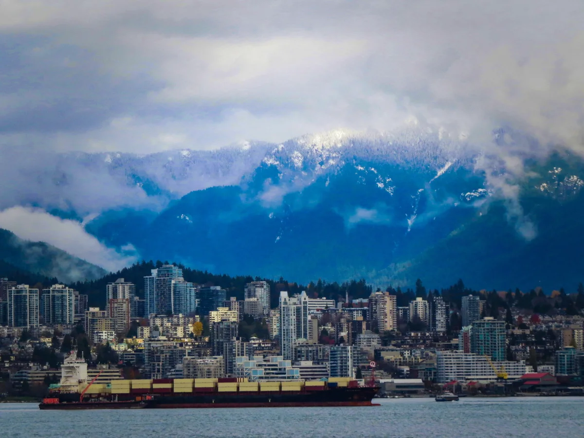
Cold air dominates B.C. as Arctic outflow sweeps province

Arctic outflow winds will keep temperatures well below seasonal for the Lower Mainland through the middle of the week.
British Columbia is facing its coldest stretch of temperatures since the beginning of the year as cold continental winds blow across the province. Daytime highs through midweek will struggle to climb much above freezing for much of the Lower Mainland, which is well below normal for the end of February. More on the gusty winds and how long the cold will last, below.
THROUGH WEDNESDAY: VANCOUVER DIPS WELL BELOW SEASONAL FOR LATE FEBRUARY
The last full week of February should feel relatively temperate across the South Coast, with seasonal temperatures in the high single digits common for this time of year.
A centre of high pressure sliding down the B.C. coast fostered a classic Arctic outflow setup, picking up some of that frigid Prairie air and sending it over the Rockies.
Extreme cold warnings are in place for the Peace River, Elk Valley, Yoho Park, and Kootenay Park, where wind chill values will drop as low as -40 through Tuesday morning.
While we won’t see those dangerously cold temperatures across the southern part of the province, gusty outflow winds will keep temperatures well below seasonal through Wednesday.
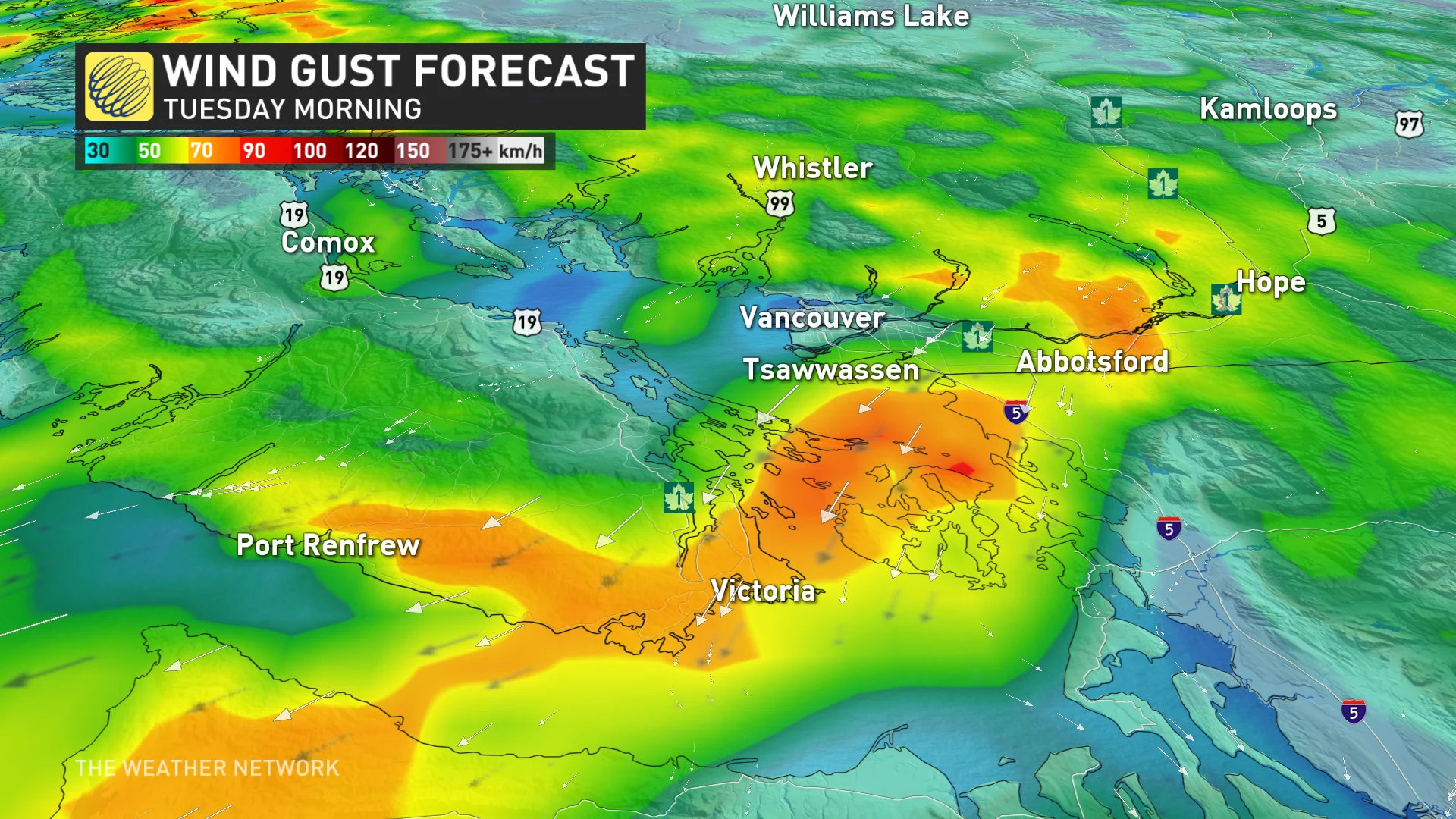
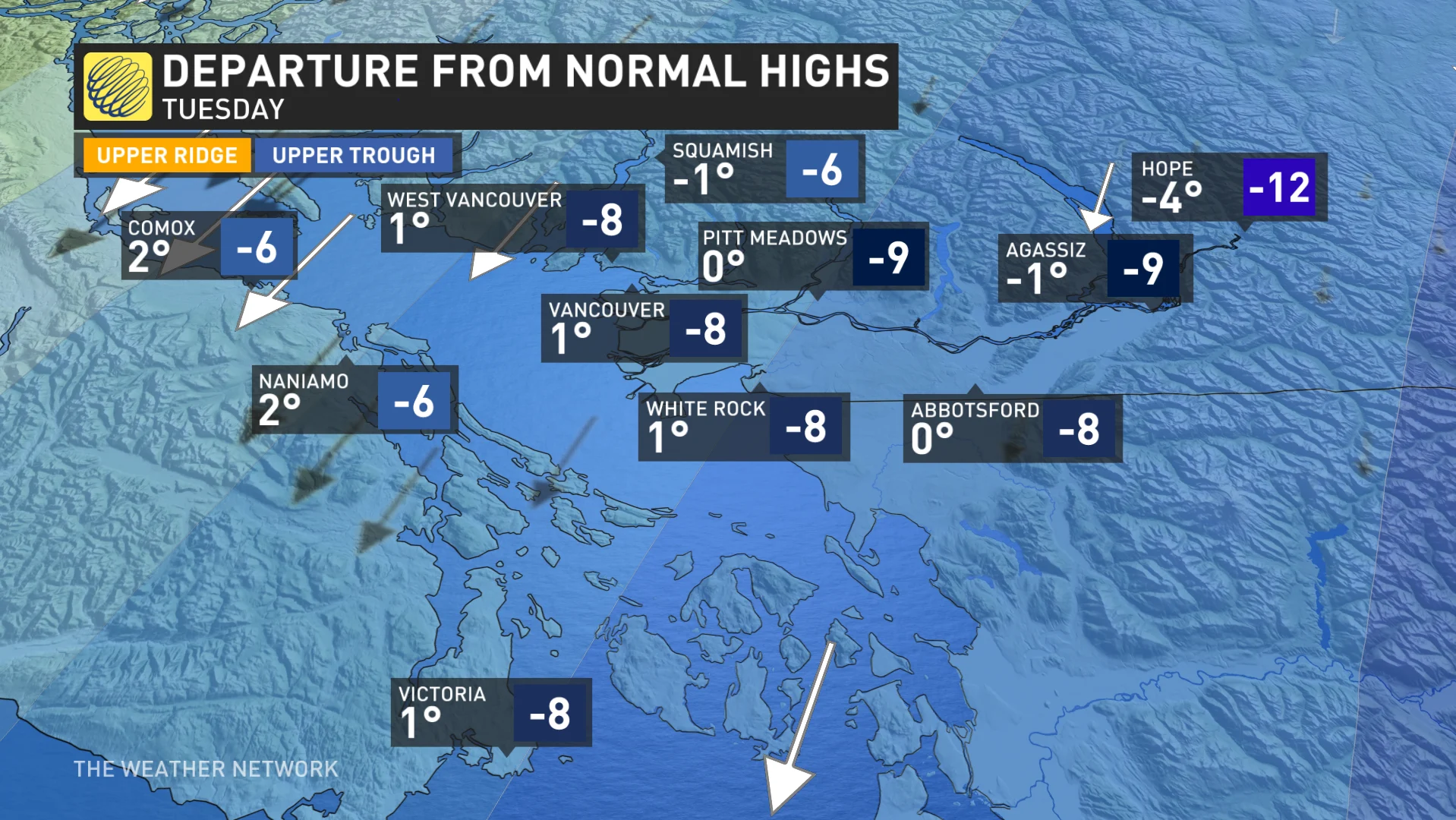
Daytime highs will top out just above the freezing mark on Tuesday and Wednesday, with morning lows dipping into the middle single digits below zero for the next few mornings. Winds will make the chilly temperatures feel even colder, with wind chill values falling below -10 at times.
It’s been a while since we’ve seen temperatures this chilly across the region. Vancouver hasn’t seen daytime temperatures this cold since early January. The city’s typical high for February 21st is about 8°C.
Thankfully, unlike the cold pattern we saw at the beginning of the winter, this cold air won’t have much moisture to work with. While some light showers or flurries are possible around the Lower Mainland, snow and ice aren’t going to pose a problem this time around.
THE WEEK AHEAD: SEASONABLE AIR RETURNS, NEXT SYSTEM ARRIVES FOR THE WEEKEND
A pattern shift by the end of the week will allow more seasonable air to spread across the South Coast, with temperatures returning to around seasonal by the weekend.
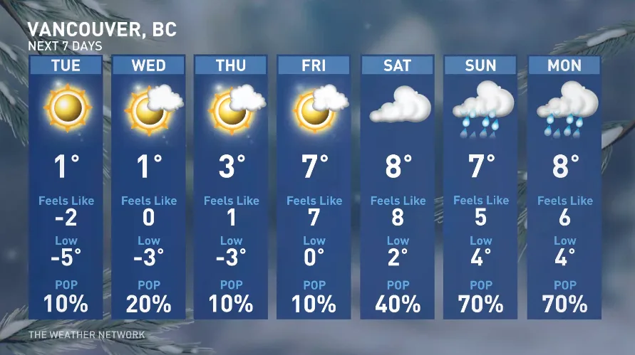
The return of the milder air will coincide with the arrival of our next system across the region.
Thumbnail courtesy of Ron Macdonald.
Stay with The Weather Network for the latest on conditions across British Columbia.