Coastal storm brewing with potential for 10-20+ cm of snow
Forecasters are closely watching the progress of a coastal storm expected to affect Atlantic Canada late this weekend
A brewing coastal storm could bring a swath of heavy precipitation and strong winds to Atlantic Canada late this weekend. This system is so potent that it could even bring snow to portions of Florida and Georgia.
Precipitation types and amounts will depend on what track this system takes as it moves up the East Coast. Based on current trends, this could be an impactful storm for some areas, including Halifax, Moncton, and St. John’s.
DON'T MISS: Second half of January looking much colder across Canada

Atlantic Canada will remain under an active storm track this weekend and into next week, with multiple systems forecast to bring rounds of snow, rain, mixed precipitation, and strong winds.
Uncertainty in the track of the storm
All the ingredients are coming together for a potentially impactful storm for much of the region. A strengthening low-pressure system will move up the coast, meeting up with cold air to the north as it pulls ample moisture from the subtropics.
We’ll see a mix of heavy snow and rain spread across the Maritimes and Newfoundland into early next week.
The precise storm track is the deciding factor in a setup like this. The system’s proximity to the coast will determine what type of precipitation falls over specific areas, as well as where the heaviest swath of snow sets up over Atlantic Canada.
The timing of the system is also not fully locked in yet. A faster forward motion could allow precipitation to arrive as early as Sunday evening.

DON’T MISS: El Niño incoming? Forecasters see signs of big changes ahead
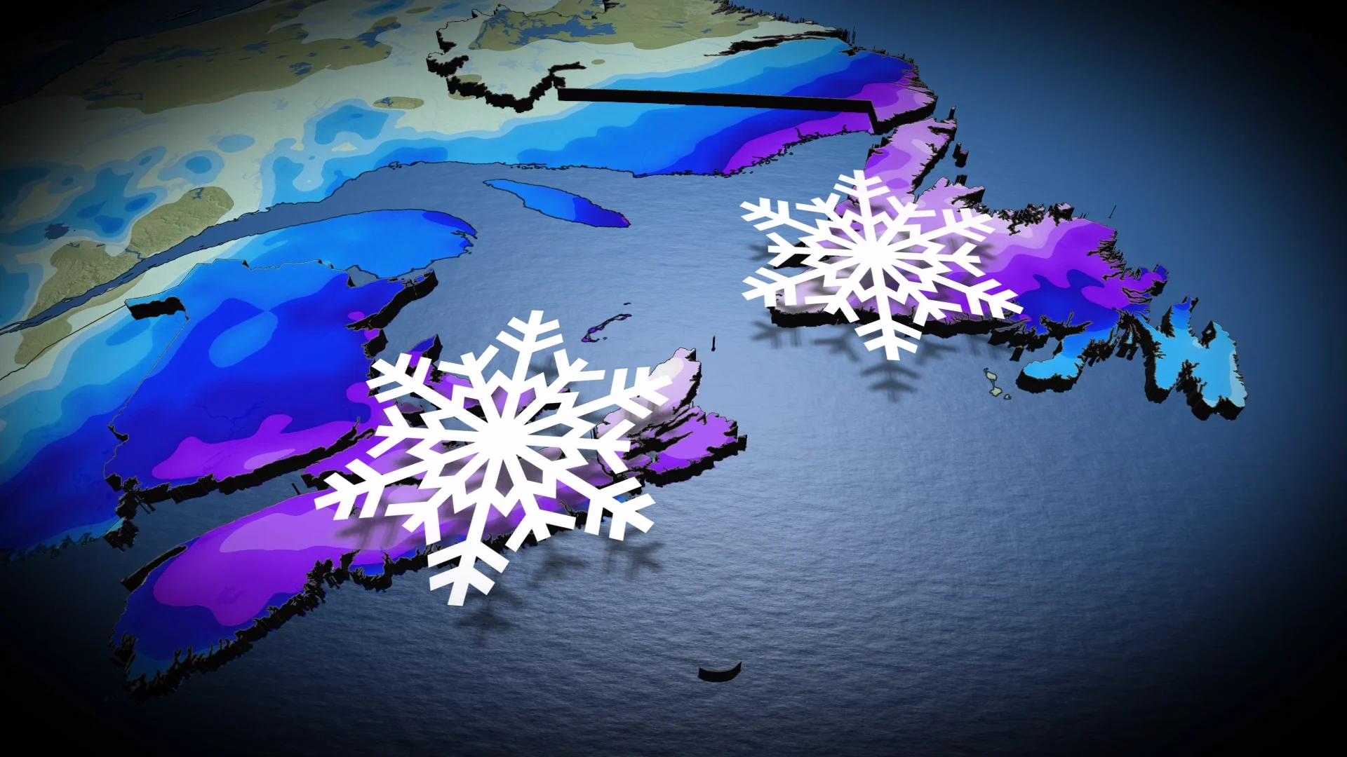
Based on current trends, forecasters expect a swath of 10-20+ cm of snow across much of Nova Scotia, eastern New Brunswick, Prince Edward Island, and much of Newfoundland. Lower snowfall totals are possible right along Nova Scotia’s southern shores.
Warmer temperatures arriving over the Avalon Peninsula will cut snowfall totals down to a dusting here before precipitation changes over to rain.
The cold pattern is forecast to persist through the end of January, with additional systems potentially bringing significant winter storms and widespread snow to the region.
Stay with The Weather Network for all the latest on conditions across Atlantic Canada.