Powerful storm in the making eyes Ontario with sweeping impacts

Consider altering travel plans in Ontario through the holiday weekend as road conditions are likely to become dangerous. Extensive utility outages are possible, alongside the chance of road and store closures, and flight cancellations or delays
With the holidays fast approaching, so, too, is the arrival of a poorly timed and massive winter storm, which is likely to ruin the plans for millions across North America including in southern Ontario. If you have any travel schemes, it's best to rethink them accordingly and leave much sooner than planned, or wait until the storm has passed and conditions have improved.
RELATED: Holiday havoc: Vast, 3,000-km-sized storm puts travel plans in peril
Special weather statements are in place in southern Ontario, with the likelihood of precipitation-related and/or wind warnings being added to some regions soon.
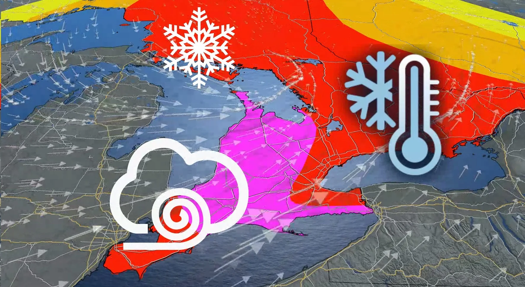
"The sheer size of this storm, the flash freeze potential and blizzard conditions with powerful winds and impressive snowfall totals are what has forecasters attention," says Kelly Sonnenburg, a meteorologist at The Weather Network.

There are several major impacts that residents in the province should prepare for when it comes to this beast of a storm, including extremely dangerous driving conditions, power outages, damage to infrastructure due to high winds, flight cancellations and delays, as well as store and road closures.
Precipitation may begin as rain or snow late Thursday before transitioning to rain in many areas in the overnight. Temperatures are expected to plummet on Friday, leading to a potential flash freeze for locations that receive rainfall.

Rapidly falling temperatures will be accompanied by strong to potentially damaging winds along with snow that may be heavy at times.
Southwesterly wind gusts exceeding 80 km/h will blanket the 401 corridor, and could even surpass 120 km/h along the Lake Erie shores. Temperatures will drop by as much as 15°C from the morning commute to the evening hours.
Hazardous, damaging winds will continue through Christmas Eve, with blizzard conditions and strong snow squalls forecast to develop Friday afternoon and continue through Christmas Day.
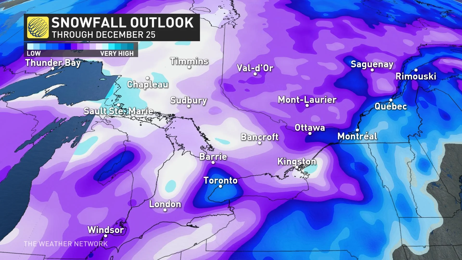
A multi-day, lake-effect snow event is expected into the weekend in the wake of the system for locations east of the Great Lakes.
Through Christmas, some areas in the snowbelt regions in Ontario may wind up with 30-50 cm of snow, thanks the lake-effect setup following the passage of the storm. The Greater Toronto Area (GTA) may see 5-15 cm of snow.
"Consider altering plans through the holiday weekend as travel conditions may become dangerous," says Environment and Climate Change Canada (ECCC) in a widespread special weather statement that covers the region. "Extensive utility outages are possible. Temperatures Friday night into the weekend will likely be the coldest of the season to date."

WATCH: What you need to have prepared in the car as a holiday storm targets Ontario
Check back for the latest on the forecast across southern Ontario.


