Classic clash of the seasons as strong blocking pattern closes out October
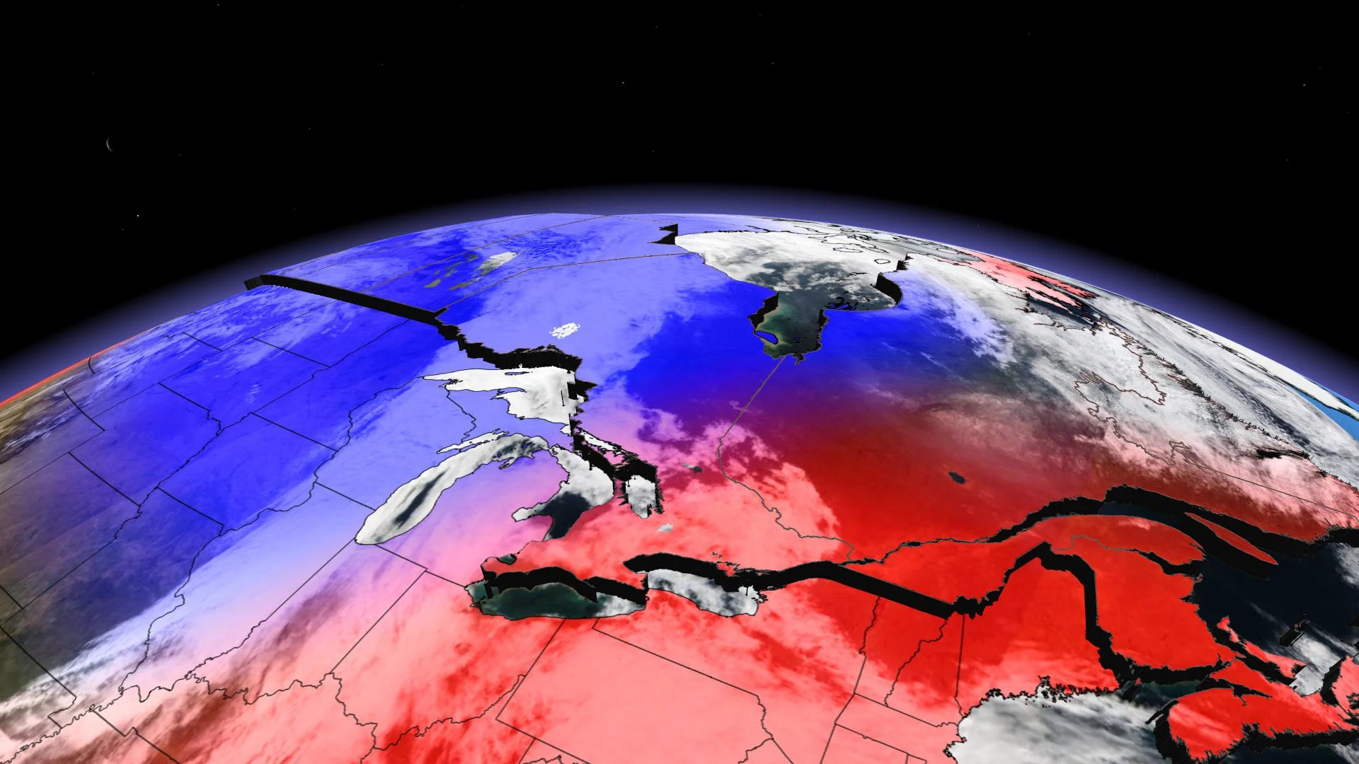
Both western and eastern Canada look to lock into a set weather pattern to end October, while southern Ontario and Quebec remain the battleground between the sharply contrasting patterns.
October is living up to its reputation of being a changeable month. Will that continue through the end of the month? I will answer that question in a minute, but first here is a quick recap of the month so far.
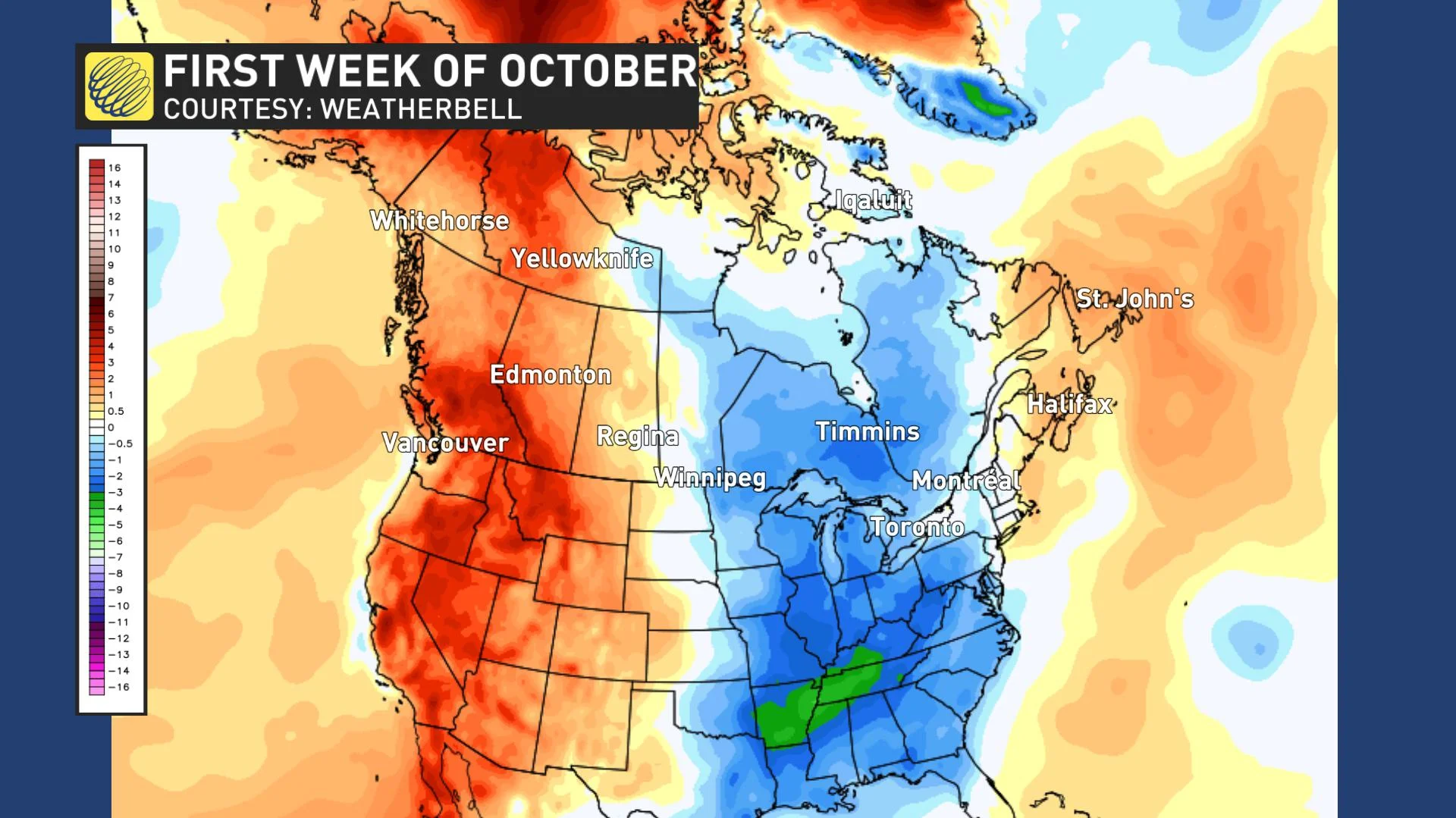
The first week of October featured very warm weather across western Canada, above seasonal temperatures across Atlantic Canada, and below seasonal temperatures across Ontario and Quebec.
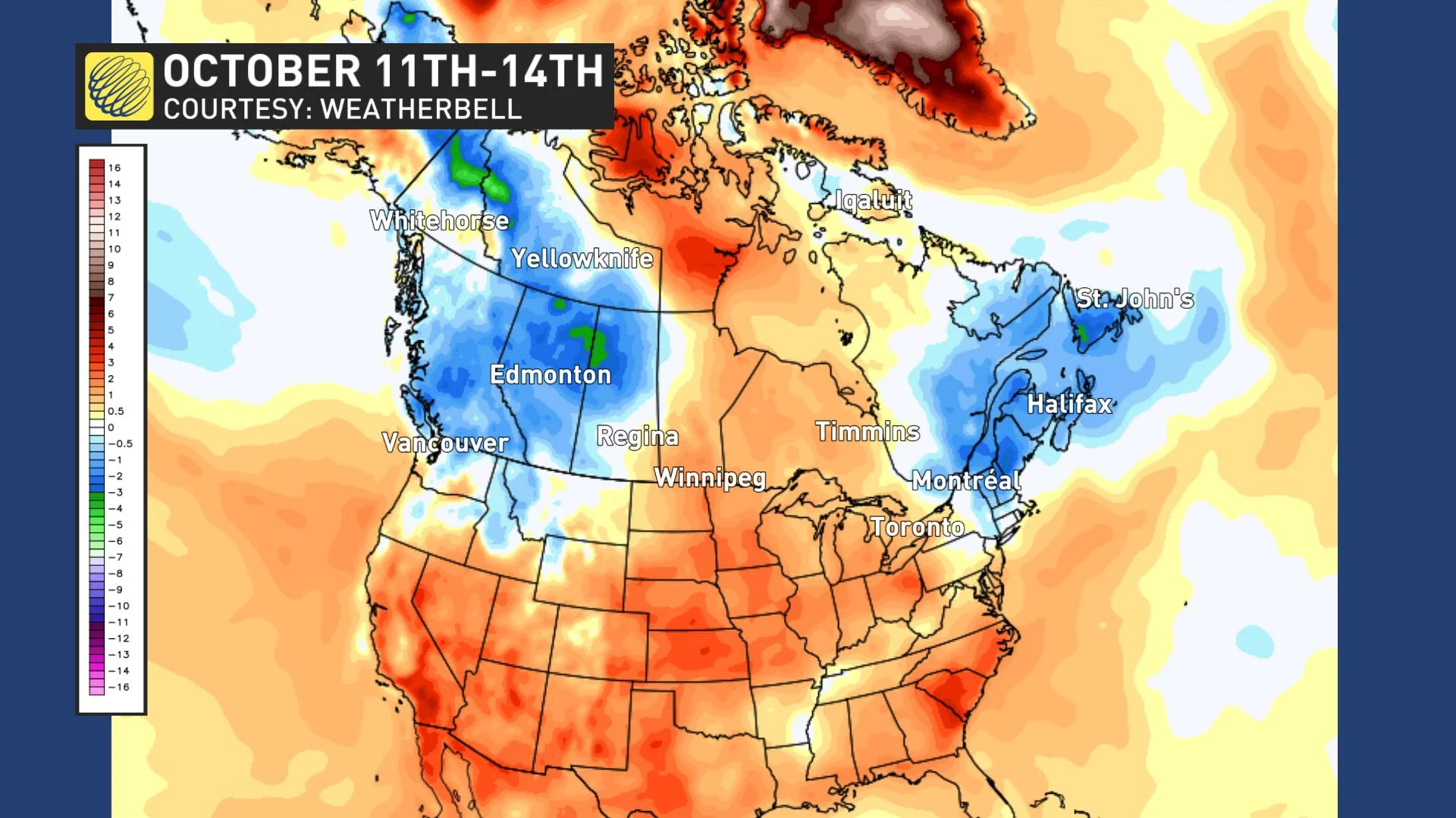
The second week of October brought a change in the pattern with a quick transition from late summer weather to early winter-like weather for parts of western Canada. Meanwhile the warm weather that was across western Canada shifted east into Ontario, and the chilly weather over Ontario shifted east into Atlantic Canada. The map below shows the temperature anomalies across Canada so far this week.
SECOND HALF OF OCTOBER: NATIONAL PATTERN LOCKS INTO PLACE
However, as we look ahead to the second half of October, our national pattern is actually going to lock into place for 10 to 14 days. An unusually strong blocking pattern that is more characteristic of winter is setting-up over Greenland and that blocking pattern will extend across the polar region.
What does that mean for Canada? Blocking patterns in the Arctic are the key to dislodging Arctic air and sending frigid temperatures plunging south, and that is what we will see during the next two weeks. Several rounds of Arctic air will descend upon western and central Canada during the next 10 to 14 days.
The map below shows the pattern during the next 10 to 14 days, with colder than normal temperatures dominating from B.C. to northern Ontario. Meanwhile, above seasonal temperatures will dominate across Atlantic Canada – though a few days of cooler weather could still mix in at times.
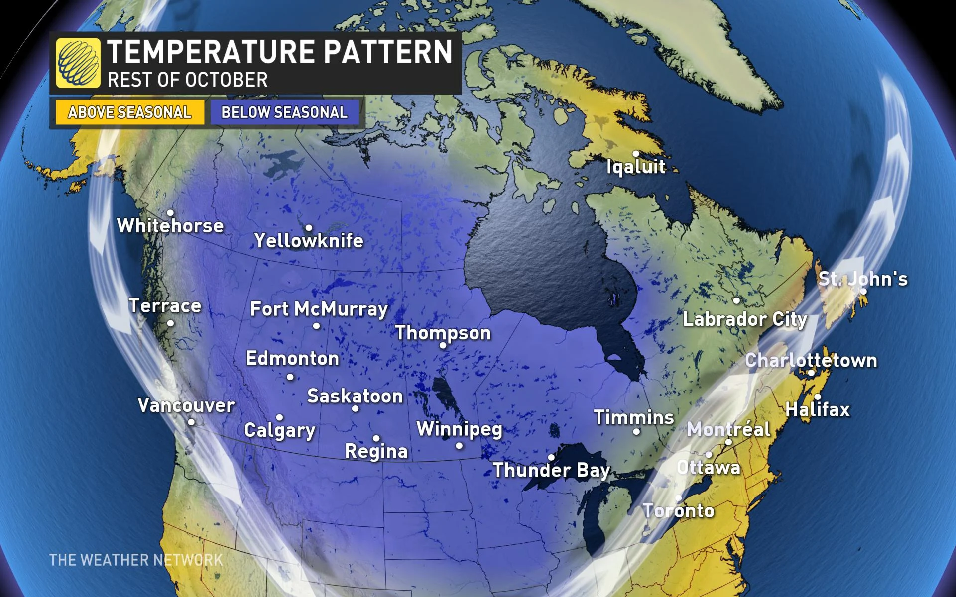
There are some indications that milder weather will finally return to western Canada during the final few days of October.
SOUTHERN ONTARIO AND QUEBEC BECOME THE BATTLEGROUND
This leaves southern Ontario and southern Quebec as the battleground between the sharply contrasting weather patterns. As a result, we will see a more active weather pattern next week with a few systems tracking across the region. We will also see changeable temperatures as the boundary between the contrasting temperature patterns shifts back and forth across the region.
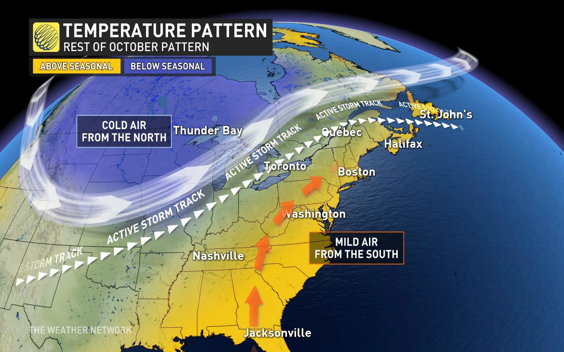
This also gives the potential for big changes to the forecast as we get close to a specific date as a minor shift in the position of the boundary will have a huge impact on daily temperatures.
The second half of week (October 22-24) is a great example of the forecast uncertainty that results from being near the boundary between November versus September-like weather. Several computer models show the temperatures soaring into the lower 20s across southern and eastern Ontario and southern Quebec for a couple of days, while other models show single digit high temperatures. At this point we think that the warmer scenario could win out for a day or two, but we are keeping our forecast conservative until confidence in the warmer scenario increases.
Regardless of how the end of next week plays out, it looks like we will see several days of cooler weather as we head into the final week of October.
MORE TROPICAL TROUBLES BREWING?
This has been a historic Atlantic hurricane season with 25 named storms by the first week of October. While the tropics have been quieter this week, the hurricane season officially runs through November 30th and we are watching the potential for one or two more storms before the end of the month. One area that we are watching closely is across the western Caribbean, south of Cuba. Another region that we will be watching is between the Bahamas and Bermuda.
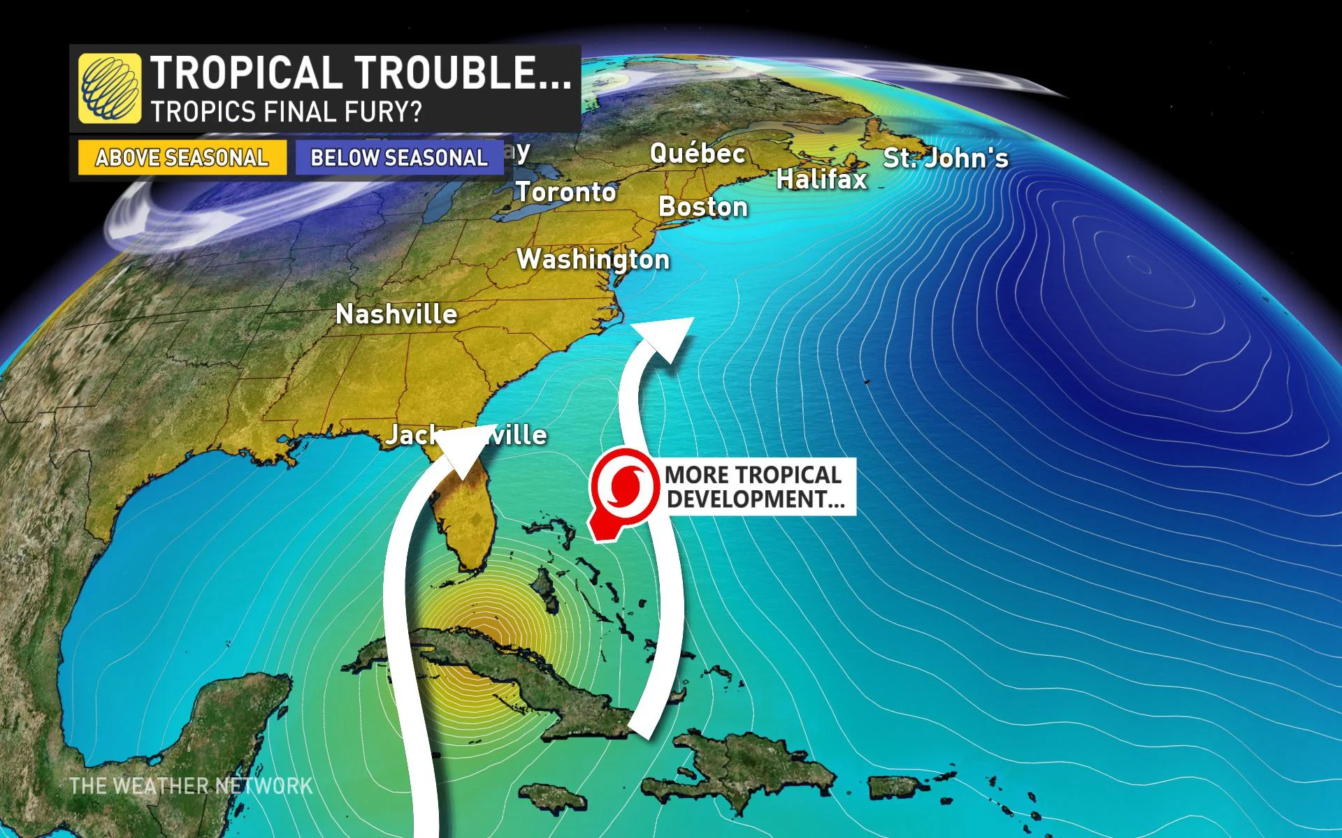
It is much too early to know if another tropical storm or hurricane will threaten Canada, but we still need to keep an eye on the tropics even as the flakes begin to fly across parts of Canada.


