Christmas Day blizzard threatens whiteout conditions in eastern Newfoundland
A strong winter storm is projected to bring heavy snow, strong winds and possible blizzard conditions to parts of Newfoundland on Christmas Day, with hazardous travel expected to continue throughout the holiday weekend.
Parts of the East Coast will get a guaranteed white Christmas this year with a little help from Mother Nature this week.
A low-pressure system on its way across Canada will intensify south of Nova Scotia on Christmas Eve and move towards Newfoundland, bringing widespread, gusty winds, a heavy snowfall and possible blizzard conditions on Christmas Day.
Heavy snow and strong winds are expected to persist throughout the day in eastern Newfoundland, with possible blizzard conditions and extremely difficult travel. Be sure to stay up to date on the latest alerts.
That won't be the end of the winter blast, as another storm will hit on Boxing Day, threatening identical conditions and travel disruptions that could last into the weekend.
CHECK OUT: Scientists find unusual structure under Bermuda that causes it 'float'
Christmas Day winter storm threatens travel in Newfoundland
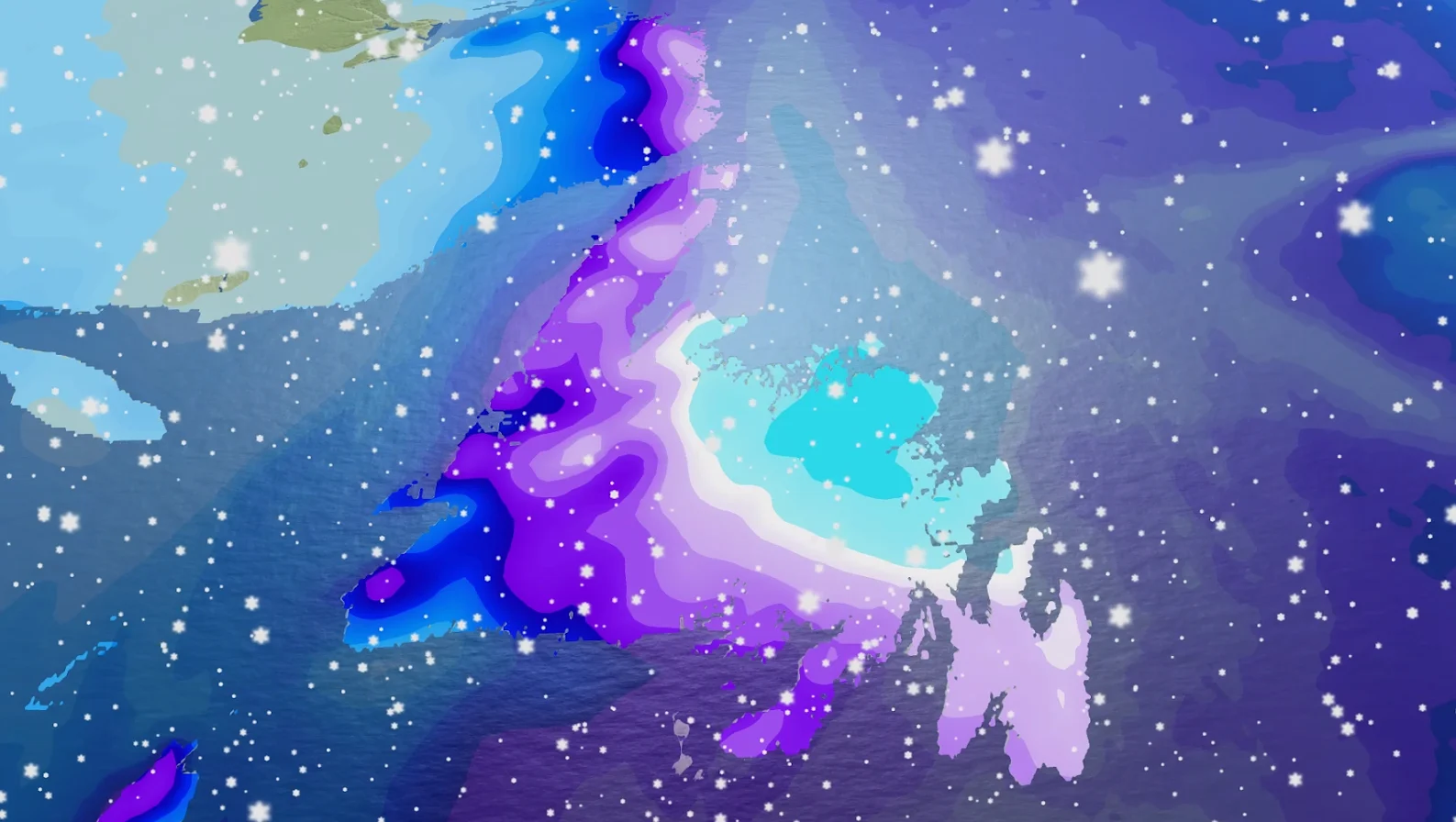
Heavy snow will fall in eastern Newfoundland early Thursday morning, including the Avalon Peninsula. Snowfall will increase throughout the morning, along with chilly wind gusts.
Snowfall rates of 2-4+ cm per hour are expected for the Avalon through the morning.
Wind gusts of 70-90 km/h are expected across Avalon and the eastern half of the island, with the strongest gusts affecting exposed coastal communities.

St. John's should see snow turn to rain towards the end of the afternoon on Thursday.
While the location and quantity of the heaviest snow are uncertain, snowfall totals could range from 20 to 30+ cm.
Slick roads, blowing snow and whiteout conditions are all potential hazards for Christmas Day travel. Strong winds may also cause power outages.
SEE ALSO: Why snow squalls are so tough to forecast

Followup storm on Boxing Day
On Boxing Day, another system will follow closely behind the first, taking a similar path and spreading another healthy swath of snow across the Avalon.
The system will need to be closely monitored because it is more likely to retrograde over the island. This could turn the initial blizzard conditions into rain in eastern Newfoundland.
If warmer air remains offshore, snow from the initial storm could cause prolonged blizzard conditions into Saturday.

Similar to Christmas Day, slick roads, blowing snow and whiteout conditions can make travel dangerous at times. Strong winds may also cause power outages.
Travel in Newfoundland and Labrador may remain hazardous due to blowing snow throughout the holiday weekend.
Coastal communities in southern Labrador could receive 20-40 cm of snow over the weekend, with wind gusts exceeding 80 km/h.
Stay with The Weather Network for the latest Newfoundland forecast updates.