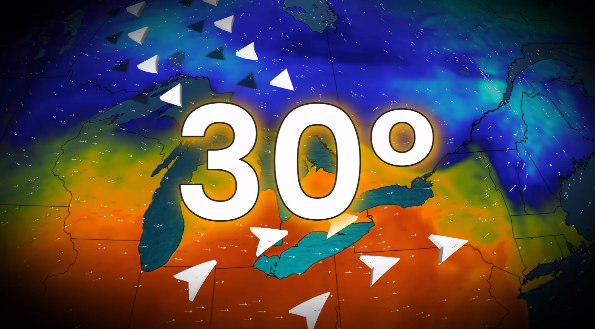
Canadian cities approach or hit 30 C as unusual heat breaks daily records

A second wave of summer weather hit parts of Central Canada on Tuesday, with cities breaking daily records and recording their latest 30 C reading in the year
The remarkable heat and humidity on Tuesday in southern Ontario was likely the last shot of summer-like weather for the year.
Tuesday was definitely a bonus summer-like day in southern Ontario as moisture from the remnants of post-tropical storm Rachel helped boost the temperatures and humidity.
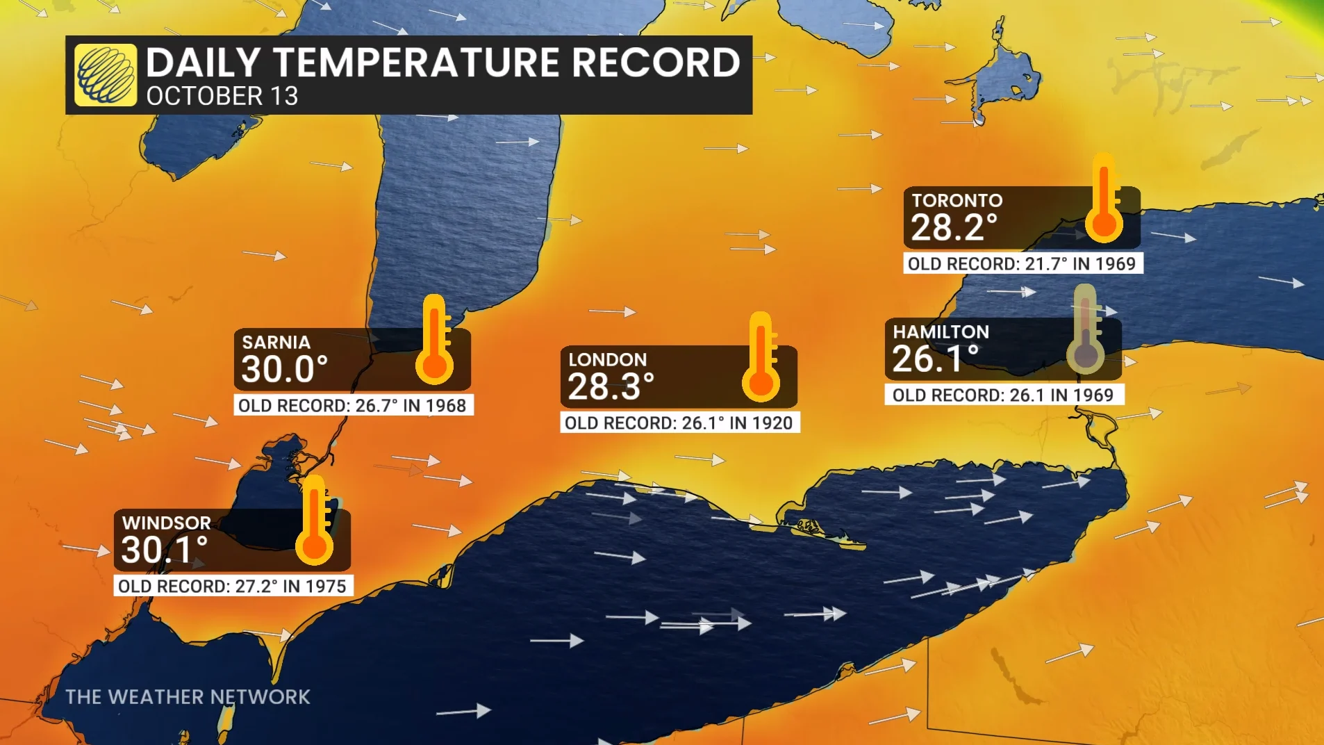
As a result, Windsor and Sarnia, Ont., both hit the 30-degree mark--an impressive, record-breaking feat for mid-October. Not only was Oct. 13 the latest in the year for those cities to hit 30 C, other Ontario cities broke daily records, as well.
DON'T MISS: Canada's Winter Sneak Peek: El Niño puts record warmth in play
Windsor, Sarnia hits 30-degree mark, daily records broken
The summer-like heat was accompanied by exceptionally high dew points for mid-October. They approached 20 C across southwestern Ontario, a region comfortably in the warm sector of an area of low pressure located near the Lake Huron shores.
High temperatures and humidity peaked on Tuesday ahead of a cold front passing through the overnight period.
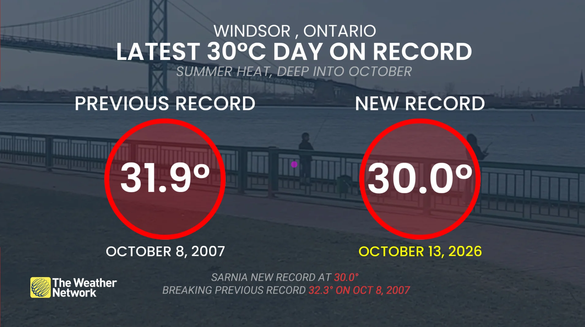
Sarnia and Windsor, Ont., both broke daily records after reaching the 30-degree mark.
Additionally, Oct. 13 is the latest, recorded date where both cities have recorded temperature at 30 C.
Other cities that broke daily records on Tuesday, but fell short of hitting 30 C, include Toronto, Hamilton and London, Ont.
For Windsor and Sarnia, the latest instance of 30 C has always been recorded within the first week of October.
Sarnia recorded 32.3 C on Oct. 8, 2007 as the previous record.
Windsor recorded 31.9 C on Oct. 8, 2007 as the previous record.
The all-time October temperature record for Windsor is 32.2 C, set on Oct. 6, 1963.
SEE ALSO: Climate versus weather? What's the difference?
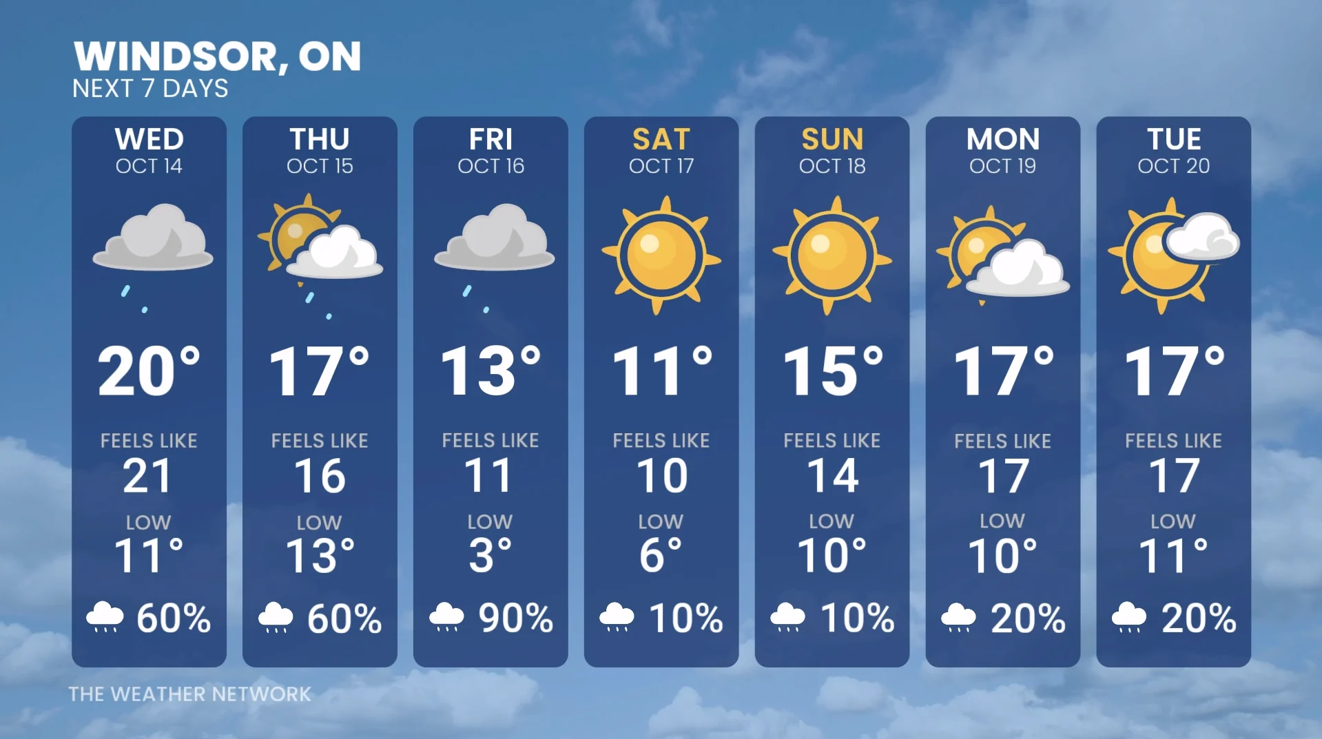
The winds will shift to come out of the north by Wednesday night, and by the end of the week, as we approach next weekend, temperatures will be drastically cooler. Some areas will only hit the single digits for highs.
Into Saturday, temperatures drop 5-10 degrees below normal in southern Ontario, with highs staying in the single digits.
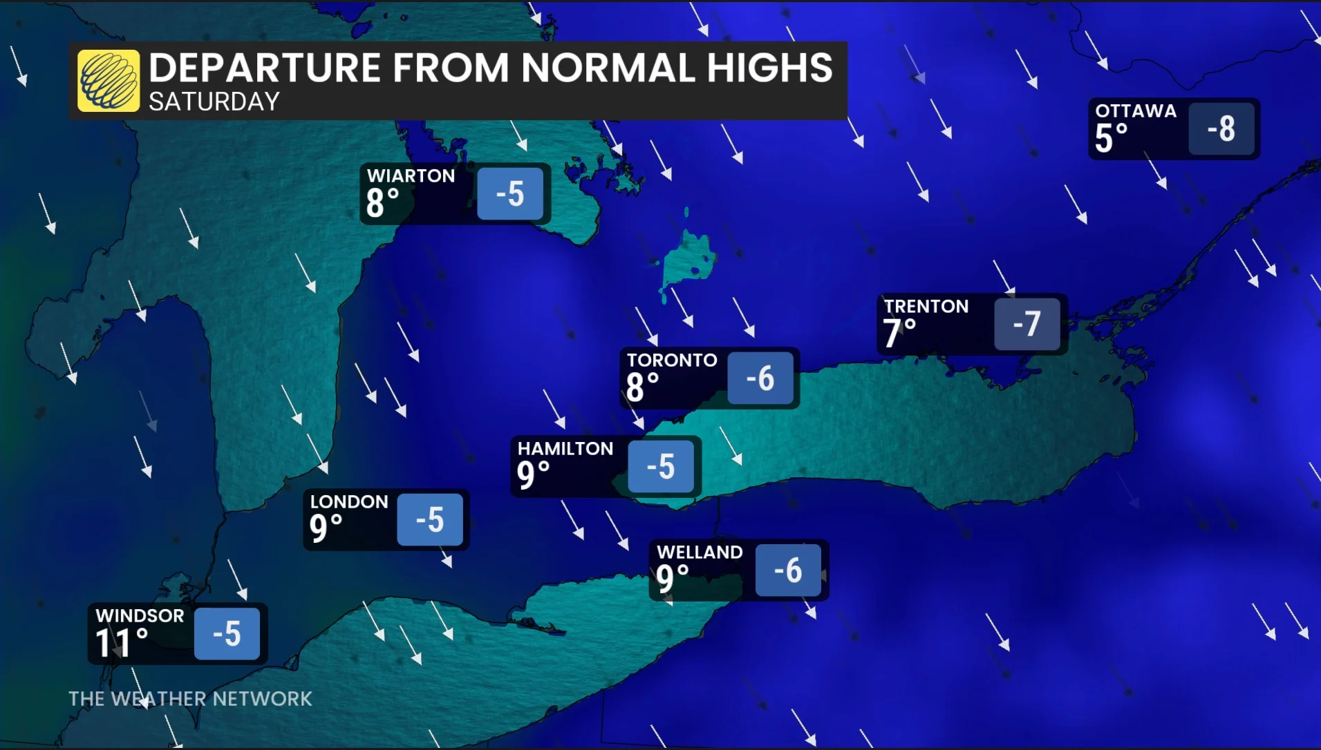
Toronto and Montreal will experience their coldest, daytime high since April 20, and the first, single-digit high of the season.
Above-seasonal temperatures are expected to return for late October and November thanks to El Niño.
With files from Rhythm Reet, a meteorologist at The Weather Network.
Stay tuned to The Weather Network for the latest forecast updates for Ontario.