
Canada's weather traffic jam traced back to an Omega and Rex block

Multiple rounds of showers and thunderstorms, as well as days of snow hit parts of the country this week, and it's all thanks to a blocking pattern slowing things down over Canada's atmosphere
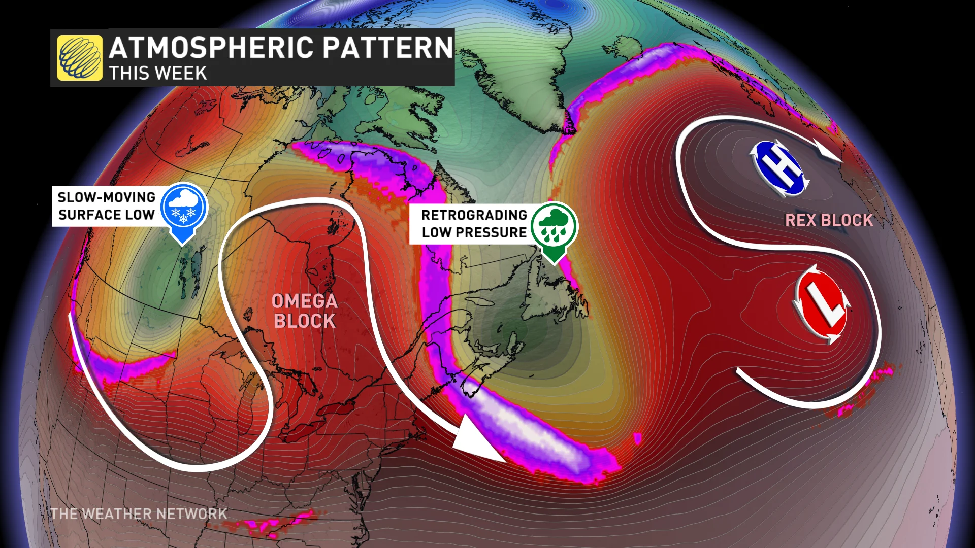
Two blocking patterns are majorly impacting Canada's weather this week. The current jet stream is dynamic and amplified, meaning depending on where you are, you could be in for several days of sun or messy precipitation.
The first is a Rex block over the Atlantic Ocean.
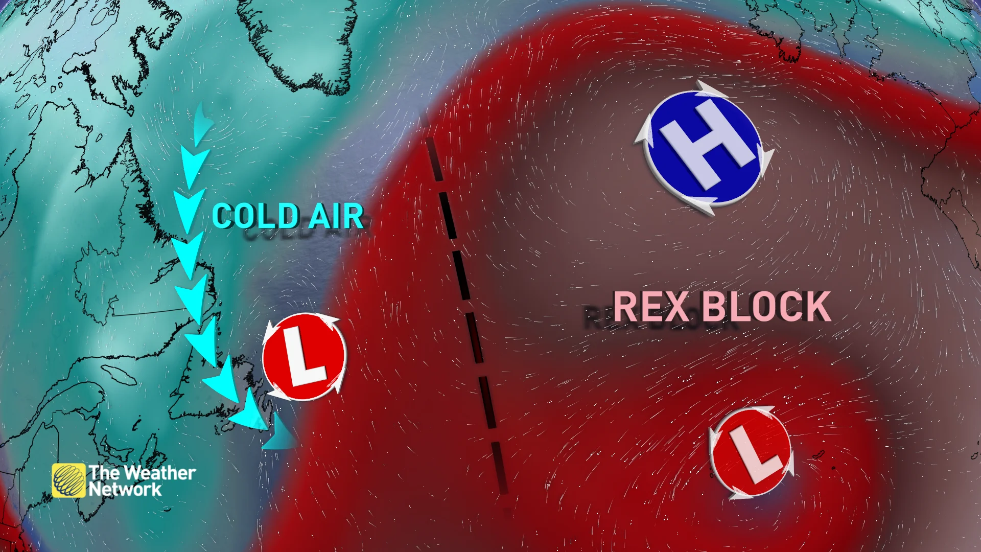
A strong high sitting directly on top of a low acts just like how a kink in a hose reduces water flow -- it blocks west to east air flow in the atmosphere. This has the most dramatic impact on Atlantic Canada this week.
DON'T MISS: How Omega blocks and Rex blocks can affect Canada's weather
A system will try to continue its journey into the Atlantic ocean, but be forced backwards into Newfoundland by the Rex block. Newfoundland’s north coast will experience brief, but significant winter weather due to this low backing into colder air it's left behind.
Up to 15 cm of snow, paired with 70-90+ km/h winds are expected, and could result in some dangerous blizzard-like conditions for the region.
FORECAST: Brace for more winter weather travel, as snow and winds return to Newfoundland
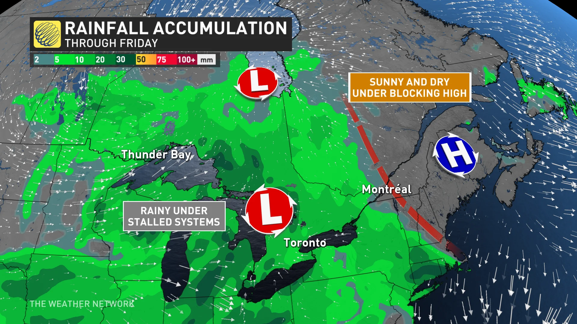
The second is an Omega block over Ontario and Quebec, areas that have also felt the weather traffic slowdown.
A sunny high over Quebec is sandwiched between two rainy lows on either side, leading to contrasting weather for the provinces. Multiple systems from the U.S. will have slow movement through Ontario, leading to very soggy conditions persisting through Friday. It will take several days to shake loose and journey out of the province, and into Quebec.
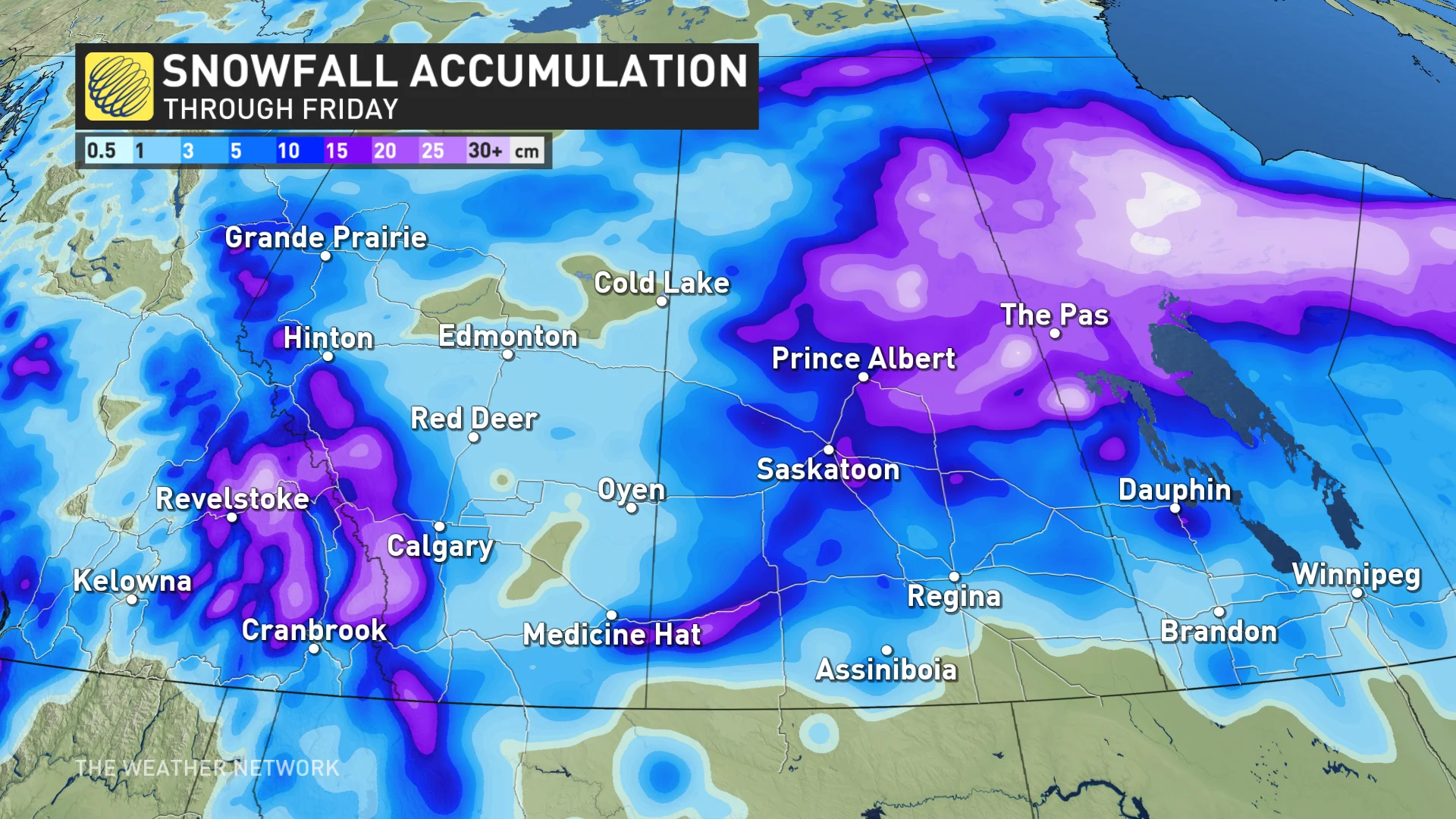
Meanwhile, the Prairies are wrapping up a sprawling snow event over all three provinces.
Once again, the stalled system has led to unsettled weather since Tuesday, with still a couple more days to go. The persistent rain has contributed to flood warnings in Manitoba, while up to 40 cm of snow is forecast in the north.
The slow movement of the system can be traced all the way across Canada to both the Rex and Omega blocks. The two will result in nearly an entire work week of active weather here.
RELATED: City of Brandon 'closely watching' river level, forecasts amid flood warning
The blocks will slowly dissipate late this week, but it will take several days to clear the stalled weather systems once it departs.
Until then, consider your weather as a "what you see, is what you get" type of thing.


