Canada's end to May: Who will get the head start on summer?
Canada’s late May forecast shows signs of heat expanding eastwards, with a wet and showery pattern in the West
As May nears its end, some areas of Canada will experience an early taste of summer with above-seasonal warmth, while others remain under the grip of a lingering cool spring pattern.
Will summer-like temperatures reach your region, or will cooler conditions persist?
DON'T MISS: How lake breezes shape your weather
The warmth spreads across the East
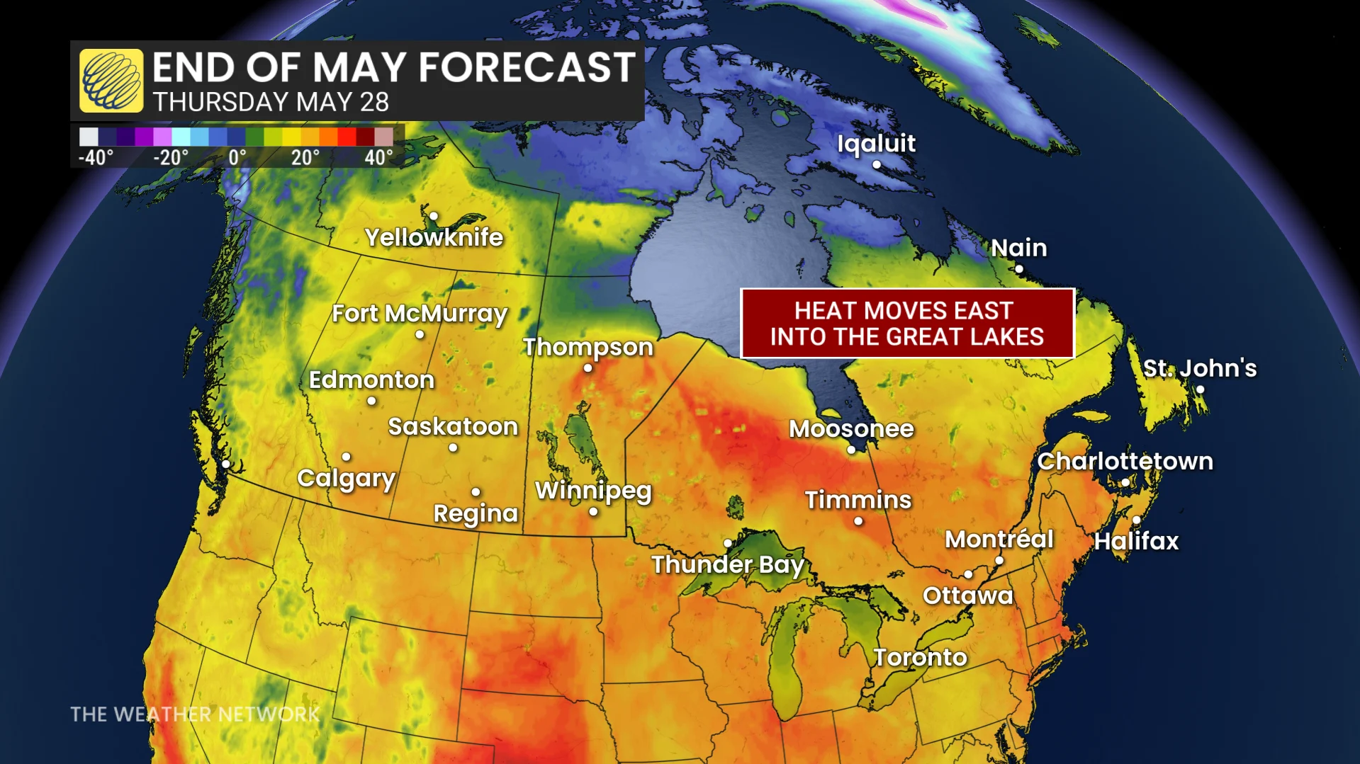
Rising temperatures are forecast to take hold across the Prairies, gradually extending eastward to the Great Lakes by month's end.
The final week of May starts off warmly across the Prairies, with widespread 30 C temperatures possible for a couple of days. Things then cool back down to seasonal or slightly below, particularly in British Columbia and Alberta.
Before the warm-up however, active weather, including widespread showers, is anticipated early in the week.
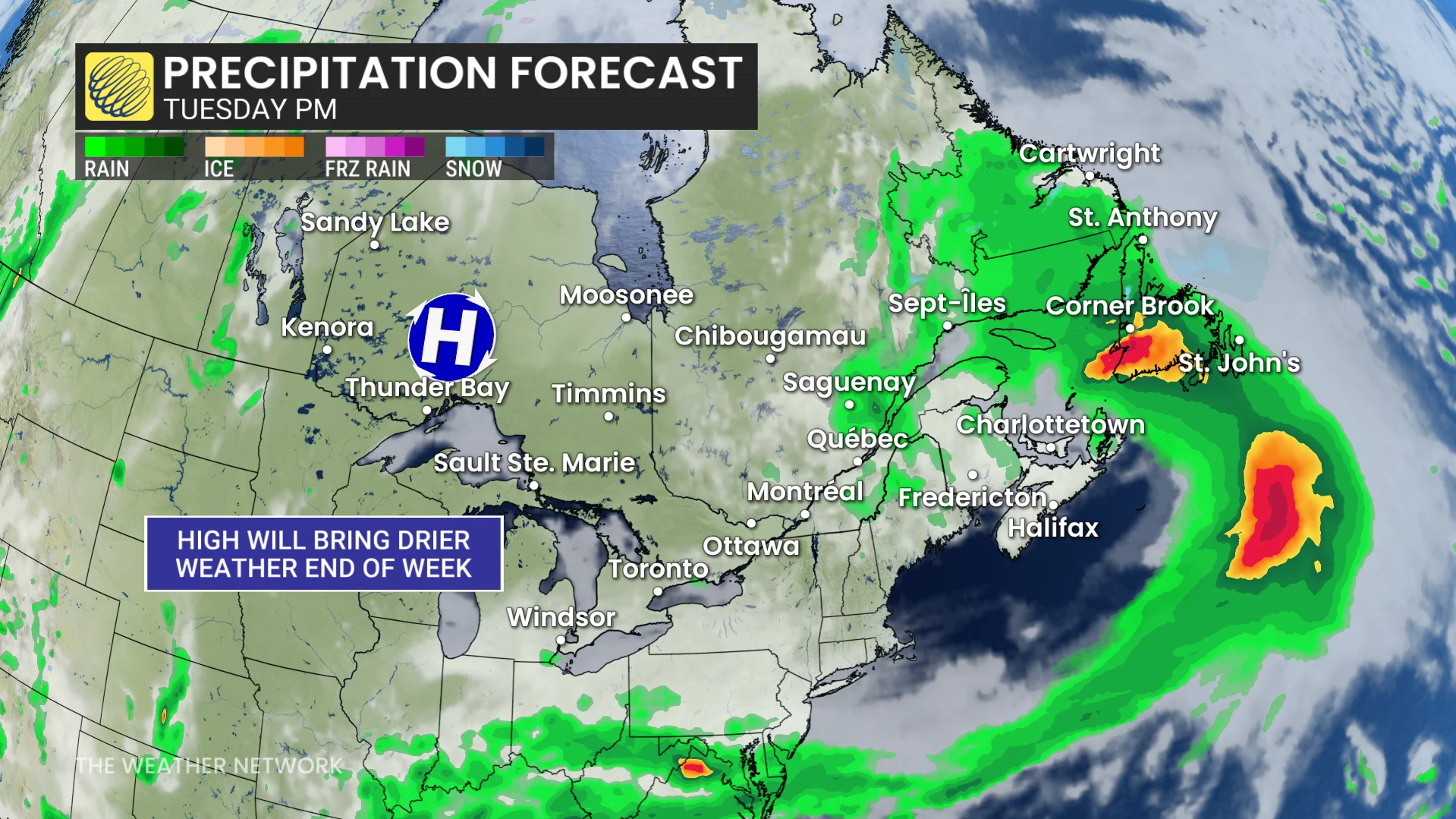
Rain will move into the Atlantic by Tuesday, with conditions expected to largely clear across the region by Thursday as an upper-level ridge takes hold. By late week, temperatures in parts of Eastern Canada may rise above seasonal norms, reaching the mid to upper twenties.
A showery end to the month in the West, but with much-needed precipitation
In contrast, unsettled weather is forecast for Western Canada due to an upper-level trough. Scattered and localized showers will begin Monday in areas such as B.C. and parts of Manitoba, becoming more widespread Tuesday.
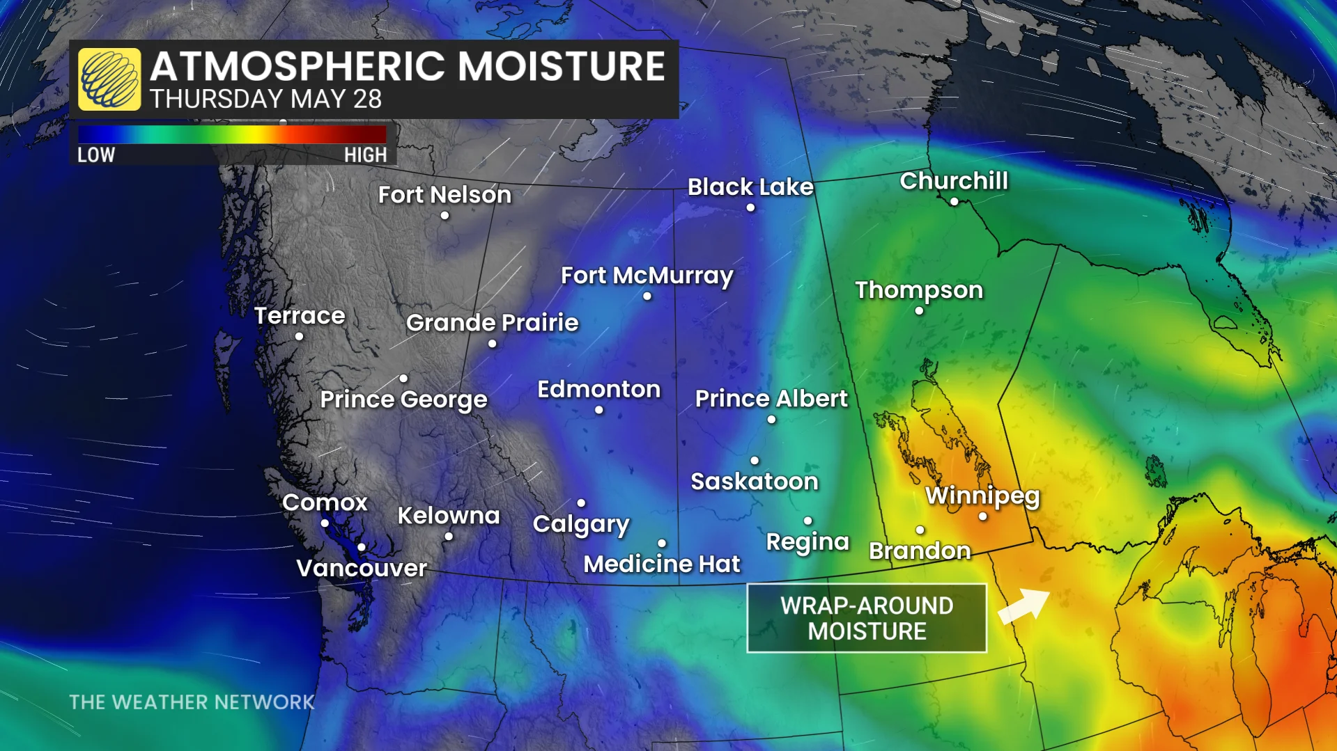
Southern Saskatchewan is projected to experience heavier rain on Wednesday, while Thursday brings more significant rainfall to eastern Alberta and Saskatchewan.
DON'T MISS: U.S., Canada off to surprising, contrasting wildfire season starts
Showers will move into Manitoba on Friday, offering much-needed precipitation to the western provinces.