Canada out-heats Florida: Yukon and Newfoundland soar into spring territory

A fascinating, atmospheric pattern causing a continent-wide temperature swap is resulting in parts of Canada to experience record-breaking January warmth, while Florida and the southern U.S. face an extreme chill, and even snow.
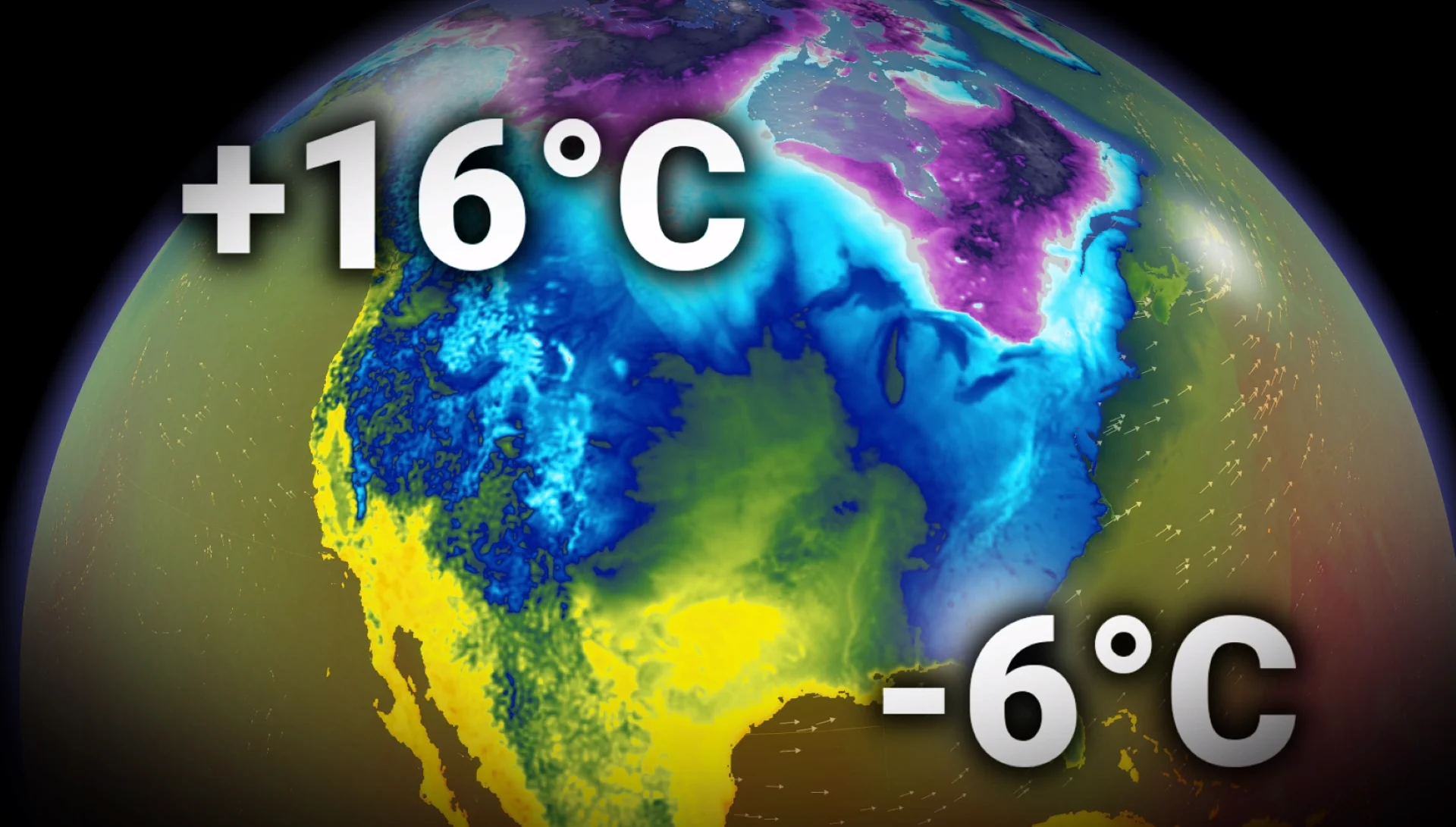
A massively amplified jet stream flipped the weather pattern on its head, sending the Yukon and Newfoundland into spring-like warmth while Florida froze.
A truly astonishing pattern as portions of Canada warmed up into the mid-teens, thanks to a towering ridge of high pressure that punched into the Arctic.

Yukon
Near all-time January records reported on Friday:
15.8°C: Haines Junction, just 0.7°C from the all-time Yukon January record
14.7°C: Burwash Landing
Historical context: Canada’s warmest January temperature was 22.2°C in 1950 (Niagara Falls)
Newfoundland

16.7°C: Grates Cove (Only 0.3°C from the January all-time, provincial record)
16.3°C: St. John’s International Airport (new monthly record, beating 15.7°C (2006)
16.1°C: St. John’s west end
14.5°C: Argentia
17.6°C: Bay Roberts (unofficial)
Florida...it froze

Friday's low temperatures
Tallahassee: -6.7°C
Gainesville: -4.4°C
Daytona Beach: -1.1°C
Jacksonville: -0.6°C
Orlando: 0°C
Cities in the Florida Panhandle and adjacent to the Gulf of Mexico recorded temperatures below the freezing mark.
Panama City: -2.8°C
Pensacola: -1.1°C
The cause?
A major, high-pressure system over Alaska and the Yukon is a key player, and a map of the upper levels highlights the classic amplified pattern:

The jet stream is beyond wavy, with the ridge in Northern Canada, allowing Pacific air associated with an atmospheric river to migrate inland, challenging all-time January warmth.
Downstream of the ridge, a sharp trough carved deep into the central and eastern U.S.
East of the anomalous trough, an exceptionally mild southwest flow tapped into tropical moisture for Newfoundland, pulling warmth in from as far as the Caribbean Sea.
Extreme pattern continues
More cold is on the way to Florida as the pattern reloads again. A trough will dive south from the central part of the U.S., reaching the Sunshine State by Sunday.

Monday morning temperatures are forecast to plunge below freezing for the Florida Panhandle and northern sections.
Temperatures in the Yukon and western N.W.T. will continue to trend well above seasonal (10-20°C).