
Canada sees its first 40°C reading this year as a prolonged heat wave hits B.C.

A building ridge allowed the country to see its first 40-degree reading of the year as temperatures climbed to dangerous levels in B.C., resulting in heat warnings
The country's streak of temperatures staying below the 40-degree mark has finally ended.
A formidable ridge over Western Canada has allowed the B.C. community of Lytton to achieve the country's first 40°C reading in 2023, reaching a high of 41.5°C on Monday.
RELATED: Why extreme heat is one of the world’s deadliest weather disasters
Tuesday
On Monday, we had our first 40°C reading in Canada this year in Lytton, where the temperature hit a sizzling 41.5°C. The previous record was held by Etzicom, Alta., where the mercury reached 39.8°C, which Lytton tied on Sunday.
Temperatures were 8-10 degrees cooler near the coast, but it was still feeling quite muggy with some excess Pacific moisture lingering around. Widespread heat warnings remain in effect.

This setup is a tradeoff between simmering mugginess and searing heat. Folks along the immediate coast will have cooler temperatures but higher humidity, while communities farther inland will see hotter but less-muggy conditions.
Temperatures will be similar on Tuesday to the conditions faced Monday, making for uncomfortable, and even dangerous heat for some. If you’re inclined to get some relief, head down to the beaches to get a cooler breeze.

RELATED: Talking about the warmth? Add heat dome to your vocabulary, here's why
Stay safe in the heat
Hot temperatures are the most dangerous weather you’re likely to face during the summer months. It’s a silent hazard that can sneak up on even the fittest individuals.
RELATED: How hot is too hot for the human body?
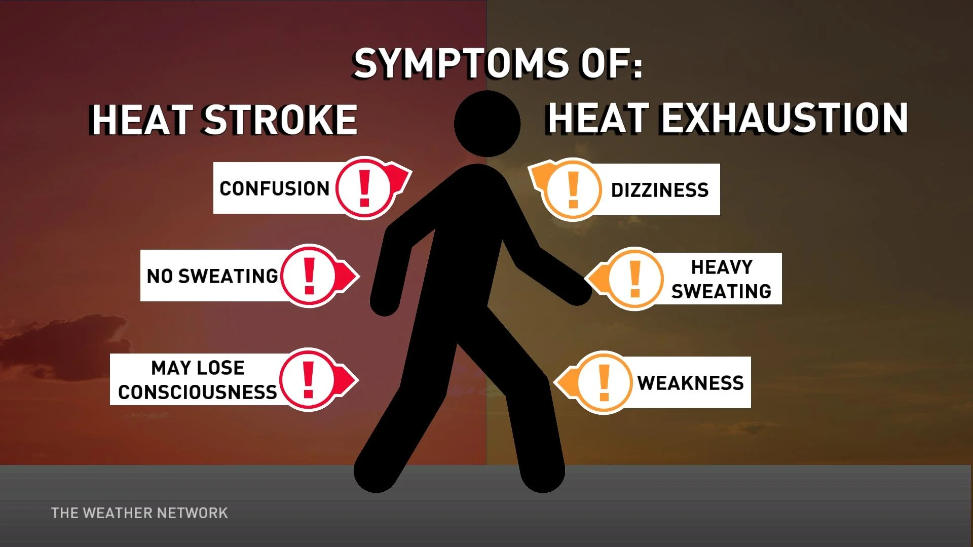
Use caution if you have to spend extended periods of time outdoors during the day. Stay aware of the symptoms of heat exhaustion and heat stroke, staying hydrated and taking frequent cooling breaks to prevent illness. Humidity will make it harder for the body to cool off during the heat of the day, and the muggy air will subdue any relief overnight.
WATCH: How living in a 'heat dome' can impact your body
Cooling long-range pattern
Temperatures will gradually cool a bit throughout the course of the week as a stronger onshore flow develops and the ridge flattens a bit. By this weekend, temperatures will be back closer to seasonal, with more cloud-cover and the return of some showers possible for the second half of August.

Thumbnail courtesy of Getty Images.
Stay with The Weather Network for the latest on conditions across British Columbia.