Canada, a perfect storm is about to change your September

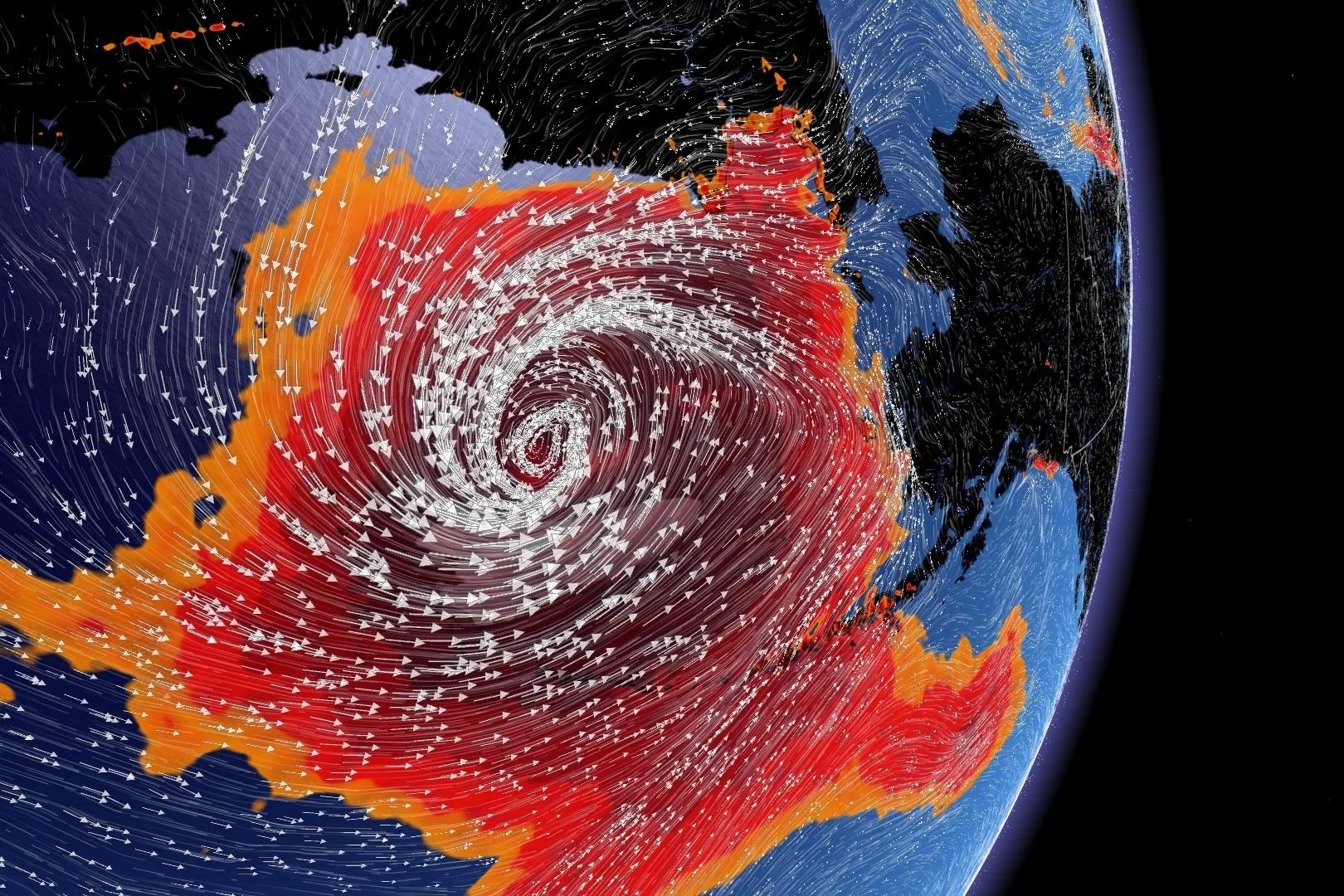
On paper, Typhoon Merbok appeared unremarkable. An intensifying typhoon in the Pacific is hardly noteworthy, but its location where it intensified is a little perplexing.
This could be a September to remember for many Canadians. Our weather patterns will become amplified, courtesy of a typhoon trekking across uncharted waters.
Sometimes things align just so in the atmosphere to produce something spectacular; this is one of those times.
Visit our Complete Guide to Fall 2022 for an in-depth look at the Fall Forecast, tips to plan for it and much more!
On paper, Typhoon Merbok appeared unremarkable. An intensifying typhoon in the Pacific is hardly noteworthy, but its location where it intensified is a little perplexing.
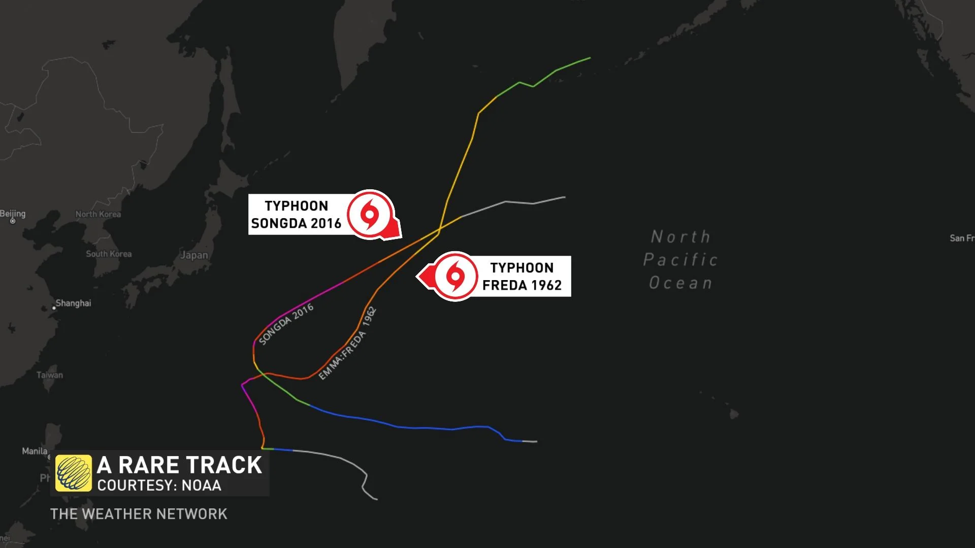
Only a handful of historical typhoons make the trek north of 40 degrees latitude and hold onto tropical characteristics in the western Pacific basin.
Some infamous examples include Typhoon Freda in 1962, remnants of which enhanced the catastrophic Columbus Day storm across the Pacific Northwest. More recently, Typhoon Songda in 2014 took a similar, peculiar trek northward. That storm grazed the Pacific Northwest, but its wind field remained compact and mainly offshore.
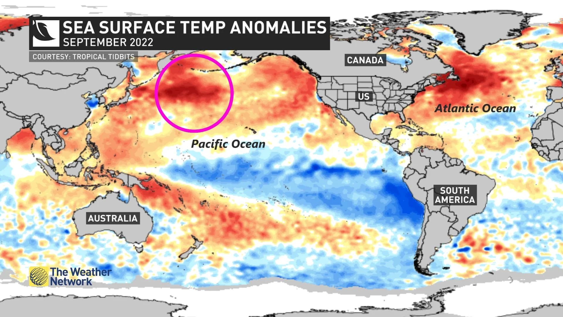
Tropical storms extract their energy from warm sea surface temperatures, and it's the critical clue to why Typhoon Merbok was a big overperformer. Temperatures are upwards of 4°C above normal across the North Pacific.
It had a fast-forward speed and maintained tropical characteristics through Thursday before the classic fronts developed -- a hallmark of mid-latitude cyclones.
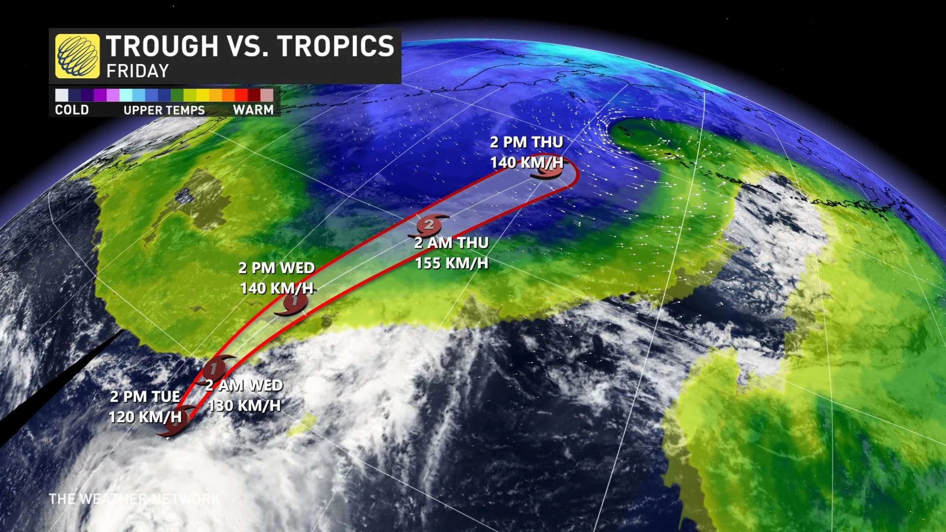
By chance, a chilly upper trough swooped in from Siberia, capturing and enhancing the tropical remnants and causing the system to easily attain bombogenesis -- a pressure drop of 24 hPa in 24 hours -- before building massive waves across the Bering Sea. Its barometric pressure dipped below 940 hPa, which is unusual for September. Deepest ever for the area? Hardly.
In late December 2020, a low-pressure system was enhanced by record-cold streaming across Japan, attaining a pressure below 930 hPa.
Some perspective. The deepest Atlantic hurricane in 2022 through Sept. 13? 954 hPa, attributed to Hurricane Earl.
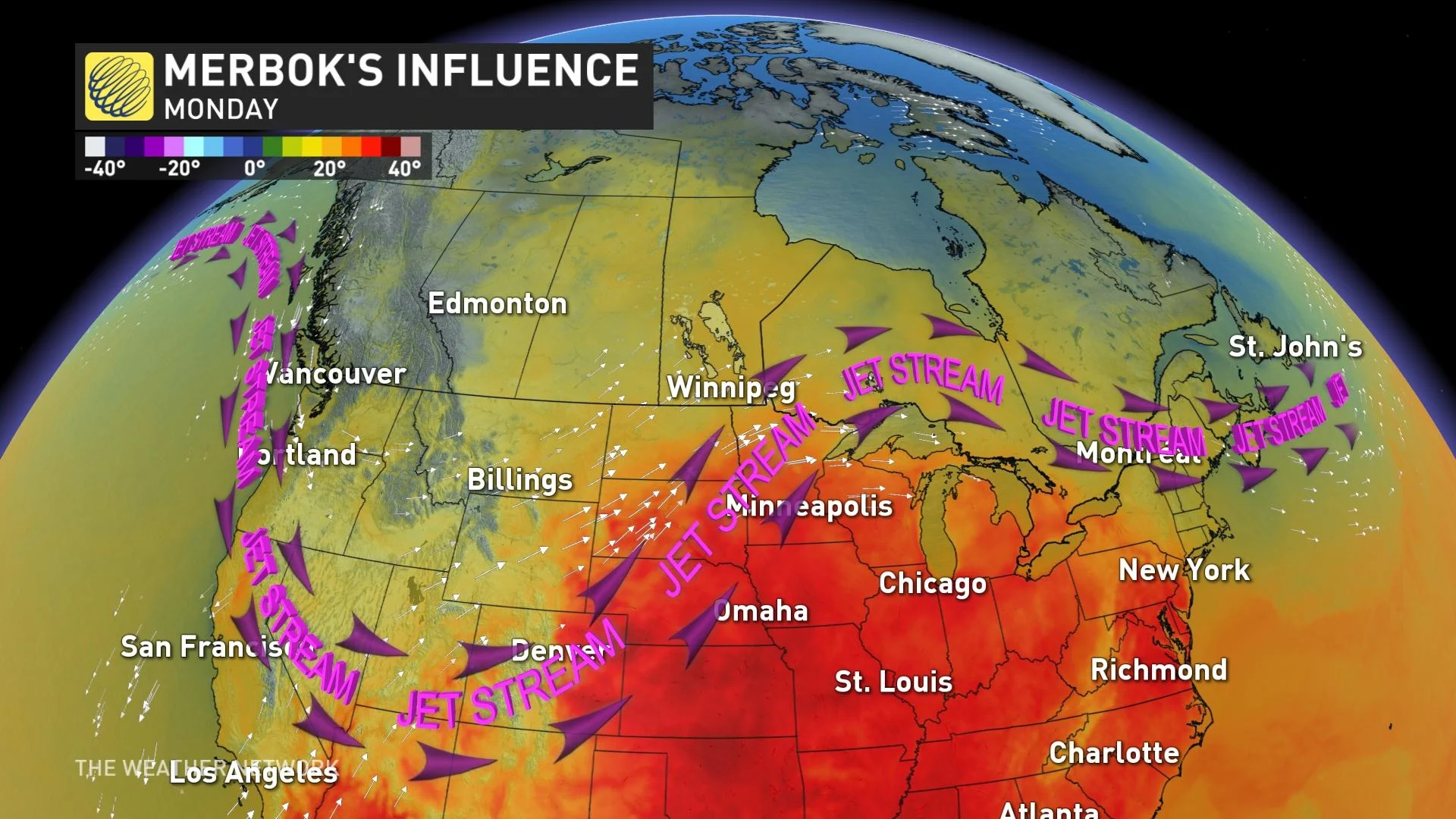
Ex-Merbok will have a ripple effect downstream and build a sizable trough over Alaska and the Yukon. This energy will continue to reinforce a trough in Western Canada early next week.
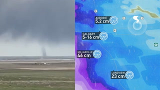
The perturbation continues eastward. As the trough digs across the West, there will be a region of adverse weather, including the prospect of a classic fall low developing across the eastern Prairies. The temperature extremes across the Prairies will be extraordinary, with wet snow across higher terrain in Alberta and southern Manitoba pushing towards 30°C.
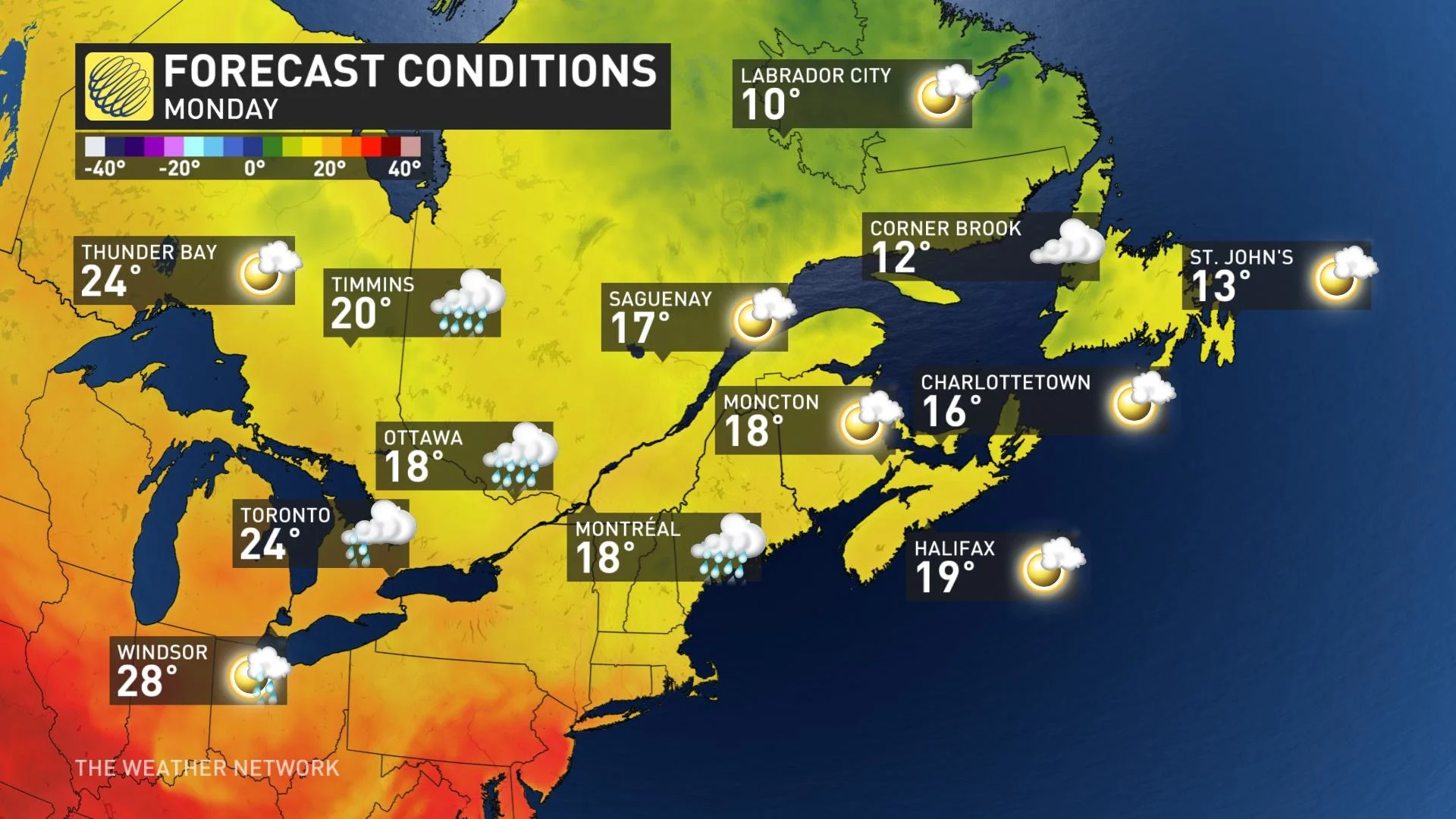
Across Ontario and Quebec, there's increasing confidence in temperatures surpassing 30°C, so some daily temperature records will likely fall next week. It's a relatively rare feat to record 30°C across the Greater Toronto Area (GTA) after mid-September, with Pearson International Airport reaching it this late in the season more than 15 times since 1938.
Editor’s Note: This article, originally published on September 13, 2022, was updated on September 16, 2022, with the latest information on Typhoon Merbok and its remnants.