Why this Rex Block pattern matters in B.C. this week

Much of B.C.'s current weather is being driven by an atmospheric block. Here's what that means.
After a messy start to the week, pleasant, sunny and mild weather is back in British Columbia. That's thanks to a pattern known as a Rex Block, that's locked in off the west coast this week. We take a look at what this pattern has in store for the next few days, and when the unsettled weather returns, below.
Visit our Complete Guide to Spring 2019 for an in depth look at the Spring Forecast, tips to plan for it and much more
WEATHER HIGHLIGHTS
High pressure over northern B.C. will hold any moisture south of the province
Fair and milder conditions persists through the remainder of the week
No major storms in sight, but pattern could become more active by end of next week
Keep up with latest watches and warnings HERE.
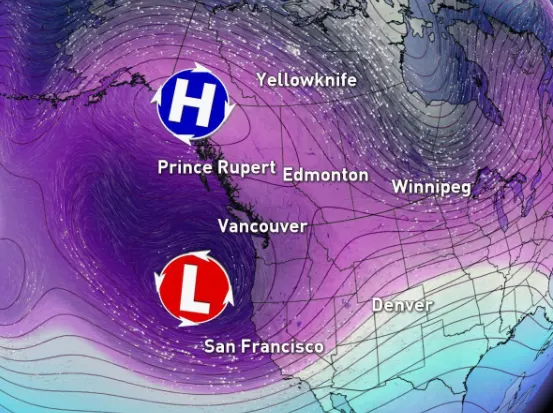
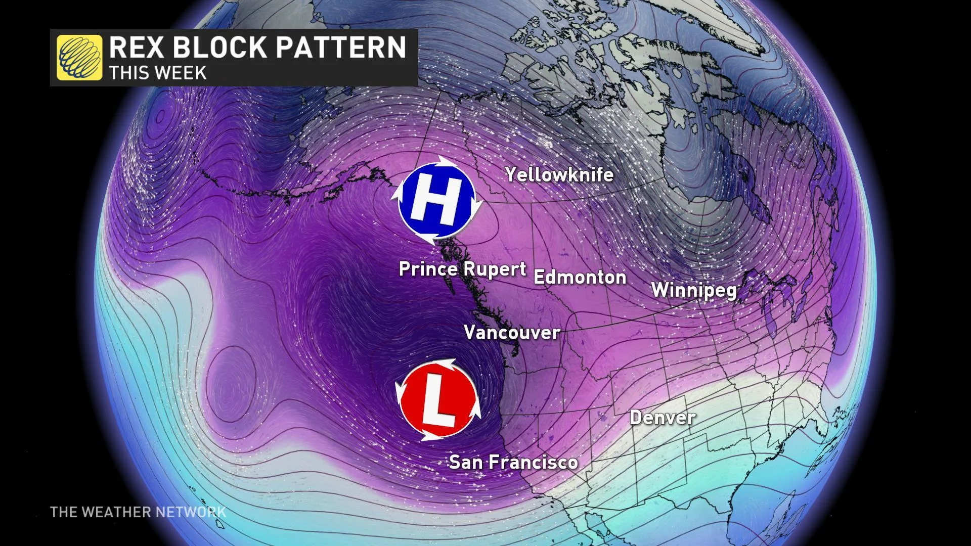
REX BLOCK PATTERN: MILD AND FAIR WEATHER RETURNS
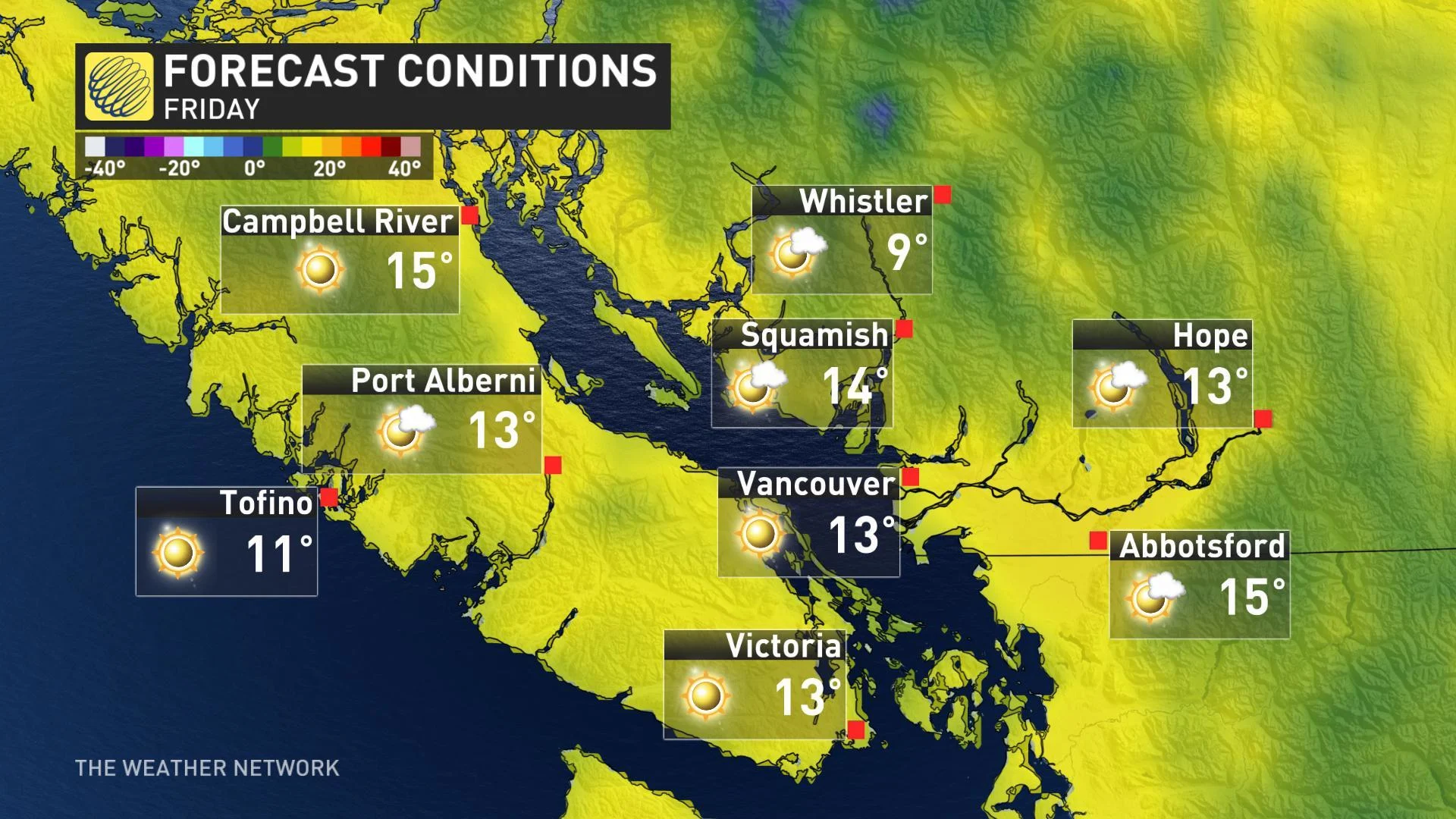
After unsettled weather during the first half of the week, fair and mild conditions will dominate as we head into the weekend.
"This is thanks to what is known as a Rex Block," says Weather Network meteorologist Kelly Sonnenburg.
We get so-called 'blocking patterns' in the atmosphere when high and low pressure centres arrange themselves in particular ways. One that may be familiar to many in Canada is the Omega Block, so named because it looks like the Greek letter. With this kind of block, we see a broad area of high pressure building north with a ridge in the jet stream, flanked by two unsettled areas of low pressure. Omega Blocks are associated with long stretches of warm, dry weather, thanks to that ridge of high pressure.
SEE ALSO: A desert hidden in B.C.'s coastal rainforest?
In the case of a Rex Block, a single high and low pressure centre are involved.
"With a Rex Block, high pressure situates itself north of low pressure and the pattern remains somewhat stationary or locked in for a number of days," Sonnenburg explains. "This prevents weather systems from typically progressing from west to east across the country."
It's a pattern of what you see is what you get, and in this case, it will be a whole lot of sun for B.C. High pressure will provide abundant sunshine and seasonably mild temperatures through the remainder of the week and into the weekend as well.
"Any unsettled weather could be delayed until early next week and no major storms are in sight," says meteorologist Dr. Doug Gillham. "B.C will become more active and unsettled late next week with the potential for a more significant system on the horizon."