B.C. parched after dry March; looking ahead to floods, fires
With some water reservoirs at their lowest levels in half a century, April showers can't come soon enough for parts of southern British Columbia.
It's been a record dry March for much of Vancouver Island and parts of the Lower Mainland, with just 28 per cent of the average rainfall for the month falling in Vancouver. Even that paltry amount is well-outdoing some spots on parched Van Island. Comox, for example, recorded just under 5 mm of rain in March -- about 100 mm less than average.
Visit our Complete Guide to Spring 2019 for an in depth look at the Spring Forecast, tips to plan for it and much more
The extended dry spell has officials operating in "conservation mode" for power generation on the island, as water levels in Comox Lake drop to the lowest point in the last 50 years. And that's after a very wet, snowy January that had those around the lake planning for flooding concerns.
It's not just the southwest that's been drier than usual. Parts of the northern Interior are also well-below average in terms of March rainfall, with Fort Nelson picking up only 1.1 per cent of its usual total for the month, and Fort St. John seeing a measly 0.8 per cent.
LOOKING AHEAD TO FLOOD AND FIRE SEASON
While reduced snowpack certainly diminishes concerns for spring flooding, it doesn't eliminate them. Rain and snow on the way to the South Coast this week will give a boost to spring snowpack over the Coast Mountains and for the interior of Vancouver Island.
According to the March 1 bulletin from British Columbia's River Forecast Centre, snowpacks for basins across the province ranged from 59 to 106 per cent of normal.
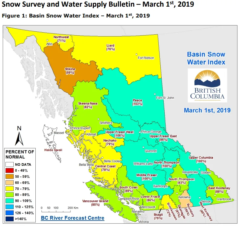
Image courtesy Province of B.C.
While the centre says that, in a typical year, 80 per cent of the province's snowpack will have accumulated by early March, seasonal snowpack can still vary significantly in March and April and adds that snowpack is only one component to consider when it comes to spring flooding.
"While snow is one significant aspect to seasonal flooding in BC, weather during the freshet season also plays a key role, and flooding is possible in years with near-normal snowpack," says the bulletin.
Current runoff forecasts from the centre give near-normal amounts for the Upper Fraser, Middle Fraser Thompson, Skeena/Bulkley, and Okanagan Lake basins, as well as for Vancouver Island, South Coast, and the Lower Fraser.
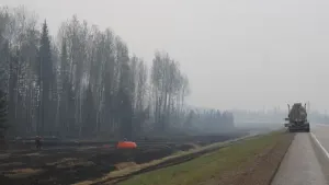
On the other side of the coin, a dry, warm spring doesn't bode well for the province's wildfire season, but it also doesn't spell certain doom.
If this spring's dry spell continues beyond March, we might be looking at an earlier start to the fire season, but it's hard to connect a dry spring to the peak of fire season, even in the past few record-setting years. With the peak generally coming in July and August, much of how the season plays out will have to do with the summer's weather patterns and local conditions, as well as fire-mitigation efforts.
The B.C. Ministry of Forests, Lands, Natural Resource Operations and Rural Development recently announced a significant increase in funding to help with those efforts.
Sources: Province of British Columbia | Comox Valley Record | Vancouver Sun |