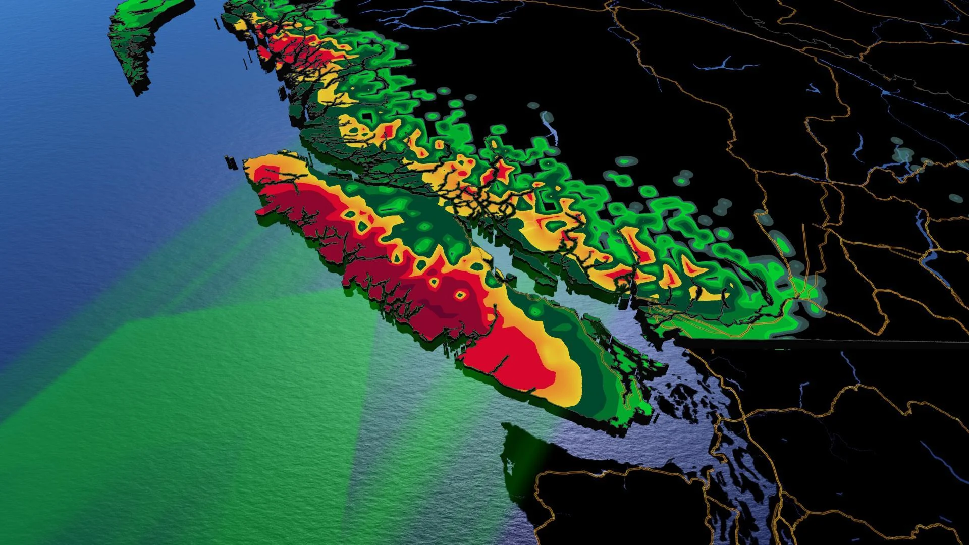
B.C.: Relentless pattern brings 200+ mm of rain this week

The active pattern continues for British Columbia
Rounds of heavy rain and snow are ahead this week as a nearly uninterrupted stream of systems surge into the Pacific Northwest, though rising freezing levels keep the snow confined to the alpine levels. Still, as milder temperatures spur snowmelt from the snowfall events of recent days, flooding concerns are on the rise. We take a look at the active week ahead below.
WEATHER HIGHLIGHTS:
Active storm pattern continues this week with multiple rounds of rain, high elevation snow
Localized flooding possible as rain, rising temperatures accelerate snowmelt
Avalanche risk improves Monday
Stay aware of ALERTS in your area
TUESDAY AND BEYOND: UNSETTLED PATTERN CONTINUES
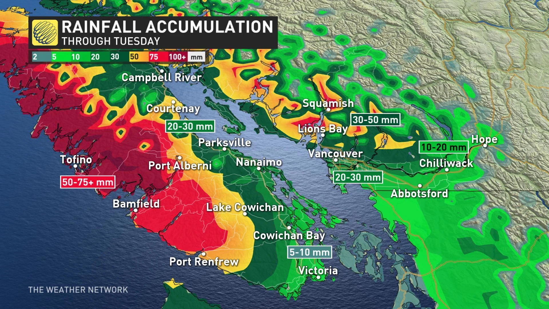
System after system will march into the B.C. coast this week, and Tuesday is no exception, with an additional 50+ mm on the way for parts of Vancouver Island. That will put some spots at nearly 100+ mm since Sunday.
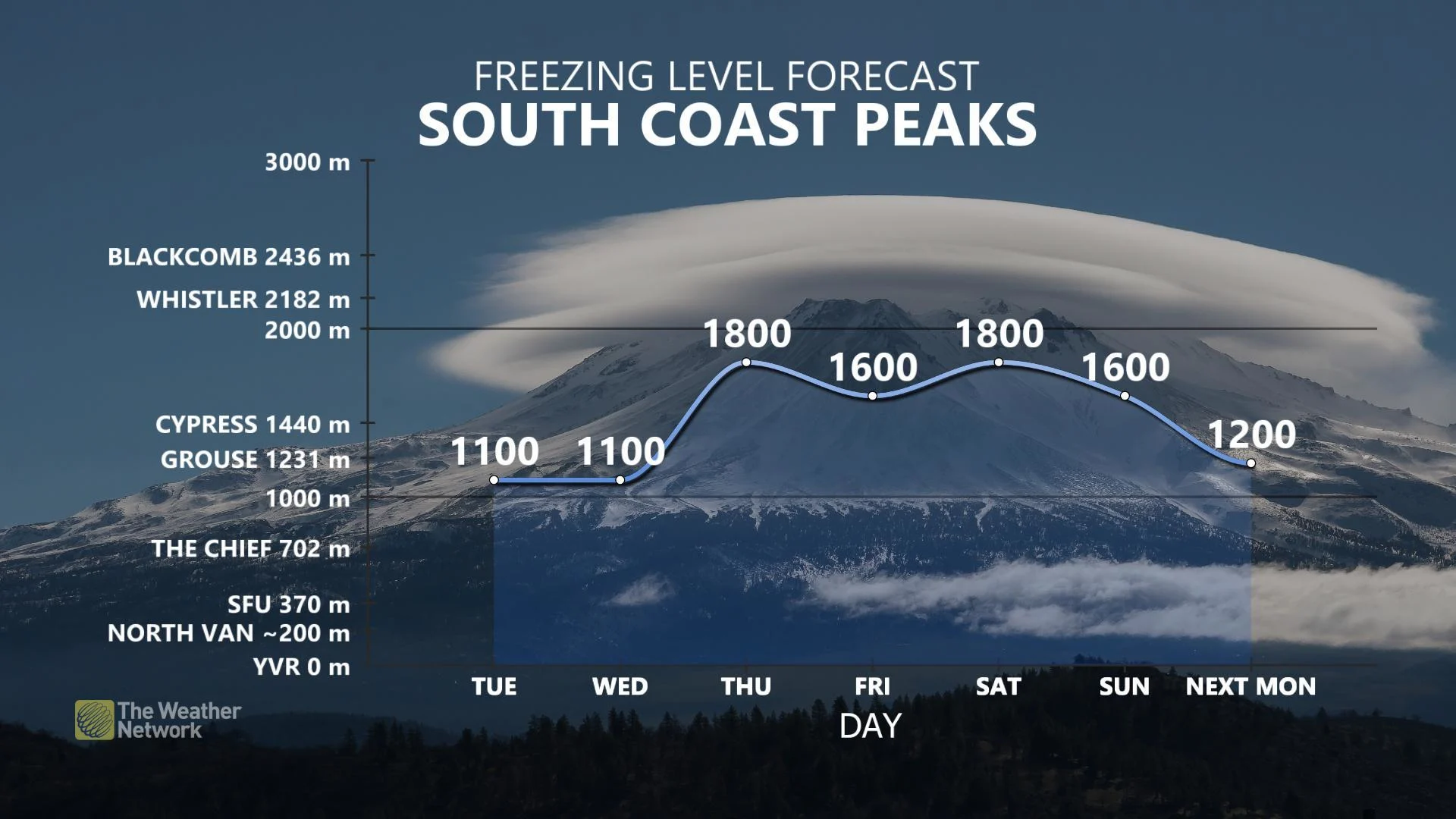
Snow levels will fall slightly into Tuesday and Wednesday but are likely to remain at or above 1000 m as warmer Pacific air takes hold. While additional brief breaks are possible between systems as we go through the week, they won't be long ones -- think on the order of hours rather than days.
WHY FLOODING IS A BIG CONCERN:
Stay with us here at The Weather Network for your latest forecast updates.