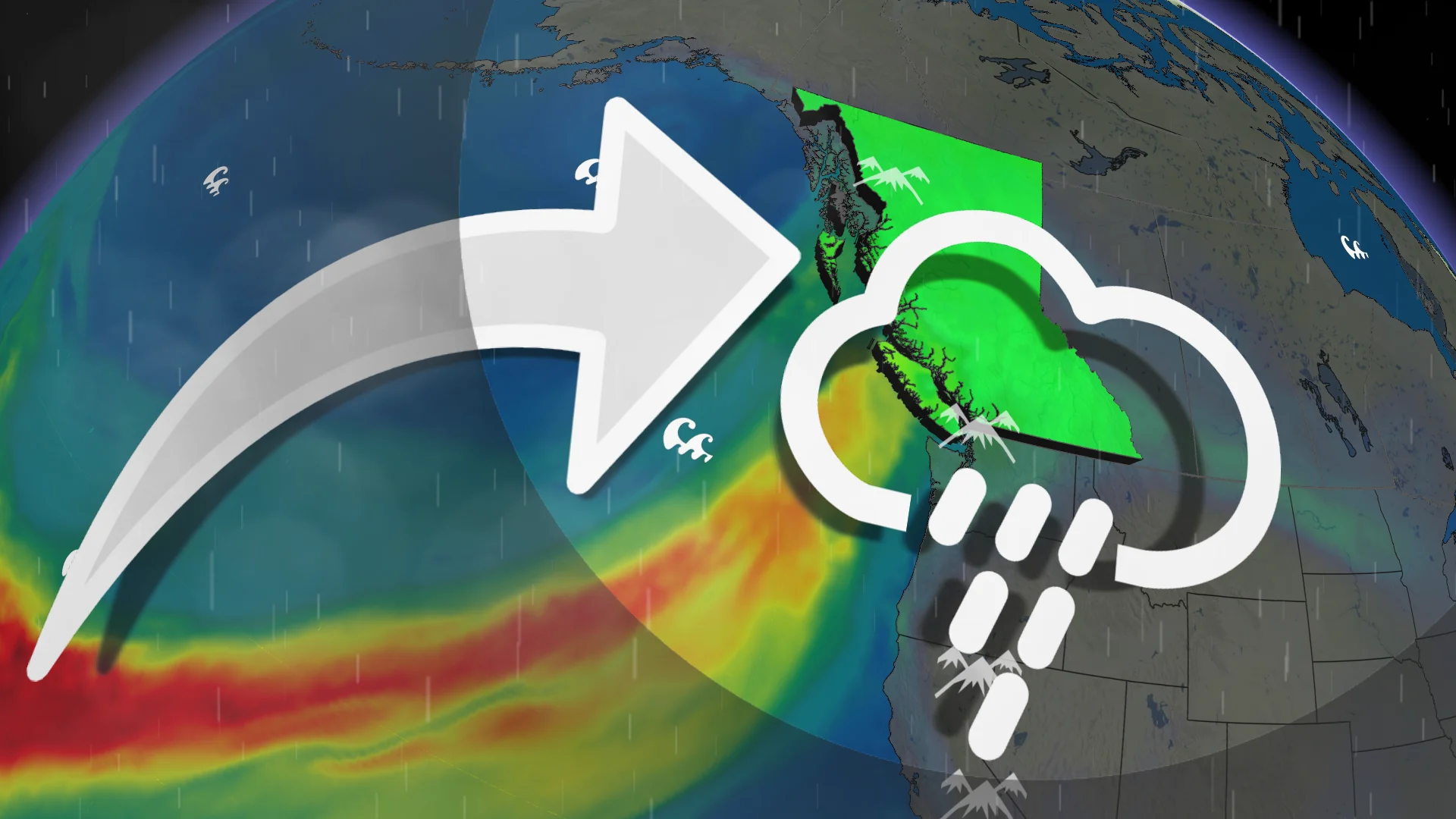
B.C.’s next atmospheric river will see dangerous rains, high winds
A new atmospheric river pushing into the West Coast could exacerbate flooding issues in areas already hard hit by recent heavy rains
Another surge of potent moisture will arrive in British Columbia this weekend, just days after another atmospheric river caused widespread flooding issues in parts of the province.
Heavy rain will return Saturday and stick around through the beginning of the week. High rainfall rates and steep totals may exacerbate flooding issues in areas already hit hard by this past week’s precipitation.
Here’s a look at how this weekend’s atmospheric river differs from the one that hit just a few days ago.
DON'T MISS: What’s a Pineapple Express? Diving into this robust atmospheric river
B.C.’s forecast holds additional hefty rainfall totals
Expect a period of heavy rain to return to southern B.C. late in the day Saturday as the next system’s fronts move across the region.

The heaviest rainfall will arrive late Sunday through Monday as a fresh atmospheric river arrives on the West Coast. This type of atmospheric river is known as a Pineapple Express because it transports a rich reserve of moisture straight from the tropics into the West Coast.
Forecasters anticipate that this event will reach an AR-3 to AR-4 on the scale used to measure the intensity and impacts of atmospheric rivers, meaning that the event’s hazardous impacts could outweigh any benefits offered by the additional precipitation.
Comparing the two atmospheric rivers
Aside from transporting more moisture into the coastline, this latest event will differ from the atmospheric river we experienced this past week.
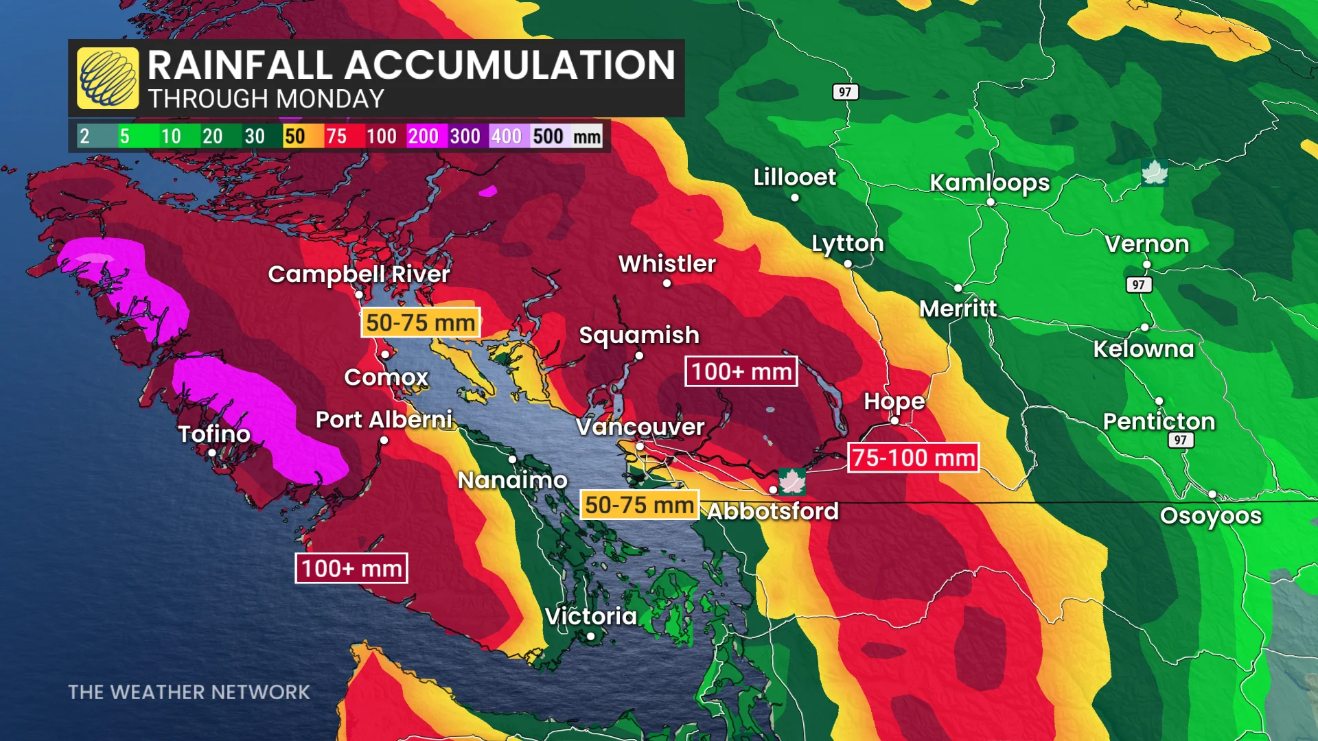
Dangerous rainfall totals: We can expect an additional 80-100+ mm of rain throughout the Fraser Valley and Coast Mountains through Monday.
Waterways are already swollen from this week’s rains. This much rain in a short period of time could exacerbate both the flooding and landslide risk in vulnerable areas.
Stronger dynamics: Enhanced lift in the atmosphere could provide an opportunity for thunder within the heaviest rainfall on Sunday night into Monday. Don’t be surprised if you hear some rumbles across southern Vancouver Island and the Lower Mainland after heading to bed.
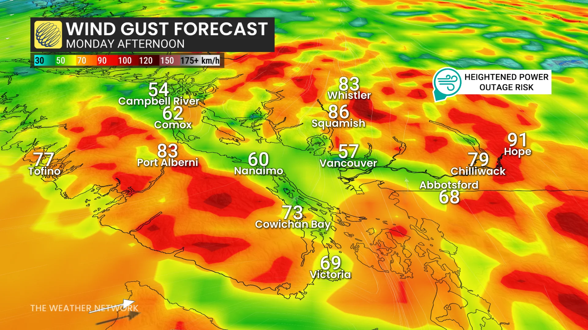
Gusty winds: Unlike last week’s event, strong wind gusts are in the forecast this weekend.
Expect 60-90+ km/h gusts along the coast and through the Fraser Valley, especially on Monday morning. The combination of high winds and soggy soils will greatly increase the risk for power outages. Travel and ferry delays are also likely.
Higher freezing levels: The arrival of tropical moisture will also mean the arrival of warmer air aloft. Freezing levels will soar above 2000 m for the Coast Mountains during this event.
This will lead to high alpine snowmelt and a destabilizing of the snowpack, which could trigger avalanches across the region.
Stay with The Weather Network for all the latest on conditions across B.C.