B.C.: March snow lingers through the end of the week

Spring snow ahead for southwestern B.C. through the end of the work week
The official start to spring is only a couple of weeks away, but winter seems set to take a few last swipes at southwestern British Columbia, with another shot of snow on the way for the South Coast and Vancouver Island. We break down what you need to know, as well as who will see over 5 cm of snow, below.
Visit our Complete Guide to Spring 2019 for an in depth look at the Spring Forecast, tips to plan for it and much more
WEATHER HIGHLIGHTS:
Light snowfall takse aim at Lower Mainland through Thursday
More significant accumulations for east side of Metro Vancouver
Latest watches and warnings HERE
It is another disturbance moving into the Pacific Northwest that's to blame for the Lower Mainland's snow chances into early Thursday, as just enough moisture slides north of the border to bring some precipitation back into southern B.C.
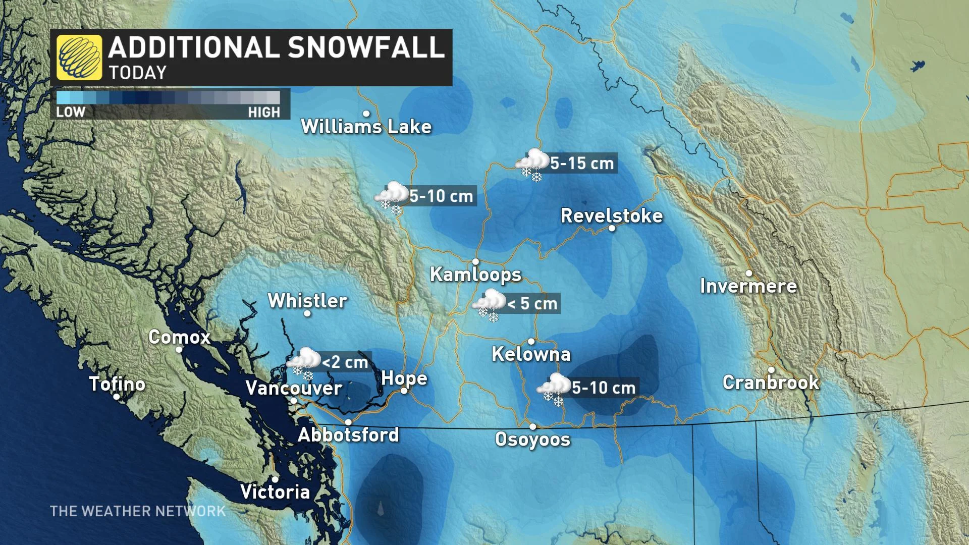
With temperatures hovering in the mid-single digits for much of the immediate coastline, we're not talking about much in the way of accumulation in Downtown Vancouver, with any snow that falls generally only sticking to grassy surfaces.
Into the evening and overnight hours, however, and further inland, chances are looking better for North Vancouver and places like Burnaby and Surrey to see some light accumulations, with the risk generally increasing both with elevation and with distance into the Fraser Valley.
WATCH BELOW: SNOWFALL TIMING
For Vancouver Island, spotty snow showers at best are in the cards through Thursday, but a trough dipping down over the southern half of the island on Friday brings a better chance for a few centimetres to higher elevations in the south.
That isn't entirely bad news for the island, where concerns are rising about low water levels heading into spring.
Officials monitoring the Lake Cowichan River system are hoping for "a ton more precipitation in the form of snow" above Cowichan Lake. The lake, which should be full by this point in the year, is sitting at just 40 per cent of its usual level.
This isn't the first time that the lake has been low going into spring, and some involved in monitoring the watershed are concerned it's part of a larger trend.
RELATED: Experts worry frozen lakes will soon be a thing of the past for millions
"We've seen a decrease in summer precipitation of over 35 per cent since the 1980s, so summer droughts have been very common,” Parker Jefferson, co-chair of the Cowichan Stewardship Roundtable, told CHEK News. "Four out of the five past years, we’ve had serious trouble. It looks like we’re in that situation again potentially this year."
The Weather Network's Official 2019 Spring Forecast calls for near normal precipitation for Vancouver Island, with above normal temperatures expected to dominate most of western Canada -- neither a particularly good sign for 'making up for lost time' when it comes to rainfall for the region.