Rocky April start in Ontario with looming, high-impact spring storm
A complex setup for spring storms will result in numerous weather hazards in southern and eastern Ontario this week, including soaking rains, thunderstorms, heavy, wet snow and strong winds.
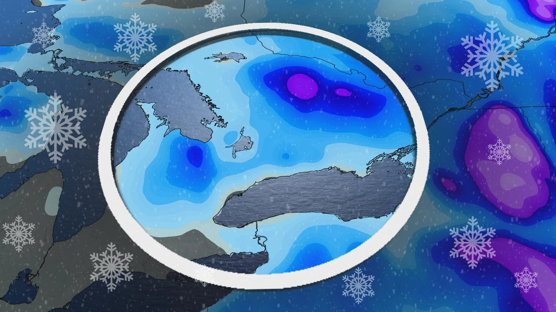
Spring is well underway, and Ontario will soon see that the season can be quite rocky and wintry at times.
Multiple systems passing through the province will see an influx of hazards, from heavy rain and a thunderstorm risk for some, to blustery winds and wet snow. Any plans to remove winter tires this week should be rescheduled.
DON'T MISS: Canada faces a fickle April as winter wanes and summer teases
As well, any travelling that needs to be done should be modified to avoid the worst of the impacts on Wednesday and Thursday. Multiple commutes will be affected.
Forecasters are confident in widespread disruptions, travel issues, and the possibility for power outages from gusty winds. Ensure your devices are charged. However, confidence is lower in the exact track of the storm, and therefore, the total precipitation amounts.
Tuesday: Rain pushes into southern Ontario, picks up as the afternoon progresses
We’ll see a Colorado low pushing into the lower Great Lakes on Tuesday morning. Showers that arrive over southern Ontario in the morning will evolve into steady rain by Tuesday afternoon, becoming heavier through the overnight hours.
There are may also be some rumbles of thunder, but the chance will be higher on Wednesday.
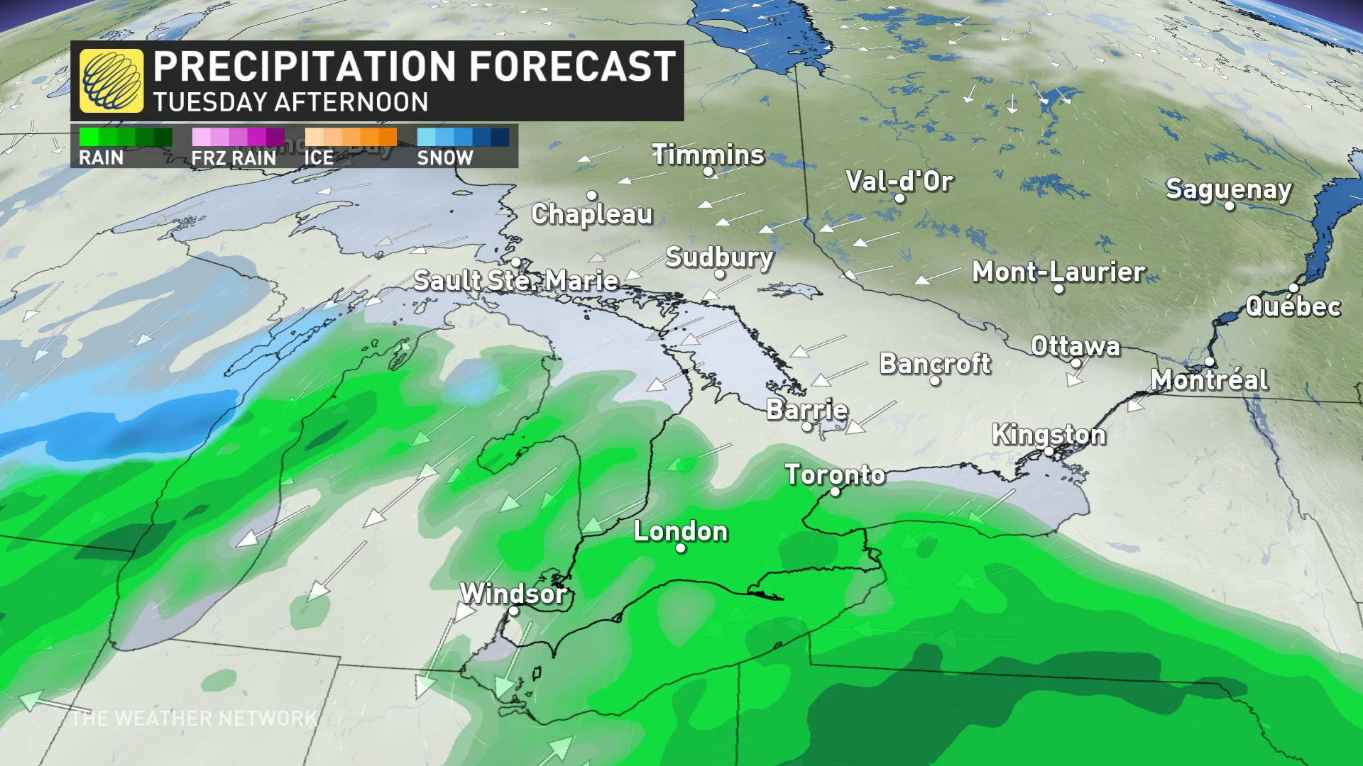
Wind gusts will also pick up through the day on Tuesday, reaching 60-80 km/h by the evening hours. This could result in scattered power outages.
ECLIPSE FORECAST: Here's an early look at how weather may affect eclipse viewing
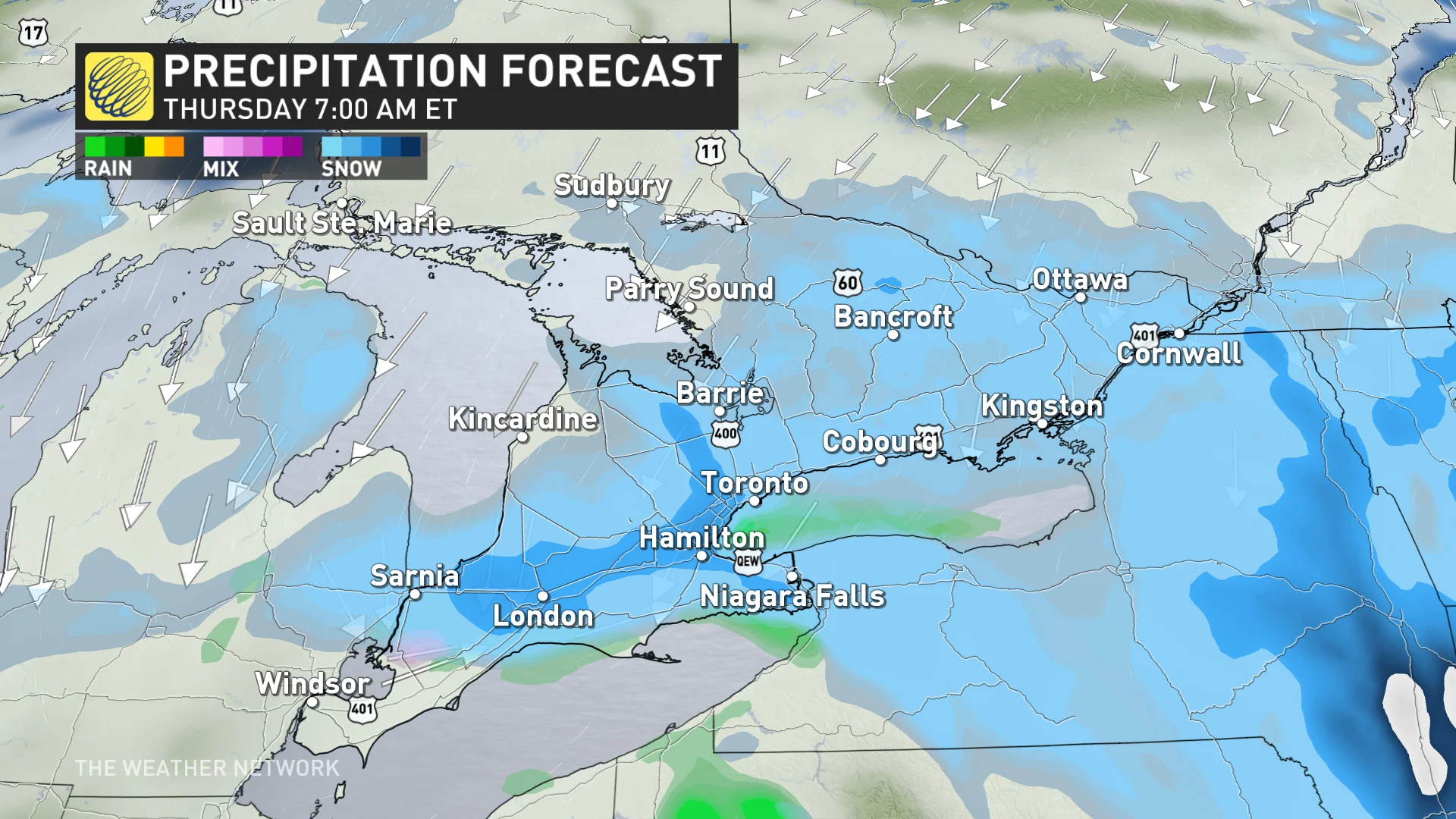
Wednesday: Rain changes to snow, gusty winds remain
The greatest impacts from this messy setup will likely be felt on Wednesday as our first storm continues and our second low-pressure system ramps up.
The rain will become quite heavy Wednesday morning, from the Greater Toronto Area (GTA) and north towards cottage country. Thunderstorms are also possible across southern and eastern Ontario, including the GTA.
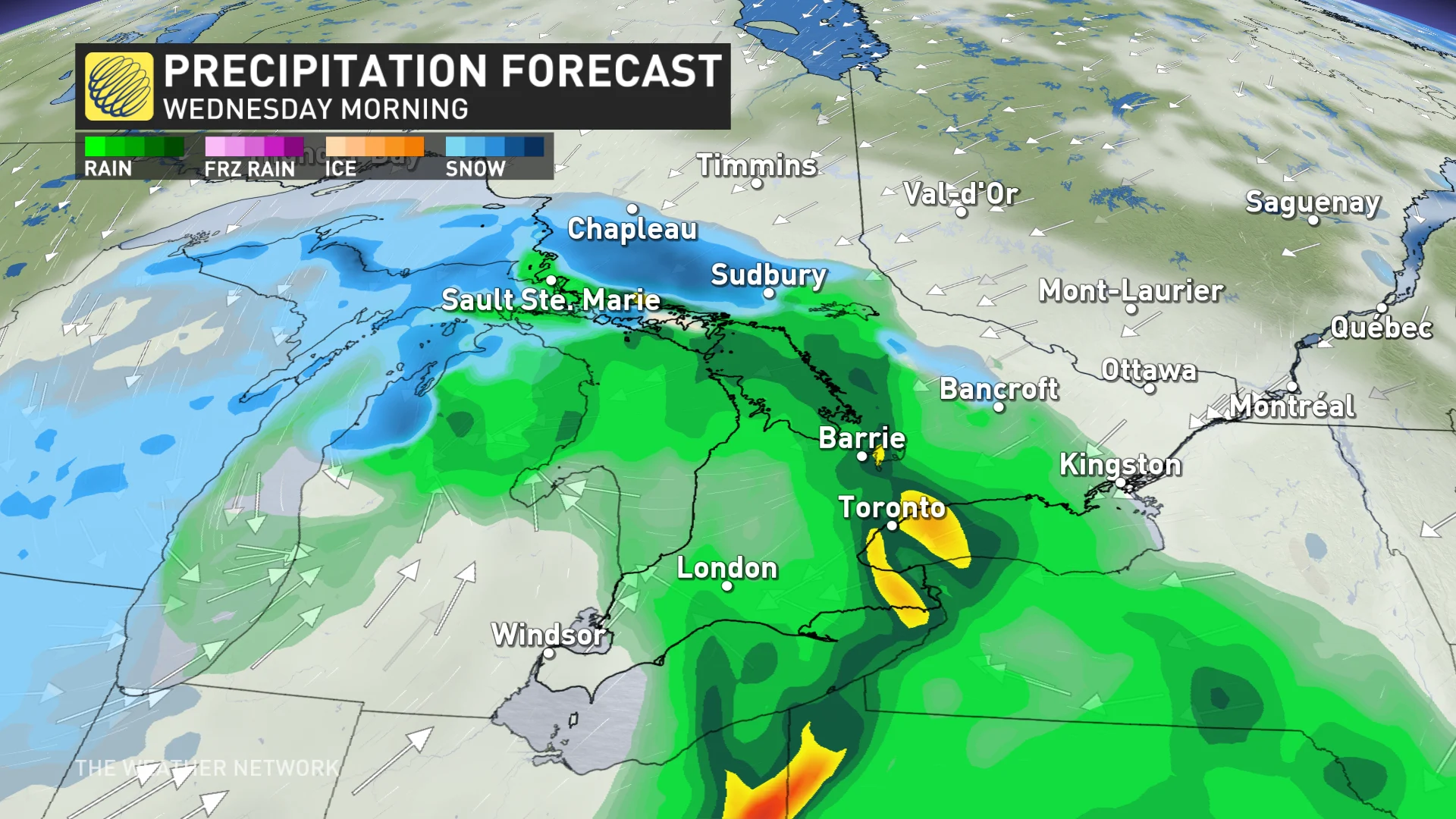
Rain will move into eastern Ontario in the later morning or early-afternoon hours as snow falls in the Algonquin Highlands. Some higher elevations on the escarpment, north of the city, will start to transition to snow in the afternoon.
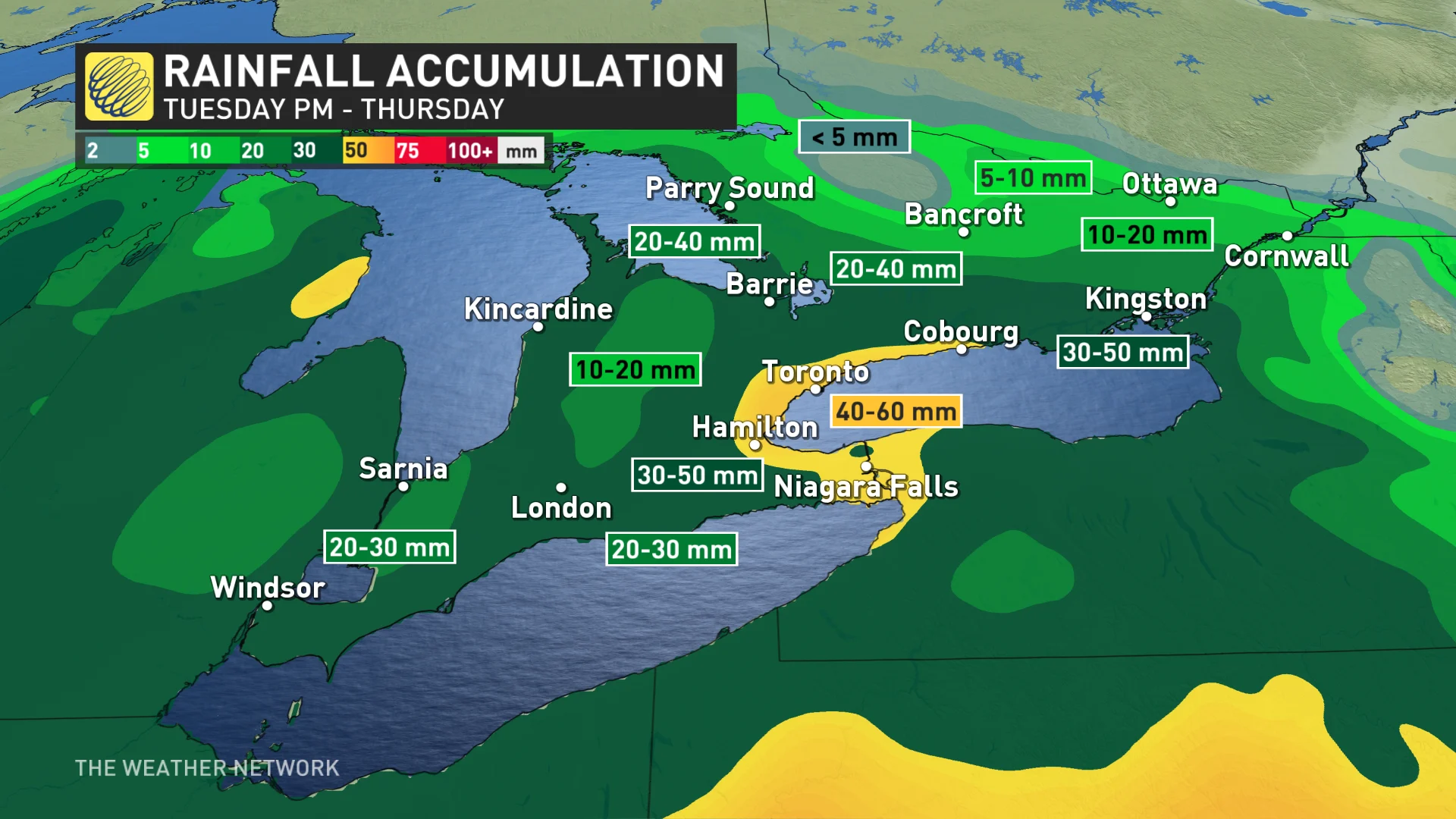
Between 30-60 mm is forecast for the hardest-hit areas, which could result in some localized flooding. Wind gusts will also remain high for the GTA, central, eastern, and northeastern Ontario through Wednesday. They will gradually subside for southwestern areas.
For some areas, this will be a long-duration snowfall that’ll unfold through much of Wednesday and Thursday.
Temperatures will fall as the storm pulls in colder air from the north, and we’ll see the rain transition to wet snow across higher terrain, with a heavy band of accumulating, wet snow across northeastern and eastern Ontario.
Periods of wet snow will fill in across GTA and the south through the overnight hours, with all of the south transitioning to wet snow by Thursday morning. However, it will slowly ease through the day.
Cottage country and eastern Ontario appear to be facing the heaviest snow threat with this system, but where exactly the axis of heaviest snow develops will determine which areas see the greatest accumulations.
Inland areas that see the heaviest and most persistent wet snow could possibly exceed 20 cm by Thursday, with locations in eastern Ontario the most likely target.
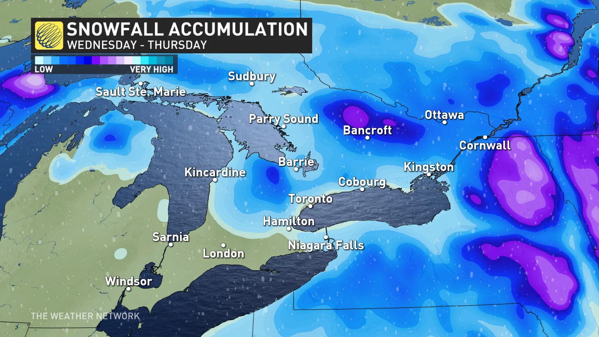
A coastal low over New England will force a renewed burst of heavy snow to spread over eastern Ontario and southern Quebec into Thursday, with treacherous travel likely across the impacted region. There is the potential for parts of eastern Ontario to overachieve with snowfall amounts due to this developing secondary system.
Expect blustery and chilly conditions for a couple days as the system slowly departs the region, then a warming trend into the weekend with temperatures climbing well above seasonal. Forecasters will continue to monitor conditions ahead of the total solar eclipse that’ll traverse the region on Monday, April 8.
Check back frequently for the latest on this evolving forecast over Ontario.